


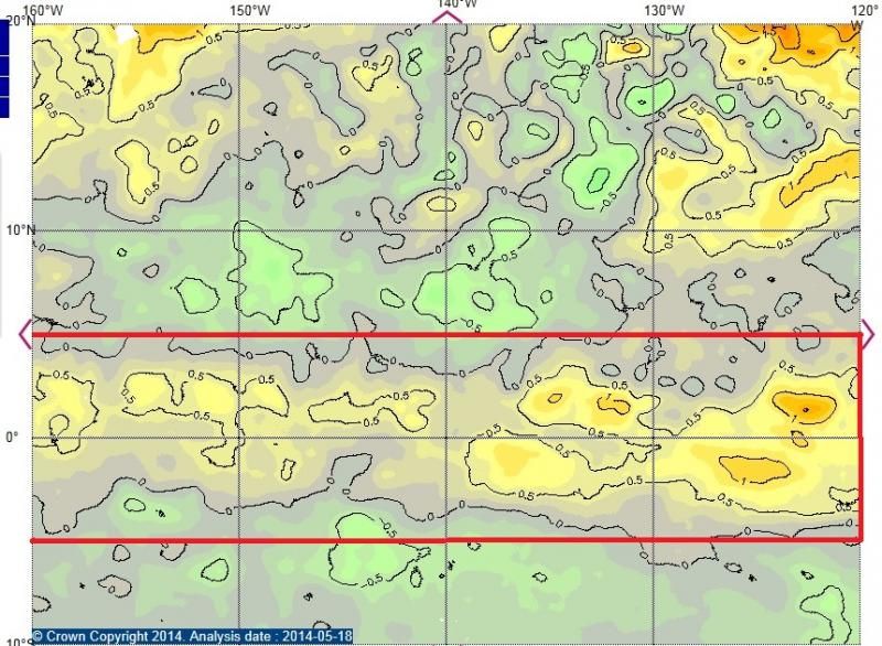
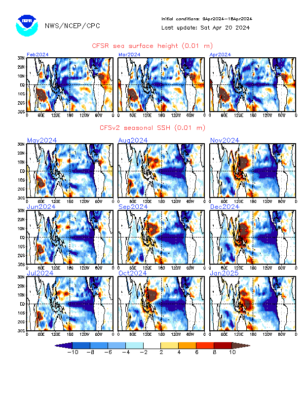
NDG wrote:If you ask me if the latest CFSv2 is correct and its trends continuous, similarities to a weak Modoki El Nino is not out of the question during the heart of the Atlantic Hurricane season, IMO.
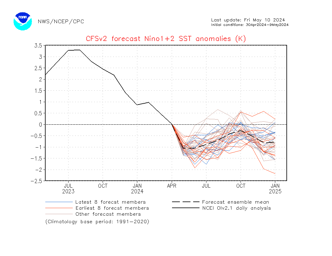
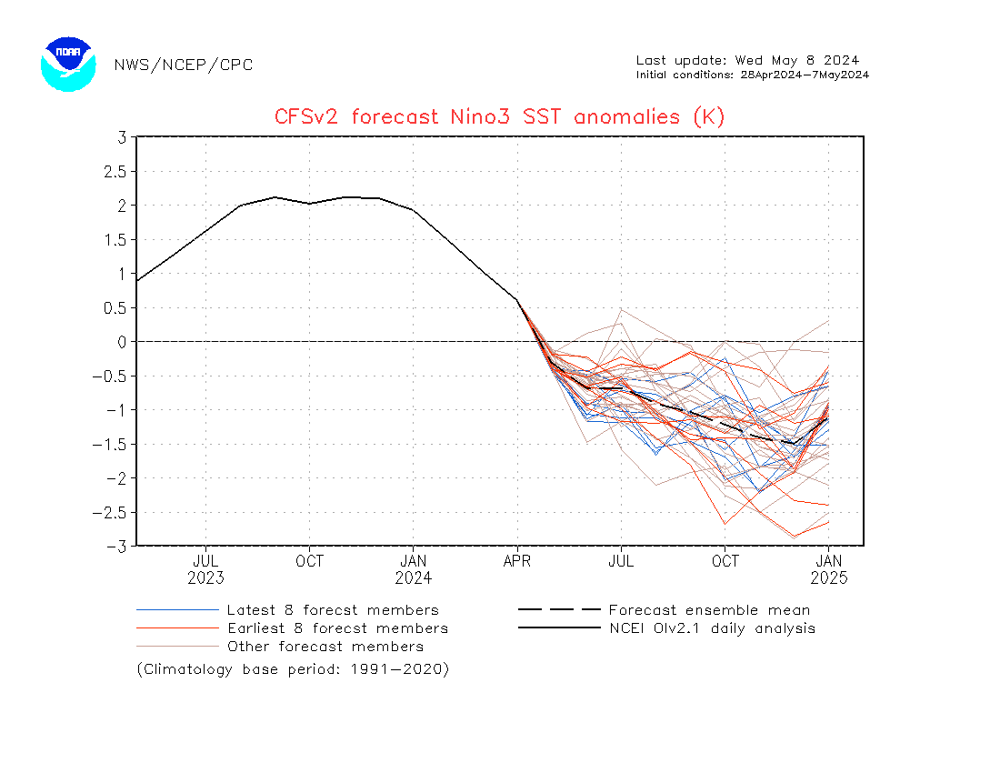


Modoki and full basin el Niño. A true Modoki means that the region 1+2 is unaffected by warming. This is a case of full basin. Models were forecasting earlier (last January) a Modoki by MJJ, but keep trending towards traditional. CFSv2 forecasted too but it turned out they are mistaken for doing so. I don't get why this model is for lower readings later, and the big decrease means they are at a cool bias.


