ATL: ARTHUR - Post-Tropical - Discussion

Moderator: S2k Moderators

Message
Author
User avatar
NDG
S2K Supporter
S2K Supporter
Posts: 15446
Joined: Sun Jul 09, 2006 10:14 pm
Location: Orlando, FL

Re: ATL: INVEST 91L - Discussion

#241 Postby NDG » Mon Jun 30, 2014 6:22 am

cycloneye wrote:It looks like the intensity down the road will depend if it spends time in the spine of Florida or it stays in the warm gulfstream waters.


I am putting all bets on the Euro, it has been very consistent about its track staying offshore of FL.
0 likes   

User avatar
cycloneye
Admin
Admin
Posts: 145299
Age: 68
Joined: Thu Oct 10, 2002 10:54 am
Location: San Juan, Puerto Rico

Re: ATL: INVEST 91L - Discussion

#242 Postby cycloneye » Mon Jun 30, 2014 6:38 am

TROPICAL WEATHER OUTLOOK
NWS NATIONAL HURRICANE CENTER MIAMI FL
800 AM EDT MON JUN 30 2014

For the North Atlantic...Caribbean Sea and the Gulf of Mexico:

Shower and thunderstorm activity remains minimal in association with
a low pressure area located about 140 miles east-northeast of
Melbourne, Florida. However, surface pressures are falling, and
environmental conditions are forecast to become more conducive for
development during the next few days. A tropical depression is
likely to form by mid-week while the system moves slowly
southwestward and thens turns northward and northeastward near the
southeastern United States coast. An Air Force Reserve
reconnaissance aircraft is scheduled to investigate the low this
afternoon, if necessary.
* Formation chance through 48 hours...high...60 percent.
* Formation chance through 5 days...high...80 percent.

$$
Forecaster Kimberlain
0 likes   
Visit the Caribbean-Central America Weather Thread where you can find at first post web cams,radars
and observations from Caribbean basin members Click Here

User avatar
cycloneye
Admin
Admin
Posts: 145299
Age: 68
Joined: Thu Oct 10, 2002 10:54 am
Location: San Juan, Puerto Rico

Re: ATL: INVEST 91L - Discussion

#243 Postby cycloneye » Mon Jun 30, 2014 6:49 am

Here is a detailed discussion from the Wilmington NC NWS:


.LONG TERM /THURSDAY THROUGH SUNDAY/...
AS OF 3 AM MONDAY...CONFIDENCE INCREASING THAT TROPICAL SYSTEM TO
AFFECT THE REGION EARLY IN THE PERIOD...BIT QUESTIONS REMAIN AS TO
TO WHAT EXTENT AND WHEN. FIRST OFF MODELS ARE STARTING TO SHOW SOME
CONSENSUS NOW WITH THE EVOLUTION OF THE TRACK OF THE LOW AND THEY
ARE GENERALLY FASTER AND CLOSER TO THE COAST THAN BEFORE. BEFORE
PUTTING TOO MUCH STOCK IN THESE SOLUTIONS THOUGH A FEW THINGS TO
BEAR IN MIND. 1...THE SYSTEM STILL HAS TO TURN ALMOST COMPLETELY
AROUND FROM ITS CURRENT SOUTHWARD MOTION BEFORE IT STARTS AFFECTING
THE CAROLINAS. SUCH TRACK REVERSALS OFTEN CAUSE CONSIDERABLE TRACK
UNCERTAINTY. 2...THE SYSTEM IS BEREFT OF DEEP CONVECTION. ONCE
CONVECTION BECOMES INITIALLY ESTABLISHED OVER A GIVEN SEMICIRCLE THE
CENTER WILL LIKELY WOBBLE IN THAT DIRECTION...WITH THE TRACK CHANGE
OF THE INITIAL WOBBLE GROWING IN TIME AS THE SYSTEM MOVES
NORTHEASTWARD UP OR ALONG THE COAST. RELATED TO THESE TWO
MATTERS...THIS IS FORECAST TO BE A PHYSICALLY SMALL AND COMPACT
STORM. THIS WILL CERTAINLY LIMIT WHERE ITS EFFECTS ARE FELT
GEOGRAPHICALLY WITH SUCH A SMALL ANGLE OF INCIDENCE TO THE COASTLINE
EXPECTED FOR MUCH OF ITS TRACK. HISTORICALLY...SUCH TRACKS HAVE ALSO
FEATURED STORMS LOCALLY WHERE CONTINENTAL AIR GETS ENTRENCHED OVER
THE WESTERN SEMICIRCLE LIMITING WINDS AND RAIN ANYWHERE WEST OF ITS
CENTER (CHARLEY, 2004, E.G.). FOR NOW MAIN CHANGES WERE TO SHOW MORE
PESSIMISTIC CONDITIONS ON THURSDAY AND THURSDAY NIGHT TO ACCOUNT
FOR POSSIBLE QUICKER TIMING. THIS IS A WEEK OF HIGH TOURIST VOLUME
AND COPIOUS FIREWORKS DISPLAYS...BUT UNTIL THE SYSTEM MAKES ITS TURN
AND STARTS DEVELOPING THERE ARE SIMPLY TOO MANY VARIABLES TO
INTRODUCE MUCH SPECIFICITY. WHAT DOES SEEM MORE FOR SURE IS SOME
LATE WEEK ROUGH SURF AND DANGEROUS RIP CURRENTS.
0 likes   
Visit the Caribbean-Central America Weather Thread where you can find at first post web cams,radars
and observations from Caribbean basin members Click Here

User avatar
artist
Category 5
Category 5
Posts: 9792
Joined: Mon Jun 06, 2005 3:26 pm
Location: West Palm

Re: ATL: INVEST 91L - Discussion

#244 Postby artist » Mon Jun 30, 2014 7:01 am

Image close enough it could cause lots of rain, though.
NDG wrote:
cycloneye wrote:It looks like the intensity down the road will depend if it spends time in the spine of Florida or it stays in the warm gulfstream waters.


I am putting all bets on the Euro, it has been very consistent about its track staying offshore of FL.
0 likes   

User avatar
Blown Away
S2K Supporter
S2K Supporter
Posts: 10145
Joined: Wed May 26, 2004 6:17 am

Re: ATL: INVEST 91L - Discussion

#245 Postby Blown Away » Mon Jun 30, 2014 7:06 am

Nice to see a tight LLC... IMO, 91L has the foundation to take off once it builds some convection...
0 likes   
Hurricane Eye Experience: David 79, Irene 99, Frances 04, Jeanne 04, Wilma 05... EYE COMING MY WAY IN 2024…
Hurricane Brush Experience: Andrew 92, Erin 95, Floyd 99, Matthew 16, Irma 17, Ian 22, Nicole 22…

User avatar
robbielyn
Category 5
Category 5
Posts: 1298
Joined: Wed May 07, 2003 9:45 am
Location: brooksville, fl

#246 Postby robbielyn » Mon Jun 30, 2014 7:18 am

alyono is right, its a broad load with an llc. its surely not tightly wound. u can disagree with him but at least consider that as a met he might know what he is talking about. :D
Robbielyn
0 likes   
Robbielyn McCrary
I know just about enough to sound like I know what I'm talking about sometimes. But for your safety please follow the nhc for truly professional forecasting. :D

User avatar
cycloneye
Admin
Admin
Posts: 145299
Age: 68
Joined: Thu Oct 10, 2002 10:54 am
Location: San Juan, Puerto Rico

Re: ATL: INVEST 91L - Discussion

#247 Postby cycloneye » Mon Jun 30, 2014 7:25 am

12z Best Track.

AL, 91, 2014063012, , BEST, 0, 286N, 785W, 25, 1011, LO
0 likes   
Visit the Caribbean-Central America Weather Thread where you can find at first post web cams,radars
and observations from Caribbean basin members Click Here

tolakram
Admin
Admin
Posts: 20009
Age: 62
Joined: Sun Aug 27, 2006 8:23 pm
Location: Florence, KY (name is Mark)

Re: ATL: INVEST 91L - Discussion

#248 Postby tolakram » Mon Jun 30, 2014 7:40 am

0 likes   
M a r k
- - - - -
Join us in chat: Storm2K Chatroom Invite. Android and IOS apps also available.

The posts in this forum are NOT official forecasts and should not be used as such. Posts are NOT endorsed by any professional institution or STORM2K.org. For official information and forecasts, please refer to NHC and NWS products.

adam0983

Re: ATL: INVEST 91L - Discussion

#249 Postby adam0983 » Mon Jun 30, 2014 7:42 am

I think that Invest 91L will have to survive the next 12 hours to turn into a Tropical Depression. Does anyone know how much Shear and dry air is expected during the next 3 days? Just an opinion not a forecast.
0 likes   

SeGaBob

#250 Postby SeGaBob » Mon Jun 30, 2014 7:45 am

I'm guessing NHC will cancel the missions for today being as it's mostly a naked swirl... I could be wrong though.
0 likes   

tolakram
Admin
Admin
Posts: 20009
Age: 62
Joined: Sun Aug 27, 2006 8:23 pm
Location: Florence, KY (name is Mark)

Re: ATL: INVEST 91L - Discussion

#251 Postby tolakram » Mon Jun 30, 2014 7:51 am

Euro still shows development delayed until it starts drifting north again, so I also suspect recon may be cancelled.

I posted this in the models thread and I'll post it here as well. There is a great page for tracking all the major model forecasts in one place.

http://ruc.noaa.gov/hfip/tcgen/
0 likes   
M a r k
- - - - -
Join us in chat: Storm2K Chatroom Invite. Android and IOS apps also available.

The posts in this forum are NOT official forecasts and should not be used as such. Posts are NOT endorsed by any professional institution or STORM2K.org. For official information and forecasts, please refer to NHC and NWS products.

User avatar
NDG
S2K Supporter
S2K Supporter
Posts: 15446
Joined: Sun Jul 09, 2006 10:14 pm
Location: Orlando, FL

Re: ATL: INVEST 91L - Discussion

#252 Postby NDG » Mon Jun 30, 2014 7:55 am

Latest NHC best track position is exactly where the LLC is, if there would had been a broad they would had been plotting it and not the LLC.
0 likes   

Frank2
Category 5
Category 5
Posts: 4061
Joined: Mon Jul 25, 2005 12:47 pm

Re: ATL: INVEST 91L - Discussion

#253 Postby Frank2 » Mon Jun 30, 2014 8:05 am

Good morning everyone - I'm still alive and typing : )

P.S. The LLC is very evident and moving SSW, but as others said it is absent of convection and NHC forecaster Gil Clark once told me that southward moving systems in this hemisphere usually do not develop, so we'll see what happens...

Also, LLC's that small often as we've seen do dissipate - they are more likely eddies than anything, though the NHC has said that pressures are falling, but aside from the small LLC the area doesn't seem as organized as it did 24 hours ago, again perhaps due to northerly shear and southward motion - we'll see...

Frank
Last edited by Frank2 on Mon Jun 30, 2014 8:07 am, edited 1 time in total.
0 likes   

User avatar
gatorcane
S2K Supporter
S2K Supporter
Posts: 23691
Age: 47
Joined: Sun Mar 13, 2005 3:54 pm
Location: Boca Raton, FL

#254 Postby gatorcane » Mon Jun 30, 2014 8:07 am

Latest saved visible loop. You can see the northerly shear still continues to be a problem or this system especially the right half as you can see the convection builds and then gets blown off to the south preventing it from wrapping around the center. Overall circulation is very vigorous though and is sitting right over the very warm Gulf Stream current.

Image

On the other hand, look at this pressure drop at a nearby buoy. My feeling on this system is that as soon as conditions improve, it is going to take off.

Image
Last edited by gatorcane on Mon Jun 30, 2014 8:13 am, edited 1 time in total.
0 likes   

User avatar
vacanechaser
Category 5
Category 5
Posts: 1461
Joined: Wed Dec 03, 2003 9:34 pm
Location: Portsmouth, Va
Contact:

Re:

#255 Postby vacanechaser » Mon Jun 30, 2014 8:12 am

robbielyn wrote:alyono is right, its a broad load with an llc. its surely not tightly wound. u can disagree with him but at least consider that as a met he might know what he is talking about. :D
Robbielyn


Nothing "broad" about this low this morning.. It is nicely compact and looking like a depression with the exception of no convection. The center is much better defined today. I would not be surprised if recon does go with the look of it today. I could also see them calling it off too. Reminds me very much like Alex...


Jesse V. Bass III
http://Www.vastormphoto.com
Hurricane intercept research team
0 likes   
Jesse V. Bass III
http://www.vastormphoto.com
Hurricane Intercept Research Team

User avatar
NDG
S2K Supporter
S2K Supporter
Posts: 15446
Joined: Sun Jul 09, 2006 10:14 pm
Location: Orlando, FL

Re: ATL: INVEST 91L - Discussion

#256 Postby NDG » Mon Jun 30, 2014 8:20 am

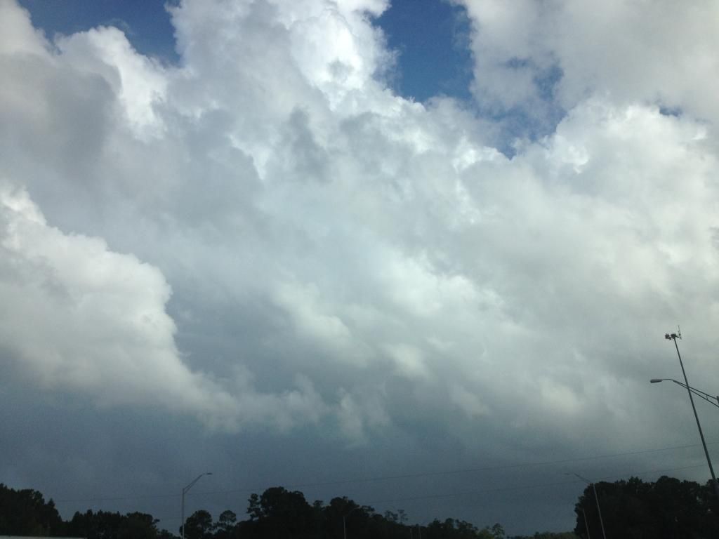
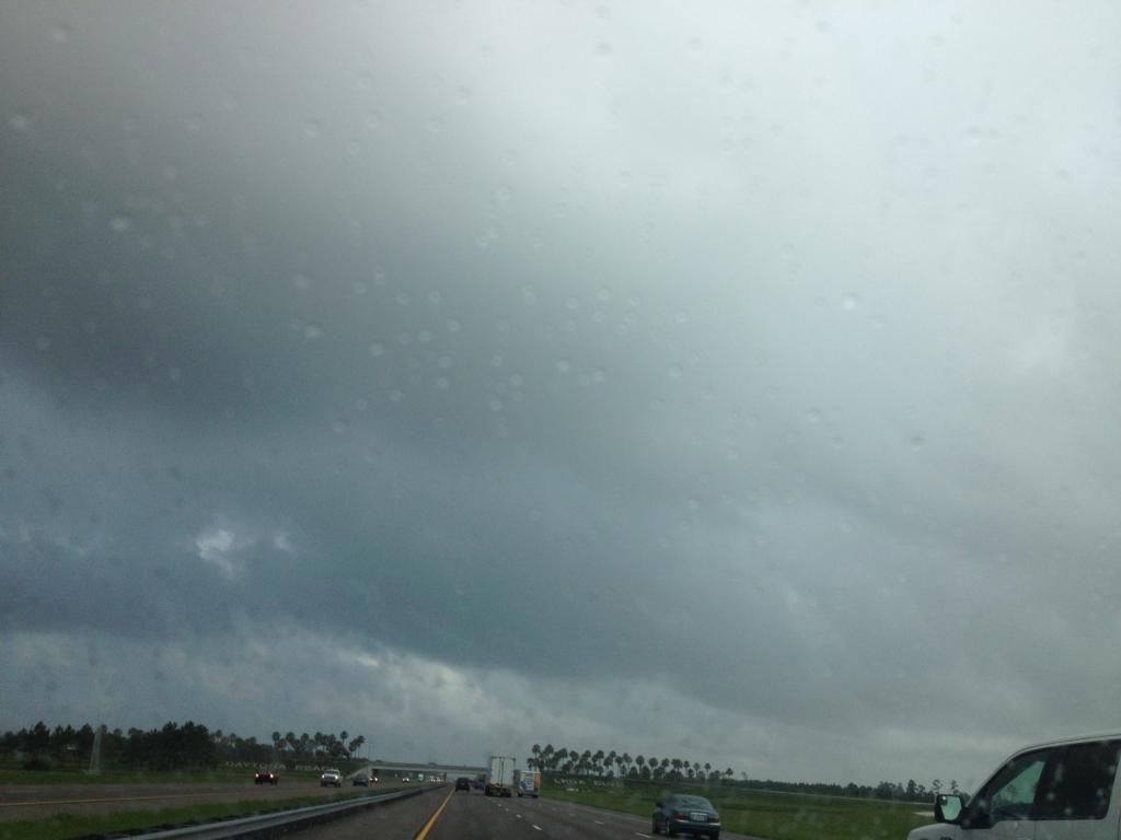
Some light showers coming onshore in Daytona rotating around 91L as I drive up to Jacksonville this morning.

Image
Image
0 likes   

stormcruisin

#257 Postby stormcruisin » Mon Jun 30, 2014 8:44 am

Looks sheared and barely pulsing.
0 likes   

User avatar
cycloneye
Admin
Admin
Posts: 145299
Age: 68
Joined: Thu Oct 10, 2002 10:54 am
Location: San Juan, Puerto Rico

Re: ATL: INVEST 91L - Discussion

#258 Postby cycloneye » Mon Jun 30, 2014 8:56 am

It would be interesting to see some live web cams from the east coast of Florida to see how things are doing.If anyone has cams to post go ahead.
0 likes   
Visit the Caribbean-Central America Weather Thread where you can find at first post web cams,radars
and observations from Caribbean basin members Click Here

User avatar
nativefloridian
Tropical Storm
Tropical Storm
Posts: 172
Joined: Tue Aug 21, 2012 2:48 pm
Location: Pembroke Pines, FL

#259 Postby nativefloridian » Mon Jun 30, 2014 9:02 am

Here's a link that gives you a variety of webcams to choose from. http://floridabeachlive.com/

You might want to try this one also: http://www.surfline.com/surf-report/may ... rida_5318/
Last edited by nativefloridian on Mon Jun 30, 2014 9:13 am, edited 2 times in total.
0 likes   

tolakram
Admin
Admin
Posts: 20009
Age: 62
Joined: Sun Aug 27, 2006 8:23 pm
Location: Florence, KY (name is Mark)

Re: ATL: INVEST 91L - Discussion

#260 Postby tolakram » Mon Jun 30, 2014 9:10 am

If you speed this live loop up it appears there is only a single well defined circulation now. IMO of course.

http://wwwghcc.msfc.nasa.gov/cgi-bin/ge ... map=latlon
0 likes   
M a r k
- - - - -
Join us in chat: Storm2K Chatroom Invite. Android and IOS apps also available.

The posts in this forum are NOT official forecasts and should not be used as such. Posts are NOT endorsed by any professional institution or STORM2K.org. For official information and forecasts, please refer to NHC and NWS products.


Return to “2014”

Who is online

Users browsing this forum: No registered users and 3 guests