cycloneye wrote:Important section of the 11 PM discussion.
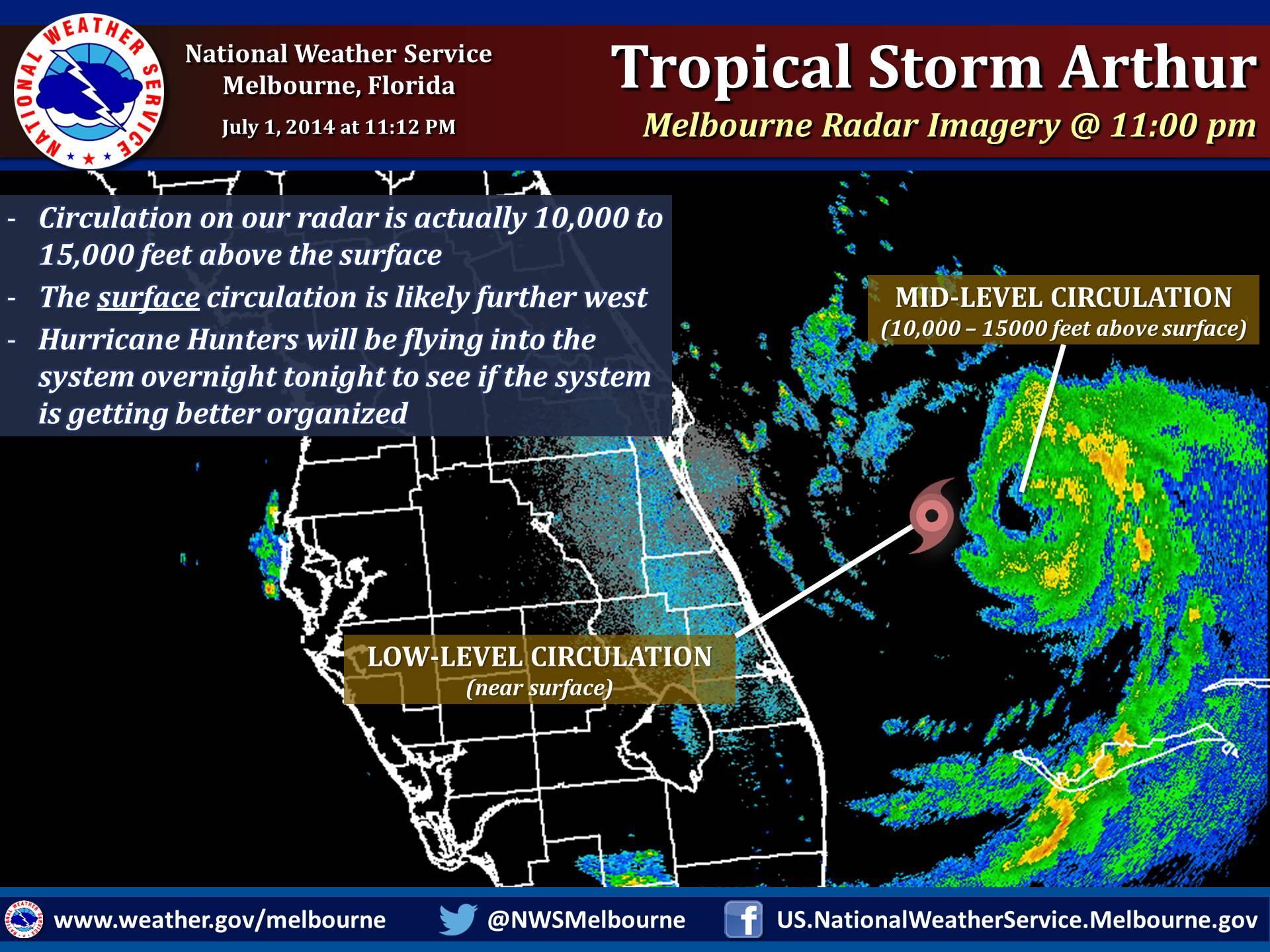
Data from the Melbourne WSR-88D radar indicates that Arthur has a
complex structure this evening. A mid-level cyclonic circulation
accompanied by a possible eye feature is clearly evident near 27.8N
78.8W. However, the motions of the light showers/low clouds seen in
the radar data suggest that the low-level center is about 25-30 n mi
west of the mid-level center. Air Force Reserve and NOAA Hurricane
Hunter aircraft are scheduled to investigate Arthur early Wednesday
morning to see if the center has re-formed to the east. Pending the
arrival of the aircraft, the initial intensity remains 45 kt.
very interesting.. we will find out.. lol