2014 EPAC Season
Moderator: S2k Moderators
Forum rules

The posts in this forum are NOT official forecasts and should not be used as such. They are just the opinion of the poster and may or may not be backed by sound meteorological data. They are NOT endorsed by any professional institution or STORM2K. For official information, please refer to products from the National Hurricane Center and National Weather Service.
-
Yellow Evan

- Professional-Met

- Posts: 16241
- Age: 27
- Joined: Fri Jul 15, 2011 12:48 pm
- Location: Henderson, Nevada/Honolulu, HI
- Contact:
-
hurricanes1234
- Category 5

- Posts: 2908
- Joined: Sat Jul 28, 2012 6:19 pm
- Location: Trinidad and Tobago
Something has the EPAC a bit dormant right now.
0 likes
PLEASE NOTE: With the exception of information from weather agencies that I may copy and paste here, my posts will NEVER be official, since I am NOT a meteorologist. They are solely my amateur opinion, and may or may not be accurate. Therefore, please DO NOT use them as official details, particularly when making important decisions. Thank you.
-
Yellow Evan
- Professional-Met
- Posts: 16241
- Age: 27
- Joined: Fri Jul 15, 2011 12:48 pm
- Location: Henderson, Nevada/Honolulu, HI
- Contact:
1. A low pressure area could form well to the southwest of the southern
tip of the Baja California peninsula in a couple of days. Some
gradual development of this system is possible next week while it
moves westward or west-northwestward.
* Formation chance through 48 hours...low...near 0 percent.
* Formation chance through 5 days...low...20 percent.
tip of the Baja California peninsula in a couple of days. Some
gradual development of this system is possible next week while it
moves westward or west-northwestward.
* Formation chance through 48 hours...low...near 0 percent.
* Formation chance through 5 days...low...20 percent.
0 likes
-
Yellow Evan
- Professional-Met
- Posts: 16241
- Age: 27
- Joined: Fri Jul 15, 2011 12:48 pm
- Location: Henderson, Nevada/Honolulu, HI
- Contact:
Re:
hurricanes1234 wrote:Something has the EPAC a bit dormant right now.
MJO has been somewhat dormant lately. Did not have much effect on the EPAC. The early May MJO pulse was much stronger.
0 likes
-
stormcruisin
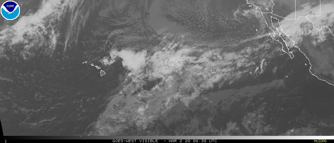
http://www.ssd.noaa.gov/goes/west/tpac/vis-animated.gif
Interesting little area there down in the doldrums.
Interesting little area there down in the doldrums.
0 likes
-
Yellow Evan
- Professional-Met
- Posts: 16241
- Age: 27
- Joined: Fri Jul 15, 2011 12:48 pm
- Location: Henderson, Nevada/Honolulu, HI
- Contact:
A tropical wave with scattered showers and thunderstorms is located
several hundred miles south of the southern tip of the Baja
California peninsula of Mexico. Development, if any, of this
system is expected to be slow to occur over the next few days while
it moves westward or west-northwestward at 10 to 15 mph.
* Formation chance through 48 hours...low...near 0 percent.
* Formation chance through 5 days...low...20 percent.
0 likes
-
Yellow Evan
- Professional-Met
- Posts: 16241
- Age: 27
- Joined: Fri Jul 15, 2011 12:48 pm
- Location: Henderson, Nevada/Honolulu, HI
- Contact:
1. A broad area of low pressure is located several hundred miles south
of the southern tip of the Baja California peninsula of Mexico.
Showers and thunderstorms associated with this low are disorganized,
and any development should be slow to occur during the next few days
while it moves westward or west-northwestward at 10 to 15 mph.
* Formation chance through 48 hours...low...10 percent.
* Formation chance through 5 days...low...20 percent.
0 likes
-
Yellow Evan
- Professional-Met
- Posts: 16241
- Age: 27
- Joined: Fri Jul 15, 2011 12:48 pm
- Location: Henderson, Nevada/Honolulu, HI
- Contact:
000
ABPZ20 KNHC 060513
TWOEP
TROPICAL WEATHER OUTLOOK
NWS NATIONAL HURRICANE CENTER MIAMI FL
1100 PM PDT SAT JUL 5 2014
For the eastern North Pacific...east of 140 degrees west longitude:
A broad area of low pressure is located several hundred miles south
of the southern tip of the Baja California peninsula of Mexico.
Showers and thunderstorms associated with this low remain
disorganized, and any development should be slow to occur during the
next few days while it moves westward or west-northwestward at 10 to
15 mph.
* Formation chance through 48 hours...low...10 percent.
* Formation chance through 5 days...low...20 percent.
$$
Forecaster Cangialosi
0 likes
-
hurricanes1234
- Category 5
- Posts: 2908
- Joined: Sat Jul 28, 2012 6:19 pm
- Location: Trinidad and Tobago
I checked yesterday and GFS showed nothing for quite some time again. It could be weeks before we see Fausto.
Not official.
Not official.
0 likes
PLEASE NOTE: With the exception of information from weather agencies that I may copy and paste here, my posts will NEVER be official, since I am NOT a meteorologist. They are solely my amateur opinion, and may or may not be accurate. Therefore, please DO NOT use them as official details, particularly when making important decisions. Thank you.
-
Yellow Evan
- Professional-Met
- Posts: 16241
- Age: 27
- Joined: Fri Jul 15, 2011 12:48 pm
- Location: Henderson, Nevada/Honolulu, HI
- Contact:
Re:
hurricanes1234 wrote:I checked yesterday and GFS showed nothing for quite some time again. It could be weeks before we see Fausto.
Not official.
It does close it off, so it kinda hints at it.
0 likes
-
Yellow Evan
- Professional-Met
- Posts: 16241
- Age: 27
- Joined: Fri Jul 15, 2011 12:48 pm
- Location: Henderson, Nevada/Honolulu, HI
- Contact:
000
ABPZ20 KNHC 061137
TWOEP
TROPICAL WEATHER OUTLOOK
NWS NATIONAL HURRICANE CENTER MIAMI FL
500 AM PDT SUN JUL 6 2014
For the eastern North Pacific...east of 140 degrees west longitude:
A weak area of low pressure is located several hundred miles south-
southwest of the southern tip of the Baja California peninsula.
Showers and thunderstorms associated with this low remain minimal,
and any development should be slow to occur during the next few days
while it moves westward or west-northwestward at 10 to 15 mph.
* Formation chance through 48 hours...low...10 percent.
* Formation chance through 5 days...low...20 percent.
$$
Forecaster Blake
0 likes
-
TheStormExpert
-
Yellow Evan
- Professional-Met
- Posts: 16241
- Age: 27
- Joined: Fri Jul 15, 2011 12:48 pm
- Location: Henderson, Nevada/Honolulu, HI
- Contact:
Re:
TheStormExpert wrote::uarrow: Don't see much at all coming from this. Looks that the East Pacific has hit a somewhat quiet period for now, with Douglas and Elida recently forming and struggling to become more than weak TS's I think a lull is happening or expected to happen for a little bit.
El Nino years tend to have a big lull in activity at some point.
Wind shear is very high right now, much higher than they were a few days ago.
0 likes
-
Yellow Evan
- Professional-Met
- Posts: 16241
- Age: 27
- Joined: Fri Jul 15, 2011 12:48 pm
- Location: Henderson, Nevada/Honolulu, HI
- Contact:

-
Yellow Evan
- Professional-Met
- Posts: 16241
- Age: 27
- Joined: Fri Jul 15, 2011 12:48 pm
- Location: Henderson, Nevada/Honolulu, HI
- Contact:
Re: 2014 EPAC Season
A broad area of low pressure has formed several hundred miles
south-southwest of Acapulco, Mexico. Gradual development of this
system is possible during the next couple of days as it moves
west-northwestward at 10 to 15 mph.
* Formation chance through 48 hours...low...20 percent.
* Formation chance through 5 days...low...20 percent.
A weak area of low pressure located several hundred miles
south-southwest of the southern tip of the Baja California peninsula
continues to produce disorganized showers and a few thunderstorms.
Development, if any, of this system should be slow to occur during
the next few days while it moves westward or west-northwestward at
10 to 15 mph.
* Formation chance through 48 hours...low...10 percent.
* Formation chance through 5 days...low...20 percent.
10/20 is the previous disturbance.
0 likes
-
cycloneye

- Admin

- Posts: 149516
- Age: 69
- Joined: Thu Oct 10, 2002 10:54 am
- Location: San Juan, Puerto Rico
Re: 2014 EPAC Season
We have up INVEST 98E.
0 likes
Visit the Caribbean-Central America Weather Thread where you can find at first post web cams,radars
and observations from Caribbean basin members Click Here
and observations from Caribbean basin members Click Here
-
Yellow Evan
- Professional-Met
- Posts: 16241
- Age: 27
- Joined: Fri Jul 15, 2011 12:48 pm
- Location: Henderson, Nevada/Honolulu, HI
- Contact:
A small low pressure area located several hundred miles
south-southwest of the southern tip of the Baja California peninsula
continues to produce disorganized showers and thunderstorms. Any
development this disturbance should be slow to occur during the next
few days while it moves generally westward at 10 to 15 mph.
* Formation chance through 48 hours...low...20 percent.
* Formation chance through 5 days...low...20 percent.
0 likes
-
Yellow Evan
- Professional-Met
- Posts: 16241
- Age: 27
- Joined: Fri Jul 15, 2011 12:48 pm
- Location: Henderson, Nevada/Honolulu, HI
- Contact:
-
hurricanes1234
- Category 5
- Posts: 2908
- Joined: Sat Jul 28, 2012 6:19 pm
- Location: Trinidad and Tobago
Fausto was a pathetic storm which defied initial forecasts and peaked at 40 knots.
Now that Fausto is done and Invest 98E will have to face shear in a couple of days, in my opinion it would not surprise me if we enter a lull of activity. However, that's just my amateur opinion (see below).
Now that Fausto is done and Invest 98E will have to face shear in a couple of days, in my opinion it would not surprise me if we enter a lull of activity. However, that's just my amateur opinion (see below).
0 likes
PLEASE NOTE: With the exception of information from weather agencies that I may copy and paste here, my posts will NEVER be official, since I am NOT a meteorologist. They are solely my amateur opinion, and may or may not be accurate. Therefore, please DO NOT use them as official details, particularly when making important decisions. Thank you.
-
Yellow Evan
- Professional-Met
- Posts: 16241
- Age: 27
- Joined: Fri Jul 15, 2011 12:48 pm
- Location: Henderson, Nevada/Honolulu, HI
- Contact:
Re:
hurricanes1234 wrote:Fausto was a pathetic storm which defied initial forecasts and peaked at 40 knots.
Now that Fausto is done and Invest 98E will have to face shear in a couple of days, in my opinion it would not surprise me if we enter a lull of activity. However, that's just my amateur opinion (see below).
For a little while, yes. When MJO comes back, it should pick back up IMO.
0 likes
Who is online
Users browsing this forum: dexterlabio, Ulf, xtyphooncyclonex and 137 guests