

Moderator: S2k Moderators


We made it to 99 °F again today, and it looks like our first official triple-digit day for the Metroplex will be tomorrow (Sunday) with another one to follow on Monday. The air continues to sink across the area making it extremely difficult to impossible for clouds to tower up into thunderstorms. BUT THAT WILL BE CHANGING next week.
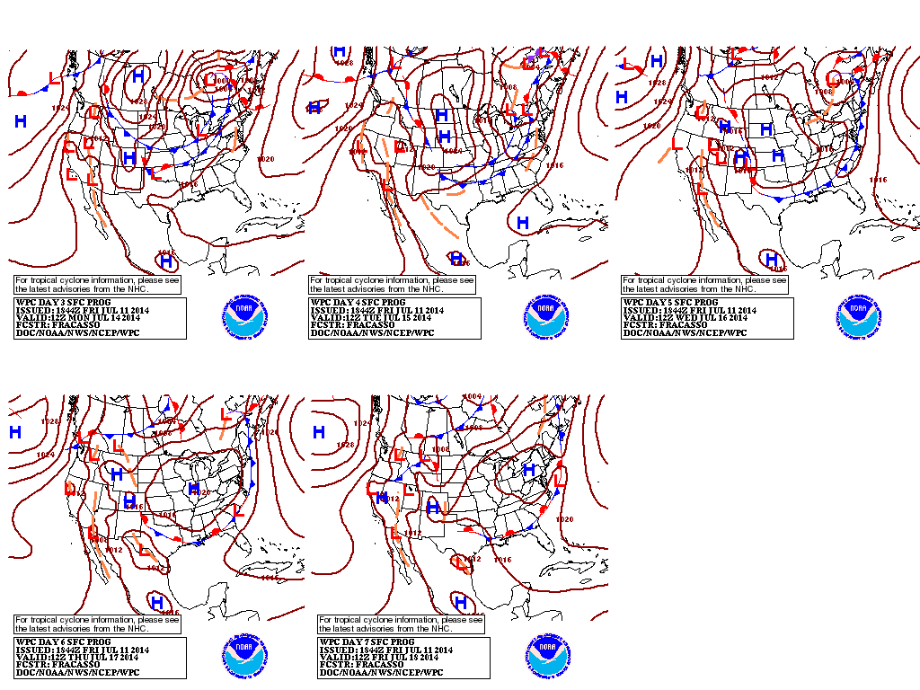
First, a cold front will arrive Tuesday morning bringing a chance for a few showers and temps falling back into the lower 90s. No big deal, But Wednesday night through Friday will see an unusually strong upper-level disturbance sweep directly over north Texas which "should" obliterate the cap and open our skies and allow widespread rain to fall. Temps will struggle to get to get into the 80s by Thursday, and parts of Oklahoma may not get out of the 60s !
This is very much NOT the climatology for this time of year. It is worthwhile to note that computer models are strongly influenced by a region's climatology (long term averages) when it comes to making their long-range predictions, and it is interesting to see them fight against what they "think" should happen this time of year in terms of climate and what the atmosphere may actually end up doing for the latter half of next week.


dhweather wrote:For ENTERTAINMENT purposes only. 7/12 12Z Euro run total precip. I would be extremely surprised if this much happens. Has the big rain coming from a system dropping out of the rockies next Thursday/Friday. My opinion - Maybe in the 1" range, 2" for the lucky ones. Of course, all liquid gold is welcome, just wish we would get a lot more.

Ntxw wrote:
BECAUSE
SOUTHERLY LOW LEVEL FLOW BECOMES STRONGER AND MORE ORGANIZED IT
LIKELY INCREASES THE PROBABILITY THAT A MCS WILL DEVELOP THURSDAY
AND TRAVEL INTO THE WARM SECTOR AIRMASS.


horselattitudesfarm wrote:I wonder how all the dumping of this cold air out of the arctic will affect the ice coverage up there. The latest ice graph showed a rapid decrease of ice for the last month.
Portastorm wrote:horselattitudesfarm wrote:I wonder how all the dumping of this cold air out of the arctic will affect the ice coverage up there. The latest ice graph showed a rapid decrease of ice for the last month.
The Arctic ice levels always decrease in summer. That's standard. However the latest graphic does suggest the rate of decrease has ramped up some.
http://nsidc.org/arcticseaicenews/


TheProfessor wrote:Accuweather has gone Crazy,(I hope its right though) Its forecasting 8 inches of rain for the cities using Fort-Worth Alliance weather conditions like Roanoke, but 4.93 inches for cities using DFW as their weather conditions like Trophy Club and Southlake. Though Accuweather isn't reliable a lot of the times. I sure hope that is prediction for alliance is correct, that would be some crazy summer rain!
IT IS WORTH NOTING THAT THE GFS RUNS LATELY HAVE BEEN
SUFFERING FROM CONVECTIVE FEEDBACK...WITH CONTAMINATED MASS FIELD
AND OUTRAGEOUSLY HIGH QPF WEDNESDAY NIGHT AND THURSDAY MORNING.
WHILE THE ATMOSPHERE CAN UNDERGO A FEEDBACK LOOP OF ITS OWN AS A
RESULT OF WARM CORE VORTEX AMPLIFICATION...THIS IS UNLIKELY TO
OCCUR WHEN ANY LOW LEVEL BAROCLINICITY...IE A FRONT...IS IN THE
AREA. THUS IF A MCS WERE TO FORM IT WOULD TRACK FASTER TO THE
SOUTHEAST THAN THE GFS INDICATES...AND WOULD LIMIT THE POTENTIAL
FOR EXCESSIVE RAINFALL.
STILL THIS WEDNESDAY NIGHT SYSTEM MAY DROP
AN EASY 1-2 INCHES ACROSS THE CWA...WITH THE NORTHERN HALF OF THE
AREA BEING MORE FAVORED.


Return to “USA & Caribbean Weather”
Users browsing this forum: Cpv17, mmmmsnouts, Quixotic, Stratton23 and 189 guests


