ATL: BERTHA - Post-Tropical - Discussion

Moderator: S2k Moderators

Message
Author
User avatar
Blown Away
S2K Supporter
S2K Supporter
Posts: 10140
Joined: Wed May 26, 2004 6:17 am

Re: ATL: INVEST 93L - Discussion

#341 Postby Blown Away » Tue Jul 29, 2014 10:39 pm

blp wrote:There is not one model that dissipates this system until the Bahamas and until I see a change then I will not buy into dissipation.

Agree, 18z GFS didn't dissipate 93L compared to previous runs... Struggling tonight, but there is some new convection popping and a decent circulation... I could see these models continue to shift left through 144 hours due to 93L staying shallow... A few hundred miles in deviation can change the outcome...
0 likes   
Hurricane Eye Experience: David 79, Irene 99, Frances 04, Jeanne 04, Wilma 05... EYE COMING MY WAY IN 2024…
Hurricane Brush Experience: Andrew 92, Erin 95, Floyd 99, Matthew 16, Irma 17, Ian 22, Nicole 22…

TheStormExpert

#342 Postby TheStormExpert » Tue Jul 29, 2014 10:46 pm

:uarrow: The GFS IMO is a outlier strength wise and looks to be basically there for entertainment purposes ATM. I'm now going with the Euro on this one.
0 likes   

AEWspotter
Professional-Met
Professional-Met
Posts: 57
Joined: Wed Aug 08, 2012 9:41 am

#343 Postby AEWspotter » Tue Jul 29, 2014 10:53 pm

The latest HWRF run has a sloppy system with 45kt winds dissipate just north of Puerto Rico. The latest GFDL run has a 60kt tropical storm north of Hispanola in 5 days.

I don't think 93L is dead yet, but the sudden loss of convection is not a good sign. LLC needs to tighten up and it's only going to do that if convection pops. Diurnal max or bust...
0 likes   

User avatar
CFLHurricane
Category 1
Category 1
Posts: 346
Joined: Thu Mar 27, 2014 5:56 pm
Location: Floriduh

Re: ATL: INVEST 93L - Discussion

#344 Postby CFLHurricane » Wed Jul 30, 2014 12:48 am

It's showing some renewed convection, although I'm not keeping my hopes up.

Not that I'm hoping for much seeing as I'd be just fine with it skirting Florida as a depression.

Arthur was some of the best weather we've had all year. :D
0 likes   
I'm not a meteorologist, but I did stay at a motel 8.

HurricaneTracker2031
Tropical Storm
Tropical Storm
Posts: 248
Age: 25
Joined: Fri Jul 19, 2013 7:20 pm
Location: Pembroke Pines, FL, USA
Contact:

Re: ATL: INVEST 93L - Discussion

#345 Postby HurricaneTracker2031 » Wed Jul 30, 2014 1:12 am

Convection popping near center of Invest 93L and it may get better organized later today. Let's see how much of a fighter it will be today.

Image

Synopsis for Invest 93L and other areas in other basins: http://goo.gl/B6XF3c
0 likes   
SHORT VERSION OF DISCLAIMER: THIS SITE LINK BELOW IS NOT AN OFFICIAL FORECASTING OFFICE AND SHOULD NOT BE USED TO MAKE ANY EMERGENCY DECISIONS....

http://www.macstropicalweather.weebly.com

User avatar
Hammy
Category 5
Category 5
Posts: 5849
Age: 41
Joined: Fri May 25, 2012 5:25 pm
Contact:

#346 Postby Hammy » Wed Jul 30, 2014 1:13 am

It almost looks like the circulation center redeveloped further west, and in fact the last ASCAT showed what appeared to be two competing LLCs.
0 likes   
The above post is not official and should not be used as such. It is the opinion of the poster and may or may not be backed by sound meteorological data. It is not endorsed by any professional institution or storm2k.org. For official information, please refer to the NHC and NWS products.

User avatar
Hurricane Alexis
Category 2
Category 2
Posts: 683
Age: 28
Joined: Thu Jun 14, 2012 7:59 pm
Location: Miami,Florida

#347 Postby Hurricane Alexis » Wed Jul 30, 2014 2:02 am

Seems like the best it's doing at DMAX isn't really much. Looks like a little bit of convection is forming over the center or just west of it.
0 likes   
Personal Forecast Disclaimer:
The posts in this forum are NOT official forecast and should not be used as such. They are just the opinion of the poster and may or may not be backed by sound meteorological data. They are NOT endorsed by any professional institution or storm2k.org. For official information, please refer to the NHC and NWS products.

Brent
S2K Supporter
S2K Supporter
Posts: 37990
Age: 36
Joined: Sun May 16, 2004 10:30 pm
Location: Tulsa Oklahoma
Contact:

Re: ATL: INVEST 93L - Discussion

#348 Postby Brent » Wed Jul 30, 2014 2:06 am

Looks like death! I can't help but think that this is just 2013 all over again.
0 likes   
#neversummer

100feettstormsurge
Tropical Depression
Tropical Depression
Posts: 67
Joined: Wed Aug 24, 2005 12:13 pm

Re: ATL: INVEST 93L - Discussion

#349 Postby 100feettstormsurge » Wed Jul 30, 2014 3:12 am

Brent wrote:Looks like death! I can't help but think that this is just 2013 all over again.


Except the U.S. has already had Arthur.
0 likes   

Alyono
Professional-Met
Professional-Met
Posts: 6961
Joined: Fri Apr 26, 2013 3:52 pm
Location: Texas Coast

#350 Postby Alyono » Wed Jul 30, 2014 3:15 am

think we MAY have one dead system. Couldn't fire at DMAX. Couldnt overcome the very hostile large scale conditions
0 likes   

User avatar
Hurricane Alexis
Category 2
Category 2
Posts: 683
Age: 28
Joined: Thu Jun 14, 2012 7:59 pm
Location: Miami,Florida

Re: ATL: INVEST 93L - Discussion

#351 Postby Hurricane Alexis » Wed Jul 30, 2014 4:25 am

Only seems to be producing weak convection at this time. The burst of convection from earlier in the night seems to be weakening now. It will probably be a naked swirl later on in the day.
0 likes   
Personal Forecast Disclaimer:
The posts in this forum are NOT official forecast and should not be used as such. They are just the opinion of the poster and may or may not be backed by sound meteorological data. They are NOT endorsed by any professional institution or storm2k.org. For official information, please refer to the NHC and NWS products.

User avatar
abajan
S2K Supporter
S2K Supporter
Posts: 4229
Joined: Sun Sep 07, 2003 5:10 am
Location: Barbados

Re:

#352 Postby abajan » Wed Jul 30, 2014 4:26 am

Alyono wrote:think we MAY have one dead system. Couldn't fire at DMAX. Couldnt overcome the very hostile large scale conditions
I'm inclined to agree. This thing just looks awful! I'm really surprised at the formation chances given in the 2 AM TWO. I thought both percentages would have dropped significantly.
0 likes   

User avatar
Hurricane Alexis
Category 2
Category 2
Posts: 683
Age: 28
Joined: Thu Jun 14, 2012 7:59 pm
Location: Miami,Florida

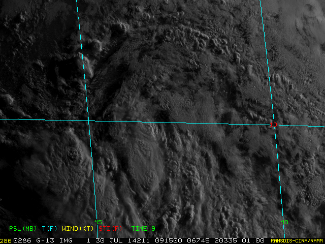
#353 Postby Hurricane Alexis » Wed Jul 30, 2014 4:34 am

First visible

Image
0 likes   
Personal Forecast Disclaimer:
The posts in this forum are NOT official forecast and should not be used as such. They are just the opinion of the poster and may or may not be backed by sound meteorological data. They are NOT endorsed by any professional institution or storm2k.org. For official information, please refer to the NHC and NWS products.

User avatar
cycloneye
Admin
Admin
Posts: 143877
Age: 68
Joined: Thu Oct 10, 2002 10:54 am
Location: San Juan, Puerto Rico

Re: ATL: INVEST 93L - Discussion

#354 Postby cycloneye » Wed Jul 30, 2014 5:11 am

I thought that the overnight hours would be beneficial for 93L to gather convection but it has only managed to form a few clouds.And this is almost opening up.

TXNT25 KNES 300608
TCSNTL

A. TROPICAL DISTURBANCE (93L)

B. 30/0545Z

C. 9.4N

D. 42.8W

E. THREE/GOES-E

F. T1.0/1.0/S0.0/24HRS

G. IR/EIR/SWIR

H. REMARKS...LESS THAN 2/10 CURVED BANDING YIELDS A DT=0.0 WITH THE
MET AND PT IN AGREEMENT. FT IS BASED ON CONSTRAINTS WHICH DO NO ALLOW
THE FT TO BE LOWERED AT NIGHT IN THE FIRST 48 HOURS OF DEVELOPMENT.

I. ADDL POSITIONS

NIL


...MCCARTHY
0 likes   
Visit the Caribbean-Central America Weather Thread where you can find at first post web cams,radars
and observations from Caribbean basin members Click Here

User avatar
SFLcane
S2K Supporter
S2K Supporter
Posts: 10162
Age: 47
Joined: Sat Jun 05, 2010 1:44 pm
Location: Lake Worth Florida

Re: ATL: INVEST 93L - Discussion

#355 Postby SFLcane » Wed Jul 30, 2014 5:16 am

Atlantic basin = Joke
0 likes   

User avatar
cycloneye
Admin
Admin
Posts: 143877
Age: 68
Joined: Thu Oct 10, 2002 10:54 am
Location: San Juan, Puerto Rico

Re: ATL: INVEST 93L - Discussion

#356 Postby cycloneye » Wed Jul 30, 2014 5:44 am

The headline in the main Puerto Rico newspaper is PR prepares for rationing of water. We had been waiting to see if 93L would terminate the drought but it looks like is not a sure thing right now.

Image
0 likes   
Visit the Caribbean-Central America Weather Thread where you can find at first post web cams,radars
and observations from Caribbean basin members Click Here

User avatar
tropicwatch
Category 5
Category 5
Posts: 3364
Age: 61
Joined: Sat Jun 02, 2007 10:01 am
Location: Panama City Florida
Contact:

#357 Postby tropicwatch » Wed Jul 30, 2014 5:58 am

Well the shear has lessened and as it gets closer to the islands there is not as much dry air but the shear picks back up in that area. Unless the shear comes down in the Caribbean, 93L will have a hard time of it I think.
0 likes   
Tropicwatch


Agnes 72', Eloise 75, Elena 85', Kate 85', Charley 86', Florence 88', Beryl 94', Dean 95', Erin 95', Opal 95', Earl 98', Georges 98', Ivan 2004', Arlene 2005', Dennis 2005', Ida 2009' Debby 2012' Irma 2017' Michael 2018'

ninel conde

Re: ATL: INVEST 93L - Discussion

#358 Postby ninel conde » Wed Jul 30, 2014 6:21 am

cycloneye wrote:The headline in the main Puerto Rico newspaper is PR prepares for rationing of water. We had been waiting to see if 93L would terminate the drought but it looks like is not a sure thing right now.

Image


sorry to hear that. it used to be even in dead seasons waves with convection would give you rain. now they just all dry up.
0 likes   

User avatar
caribepr
Category 5
Category 5
Posts: 1794
Joined: Fri Sep 05, 2003 10:43 pm
Location: Culebra, PR 18.33 65.33

Re: ATL: INVEST 93L - Discussion

#359 Postby caribepr » Wed Jul 30, 2014 6:25 am

cycloneye wrote:The headline in the main Puerto Rico newspaper is PR prepares for rationing of water. We had been waiting to see if 93L would terminate the drought but it looks like is not a sure thing right now.

Image


Fingers crossed and doing the gentle rain dance
0 likes   

User avatar
cycloneye
Admin
Admin
Posts: 143877
Age: 68
Joined: Thu Oct 10, 2002 10:54 am
Location: San Juan, Puerto Rico

Re: ATL: INVEST 93L - Discussion

#360 Postby cycloneye » Wed Jul 30, 2014 6:44 am

TROPICAL WEATHER OUTLOOK
NWS NATIONAL HURRICANE CENTER MIAMI FL
800 AM EDT WED JUL 30 2014

For the North Atlantic...Caribbean Sea and the Gulf of Mexico:

Showers and thunderstorms associated with an area of low pressure
located about 1150 miles east of the southern Windward Islands
remain limited. This system continues to show signs of
organization, however, and the low could develop into a tropical
depression later today or tomorrow while it moves generally
west-northwestward near 15 mph. Interests in the Lesser Antilles
should monitor the progress of this system.
* Formation chance through 48 hours...high...70 percent.
* Formation chance through 5 days...high...70 percent.

$$
Forecaster Pasch
0 likes   
Visit the Caribbean-Central America Weather Thread where you can find at first post web cams,radars
and observations from Caribbean basin members Click Here


Return to “2014”

Who is online

Users browsing this forum: No registered users and 63 guests