Bertha should start doing is best work when it reachs 20N . Expecting to much before that i think is wishful thinking.
The posts in this forum are NOT official forecast and should not be used as such. They are just the opinion of the poster and may or may not be backed by sound meteorological data. They are NOT endorsed by any professional institution or storm2k.org. For official information, please refer to the NHC and NWS products
ATL: BERTHA - Post-Tropical - Discussion
Moderator: S2k Moderators
-
Hurricaneman

- Category 5

- Posts: 7404
- Age: 45
- Joined: Tue Aug 31, 2004 3:24 pm
- Location: central florida
Re: ATL: BERTHA - Tropical Storm - Discussion
We now seem to have thunderstorms almost completely around the center so this may be going through a slight strengthening phase at the moment so maybe it will maintain until North of Hispaniola but thats where there could be a surprise as in if the shear is less than 10kts there this could be stronger after 72hrs than the NHC has it so there could be some anxious moments for the SEUS or Florida if somehow the ridge builds in like some of the GFS ensembles so it could still be interesting for those areas
here are my percentages for what will happen
Death over Hispaniola: 10%
Moves into the SEUS: 10%
Moves out to sea after the islands: 25%
Moves out to sea after the islands and possibly effects Bermuda: 55%
the more imminent threat is the islands and possibly Puerto Rico and Hispaniola and IMO this would be good news for PR
The posts in this forum are NOT official forecast and should not be used as such. They are just the opinion of the poster and may or may not be backed by sound meteorological data. They are NOT endorsed by any professional institution or storm2k.org. For official information, please refer to the NHC and NWS products
0 likes

Re:
Equilibrium wrote:Bertha should start doing is best work when it reachs 20N . Expecting to much before that i think is wishful thinking.
The posts in this forum are NOT official forecast and should not be used as such. They are just the opinion of the poster and may or may not be backed by sound meteorological data. They are NOT endorsed by any professional institution or storm2k.org. For official information, please refer to the NHC and NWS products
I totally agree, Bertha still has her best days ahead once she gets north of the Antilles, is what I have been saying for the last couple of days. Until she gets closer to the Lesser Antilles she will be fighting some dry air and convection will be fluctuating back and forth.
0 likes
Re: ATL: BERTHA - Tropical Storm - Discussion
Hurricaneman wrote:We now seem to have thunderstorms almost completely around the center so this may be going through a slight strengthening phase at the moment so maybe it will maintain until North of Hispaniola but thats where there could be a surprise as in if the shear is less than 10kts there this could be stronger after 72hrs than the NHC has it so there could be some anxious moments for the SEUS or Florida if somehow the ridge builds in like some of the GFS ensembles so it could still be interesting for those areas
here are my percentages for what will happen
Death over Hispaniola: 10%
Moves into the SEUS: 10%
Moves out to sea after the islands: 25%
Moves out to sea after the islands and possibly effects Bermuda: 55%
the more imminent threat is the islands and possibly Puerto Rico and Hispaniola and IMO this would be good news for PR
The posts in this forum are NOT official forecast and should not be used as such. They are just the opinion of the poster and may or may not be backed by sound meteorological data. They are NOT endorsed by any professional institution or storm2k.org. For official information, please refer to the NHC and NWS products
I don't see Bertha affecting Bermuda, as they will be protected by the strong Bermuda ridge building over the Island over the next 5 days, recurve should halfway between the Carolinas coast and Bermuda.
0 likes
-
TheStormExpert
Re: Re:
NDG wrote:Equilibrium wrote:Bertha should start doing is best work when it reachs 20N . Expecting to much before that i think is wishful thinking.
The posts in this forum are NOT official forecast and should not be used as such. They are just the opinion of the poster and may or may not be backed by sound meteorological data. They are NOT endorsed by any professional institution or storm2k.org. For official information, please refer to the NHC and NWS products
I totally agree, Bertha still has her best days ahead once she gets north of the Antilles, is what I have been saying for the last couple of days. Until she gets closer to the Lesser Antilles she will be fighting some dry air and convection will be fluctuating back and forth.
Are conditions off the SE U.S. as favorable as they were for Arthur?
0 likes


You look at Bertha then glance over at Iselle and it's just day and night. Head scratcher for sure if it was a beauty pageant for storms, one very wealthy the other in poverty.
I agree with NDG the best this storm has is when it is up north of the Antilles, if it can survive to there. If it gets close to the US coast it will probably feel a lot of the trough and the shear with it, a little out out and it has a good chance. But that's a long way out, just speculation.
I agree with NDG the best this storm has is when it is up north of the Antilles, if it can survive to there. If it gets close to the US coast it will probably feel a lot of the trough and the shear with it, a little out out and it has a good chance. But that's a long way out, just speculation.
0 likes
The above post and any post by Ntxw is NOT an official forecast and should not be used as such. It is just the opinion of the poster and may or may not be backed by sound meteorological data. It is NOT endorsed by any professional institution including Storm2k. For official information, please refer to NWS products.
Help support Storm2K!

-
weathernerdguy

- Tropical Storm

- Posts: 188
- Age: 23
- Joined: Wed Jul 10, 2013 8:44 pm
Knew the period of favorable conditions would be here today, not what I expected through.
0 likes
The posts in this forum are NOT official forecast and should not be used as such. They are just the opinion of the poster and may or may not be backed by sound meteorological data. They are NOT endorsed by any professional institution or storm2k.org. For official information, please refer to the NHC and NWS products
Re: Re:
TheStormExpert wrote:NDG wrote:Equilibrium wrote:Bertha should start doing is best work when it reachs 20N . Expecting to much before that i think is wishful thinking.
The posts in this forum are NOT official forecast and should not be used as such. They are just the opinion of the poster and may or may not be backed by sound meteorological data. They are NOT endorsed by any professional institution or storm2k.org. For official information, please refer to the NHC and NWS products
I totally agree, Bertha still has her best days ahead once she gets north of the Antilles, is what I have been saying for the last couple of days. Until she gets closer to the Lesser Antilles she will be fighting some dry air and convection will be fluctuating back and forth.
Are conditions off the SE U.S. as favorable as they were for Arthur?
The Euro forecasts fairly favorable UL conditions as soon as it nears the Bahamas by late Sunday into Monday, possible after that as well.
0 likes

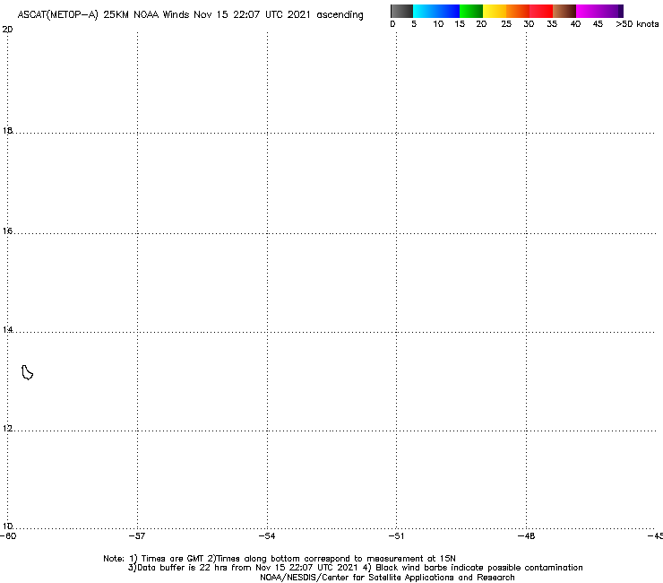
Latest ASCAT shows that the center is barely closed, so if the convection fails to maintain itself through morning as it's been doing, the plane may not find anything but a strong wave.
0 likes
The above post is not official and should not be used as such. It is the opinion of the poster and may or may not be backed by sound meteorological data. It is not endorsed by any professional institution or storm2k.org. For official information, please refer to the NHC and NWS products.
-
floridasun78
- Category 5
- Posts: 3755
- Joined: Sun May 17, 2009 10:16 pm
- Location: miami fl
-
Equilibrium
Re: Re:
TheStormExpert wrote:NDG wrote:Equilibrium wrote:Bertha should start doing is best work when it reachs 20N . Expecting to much before that i think is wishful thinking.
The posts in this forum are NOT official forecast and should not be used as such. They are just the opinion of the poster and may or may not be backed by sound meteorological data. They are NOT endorsed by any professional institution or storm2k.org. For official information, please refer to the NHC and NWS products
I totally agree, Bertha still has her best days ahead once she gets north of the Antilles, is what I have been saying for the last couple of days. Until she gets closer to the Lesser Antilles she will be fighting some dry air and convection will be fluctuating back and forth.
Are conditions off the SE U.S. as favorable as they were for Arthur?
Betwen 10N-20N available moisture thins out for this reason i would not expect to much change until the TS reaches 20N. The TS should drag along with it sufficent moisture to survive this period.
At 20N the avalible moisture and (cape) rapidly improves again and the TS will benefit from the Gulf current grye .
looking over a shear chart it appears to be more favorable with that being said its the tropics and things can change suddenly.
edit to add Disclaimer
The posts in this forum are NOT official forecast and should not be used as such. They are just the opinion of the poster and may or may not be backed by sound meteorological data. They are NOT endorsed by any professional institution or storm2k.org. For official information, please refer to the NHC and NWS products
Last edited by Equilibrium on Fri Aug 01, 2014 12:56 am, edited 1 time in total.
0 likes
Re:
Hammy wrote:Latest ASCAT shows that the center is barely closed, so if the convection fails to maintain itself through morning as it's been doing, the plane may not find anything but a strong wave.
Totally false, the latest pass missed most of its circulation.

0 likes
Re: Re:
NDG wrote:Hammy wrote:Latest ASCAT shows that the center is barely closed, so if the convection fails to maintain itself through morning as it's been doing, the plane may not find anything but a strong wave.
Totally false, the latest pass missed most of its circulation.
Using this site http://manati.star.nesdis.noaa.gov/ascat_images/cur_25km_META/zooms/WMBas100.png
Was thrown off by lack of satellite overlay and the persisting area to the southwest, thanks for the clarification.
edit: one corresponding to the timeframe I saw earlier that clipped the western half of the circulation shows it still very elongated to the SW.
http://199.9.2.143/tcdat/tc14/ATL/03L.BERTHA/ssmi/scat/scat_over_ir/20140801.0051.metop-a.ASCAT_IR.wind.03LBERTHA.2062_045pc_40kts-1008mb_121N_547W_sft20140801_0000.jpg about 12.0/54.5 was where the LLC was located at the time based on the floater.
Last edited by Hammy on Fri Aug 01, 2014 12:46 am, edited 1 time in total.
0 likes
The above post is not official and should not be used as such. It is the opinion of the poster and may or may not be backed by sound meteorological data. It is not endorsed by any professional institution or storm2k.org. For official information, please refer to the NHC and NWS products.

Re:
floridasun78 wrote:even as ts we still hear word open wave wow
I think that they want to be "safe" due to the proximity of the system to The Islands so just being able to check off each of the criteria was what they needed to name the system. All of the criteria except convection were already there (even if "barely"). Now at least the residents can take whatever precautions that are needed for at least some squalls and gusty winds.
Good news is Luis and his fellow Islanders REALLY need the rain!!!

0 likes
Personal Forecast Disclaimer:
My posts are just my opinion and are most likely not backed by sound meteorological data. They are NOT endorsed by any professional institution or storm2k.org. For official information, please refer to the NHC and NWS products.
Bottom line is that I am just expressing my opinion!!!
My posts are just my opinion and are most likely not backed by sound meteorological data. They are NOT endorsed by any professional institution or storm2k.org. For official information, please refer to the NHC and NWS products.
Bottom line is that I am just expressing my opinion!!!
Re: ATL: BERTHA - Tropical Storm - Discussion
Convection collapsing already, and the storm is also starting to come into view of Barbados radar, which should make it easier to track on an hourly basis. http://www.barbadosweather.org/RadarPro/BMS_RadarDisplayer.php
0 likes
The above post is not official and should not be used as such. It is the opinion of the poster and may or may not be backed by sound meteorological data. It is not endorsed by any professional institution or storm2k.org. For official information, please refer to the NHC and NWS products.
-
HurricaneRyan
- Category 3

- Posts: 846
- Age: 32
- Joined: Sun Dec 05, 2010 3:05 pm
-
Kingarabian

- S2K Supporter

- Posts: 16373
- Joined: Sat Aug 08, 2009 3:06 am
- Location: Honolulu, Hawaii
-
Hurricane Alexis

- Category 2

- Posts: 683
- Age: 29
- Joined: Thu Jun 14, 2012 7:59 pm
- Location: Miami,Florida
Re: ATL: BERTHA - Tropical Storm - Discussion
Convection looked like it was collapsing till the last couple of frames. You can see a band forming in the north side with the main blob expanding west and maintaining it's strength.
0 likes
Personal Forecast Disclaimer:
The posts in this forum are NOT official forecast and should not be used as such. They are just the opinion of the poster and may or may not be backed by sound meteorological data. They are NOT endorsed by any professional institution or storm2k.org. For official information, please refer to the NHC and NWS products.
The posts in this forum are NOT official forecast and should not be used as such. They are just the opinion of the poster and may or may not be backed by sound meteorological data. They are NOT endorsed by any professional institution or storm2k.org. For official information, please refer to the NHC and NWS products.


Re: ATL: BERTHA - Tropical Storm - Discussion
A snap shot of the big picture. Bertha and the wave behind her are looking a lot like twins tonight... 

Last edited by baytownwx on Fri Aug 01, 2014 3:30 am, edited 1 time in total.
0 likes
The following post is NOT an official forecast and should not be used as such. It is just the opinion of the poster and may or may not be backed by sound meteorological data. It is NOT endorsed by storm2k.org.
Re: ATL: BERTHA - Tropical Storm - Discussion
http://www.barbadosweather.org/RadarPro/BMS_RadarDisplayer.php Barbados radar raises further doubt that this is even closed any longer, none of the echoes are moving from the west, or even from due north.
0 likes
The above post is not official and should not be used as such. It is the opinion of the poster and may or may not be backed by sound meteorological data. It is not endorsed by any professional institution or storm2k.org. For official information, please refer to the NHC and NWS products.
Who is online
Users browsing this forum: No registered users and 34 guests