
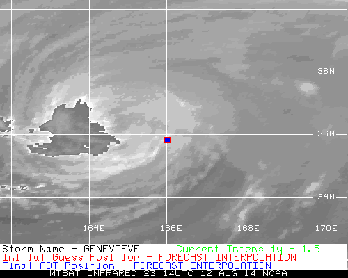
WPAC: GENEVIEVE - Post-Tropical
Moderator: S2k Moderators
-
euro6208
Re: CPAC: GENEVIEVE - Hurricane
Last edited by euro6208 on Thu Aug 07, 2014 4:50 am, edited 2 times in total.
0 likes
-
euro6208
Re: CPAC: GENEVIEVE - Hurricane
JTWC conitnues where CPHC left off. CATEGORY 4 Super Typhoon with winds of 130 knots and forecast to peak at 145 knots, Cat 5!
0 likes
-
dexterlabio
- Category 5

- Posts: 3511
- Joined: Sat Oct 24, 2009 11:50 pm
Re: CPAC: GENEVIEVE - Hurricane
thats a lot of ACE imported from EPAC/CPAC...will it gain more strength as a typhoon?
0 likes
Personal Forecast Disclaimer:
The posts in this forum are NOT official forecast and should not be used as such. They are just the opinion of the poster and may or may not be backed by sound meteorological data. They are NOT endorsed by any professional institution or storm2k.org. For official information, please refer to the NHC and NWS products.
The posts in this forum are NOT official forecast and should not be used as such. They are just the opinion of the poster and may or may not be backed by sound meteorological data. They are NOT endorsed by any professional institution or storm2k.org. For official information, please refer to the NHC and NWS products.
-
xtyphooncyclonex

- Category 5
- Posts: 3892
- Age: 24
- Joined: Sat Dec 08, 2012 9:07 am
- Location: Cebu City
- Contact:
WOW!!!!! SUPER TYPHOON??? FORECAST PEAK IS 145 KTS AND STRONGEST EVER FOR IDL!!!!
WTPN32 PGTW 070900
MSGID/GENADMIN/JOINT TYPHOON WRNCEN PEARL HARBOR HI//
SUBJ/TROPICAL CYCLONE WARNING//
RMKS/
1. SUPER TYPHOON 07E (GENEVIEVE) WARNING NR 041
UPGRADED FROM TYPHOON 07E
02 ACTIVE TROPICAL CYCLONES IN NORTHWESTPAC
MAX SUSTAINED WINDS BASED ON ONE-MINUTE AVERAGE
WIND RADII VALID OVER OPEN WATER ONLY
---
WARNING POSITION:
070600Z --- NEAR 14.5N 179.8E
MOVEMENT PAST SIX HOURS - 300 DEGREES AT 14 KTS
POSITION ACCURATE TO WITHIN 020 NM
POSITION BASED ON EYE FIXED BY SATELLITE
PRESENT WIND DISTRIBUTION:
MAX SUSTAINED WINDS - 130 KT, GUSTS 160 KT
WIND RADII VALID OVER OPEN WATER ONLY
RADIUS OF 064 KT WINDS - 050 NM NORTHEAST QUADRANT
040 NM SOUTHEAST QUADRANT
035 NM SOUTHWEST QUADRANT
045 NM NORTHWEST QUADRANT
RADIUS OF 050 KT WINDS - 080 NM NORTHEAST QUADRANT
070 NM SOUTHEAST QUADRANT
070 NM SOUTHWEST QUADRANT
080 NM NORTHWEST QUADRANT
RADIUS OF 034 KT WINDS - 135 NM NORTHEAST QUADRANT
115 NM SOUTHEAST QUADRANT
115 NM SOUTHWEST QUADRANT
135 NM NORTHWEST QUADRANT
REPEAT POSIT: 14.5N 179.8E
---
FORECASTS:
12 HRS, VALID AT:
071800Z --- 15.5N 177.7E
MAX SUSTAINED WINDS - 145 KT, GUSTS 175 KT
WIND RADII VALID OVER OPEN WATER ONLY
RADIUS OF 064 KT WINDS - 045 NM NORTHEAST QUADRANT
040 NM SOUTHEAST QUADRANT
035 NM SOUTHWEST QUADRANT
045 NM NORTHWEST QUADRANT
RADIUS OF 050 KT WINDS - 080 NM NORTHEAST QUADRANT
070 NM SOUTHEAST QUADRANT
070 NM SOUTHWEST QUADRANT
080 NM NORTHWEST QUADRANT
RADIUS OF 034 KT WINDS - 130 NM NORTHEAST QUADRANT
115 NM SOUTHEAST QUADRANT
115 NM SOUTHWEST QUADRANT
130 NM NORTHWEST QUADRANT
VECTOR TO 24 HR POSIT: 315 DEG/ 12 KTS
0 likes
REMINDER: My opinions that I, or any other NON Pro-Met in this forum, are unofficial. Please do not take my opinions as an official forecast and warning. I am NOT a meteorologist. Following my forecasts blindly may lead to false alarm, danger and risk if official forecasts from agencies are ignored.
-
xtyphooncyclonex
- Category 5
- Posts: 3892
- Age: 24
- Joined: Sat Dec 08, 2012 9:07 am
- Location: Cebu City
- Contact:
Unusually high pressure for a Violent typhoon in JMA forecast, 945 hPa and it usually is at 905-925 hPa if it were in the other parts of te WPAC. The most impressive storm I have tracked since Haiyan last year.
0 likes
REMINDER: My opinions that I, or any other NON Pro-Met in this forum, are unofficial. Please do not take my opinions as an official forecast and warning. I am NOT a meteorologist. Following my forecasts blindly may lead to false alarm, danger and risk if official forecasts from agencies are ignored.
-
WeatherGuesser
- Category 5
- Posts: 2672
- Joined: Tue Jun 29, 2010 6:46 am
-
somethingfunny

- ChatStaff

- Posts: 3926
- Age: 37
- Joined: Thu May 31, 2007 10:30 pm
- Location: McKinney, Texas
It's interesting how much sooner the recurve is now forecast to occur compared to on earlier model runs. Genevieve wasn't expected to intensify so rapidly and thus feel poleward forcing at this longitude, where there is obviously a small weakness. Earlier runs of the GFS had Genevieve meandering around the higher latitudes west of Wake Island for over a week, after becoming a major typhoon, while Halong and Julio each caught a seat on the Alaskan Cruise Line.
Now it's Julio and Halong that will apparently be meandering while massive and powerful Genevieve slips poleward. I wonder what kind of long-term effect a supertyphoon entering the jet stream from the region of the Date Line would have teleconnectively. So far this summer's North American troughing pattern (and West Coast heat ridge) has seemingly been fueled by typhoons entering the jet stream from the far WPAC. Maybe an unforeseen pattern shift will result from Genevieve changing things up?
Regrettably, JMA is horrendous about underestimating central pressures (they're usually not THIS bad though....950mb, really? ) and JTWC doesn't do intensity estimate. I hope that Iselle and Julio miraculously evaporate, and the reconnaissance crews in Hawaii decide to fly a mission into Genevieve because hey, why not?
Now it's Julio and Halong that will apparently be meandering while massive and powerful Genevieve slips poleward. I wonder what kind of long-term effect a supertyphoon entering the jet stream from the region of the Date Line would have teleconnectively. So far this summer's North American troughing pattern (and West Coast heat ridge) has seemingly been fueled by typhoons entering the jet stream from the far WPAC. Maybe an unforeseen pattern shift will result from Genevieve changing things up?
Regrettably, JMA is horrendous about underestimating central pressures (they're usually not THIS bad though....950mb, really?
0 likes
I am not a meteorologist, and any posts made by me are not official forecasts or to be interpreted as being intelligent. These posts are just my opinions and are probably silly opinions.
-
ManilaTC

- WesternPacificWeather.com

- Posts: 593
- Age: 47
- Joined: Mon Oct 26, 2009 5:13 am
- Location: Mandaluyong City, Philippines
- Contact:
Hey so this storm crosses the dateline and is now in our territory hehe... Curiously asking, how does S2k handle this? Do you move the forum to the WPAC forums or keep it in the basin of origin?
0 likes
The above post is NOT official and should not be used as such. It is my opinion and may or may not be backed by sound meteorological data. It is not endorsed by any professional institution or storm2k.org. Please refer to your official national weather agency.
WEB http://goo.gl/JDiKXB | FB https://goo.gl/N5sIle | @ManilaTC
WEB http://goo.gl/JDiKXB | FB https://goo.gl/N5sIle | @ManilaTC
-
ManilaTC
- WesternPacificWeather.com
- Posts: 593
- Age: 47
- Joined: Mon Oct 26, 2009 5:13 am
- Location: Mandaluyong City, Philippines
- Contact:
By the way the CDG in the dvorak satellite image has completely surrounded the eye... perhaps its now T8.0 
0 likes
The above post is NOT official and should not be used as such. It is my opinion and may or may not be backed by sound meteorological data. It is not endorsed by any professional institution or storm2k.org. Please refer to your official national weather agency.
WEB http://goo.gl/JDiKXB | FB https://goo.gl/N5sIle | @ManilaTC
WEB http://goo.gl/JDiKXB | FB https://goo.gl/N5sIle | @ManilaTC
-
xtyphooncyclonex
- Category 5
- Posts: 3892
- Age: 24
- Joined: Sat Dec 08, 2012 9:07 am
- Location: Cebu City
- Contact:
Re:
somethingfunny wrote:It's interesting how much sooner the recurve is now forecast to occur compared to on earlier model runs. Genevieve wasn't expected to intensify so rapidly and thus feel poleward forcing at this longitude, where there is obviously a small weakness. Earlier runs of the GFS had Genevieve meandering around the higher latitudes west of Wake Island for over a week, after becoming a major typhoon, while Halong and Julio each caught a seat on the Alaskan Cruise Line.
Now it's Julio and Halong that will apparently be meandering while massive and powerful Genevieve slips poleward. I wonder what kind of long-term effect a supertyphoon entering the jet stream from the region of the Date Line would have teleconnectively. So far this summer's North American troughing pattern (and West Coast heat ridge) has seemingly been fueled by typhoons entering the jet stream from the far WPAC. Maybe an unforeseen pattern shift will result from Genevieve changing things up?
Regrettably, JMA is horrendous about underestimating central pressures (they're usually not THIS bad though....950mb, really?
JMA may actually right. It is moving around 25 kph and that the area where Genevieve is located has higher pressures. This happened several occasions; those were during typhoons John, Ele, Pewa and Huko.
0 likes
REMINDER: My opinions that I, or any other NON Pro-Met in this forum, are unofficial. Please do not take my opinions as an official forecast and warning. I am NOT a meteorologist. Following my forecasts blindly may lead to false alarm, danger and risk if official forecasts from agencies are ignored.
-
xtyphooncyclonex
- Category 5
- Posts: 3892
- Age: 24
- Joined: Sat Dec 08, 2012 9:07 am
- Location: Cebu City
- Contact:
Re: WPAC: GENEVIEVE - Typhoon
Wow!
07/0832 UTC 14.8N 179.3E T7.0/7.0 GENEVIEVE -- West Pacific
07/0832 UTC 14.8N 179.3E T7.0/7.0 GENEVIEVE -- West Pacific
0 likes
REMINDER: My opinions that I, or any other NON Pro-Met in this forum, are unofficial. Please do not take my opinions as an official forecast and warning. I am NOT a meteorologist. Following my forecasts blindly may lead to false alarm, danger and risk if official forecasts from agencies are ignored.

Welcome the monster


This super typhoon is off the chain. Becoming a monster that will stand out for 2014. The rate might have slowed down but I believe its still strengthening. The eye is now really warm and circular with a perfect CDO that is becoming much wider. IMO its at least 150 knots bare minimum, maybe 155 knots. Looks like Hurricane Rita at peak but now the CDO is becoming more perfect than even her!
The posts in this forum are NOT official forecast and should not be used as such.
0 likes
-
hurricanes1234
- Category 5
- Posts: 2908
- Joined: Sat Jul 28, 2012 6:19 pm
- Location: Trinidad and Tobago
No words to describe this...
0 likes
PLEASE NOTE: With the exception of information from weather agencies that I may copy and paste here, my posts will NEVER be official, since I am NOT a meteorologist. They are solely my amateur opinion, and may or may not be accurate. Therefore, please DO NOT use them as official details, particularly when making important decisions. Thank you.
-
dexterlabio
- Category 5
- Posts: 3511
- Joined: Sat Oct 24, 2009 11:50 pm
Re: WPAC: GENEVIEVE - Typhoon

Make the CDO a bit colder and it will be like Haiyan. Right now it looks way more intense than Halong.
0 likes
Personal Forecast Disclaimer:
The posts in this forum are NOT official forecast and should not be used as such. They are just the opinion of the poster and may or may not be backed by sound meteorological data. They are NOT endorsed by any professional institution or storm2k.org. For official information, please refer to the NHC and NWS products.
The posts in this forum are NOT official forecast and should not be used as such. They are just the opinion of the poster and may or may not be backed by sound meteorological data. They are NOT endorsed by any professional institution or storm2k.org. For official information, please refer to the NHC and NWS products.
-
xtyphooncyclonex
- Category 5
- Posts: 3892
- Age: 24
- Joined: Sat Dec 08, 2012 9:07 am
- Location: Cebu City
- Contact:
Eerily reminds me of Super Typhoon Haiyan. The movement, structure, convection and intensity; Just wow. But Haiyan's cloud tops were MUCH COLDER than of Genevieve.

0 likes
REMINDER: My opinions that I, or any other NON Pro-Met in this forum, are unofficial. Please do not take my opinions as an official forecast and warning. I am NOT a meteorologist. Following my forecasts blindly may lead to false alarm, danger and risk if official forecasts from agencies are ignored.
-
xtyphooncyclonex
- Category 5
- Posts: 3892
- Age: 24
- Joined: Sat Dec 08, 2012 9:07 am
- Location: Cebu City
- Contact:
I somewhat want this to last longer and that the shear would decrease over the track it would go through. This would be like Ioke 2006. IMO, I guess that this would not weaken as fast as the JTWC forecast, and this is the opposite of what the JMA shows.
0 likes
REMINDER: My opinions that I, or any other NON Pro-Met in this forum, are unofficial. Please do not take my opinions as an official forecast and warning. I am NOT a meteorologist. Following my forecasts blindly may lead to false alarm, danger and risk if official forecasts from agencies are ignored.
-
euro6208
Re: WPAC: GENEVIEVE - Typhoon
It does look like haiyan but what is lacking is a curved band to the west and extremely cold convection and warm eye...
0 likes

-
xtyphooncyclonex
- Category 5
- Posts: 3892
- Age: 24
- Joined: Sat Dec 08, 2012 9:07 am
- Location: Cebu City
- Contact:
Re:
RL3AO wrote:Lets go easy with the Haiyan comparisons. This doesn't even qualify for CMG around the center much less CDG.
Yes, and that is one thing that needs to be improved, but it can not. Conditions aren't as favorable as during Haiyan.
0 likes
REMINDER: My opinions that I, or any other NON Pro-Met in this forum, are unofficial. Please do not take my opinions as an official forecast and warning. I am NOT a meteorologist. Following my forecasts blindly may lead to false alarm, danger and risk if official forecasts from agencies are ignored.
-
euro6208
Re: WPAC: GENEVIEVE - Typhoon
Will this get upgraded into a category 5?
Anxiously waiting for the 12Z BT...
Dvorak numbers from PGTW and KNES are 7.0 while ADT is up to 7.1 (143 knots)...
Anxiously waiting for the 12Z BT...
Dvorak numbers from PGTW and KNES are 7.0 while ADT is up to 7.1 (143 knots)...
0 likes
Who is online
Users browsing this forum: No registered users and 17 guests