
Friends in So Fla said on of the local mets said the disturbance will pass to the east of the Bahamas and not affect SE fl at all.
Everyone agree? How can he be so sure when the storm has not even formed?
ATL: CRISTOBAL - Post-Tropical - Discussion
Moderator: S2k Moderators
Re: ATL: INVEST 96L - Discussion
0 likes
-
somethingfunny

- ChatStaff

- Posts: 3926
- Age: 37
- Joined: Thu May 31, 2007 10:30 pm
- Location: McKinney, Texas
Re: ATL: INVEST 96L - Discussion
sunnyday wrote:Friends in So Fla said on of the local mets said the disturbance will pass to the east of the Bahamas and not affect SE fl at all.
Everyone agree? How can he be so sure when the storm has not even formed?
I have no contention with that meteorologist's statement except for one: Never say "will" when you should say "could".
0 likes
I am not a meteorologist, and any posts made by me are not official forecasts or to be interpreted as being intelligent. These posts are just my opinions and are probably silly opinions.
-
deltadog03

- Professional-Met

- Posts: 3580
- Joined: Tue Jul 05, 2005 6:16 pm
- Location: Macon, GA
Re:
gatorcane wrote:Anybody see a broad circulation at 16N, 60W heading nearly due west? This one could end up taking over...

I think there is a some slight rotation there possibly. I actually think this could get tucked in further W or WNW with that main convection.
0 likes

Re:
gatorcane wrote:Anybody see a broad circulation at 16N, 60W heading nearly due west? This one could end up taking over...
Yes..., No..., Maybe...LOL Seriously though, one could make a case for a larger broader center there. Heck, I'm starting to wonder if something could be trying to reform at about 16.5N & 63W ??
0 likes
Andy D
(For official information, please refer to the NHC and NWS products.)
(For official information, please refer to the NHC and NWS products.)
-
deltadog03
- Professional-Met
- Posts: 3580
- Joined: Tue Jul 05, 2005 6:16 pm
- Location: Macon, GA
Re:
Alyono wrote:something to consider, there are TWO ways this could impact the USA. One is to move very fast in the short term, like the 12Z HWRF. It makes it far enough west to miss the trough. The other is to move slower than it is moving, which would result in it being trapped by the ridge
I agree with you on this as well. It could get fast enough to out race the weakness....That could be the most plausible thing right now.
0 likes

Re: ATL: INVEST 96L - Discussion
deltadog03 wrote:Alyono wrote:something to consider, there are TWO ways this could impact the USA. One is to move very fast in the short term, like the 12Z HWRF. It makes it far enough west to miss the trough. The other is to move slower than it is moving, which would result in it being trapped by the ridge
I agree with you on this as well. It could get fast enough to out race the weakness....That could be the most plausible thing right now.
Very good obeservations. I also think on the trapping scenario it has to get passed 75w because the blocking ridge will not extend too far out during that time.
0 likes
The following post is NOT an official forecast and should not be used as such. It is just the opinion of the poster and may or may not be backed by sound meteorological data. It is NOT endorsed by any professional institution including storm2k.org For Official Information please refer to the NHC and NWS products.
Sitting back and looking at the bigger picture it is a fairly overall large rotation
http://www.ssd.noaa.gov/goes/east/carb/flash-vis.html
http://www.ssd.noaa.gov/goes/east/carb/flash-vis.html
0 likes
-
Gustywind

- Category 5

- Posts: 12334
- Joined: Mon Sep 03, 2007 7:29 am
- Location: Baie-Mahault, GUADELOUPE
Re:
gatorcane wrote:Anybody see a broad circulation at 16N, 60W heading nearly due west? This one could end up taking over...
Waouw just east Guadeloupe, that won't be good news for us Gatorcane
 We want juicy amount of water
0 likes
-
Hurricane Andrew

- S2K Supporter

- Posts: 1891
- Age: 27
- Joined: Sun May 23, 2010 2:53 pm
- Location: KS
-
deltadog03
- Professional-Met
- Posts: 3580
- Joined: Tue Jul 05, 2005 6:16 pm
- Location: Macon, GA

-
Hurricane Andrew
- S2K Supporter
- Posts: 1891
- Age: 27
- Joined: Sun May 23, 2010 2:53 pm
- Location: KS
Re: ATL: INVEST 96L - Discussion
deltadog03 wrote:[img][/img]
I agree. The old LLC is likely winding down, and a new LLC will transfer down underneath the convection.
0 likes
The Enthusiast
NREMT-AEMT, WX nerd
Irene '11, Sandy '12, Irma '17 (SAR)
"Hard to think we were born to live this way..." -Wage War
-
rolltide

- Tropical Storm

- Posts: 234
- Age: 65
- Joined: Thu Sep 09, 2004 5:33 pm
- Location: Pensacola Florida
Re: ATL: INVEST 96L - Discussion
It looks to me like the likely COC will go right over Puerto Rico heading wnw. If so this means it will have to deal with the DR. This may delay any development until it reaches the southern Bahamas if it doesn't fall apart. After that who knows.
This post is NOT AN OFFICIAL FORECAST and should not be used as such. It is just the opinion of the poster and may or may not be backed by sound meteorological data. It is NOT endorsed by any professional institution including storm2k.org. For Official Information please refer to the NHC and NWS products
This post is NOT AN OFFICIAL FORECAST and should not be used as such. It is just the opinion of the poster and may or may not be backed by sound meteorological data. It is NOT endorsed by any professional institution including storm2k.org. For Official Information please refer to the NHC and NWS products
0 likes
-
Hurricaneman
- Category 5
- Posts: 7404
- Age: 45
- Joined: Tue Aug 31, 2004 3:24 pm
- Location: central florida
Re: ATL: INVEST 96L - Discussion
Hurricane Andrew wrote:deltadog03 wrote:[img]
I agree. The old LLC is likely winding down, and a new LLC will transfer down underneath the convection.
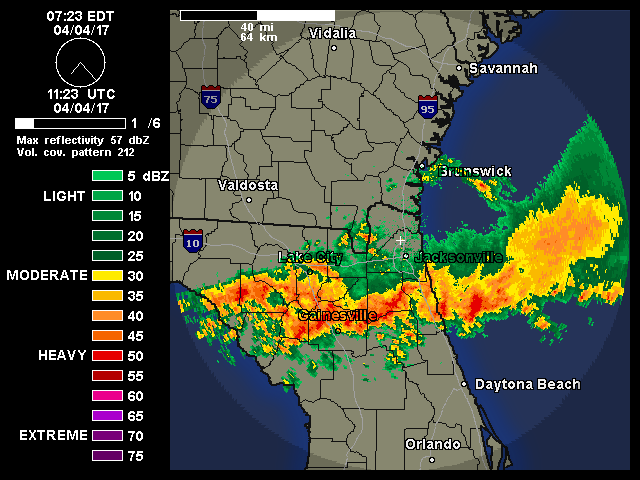
radar seems to be indicating the same thing so this could get going fast tonight if thats the case
The posts in this forum are NOT official forecast and should not be used as such. They are just the opinion of the poster and may or may not be backed by sound meteorological data. They are NOT endorsed by any professional institution or storm2k.org. For official information, please refer to the NHC and NWS products
0 likes
-
Aric Dunn
- Category 5
- Posts: 21238
- Age: 43
- Joined: Sun Sep 19, 2004 9:58 pm
- Location: Ready for the Chase.
- Contact:
Re: ATL: INVEST 96L - Discussion
deltadog03 wrote:[img]
\Quite likely there are multiple vort rotating around and any convective increase will likely lower the pressure that area and produce another vort and many more until persistent convection can maintain.
0 likes
Note: If I make a post that is brief. Please refer back to previous posts for the analysis or reasoning. I do not re-write/qoute what my initial post said each time.
If there is nothing before... then just ask
Space & Atmospheric Physicist, Embry-Riddle Aeronautical University,
I believe the sky is falling...
If there is nothing before... then just ask
Space & Atmospheric Physicist, Embry-Riddle Aeronautical University,
I believe the sky is falling...
-
deltadog03
- Professional-Met
- Posts: 3580
- Joined: Tue Jul 05, 2005 6:16 pm
- Location: Macon, GA
-
SFLcane

- S2K Supporter
- Posts: 10281
- Age: 48
- Joined: Sat Jun 05, 2010 1:44 pm
- Location: Lake Worth Florida
Re: ATL: INVEST 96L - Discussion
racing at 25 mph theres no way this developes . I like the hwrf in terms of getting tangled with the islands then quick ramp up in Bahamas.
0 likes
-
tropicwatch

- Category 5
- Posts: 3426
- Age: 62
- Joined: Sat Jun 02, 2007 10:01 am
- Location: The Villages, Florida
- Contact:
Re: ATL: INVEST 96L - Discussion
Well the showers in Puerto Rico are moving from north to south.
0 likes
Tropicwatch
Agnes 72', Eloise 75, Elena 85', Kate 85', Charley 86', Florence 88', Beryl 94', Dean 95', Erin 95', Opal 95', Earl 98', Georges 98', Ivan 2004', Arlene 2005', Dennis 2005', Ida 2009' Debby 2012' Irma 2017' Michael 2018'
Agnes 72', Eloise 75, Elena 85', Kate 85', Charley 86', Florence 88', Beryl 94', Dean 95', Erin 95', Opal 95', Earl 98', Georges 98', Ivan 2004', Arlene 2005', Dennis 2005', Ida 2009' Debby 2012' Irma 2017' Michael 2018'
-
tolakram
- Admin

- Posts: 20185
- Age: 62
- Joined: Sun Aug 27, 2006 8:23 pm
- Location: Florence, KY (name is Mark)
Re: ATL: INVEST 96L - Discussion
Live visible loop as the sun sets. Speed up for full effect. At this rate it will be in the Bahamas tomorrow.
http://wwwghcc.msfc.nasa.gov/cgi-bin/get-goes?satellite=GOES-E%20HURRICANE&lat=18&lon=-63&info=vis&zoom=2&width=1000&height=800&type=Animation&quality=95&palette=ir1.pal&numframes=15
http://wwwghcc.msfc.nasa.gov/cgi-bin/get-goes?satellite=GOES-E%20HURRICANE&lat=18&lon=-63&info=vis&zoom=2&width=1000&height=800&type=Animation&quality=95&palette=ir1.pal&numframes=15
0 likes
M a r k
- - - - -
Join us in chat: Storm2K Chatroom Invite. Android and IOS apps also available.
The posts in this forum are NOT official forecasts and should not be used as such. Posts are NOT endorsed by any professional institution or STORM2K.org. For official information and forecasts, please refer to NHC and NWS products.
-
tropicwatch
- Category 5
- Posts: 3426
- Age: 62
- Joined: Sat Jun 02, 2007 10:01 am
- Location: The Villages, Florida
- Contact:
It does seem to be cruisin 
0 likes
Tropicwatch
Agnes 72', Eloise 75, Elena 85', Kate 85', Charley 86', Florence 88', Beryl 94', Dean 95', Erin 95', Opal 95', Earl 98', Georges 98', Ivan 2004', Arlene 2005', Dennis 2005', Ida 2009' Debby 2012' Irma 2017' Michael 2018'
Agnes 72', Eloise 75, Elena 85', Kate 85', Charley 86', Florence 88', Beryl 94', Dean 95', Erin 95', Opal 95', Earl 98', Georges 98', Ivan 2004', Arlene 2005', Dennis 2005', Ida 2009' Debby 2012' Irma 2017' Michael 2018'
Who is online
Users browsing this forum: No registered users and 9 guests