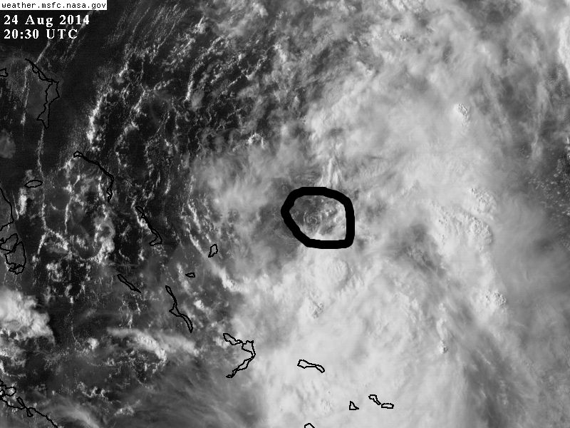
Recurve wrote:Untrained eye -- have a very hard time seeing LL center. All the components are there, nice outflow, good inflow visible to W, storm tops bubbling near center. But where it is exactly and if/where it's moving could only be known from recon fixes I'd say.
NASA satellite gives a good idea where it's at as it's much higher resolution (and more imagery) than the floaters, a swirl on the NW edge of the convection can be seen.