Florida Weather
Moderator: S2k Moderators
Forum rules

The posts in this forum are NOT official forecast and should not be used as such. They are just the opinion of the poster and may or may not be backed by sound meteorological data. They are NOT endorsed by any professional institution or STORM2K.
-
tropicwatch

- Category 5

- Posts: 3427
- Age: 62
- Joined: Sat Jun 02, 2007 10:01 am
- Location: The Villages, Florida
- Contact:
Re: Florida Weather
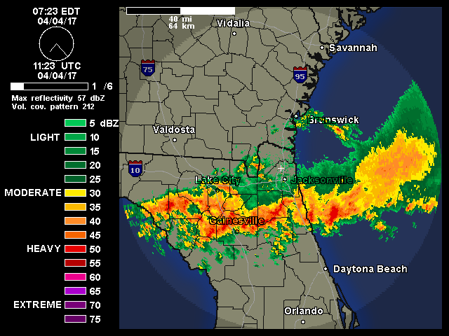
Nice line of showers crossing the panhandle.
0 likes
Tropicwatch
Agnes 72', Eloise 75, Elena 85', Kate 85', Charley 86', Florence 88', Beryl 94', Dean 95', Erin 95', Opal 95', Earl 98', Georges 98', Ivan 2004', Arlene 2005', Dennis 2005', Ida 2009' Debby 2012' Irma 2017' Michael 2018'
Agnes 72', Eloise 75, Elena 85', Kate 85', Charley 86', Florence 88', Beryl 94', Dean 95', Erin 95', Opal 95', Earl 98', Georges 98', Ivan 2004', Arlene 2005', Dennis 2005', Ida 2009' Debby 2012' Irma 2017' Michael 2018'
-
SouthFloridian92
- Tropical Storm

- Posts: 120
- Age: 33
- Joined: Tue Dec 11, 2012 4:50 pm
- Location: Sebring, Florida
Re: Florida Weather
The humidity down here is horrible. It can be 10 at night or 10 in the morning, it still feels like 100! I HATE it. I don't know how anyone can enjoy it.
0 likes
-
JonathanBelles
- Professional-Met

- Posts: 11430
- Age: 35
- Joined: Sat Dec 24, 2005 9:00 pm
- Location: School: Florida State University (Tallahassee, FL) Home: St. Petersburg, Florida
- Contact:

Re: Florida Weather
Anyone know what happened to the Orlando TDWR radar on Wunderground?
http://www.wunderground.com/radar/radblast.asp?ID=MCO
It's been out of service for a couple of days for now.
Last time the radar was down, there was an announcement on the radar somewhere saying for how long the radar would be down.
http://www.wunderground.com/radar/radblast.asp?ID=MCO
It's been out of service for a couple of days for now.
Last time the radar was down, there was an announcement on the radar somewhere saying for how long the radar would be down.
0 likes
This post is NOT AN OFFICIAL FORECAST and should not be used as such. It is just the opinion of the poster and may or may not be backed by sound meteorological data. It is NOT endorsed by any professional institution including storm2k.org. For Official Information please refer to the NHC and NWS products.

Here is the survey done on the Tornado in Edgewater in Volusia County Friday evening, they up it to EF-1. Very rare to see tornadoes this time of the year during non-tropical cyclone events.
http://www.srh.noaa.gov/images/mlb/pdfs ... ITE-UP.pdf
http://www.srh.noaa.gov/images/mlb/pdfs ... ITE-UP.pdf
0 likes
-
northjaxpro

- S2K Supporter

- Posts: 8900
- Joined: Mon Sep 27, 2010 11:21 am
- Location: Jacksonville, FL
Re: Florida Weather
Thankfully, no one was killed or seriously injured in the Edgewater tornado. Yeah NDG, quiye rare to see tornadoes outside of tropical cyclone events across the peninsula. However, seabreeze fronts during the summer can spawn tornadoes on rare occasions. Last year, a tornado similar to this one in Edgewater touched down in the Arlington area of Jax from a seabreeze front as well,
0 likes
NEVER, EVER SAY NEVER in the tropics and weather in general, and most importantly, with life itself!!
________________________________________________________________________________________
Fay 2008 Beryl 2012 Debby 2012 Colin 2016 Hermine 2016 Julia 2016 Matthew 2016 Irma 2017 Dorian 2019
________________________________________________________________________________________
Fay 2008 Beryl 2012 Debby 2012 Colin 2016 Hermine 2016 Julia 2016 Matthew 2016 Irma 2017 Dorian 2019
-
JonathanBelles
- Professional-Met
- Posts: 11430
- Age: 35
- Joined: Sat Dec 24, 2005 9:00 pm
- Location: School: Florida State University (Tallahassee, FL) Home: St. Petersburg, Florida
- Contact:
-
northjaxpro
- S2K Supporter
- Posts: 8900
- Joined: Mon Sep 27, 2010 11:21 am
- Location: Jacksonville, FL
0 likes
NEVER, EVER SAY NEVER in the tropics and weather in general, and most importantly, with life itself!!
________________________________________________________________________________________
Fay 2008 Beryl 2012 Debby 2012 Colin 2016 Hermine 2016 Julia 2016 Matthew 2016 Irma 2017 Dorian 2019
________________________________________________________________________________________
Fay 2008 Beryl 2012 Debby 2012 Colin 2016 Hermine 2016 Julia 2016 Matthew 2016 Irma 2017 Dorian 2019
Re: Florida Weather
asd123 wrote:Anyone know what happened to the Orlando TDWR radar on Wunderground?
http://www.wunderground.com/radar/radblast.asp?ID=MCO
It's been out of service for a couple of days for now.
Last time the radar was down, there was an announcement on the radar somewhere saying for how long the radar would be down.
Does anyone know when the radar will be back up? I really like the higher definition, clarity, and better view of boundary interactions than the regular radar.
0 likes
This post is NOT AN OFFICIAL FORECAST and should not be used as such. It is just the opinion of the poster and may or may not be backed by sound meteorological data. It is NOT endorsed by any professional institution including storm2k.org. For Official Information please refer to the NHC and NWS products.
-
JonathanBelles
- Professional-Met
- Posts: 11430
- Age: 35
- Joined: Sat Dec 24, 2005 9:00 pm
- Location: School: Florida State University (Tallahassee, FL) Home: St. Petersburg, Florida
- Contact:
New Blog Post: Drier Air Dictates The Forecast for Florida and 93L: Why Dry Air Could Be A Drought Buster http://wp.me/p1xnuB-fP
0 likes
-
JonathanBelles
- Professional-Met
- Posts: 11430
- Age: 35
- Joined: Sat Dec 24, 2005 9:00 pm
- Location: School: Florida State University (Tallahassee, FL) Home: St. Petersburg, Florida
- Contact:
Re: Florida Weather
I couldn't believe my eyes when I saw this, ocean temperatures around western and especially southwest Florida: http://www.wunderground.com/hurricane/?index_region=at
A big portion of the Southwest coast has water temps at least 90-92 degrees with a few 94-95 temps showing up near the Florida Keys.
Does anyone find this unusual and how do the waters get so warm? Even if the currents bring the warm water from the south, I still find it hard to image how the water temperature can get 94 95 degrees considering that the air temperature has to be at or above that temperature for a very long time.
0 likes
This post is NOT AN OFFICIAL FORECAST and should not be used as such. It is just the opinion of the poster and may or may not be backed by sound meteorological data. It is NOT endorsed by any professional institution including storm2k.org. For Official Information please refer to the NHC and NWS products.
-
northjaxpro
- S2K Supporter
- Posts: 8900
- Joined: Mon Sep 27, 2010 11:21 am
- Location: Jacksonville, FL
It looks as if above normal precipitation pattern will set up across the northern peninsula beginning into early next week as a mid level trough will sink south from the Tennessee Valley into Georgia, bringing a front into north and central Georgia. This will enhance lift and moisture, especially across North and Northeast Florida especially for Monday and Tuesday.
0 likes
NEVER, EVER SAY NEVER in the tropics and weather in general, and most importantly, with life itself!!
________________________________________________________________________________________
Fay 2008 Beryl 2012 Debby 2012 Colin 2016 Hermine 2016 Julia 2016 Matthew 2016 Irma 2017 Dorian 2019
________________________________________________________________________________________
Fay 2008 Beryl 2012 Debby 2012 Colin 2016 Hermine 2016 Julia 2016 Matthew 2016 Irma 2017 Dorian 2019
-
gatorcane

- S2K Supporter
- Posts: 23708
- Age: 48
- Joined: Sun Mar 13, 2005 3:54 pm
- Location: Boca Raton, FL
the SAL has been quite thick the past couple of days here in South Florida - thickest we have seen this summer so far.
In all the years I have lived in Florida, I don't recall a SAL outbreak like this in the mid to late August timeframe - usually we see the outbreaks in July. It just shows how pervasive the SAL is across the tropical Atlantic which has helped put a cap on tropical activity so far.
In all the years I have lived in Florida, I don't recall a SAL outbreak like this in the mid to late August timeframe - usually we see the outbreaks in July. It just shows how pervasive the SAL is across the tropical Atlantic which has helped put a cap on tropical activity so far.
0 likes
-
northjaxpro
- S2K Supporter
- Posts: 8900
- Joined: Mon Sep 27, 2010 11:21 am
- Location: Jacksonville, FL
The temperature reached 100.2 degrees at my locale this afternoon. My goodness we are frying here in North Florida as the hottest weather of the summer has arrived here and throughout the peninsula and along the Gulf Coast as well.
We will have one more day of extreme heat as the mercury is expected to reach near 100 degrees again tomorrow. A back door front will come into Jax area during the day on Sunday, and that will bring notheast wind flow and cool us down back to normal values and also bring an increase of moisture and rain back to the area.
Beyond that, much uncertainty with the weather across the peninsula going into next week as it is all dependent on what evolves with 96L / future Cristobal. We hopefully will know more about this during this weekend.
0 likes
NEVER, EVER SAY NEVER in the tropics and weather in general, and most importantly, with life itself!!
________________________________________________________________________________________
Fay 2008 Beryl 2012 Debby 2012 Colin 2016 Hermine 2016 Julia 2016 Matthew 2016 Irma 2017 Dorian 2019
________________________________________________________________________________________
Fay 2008 Beryl 2012 Debby 2012 Colin 2016 Hermine 2016 Julia 2016 Matthew 2016 Irma 2017 Dorian 2019
-
JonathanBelles
- Professional-Met
- Posts: 11430
- Age: 35
- Joined: Sat Dec 24, 2005 9:00 pm
- Location: School: Florida State University (Tallahassee, FL) Home: St. Petersburg, Florida
- Contact:
-
northjaxpro
- S2K Supporter
- Posts: 8900
- Joined: Mon Sep 27, 2010 11:21 am
- Location: Jacksonville, FL
Count me as someone who is happy about it as well Jonathan. I recorded back to back days of 100 degree temps Friday and yesterday, The back door front came through this morning and brought some rain and fresh northeast breezes which has kept temps only in the upper 80s to lower 90s for today. A definite reprieve from the extreme heat for sure.
Thanks to another abnormally strong trough bringing this back door front down the U.S. Eastern seaboard in keeping Cristobal away from the peninsula. Barring any shocking developments, We will be waving bye to Cristobal as this trough picks up the cyclone harmlessly out to sea, other than the impacts currently occuring in the SE Bahamas of course.
Last edited by northjaxpro on Sun Aug 24, 2014 5:23 pm, edited 1 time in total.
0 likes
NEVER, EVER SAY NEVER in the tropics and weather in general, and most importantly, with life itself!!
________________________________________________________________________________________
Fay 2008 Beryl 2012 Debby 2012 Colin 2016 Hermine 2016 Julia 2016 Matthew 2016 Irma 2017 Dorian 2019
________________________________________________________________________________________
Fay 2008 Beryl 2012 Debby 2012 Colin 2016 Hermine 2016 Julia 2016 Matthew 2016 Irma 2017 Dorian 2019
Re:
northjaxpro wrote::uarrow:
Count me as someone who is happy about it as well Jonathan. I recorded back to back days of 100 degree temps Friday and yesterday, The back door front came through this morning and brought some rain and fresh northeast breezes which has kept temps only in the upper 80s to lower 90s for today. A definite reprieve from the extreme heat for sure.
Thanks to another abnormally strong trough bringing this back door front down the U.S. Eastern seaboard in keeping Cristobal away from the peninsula. Barring any shocking developments, We will be waving bye to Cristobal as this trough picks up the cyclone harmlessly out to sea, other than the impacts currently occuring in the SE Bahamas of course.
Aside from that other impacts will include increased subsidence through mid week and of course toasty 500 mb temps of around 0 and -1 degrees Celsius.
So unusually warm are the h5 temps that both weather offices in Cfla have written about it: http://forecast.weather.gov/product.php ... glossary=1 http://forecast.weather.gov/product.php ... glossary=1
According to the NWS, these h5 temps are some 3.5 to 4.5 standard deviations above normal! This would likely mean little chance of thunderstorms.
I'm just curious, I'm aware that tropical systems warm up 500 mb temps because systems are a heat pump, but how can this system that is relatively far and not really that strong away warm up the h5 temps so significantly?
0 likes
This post is NOT AN OFFICIAL FORECAST and should not be used as such. It is just the opinion of the poster and may or may not be backed by sound meteorological data. It is NOT endorsed by any professional institution including storm2k.org. For Official Information please refer to the NHC and NWS products.
-
SouthFloridian92
- Tropical Storm
- Posts: 120
- Age: 33
- Joined: Tue Dec 11, 2012 4:50 pm
- Location: Sebring, Florida
Re: Florida Weather
Thankfully this is about as hot as it's going to get. Autumn will be here in a month. Temps should start moderating.
Also, I just moved here to Tampa last month from South Florida and I've noticed some of the maple trees in the area are turning a yellowish color. Some other trees (not sure what they're called) are also turning slightly orange and I've a seen a couple of red trees as well. Is this normal? I live in the NE Tampa, up by Zephryhills.
Also, I just moved here to Tampa last month from South Florida and I've noticed some of the maple trees in the area are turning a yellowish color. Some other trees (not sure what they're called) are also turning slightly orange and I've a seen a couple of red trees as well. Is this normal? I live in the NE Tampa, up by Zephryhills.
0 likes
-
gatorcane
- S2K Supporter
- Posts: 23708
- Age: 48
- Joined: Sun Mar 13, 2005 3:54 pm
- Location: Boca Raton, FL
I haven't seen much of this from the NWS Miami discussions all summer as we finally get a deep east flow going again. Based on what I am seeing from the global models, it could last well into next week. Of course now that we are nearing the peak of the hurricane season, we will look towards the east to see if there is anything out there with such a pattern in place:
LONG TERM (FRIDAY-MONDAY)...
DEEP LAYER RIDGING WILL BECOME WELL ESTABLISHED ACROSS NORTH FLORIDA
IN THE EXTENDED PERIOD WITH DEEP EASTERLY FLOW OVER SOUTH FLORIDA.
MOISTURE LEVELS WILL NOT BE TERRIBLY IMPRESSIVE WITH PWAT IN THE
RANGE OF 1.7 TO 1.9 INCHES SO SLIGHTLY BELOW THE AVERAGE FOR THIS
TIME OF YEAR. STORM COVERAGE WILL CONTINUE ACROSS THE INTERIOR BUT
SHIFT MORE TOWARDS THE WEST COAST IN THE EASTERLY FLOW REGIME
http://forecast.weather.gov/product.php ... glossary=1
0 likes
Return to “USA & Caribbean Weather”
Who is online
Users browsing this forum: Stratton23, wxman22 and 122 guests