ATL: INVEST 92L - Discussion
Moderator: S2k Moderators
-
MississippiWx

- S2K Supporter

- Posts: 1720
- Joined: Sat Aug 14, 2010 1:44 pm
- Location: Hattiesburg, Mississippi
Re: ATL: INVEST 92L - Discussion
Upper level low to the south and east of 92L is helping to keep the air above 92L more divergent rather than convergent. You can see the high cirrus on the east side of 92L being pulled to the south and southeast rather than the southwest like the rest of the cirrus. This is just enough divergence aloft to keep the convection firing and to keep the shear from being deadly at the time being.
0 likes
This post is not an official forecast and should not be used as such. It is just the opinion of MississippiWx and may or may not be backed by sound meteorological data. It is not endorsed by any professional institution including storm2k.org. For Official Information please refer to the NHC and NWS products.

Re: ATL: INVEST 92L - Discussion
radar presentation doesn't look as good as it did earlier
http://radar.weather.gov/radar.php?prod ... b&loop=yes
http://radar.weather.gov/radar.php?prod ... b&loop=yes
0 likes

Re: ATL: INVEST 92L - Discussion
Just read the few posts that just came up as I was "one finger" typing my prior post above, LOL. I do think that if NHC were to upgrade this system to a depression, Storm Watches would have to be included in the package. It's not out of the question that an upgrade to TS could even occur, but taking account upper air conditions & the amount of time prior to moving ashore, i just don't think it likely. Regardless, this will be limited to being a flooding risk beyond anything else.
0 likes
Andy D
(For official information, please refer to the NHC and NWS products.)
(For official information, please refer to the NHC and NWS products.)

-
gatorcane

- S2K Supporter
- Posts: 23708
- Age: 48
- Joined: Sun Mar 13, 2005 3:54 pm
- Location: Boca Raton, FL
Re: ATL: INVEST 92L - Discussion
jhpigott wrote:radar presentation doesn't look as good as it did earlier
http://radar.weather.gov/radar.php?prod ... b&loop=yes
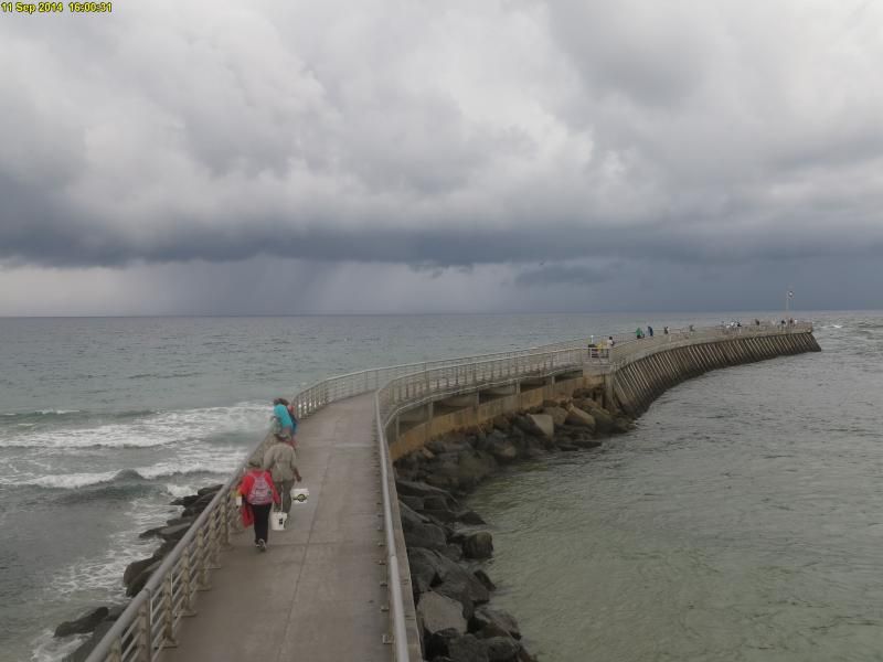
Still I am seeing some squalls building offshore Palm Beach, Martin, St. Lucie Counties that are swinging SW.
Wouldn't be surprised if NWS Miami and Melbourne start issuing some special marine warnings and coastal warnings as these squalls build.
They did mention the small chance of waterspouts in their hazardous weather outlook they issued earlier today.
Last edited by gatorcane on Thu Sep 11, 2014 2:40 pm, edited 7 times in total.
0 likes
-
tropicwatch

- Category 5

- Posts: 3426
- Age: 62
- Joined: Sat Jun 02, 2007 10:01 am
- Location: The Villages, Florida
- Contact:
Busy radar, nice presentation of storm directions.

0 likes
Tropicwatch
Agnes 72', Eloise 75, Elena 85', Kate 85', Charley 86', Florence 88', Beryl 94', Dean 95', Erin 95', Opal 95', Earl 98', Georges 98', Ivan 2004', Arlene 2005', Dennis 2005', Ida 2009' Debby 2012' Irma 2017' Michael 2018'
Agnes 72', Eloise 75, Elena 85', Kate 85', Charley 86', Florence 88', Beryl 94', Dean 95', Erin 95', Opal 95', Earl 98', Georges 98', Ivan 2004', Arlene 2005', Dennis 2005', Ida 2009' Debby 2012' Irma 2017' Michael 2018'
-
Bocadude85

- Category 5
- Posts: 2991
- Age: 39
- Joined: Mon Apr 18, 2005 2:20 pm
- Location: Honolulu,Hi
Re: ATL: INVEST 92L - Discussion
gatorcane wrote:jhpigott wrote:radar presentation doesn't look as good as it did earlier
http://radar.weather.gov/radar.php?prod ... b&loop=yes
Still I am seeing some squalls building offshore Palm Beach, Martin, St. Lucie Counties that are swinging SW.
Wouldn't be surprised if NWS Miami and Melbourne start issuing some special marine warnings and coastal warnings as these squalls build.
They did mention the small chance of waterspouts in their hazardous weather outlook they issued earlier today.
MARINE WEATHER STATEMENT
NATIONAL WEATHER SERVICE MELBOURNE FL
243 PM EDT THU SEP 11 2014
AMZ555-575-112100-
243 PM EDT THU SEP 11 2014
...STRONG THUNDERSTORMS WELL OFFSHORE SOUTH OF VERO BEACH...
AT 235 PM EDT...NATIONAL WEATHER SERVICE DOPPLER RADAR INDICATED
THUNDERSTORMS...PRODUCING STRONG WINDS NEAR 30 KNOTS...FROM 60 MILES
EAST OF VERO BEACH 30 MILES EAST OF JUPITER INLET..MOVING SOUTHWEST
AT 15 KNOTS.
MARINERS CAN EXPECT GUSTY WINDS UP TO 30 KNOTS...LOCALLY HIGHER
WAVES...AND LIGHTNING STRIKES. THERE IS SOME POTENTIAL FOR THESE
STORMS TO PRODUCE FUNNEL CLOUDS OR WATERSPOUTS. LISTEN FOR FURTHER
UPDATES AND POSSIBLE MARINE WARNINGS.
BOATERS SHOULD SEEK SAFE HARBOR IMMEDIATELY UNTIL THESE STORMS PASS.
LAT...LON 2697 7989 2697 7990 2709 7986 2752 7952
2769 7938 2771 7930 2732 7913 2698 7904
TIME...MOT...LOC 1840Z 060DEG 16KT 2748 7921 2692 7903
2690 7959
$$
0 likes
-
TARHEELPROGRAMMER
Anyone else seeing how large this thing is getting. It is getting quite impressive in displaying how to fire up convection. It must of heard me last night. Is it just me or is it building convection to the north of it as well. It looks like it is not in good conditions but still firing up not a good sign for the Gulf of Mexico residents.
0 likes

-
Bocadude85
- Category 5
- Posts: 2991
- Age: 39
- Joined: Mon Apr 18, 2005 2:20 pm
- Location: Honolulu,Hi
Re:
NDG wrote:92L about to go naked.
Yup just about completely exposed. No way the NHC upgrades this unless the center can keep under the convection.
0 likes
-
TARHEELPROGRAMMER

Still wouldn't write it off yet, convection is still very near the circulation, and we're approaching D-min as well.
0 likes
The above post is not official and should not be used as such. It is the opinion of the poster and may or may not be backed by sound meteorological data. It is not endorsed by any professional institution or storm2k.org. For official information, please refer to the NHC and NWS products.
-
Hurricaneman
- Category 5
- Posts: 7404
- Age: 45
- Joined: Tue Aug 31, 2004 3:24 pm
- Location: central florida
Re:
TARHEELPROGRAMMER wrote:IT IS NAKED I SEE IT SOMEONE CALL THE COPS. It can get convection everywhere except the actual center lol. It is literally firing up convection everywhere BUT the center.
That tends to happen in sheared systems and looking at forecasts the shear may not get much stronger but its 15 to 20kts which is quite disruptive to keeping convection at the center
The posts in this forum are NOT official forecast and should not be used as such. They are just the opinion of the poster and may or may not be backed by sound meteorological data. They are NOT endorsed by any professional institution or storm2k.org. For official information, please refer to the NHC and NWS products
0 likes

Re:
TARHEELPROGRAMMER wrote:IT IS NAKED I SEE IT SOMEONE CALL THE COPS. It can get convection everywhere except the actual center lol. It is literally firing up convection everywhere BUT the center.
Surprised to see you on here still, you said yesterday we should move on. Looks like you are not following your own advice.
0 likes
The following post is NOT an official forecast and should not be used as such. It is just the opinion of the poster and may or may not be backed by sound meteorological data. It is NOT endorsed by any professional institution including storm2k.org For Official Information please refer to the NHC and NWS products.
-
TARHEELPROGRAMMER
Re: Re:
Hurricaneman wrote:TARHEELPROGRAMMER wrote:IT IS NAKED I SEE IT SOMEONE CALL THE COPS. It can get convection everywhere except the actual center lol. It is literally firing up convection everywhere BUT the center.
That tends to happen in sheared systems and looking at forecasts the shear may not get much stronger but its 15 to 20kts which is quite disruptive to keeping convection at the center
The posts in this forum are NOT official forecast and should not be used as such. They are just the opinion of the poster and may or may not be backed by sound meteorological data. They are NOT endorsed by any professional institution or storm2k.org. For official information, please refer to the NHC and NWS products
Yes but I will note that this system looks like it is building convection to the north of the center and closing convection all around it. The possibility is there and it already looks better than Arthur did as a TD JUST SAYING. Just only problem is the center is not in that convection IF it does get there though it will be a tropical storm.
0 likes
-
TARHEELPROGRAMMER
Re: Re:
blp wrote:TARHEELPROGRAMMER wrote:IT IS NAKED I SEE IT SOMEONE CALL THE COPS. It can get convection everywhere except the actual center lol. It is literally firing up convection everywhere BUT the center.
Surprised to see you on here still, you said yesterday we should move on. Looks like you are not following your own advice.
I am a weather nut myself and I was convinced yesterday this thing was done for. I however am a programmer and not a weatherman so just opinions of mine.
0 likes
-
wxman57

- Moderator-Pro Met

- Posts: 23175
- Age: 68
- Joined: Sat Jun 21, 2003 8:06 pm
- Location: Houston, TX (southwest)
Re: ATL: INVEST 92L - Discussion
In the last hour or two, the weak LLC appears to have opened up a bit. Doesn't qualify for TD upgrade, as it lacks organized convection around the rather weak LLC. GFS & EC indicate weakening beyond 24-36 hrs as it crosses Florida and moves into the eastern Gulf. That seams reasonable.
0 likes
Re: ATL: INVEST 92L - Discussion
0 likes
Who is online
Users browsing this forum: No registered users and 25 guests