System near Bermuda is now Invest 96L. Floater is already on it:
Outlook from NHC:
TROPICAL WEATHER OUTLOOK
NWS NATIONAL HURRICANE CENTER MIAMI FL
200 AM EDT MON SEP 29 2014
For the North Atlantic...Caribbean Sea and the Gulf of Mexico:
1. An area of low pressure located near Bermuda is producing showers
and thunderstorms. Although this system has become a little better
organized over the past several hours, upper-level winds are
expected to be unfavorable for significant development while the
low moves slowly northwestward or northward during the next few
days. Regardless of development, this system will produce
locally heavy rains and strong gusty winds over Bermuda for the next
day or so.
* Formation chance through 48 hours...low...20 percent.
* Formation chance through 5 days...low...20 percent.
Forecaster Pasch
Link to (short) discussion in Talkin' Tropics:
http://www.storm2k.org/phpbb2/viewtopic.php?f=31&t=116797
ATL: INVEST 97L - Discussion
Moderator: S2k Moderators
-
TheEuropean

- Professional-Met

- Posts: 1797
- Age: 60
- Joined: Tue Sep 20, 2005 3:17 pm
- Location: Voerde, Germany
- Contact:
ATL: INVEST 97L - Discussion
Last edited by cycloneye on Mon Sep 29, 2014 5:52 am, edited 2 times in total.
Reason: Changed invest number
Reason: Changed invest number
0 likes
-
TheStormExpert
-
TheEuropean
- Professional-Met
- Posts: 1797
- Age: 60
- Joined: Tue Sep 20, 2005 3:17 pm
- Location: Voerde, Germany
- Contact:
-
cycloneye

- Admin

- Posts: 149550
- Age: 69
- Joined: Thu Oct 10, 2002 10:54 am
- Location: San Juan, Puerto Rico
Re:
TheEuropean wrote:Oh sorry, ma mistake.
@ Admin: Please delete this thread, thx.
No problem at all as I changed the invest number to 97L so this thread can go ahead.
0 likes
Visit the Caribbean-Central America Weather Thread where you can find at first post web cams,radars
and observations from Caribbean basin members Click Here
and observations from Caribbean basin members Click Here
-
cycloneye
- Admin
- Posts: 149550
- Age: 69
- Joined: Thu Oct 10, 2002 10:54 am
- Location: San Juan, Puerto Rico
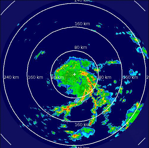
Re: ATL: INVEST 97L - Discussion
Bermuda radar.
0 likes
Visit the Caribbean-Central America Weather Thread where you can find at first post web cams,radars
and observations from Caribbean basin members Click Here
and observations from Caribbean basin members Click Here
-
cycloneye
- Admin
- Posts: 149550
- Age: 69
- Joined: Thu Oct 10, 2002 10:54 am
- Location: San Juan, Puerto Rico
Re: ATL: INVEST 97L - Discussion
TROPICAL WEATHER OUTLOOK
NWS NATIONAL HURRICANE CENTER MIAMI FL
800 AM EDT MON SEP 29 2014
For the North Atlantic...Caribbean Sea and the Gulf of Mexico:
Showers and thunderstorms associated with a low pressure area
located just west of Bermuda have become a little better organized
overnight and this morning. This system could become a subtropical
cyclone today before upper-level winds become unfavorable tonight
and Tuesday. This system is expected to move northwestward and then
northward during the next couple of days with increasing forward
speed. Regardless of development, the low will produce locally heavy
rains and strong gusty winds over Bermuda through tonight.
* Formation chance through 48 hours...medium...30 percent.
* Formation chance through 5 days...medium...30 percent.
$$
Forecaster Brown
0 likes
Visit the Caribbean-Central America Weather Thread where you can find at first post web cams,radars
and observations from Caribbean basin members Click Here
and observations from Caribbean basin members Click Here
-
cycloneye
- Admin
- Posts: 149550
- Age: 69
- Joined: Thu Oct 10, 2002 10:54 am
- Location: San Juan, Puerto Rico
Re: ATL: INVEST 97L - Discussion
12z Best Track:
AL, 97, 2014092912, , BEST, 0, 324N, 652W, 30, 1008, DB
AL, 97, 2014092912, , BEST, 0, 324N, 652W, 30, 1008, DB
0 likes
Visit the Caribbean-Central America Weather Thread where you can find at first post web cams,radars
and observations from Caribbean basin members Click Here
and observations from Caribbean basin members Click Here
-
cycloneye
- Admin
- Posts: 149550
- Age: 69
- Joined: Thu Oct 10, 2002 10:54 am
- Location: San Juan, Puerto Rico
Re: ATL: INVEST 97L - Discussion
Interesting look to it but needs more convection.

0 likes
Visit the Caribbean-Central America Weather Thread where you can find at first post web cams,radars
and observations from Caribbean basin members Click Here
and observations from Caribbean basin members Click Here
-
TropicalAnalystwx13

- Category 5

- Posts: 2109
- Age: 28
- Joined: Tue Jul 19, 2011 8:20 pm
- Location: Wilmington, NC
- Contact:
There's no question this has a well-defined and closed low-level circulation, but it's lacking sufficient convective organization to be declared a subtropical depression. And with shear already a moderate 15-20 knots, increasing to 30 knots and higher going into tonight, this one probably doesn't have much of a chance.
It's cute though.

It's cute though.
0 likes
-
AJC3

- Admin
- Posts: 4156
- Age: 62
- Joined: Tue Aug 31, 2004 7:04 pm
- Location: Ballston Spa, New York
- Contact:
Re:
TropicalAnalystwx13 wrote:There's no question this has a well-defined and closed low-level circulation, but it's lacking sufficient convective organization to be declared a subtropical depression. And with shear already a moderate 15-20 knots, increasing to 30 knots and higher going into tonight, this one probably doesn't have much of a chance.
It's cute though.
Precisely. This is a case where you really need to have visible and IR side by side to show that you have a very vigorous low level circulation, but said circulation only has weak to moderate shallow banded convection, and a paucity of deep (cold topped) convection, particularly near the center.
I'll put this out there for reference: From the Glossary of NHC of terms...
Subtropical Cyclone:
A non-frontal low-pressure system that has characteristics of both tropical and extratropical cyclones. Like tropical cyclones, they are non-frontal, synoptic-scale cyclones that originate over tropical or subtropical waters, and have a closed surface wind circulation about a well-defined center. In addition, they have organized moderate to deep convection, but lack a central dense overcast. Unlike tropical cyclones, subtropical cyclones derive a significant proportion of their energy from baroclinic sources, and are generally cold-core in the upper troposphere, often being associated with an upper-level low or trough. In comparison to tropical cyclones, these systems generally have a radius of maximum winds occurring relatively far from the center (usually greater than 60 n mi), and generally have a less symmetric wind field and distribution of convection.
0 likes
-
cycloneye
- Admin
- Posts: 149550
- Age: 69
- Joined: Thu Oct 10, 2002 10:54 am
- Location: San Juan, Puerto Rico
Re: ATL: INVEST 97L - Discussion
TROPICAL WEATHER OUTLOOK
NWS NATIONAL HURRICANE CENTER MIAMI FL
200 PM EDT MON SEP 29 2014
For the North Atlantic...Caribbean Sea and the Gulf of Mexico:
Showers and thunderstorms associated with a low pressure area
located just west of Bermuda have decreased in coverage since this
morning. Upper-level winds are expected to become unfavorable for
development tonight and Tuesday, and the likelihood of subtropical
or tropical cyclone formation has decreased. This system is expected
to move generally northward during the next couple of days with
increasing forward speed. Regardless of development, the low could
produce locally heavy rains and gusty winds over Bermuda through
tonight.
* Formation chance through 48 hours...low...20 percent.
* Formation chance through 5 days...low...20 percent.
$$
Forecaster Brown
0 likes
Visit the Caribbean-Central America Weather Thread where you can find at first post web cams,radars
and observations from Caribbean basin members Click Here
and observations from Caribbean basin members Click Here
-
AJC3
- Admin
- Posts: 4156
- Age: 62
- Joined: Tue Aug 31, 2004 7:04 pm
- Location: Ballston Spa, New York
- Contact:
Re: ATL: INVEST 97L - Discussion
Joe Bastardi @BigJoeBastardi Is it me or does this look like a closed rotary circulation with eye like feature.
http://www.ssd.noaa.gov/PS/TROP/floater ... short.html #whatever
Seriously?

http://www.ssd.noaa.gov/PS/TROP/floater ... short.html #whatever
Seriously?
0 likes
-
wxman57

- Moderator-Pro Met

- Posts: 23175
- Age: 68
- Joined: Sat Jun 21, 2003 8:06 pm
- Location: Houston, TX (southwest)
Re: ATL: INVEST 97L - Discussion
Come on, guys! Below is a REAL 45kt TS. How can you even say that 97L compares?! 
Bertha at 45kts:

Bertha at 45kts:
0 likes
-
AJC3
- Admin
- Posts: 4156
- Age: 62
- Joined: Tue Aug 31, 2004 7:04 pm
- Location: Ballston Spa, New York
- Contact:
Re: ATL: INVEST 97L - Discussion
wxman57 wrote:Come on, guys! Below is a REAL 45kt TS. How can you even say that 97L compares?!
Bertha at 45kts:
I've stared at this for 10 minutes. Interestingly, it hasn't made 97L look any better.
0 likes
-
wxman57
- Moderator-Pro Met
- Posts: 23175
- Age: 68
- Joined: Sat Jun 21, 2003 8:06 pm
- Location: Houston, TX (southwest)
Re: ATL: INVEST 97L - Discussion
AJC3 wrote:wxman57 wrote:Come on, guys! Below is a REAL 45kt TS. How can you even say that 97L compares?!
Bertha at 45kts:
I've stared at this for 10 minutes. Interestingly, it hasn't made 97L look any better.
Neither one meets the requirements of a TD much less a TS, though I'd say 97L was closer to meeting the requirements of a TD earlier today.
0 likes
-
AJC3
- Admin
- Posts: 4156
- Age: 62
- Joined: Tue Aug 31, 2004 7:04 pm
- Location: Ballston Spa, New York
- Contact:
Re: ATL: INVEST 97L - Discussion
wxman57 wrote:AJC3 wrote:wxman57 wrote:Come on, guys! Below is a REAL 45kt TS. How can you even say that 97L compares?!
Bertha at 45kts:
I've stared at this for 10 minutes. Interestingly, it hasn't made 97L look any better.
Neither one meets the requirements of a TD much less a TS, though I'd say 97L was closer to meeting the requirements of a TD earlier today.
Oh, I agree. But we've had this discussion on a number of occasions on how NHC will wait on both:
1) Declaring a marginal system dissipated or post-tropical, and
2) Initiating advisories on marginal systems.
That's why you can take a snapshot of similar (identical?) looking systems, and have one be an "operationally declared" TC at the time, and the other not be. Of course, there's also going to be some subjectivity amongst the NHC forecasters on when to initiate/stop advisories, which can result in some inconsistency as well. In a perfect world of TC forecasting, this would be minimal, but we know that's not always the case.
0 likes
-
wxman57
- Moderator-Pro Met
- Posts: 23175
- Age: 68
- Joined: Sat Jun 21, 2003 8:06 pm
- Location: Houston, TX (southwest)
Re: ATL: INVEST 97L - Discussion
AJC3 wrote:
Oh, I agree. But we've had this discussion on a number of occasions on how NHC will wait on both:
1) Declaring a marginal system dissipated or post-tropical, and
2) Initiating advisories on marginal systems.
That's why you can take a snapshot of similar (identical?) looking systems, and have one be an "operationally declared" TC at the time, and the other not be.
Yeah, I know the reasoning why they're much slower to upgrade a system vs. downgrade. That doesn't mean I think it makes sense. For one season I'd like an independent agency to determine classifications each 6 hours based solely on the meteorology (no politics) and have the NHC deal with it. That's what I've been doing for 30+ years.
0 likes
-
AJC3
- Admin
- Posts: 4156
- Age: 62
- Joined: Tue Aug 31, 2004 7:04 pm
- Location: Ballston Spa, New York
- Contact:
Re: ATL: INVEST 97L - Discussion
wxman57 wrote:AJC3 wrote:
Oh, I agree. But we've had this discussion on a number of occasions on how NHC will wait on both:
1) Declaring a marginal system dissipated or post-tropical, and
2) Initiating advisories on marginal systems.
That's why you can take a snapshot of similar (identical?) looking systems, and have one be an "operationally declared" TC at the time, and the other not be.
Yeah, I know the reasoning why they're much slower to upgrade a system vs. downgrade. That doesn't mean I think it makes sense. For one season I'd like an independent agency to determine classifications each 6 hours based solely on the meteorology (no politics) and have the NHC deal with it. That's what I've been doing for 30+ years.
Yeah, erring on the side of caution (i.e. not wanting to wind up having jumped the gun) operationally, does have its upside and downside. As far as classifications go, are you talking that being done in real time/operationally, or for BT purposes?
0 likes
Who is online
Users browsing this forum: No registered users and 20 guests