The causes of whether the Arctic Oscillation shows negative or positive are much more complex than a simple factor like Eurasian snowcover. We have to be careful in assuming as much. It's just like assuming that warm NE Pacific waters cause high pressure ridging. They help facilitate that ridging but the actual causation is predicated on a number of factors as I understand it. The link below provides a nice basic discussion of the Arctic and indices and how they impact weather in the middle and upper latitudes. There is also some nice links for good reading at the end of it.
http://www.arctic.noaa.gov/essay_bond.html
Texas Fall-2014
Moderator: S2k Moderators
Forum rules

The posts in this forum are NOT official forecast and should not be used as such. They are just the opinion of the poster and may or may not be backed by sound meteorological data. They are NOT endorsed by any professional institution or STORM2K.
-
Portastorm

- Storm2k Moderator

- Posts: 9955
- Age: 63
- Joined: Fri Jul 11, 2003 9:16 am
- Location: Round Rock, TX
- Contact:
Re: Texas Fall-2014
0 likes
Any forecasts under my name are to be taken with a grain of salt. Get your best forecasts from the National Weather Service and National Hurricane Center.

Re: Re:
TeamPlayersBlue wrote:Ntxw wrote:TeamPlayersBlue wrote:I just saw a tweet from JB saying in one tweet that 2013 was second to 1976, then in a retweet it said 2012..... Two totally different years for us. Any clarification?
He picked week 43 or late October not October as whole when averaged. 2013 started with lots of snow but kind of stabilized the rest of the month. So if you look at just week 43 (the past week or so) then yes 2013 is included but overall it isn't within the top 5 for the month. By the end of that month Eurasian snow cover had melted down to roughly half of what we are now. Snow advance (SAI) was very low as a result and last winter ended up with very +AO.
Makes sense! So 2012 probably did the same thing? Stabilized or melting after this time period which lead to a +AO?
2012 was a very high snow advance year much like this year (to a lesser extent) but it was not in the top percentile. That winter was actually predominantly -AO if you remember. That Nino never materialized so it wasn't consistent. DFW had several events and the Christmas snowstorm from a big low that came from -AO dive. Later in winter southern New England got walloped by the second dip in Feb.
0 likes
The above post and any post by Ntxw is NOT an official forecast and should not be used as such. It is just the opinion of the poster and may or may not be backed by sound meteorological data. It is NOT endorsed by any professional institution including Storm2k. For official information, please refer to NWS products.
Help support Storm2K!
Re: Texas Fall-2014
Portastorm wrote:The causes of whether the Arctic Oscillation shows negative or positive are much more complex than a simple factor like Eurasian snowcover. We have to be careful in assuming as much. It's just like assuming that warm NE Pacific waters cause high pressure ridging. They help facilitate that ridging but the actual causation is predicated on a number of factors as I understand it. The link below provides a nice basic discussion of the Arctic and indices and how they impact weather in the middle and upper latitudes. There is also some nice links for good reading at the end of it.
http://www.arctic.noaa.gov/essay_bond.html
Very good point Porta. What we're trying to do is find the signal that outruns all the others. It's the chicken or the egg, which causes which but usually if you figure out the dominant signal feedback on it occurs and it just keeps rolling, snowball effect until something external (ENSO etc) flips it.
0 likes
The above post and any post by Ntxw is NOT an official forecast and should not be used as such. It is just the opinion of the poster and may or may not be backed by sound meteorological data. It is NOT endorsed by any professional institution including Storm2k. For official information, please refer to NWS products.
Help support Storm2K!
Help support Storm2K!
-
TheProfessor

- Professional-Met

- Posts: 3506
- Age: 29
- Joined: Tue Dec 03, 2013 10:56 am
- Location: Wichita, Kansas
-
srainhoutx

- S2K Supporter

- Posts: 6919
- Age: 68
- Joined: Sun Jan 14, 2007 11:34 am
- Location: Haywood County, NC
- Contact:
Re: Texas Fall-2014
The 12Z GFS attempts to develop a Coastal Low next week near the Corpus area and suggests some welcomed rainfall...if it is correct. We will see.
0 likes
Carla/Alicia/Jerry(In The Eye)/Michelle/Charley/Ivan/Dennis/Katrina/Rita/Wilma/Ike/Harvey
Member: National Weather Association
Wx Infinity Forums
http://wxinfinity.com/index.php
Facebook.com/WeatherInfinity
Twitter @WeatherInfinity
Member: National Weather Association
Wx Infinity Forums
http://wxinfinity.com/index.php
Facebook.com/WeatherInfinity
Twitter @WeatherInfinity
-
TeamPlayersBlue

- Category 5

- Posts: 3530
- Joined: Tue Feb 02, 2010 1:44 am
- Location: Denver/Applewood, CO
Re: Texas Fall-2014
Portastorm wrote:The causes of whether the Arctic Oscillation shows negative or positive are much more complex than a simple factor like Eurasian snowcover. We have to be careful in assuming as much. It's just like assuming that warm NE Pacific waters cause high pressure ridging. They help facilitate that ridging but the actual causation is predicated on a number of factors as I understand it. The link below provides a nice basic discussion of the Arctic and indices and how they impact weather in the middle and upper latitudes. There is also some nice links for good reading at the end of it.
http://www.arctic.noaa.gov/essay_bond.html
Nice link, yeah just want to see if this is one of the leading/important indicators for a -AO, i understand its not the only cog in the wheel.
Maybe my memory is fading me, i thought 12-13 was a very warm winter. Maybe im thinking of 11-12. Oh well. Again, JUST because Eurasian snow cover is high, doesnt mean cold winter. Need other factors. This year looks good so far. Im being patient!!!!......Sort of!
0 likes
Personal Forecast Disclaimer:
The posts in this forum are NOT official forecast and should not be used as such. They are just the opinion of the poster and may or may not be backed by sound meteorological data. They are NOT endorsed by any professional institution or storm2k.org. For official information, please refer to the NHC and NWS products.
The posts in this forum are NOT official forecast and should not be used as such. They are just the opinion of the poster and may or may not be backed by sound meteorological data. They are NOT endorsed by any professional institution or storm2k.org. For official information, please refer to the NHC and NWS products.
-
Ralph's Weather
- S2K Supporter
- Posts: 3371
- Age: 38
- Joined: Fri Dec 13, 2013 11:55 am
- Location: Lindale, TX
- Contact:
Re: Texas Fall-2014
TeamPlayersBlue wrote:Portastorm wrote:The causes of whether the Arctic Oscillation shows negative or positive are much more complex than a simple factor like Eurasian snowcover. We have to be careful in assuming as much. It's just like assuming that warm NE Pacific waters cause high pressure ridging. They help facilitate that ridging but the actual causation is predicated on a number of factors as I understand it. The link below provides a nice basic discussion of the Arctic and indices and how they impact weather in the middle and upper latitudes. There is also some nice links for good reading at the end of it.
http://www.arctic.noaa.gov/essay_bond.html
Nice link, yeah just want to see if this is one of the leading/important indicators for a -AO, i understand its not the only cog in the wheel.
Maybe my memory is fading me, i thought 12-13 was a very warm winter. Maybe im thinking of 11-12. Oh well. Again, JUST because Eurasian snow cover is high, doesnt mean cold winter. Need other factors. This year looks good so far. Im being patient!!!!......Sort of!
If I recall correctly 12-13 had the -AO, but lacked -NAO resulting in Europe getting the cold. I do not see that happening this year.
0 likes
Follow on Facebook at Ralph's Weather.
Re: Texas Fall-2014
Ralph's Weather wrote:TeamPlayersBlue wrote:Portastorm wrote:The causes of whether the Arctic Oscillation shows negative or positive are much more complex than a simple factor like Eurasian snowcover. We have to be careful in assuming as much. It's just like assuming that warm NE Pacific waters cause high pressure ridging. They help facilitate that ridging but the actual causation is predicated on a number of factors as I understand it. The link below provides a nice basic discussion of the Arctic and indices and how they impact weather in the middle and upper latitudes. There is also some nice links for good reading at the end of it.
http://www.arctic.noaa.gov/essay_bond.html
Nice link, yeah just want to see if this is one of the leading/important indicators for a -AO, i understand its not the only cog in the wheel.
Maybe my memory is fading me, i thought 12-13 was a very warm winter. Maybe im thinking of 11-12. Oh well. Again, JUST because Eurasian snow cover is high, doesnt mean cold winter. Need other factors. This year looks good so far. Im being patient!!!!......Sort of!
If I recall correctly 12-13 had the -AO, but lacked -NAO resulting in Europe getting the cold. I do not see that happening this year.
It was a warm winter, even though the AO had been negative. There was even good Greenland blocking however the Pacfic kept low heights over Alaska. Troughs in Alaska is never good for surface cold. So even though it was cold aloft, the EPO wanted it warm below thus resulting in some big storms but not the severe cold. So when the troughs left it got really warm (80s).
at 500mb

surface

0 likes
The above post and any post by Ntxw is NOT an official forecast and should not be used as such. It is just the opinion of the poster and may or may not be backed by sound meteorological data. It is NOT endorsed by any professional institution including Storm2k. For official information, please refer to NWS products.
Help support Storm2K!
Help support Storm2K!
-
weatherdude1108
- Category 5
- Posts: 4228
- Joined: Tue Dec 13, 2011 1:04 pm
- Location: Northwest Austin/Cedar Park, TX
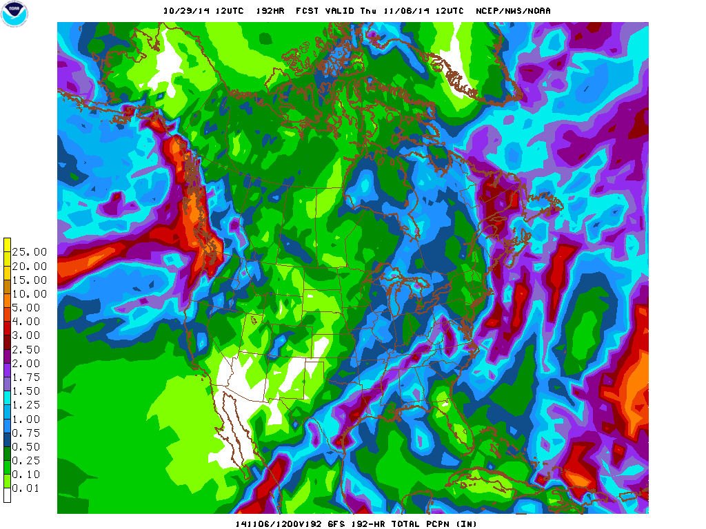
Looks like a tricky long-term forecast. But looks like models are starting to agree on more QPF. 
000
FXUS64 KEWX 292046
AFDEWX
AREA FORECAST DISCUSSION
NATIONAL WEATHER SERVICE AUSTIN/SAN ANTONIO TX
346 PM CDT WED OCT 29 2014
FORECAST REMAINS CHALLENGING NEXT WEEK. THE SOUTHERLY FLOW WILL
STRENGTHEN FURTHER ON MONDAY...AHEAD OF A DEEP TROUGH THAT
DEVELOPS ACROSS THE SOUTHERN ROCKIES...DESERT SOUTHWEST AND BAJA
CALIFORNIA. ISOLATED STREAMER SHOWERS POSSIBLE MONDAY AND
MENTIONED IN FORECAST.
DISCREPANCIES BETWEEN THE ECMWF AND GFS STILL EXIST IN THE
HANDLING OF THIS TROUGH AS IT MOVES EAST TUESDAY AND WEDNESDAY.
THE 12Z GFS AND CMC ARE MORE PROGRESSIVE WITH THE MAIN TROUGH AXIS
COMING ACROSS THE REGION...YET DEEP INTO MEXICO AND TEXAS. THE 12Z
ECMWF CONTINUES TO INDICATE AN UPPER LEVEL LOW THAT CUTS OFF IN
THE BASE OF THE TROUGH BY WEDNESDAY MORNING ACROSS NORTHERN
BAJA...BUT EVENTUALLY BRINGS THE MAIN TROUGH AXIS AND ASSOCIATED
COLD FRONT THROUGH THE REGION 12-24 HOURS SLOWER THAN THE MORE
PROGRESSIVE GFS. THE GFS CONTINUES TO ABSORB SIGNIFICANT PACIFIC
TAP OF MOISTURE AND ENERGY FROM THE NEXT PACIFIC TROPICAL SYSTEM
INTO THE TROUGH AXIS...COINCIDING WITH A FRONT ACROSS TEXAS. THE
12Z ECMWF HAS ALSO TRENDED THIS WAY NOW...JUST SLOWER AS DISCUSSED
ABOVE. BOTH ARE NOW SHOWING 1-2 INCH QPF AMOUNTS OVER THE
AREA...WITH THE GFS SHOWING THIS HAPPENING MONDAY NIGHT THROUGH
TUESDAY NIGHT...AND THE ECMWF TUESDAY NIGHT THROUGH WEDNESDAY.
HAVE CHANCE POPS TUESDAY THROUGH WEDNESDAY TO ACCOUNT AT THIS TIME
FOR THE SPREAD IN TIMING...AND BUMPED UP INTO THE 40-50 PERCENT
RANGE. STILL MAY TAKE A FEW MORE DAYS FOR MODEL CONSENSUS TO
DEVELOP...AND DETAILS IN TIMING AND EXACT QPF AMOUNTS ARE STILL
VERY DIFFICULT TO DETERMINE AT THIS TIME. STAY TUNED.
0 likes
The preceding post is NOT an official forecast, and should not be used as such. It is only the opinion of the poster and may or may not be backed by sound meteorological data. It is NOT endorsed by any professional institution including storm2k.org. For Official Information please refer to the NHC and NWS products.

-
TeamPlayersBlue
- Category 5
- Posts: 3530
- Joined: Tue Feb 02, 2010 1:44 am
- Location: Denver/Applewood, CO
Ryan Maue posted a pic of the Northern Pacific cooling rapidly in the last couple weeks  . I think it has to do with the big lows coming down from the Arctic down into the region
0 likes
Personal Forecast Disclaimer:
The posts in this forum are NOT official forecast and should not be used as such. They are just the opinion of the poster and may or may not be backed by sound meteorological data. They are NOT endorsed by any professional institution or storm2k.org. For official information, please refer to the NHC and NWS products.
The posts in this forum are NOT official forecast and should not be used as such. They are just the opinion of the poster and may or may not be backed by sound meteorological data. They are NOT endorsed by any professional institution or storm2k.org. For official information, please refer to the NHC and NWS products.
-
Portastorm
- Storm2k Moderator
- Posts: 9955
- Age: 63
- Joined: Fri Jul 11, 2003 9:16 am
- Location: Round Rock, TX
- Contact:
Re: Texas Fall-2014
Another well-written and educational AFD this morning out of EWX. The Cavanaugh Effect continues. Nice work, Mr. Hampshire. 
AREA FORECAST DISCUSSION
NATIONAL WEATHER SERVICE AUSTIN/SAN ANTONIO TX
353 AM CDT THU OCT 30 2014
.SHORT TERM (TODAY THROUGH FRIDAY)...
LIGHT EASTERLY WINDS CONTINUE ACROSS THE AREA AT THE PRESENT TIME
BUT WILL BECOME MORE SOUTHERLY TODAY AHEAD OF THE NEXT SYSTEM. AT
500 MB...THERE IS A BROAD TROUGH THAT COVERS THE EASTERN HALF OF
THE CONUS WHILE A WEAK BUT BROAD RIDGE COVERS THE WESTERN HALF OF
THE CONUS. A MUCH STRONGER LOW CENTER WILL MOVE INTO THE NORTHERN
CONUS LATE THIS AFTERNOON AND EVENING...WHICH WILL CAUSE THE UPPER
RIDGE ACROSS THE WESTERN CONUS TO QUICKLY BECOME MORE AMPLIFIED.
THIS PLACES THE CENTRAL PLAINS IN STRONG NORTH/NORTHWEST FLOW
ALOFT. THIS PATTERN WILL SEND A SURGE OF COLD AIR SOUTH INTO
SOUTH-CENTRAL TEXAS THIS EVENING AND OVERNIGHT INTO FRIDAY MORNING.
BEGINNING LAST NIGHT...MODELS HAVE BEEN TRENDING WETTER WITH THIS
FROPA. FORECAST SOUNDINGS SHOW A DECENT MOIST LAYER BETWEEN THE
SURFACE AND 700 MB. UPPER DYNAMICS ARE MOSTLY LACKING WHICH WOULD
NORMALLY LIMIT WIDESPREAD RAIN CHANCES. THE FOCUS FOR LIFT THEN
SHIFTS TO ANY MESOSCALE FEATURES THAT MAY BE PRESENT WHICH COULD
LOCALLY ENHANCE LIFT. 850 CHARTS FROM ALL MODELS SHOW A THETA-E
RIDGE AT 850 MB JUST AHEAD OF THE 850 MB FRONT. THE 850 FRONT IS
STACKED NEARLY VERTICAL OVER THE SURFACE FRONT AND ANY LIFT
ASSOCIATED WITH THE THETA-E RIDGE WOULD BE JUXTAPOSED WITH LOCALLY
ENHANCED LIFT ASSOCIATED WITH THE SURFACE FRONTAL CONVERGENCE. THE
MOISTURE AVAILABLE IS SUFFICIENT FOR CONVECTION TO DEVELOP WITH
THE LIFT AS THE FRONT MOVES THROUGH THE CWA TONIGHT. INSTABILITY
IS ENOUGH TO WARRANT THE MENTION OF THUNDER...BUT SEVERE STORMS
ARE NOT EXPECTED. THE 00Z NAM IS SHOWING SOME HEAVY RAINFALL
TONIGHT...BUT THERE APPEARS TO BE SOME CONVECTIVE FEEDBACK AT 500
MB IN THE VORTICITY FIELDS. SOMETIMES...CONVECTIVE FEEDBACK
ALTHOUGH WRONG...CAN BE A HINT AT SOMETHING....BUT OVERALL
MOISTURE LEVELS IN THE ATMOSPHERE SHOULD NOT SUPPORT WIDESPREAD
HEAVY RAIN. ISOLATED LOCATIONS COULD RECEIVE ABOUT AN INCH OF
RAIN. WENT WITH 30/40 POPS ACROSS MUCH OF THE AREA...BUT THESE
MAY NEED TO BE RAISED FURTHER ON THE DAY SHIFT IF CONFIDENCE
CONTINUES TO INCREASE.
ALL PRECIP SHOULD BE SOUTH OF THE FORECAST AREA SHORTLY AFTER
DAYBREAK FRIDAY. THE REST OF HALLOWEEN IS EXPECTED TO HAVE CLEARING
SKIES...BREEZY NORTHERLY WINDS...AND TEMPERATURES STRUGGLING TO
REACH THE MIDDLE 70S FOR MOST LOCATIONS. YOU MADE NEED TO A JACKET
OR BLANKET FOR THE TRICK OR TREATERS AS TEMPERATURES AROUND SUNSET
WILL BE DROPPING INTO THE LOWER 60S AND EVEN THE 50S BY 9 PM.
&&
.LONG TERM (FRIDAY NIGHT THROUGH WEDNESDAY)...
SOUTHERLY WINDS WILL RETURN ON SATURDAY AFTER LOWS REACH THE 40S
FOR MUCH OF THE AREA...WITH SOME 30S POSSIBLE IN THE HILL COUNTY.
INCREASING MOISTURE AND WARMER TEMPERATURES ARE EXPECTED BY
SUNDAY/MONDAY AHEAD OF THE NEXT STORM SYSTEM. OTHERWISE...THE
WEEKEND LOOKS GREAT FOR ANY OUTDOOR ACTIVITIES. THE GFS IS SHOWING
WARM AIR ADVECTION SHOWER AND THUNDERSTORM ACTIVITY ON MONDAY. THE
GFS NORMALLY TENDS TO OVERDO THESE SORT OF THINGS...BUT WITH
SURFACE DEWPOINTS QUICKLY REACHING THE 60S...CANT RULE OUT
ANYTHING. WILL CONTINUE WITH THE 20 POPS FOR MONDAY.
THE FOCUS OF THE REST OF THE FORECAST THEN SHIFTS TO THE STRONG
UPPER TROUGH OR LOW CENTER EXPECTED TO BE OVER THE WESTERN CONUS
ON MONDAY AND ITS EVENTUAL TRACK INTO TEXAS. MODELS HAD BEEN
HAVING A HARD TIME AGREEING ON WHETHER THE PATTERN WOULD BE
PROGRESSIVE AS THE GFS HAS BEEN SHOWING OR THE LOW WOULD CUT OFF
AND SLOW AS THE ECMWF HAS SHOWN. THESE TWO MODELS CONTINUE TO HAVE
THE SAME DISAGREEMENT....BUT IT SEEMS THE ECMWF IS SLOWLY COMING
INTO LINE WITH THE GFS. THE ECMWF NOW HAS A FRONT MOVING THROUGH
THE ENTIRE CWA...ALTHOUGH 12 HOURS SLOWER THAN THE GFS. THIS IS A
SIGN THAT THE PARENT UPPER TROUGH IS GOING TO REMAIN STRONG AND
PROGRESSIVE TO OUR NORTH. THE GFS CONTINUES TO SHOW THE SOUTHERN
END OF THE LONGWAVE TROUGH OPEN AND PROGRESSIVE BEFORE BECOMING
CLOSED OVER TEXAS WEDNESDAY. THE ECMWF CONTINUES TO CUT THE LOW
OFF EARLY IN THE WEEK AND THEN MOVE IT OVER TEXAS THURSDAY/FRIDAY.
HOWEVER...THE GFS SOLUTION REMAINS PREFERRED AS THERE IS
CONSIDERABLE AGREEMENT BETWEEN IT AND THE CANADIAN AND THE NORTH
AMERICAN ENSEMBLE FORECAST SYSTEM. UPPED POPS ON TUESDAY TO 50/60
PERCENT FOR MUCH OF THE CWA...WITH 50S CONTINUING TUESDAY
NIGHT....AND 30S/40S FOR WEDNESDAY. THE GFS AND CANADIAN CONTINUE
TO SHOW A VERY FAVORABLE PATTERN FOR RAINFALL EXCEEDING 1-2 INCHES
ACROSS MUCH OF THE CWA. THIS WILL BE IN PART TO PACIFIC MOISTURE
FROM A REMNANT TROPICAL SYSTEM MEETING THE FRONT AND STRONG UPPER
LOW AT THE SAME TIME. IT IS STILL TOO EARLY TO GET INTO THE
SPECIFICS OF MESOSCALE FEATURES ALONG THE BOUNDARY...BUT
CONFIDENCE IS INCREASING THAT MOST OF SOUTH CENTRAL TEXAS WILL
RECEIVE MUCH NEEDED RAINFALL. STAY TUNED.
0 likes
Any forecasts under my name are to be taken with a grain of salt. Get your best forecasts from the National Weather Service and National Hurricane Center.
-
Portastorm
- Storm2k Moderator
- Posts: 9955
- Age: 63
- Joined: Fri Jul 11, 2003 9:16 am
- Location: Round Rock, TX
- Contact:
Re:
TeamPlayersBlue wrote:Ryan Maue posted a pic of the Northern Pacific cooling rapidly in the last couple weeks
I'm growing more and more confident (as is Ntxw, I believe) of a major cold outbreak the second or third week of November. I think it's going to produce some wintry type precipitation in parts of Texas. Sudden stratospheric warming event is taking place and that has a lag time of 2-3 weeks usually. I know that's a fairly bold prediction, but I'm laying it down now. I'll say the third week of November is going to be nuts in Texas!
0 likes
Any forecasts under my name are to be taken with a grain of salt. Get your best forecasts from the National Weather Service and National Hurricane Center.
-
Tireman4

- S2K Supporter
- Posts: 5903
- Age: 60
- Joined: Fri Jun 30, 2006 1:08 pm
- Location: Humble, Texas
- Contact:
Re: Re:
Portastorm wrote:TeamPlayersBlue wrote:Ryan Maue posted a pic of the Northern Pacific cooling rapidly in the last couple weeks
I'm growing more and more confident (as is Ntxw, I believe) of a major cold outbreak the second or third week of November. I think it's going to produce some wintry type precipitation in parts of Texas. Sudden stratospheric warming event is taking place and that has a lag time of 2-3 weeks usually. I know that's a fairly bold prediction, but I'm laying it down now. I'll say the third week of November is going to be nuts in Texas!
And there ya go. Porta and the PWC have spoken. We are done here. Get your popcorn and sit back. This is will be a bumpy ride. Please make sure your seatbacks and tray tables are in their upright and locked position
0 likes
The next 7 days is going to be very wet, consistently. The el nino should be declared very soon by NOAA. The pattern is ahead of the game with parked low over Texas. With cold air on the move soon, and rain should make for some nice foliage color changes in a few weeks.
Eventually one of these lows is going to tap into cold air or generate some. 1976.
Eventually one of these lows is going to tap into cold air or generate some. 1976.
Last edited by Ntxw on Thu Oct 30, 2014 9:39 am, edited 1 time in total.
0 likes
The above post and any post by Ntxw is NOT an official forecast and should not be used as such. It is just the opinion of the poster and may or may not be backed by sound meteorological data. It is NOT endorsed by any professional institution including Storm2k. For official information, please refer to NWS products.
Help support Storm2K!
Help support Storm2K!

Re: Texas Fall-2014
Portastorm wrote:I'm growing more and more confident (as is Ntxw, I believe) of a major cold outbreak the second or third week of November. I think it's going to produce some wintry type precipitation in parts of Texas. Sudden stratospheric warming event is taking place and that has a lag time of 2-3 weeks usually. I know that's a fairly bold prediction, but I'm laying it down now. I'll say the third week of November is going to be nuts in Texas!
Whaaat? Such a bold prediction and so early in the season? I am fan of this new Portastorm. What do you think about Christmas time? White Christmas for every family in Texas, minus the Wxman57 household?
0 likes
Re:
TeamPlayersBlue wrote:Ryan Maue posted a pic of the Northern Pacific cooling rapidly in the last couple weeks
I have read about this also. Is this a concern for the upcoming winter? Or is it something minor? Portastorm, I hope you are correct. The weather is about to change and I am excited as can be. Cold, rain and snow for everyone!!!
Also Happy Halloween Texans. Should be a breezy one with a chill in the air. Saturday morning ought to be a cold one.
Last edited by gpsnowman on Thu Oct 30, 2014 9:45 am, edited 1 time in total.
0 likes
-
gboudx

- S2K Supporter
- Posts: 4090
- Joined: Thu Sep 04, 2003 1:39 pm
- Location: Rockwall, Tx but from Harvey, La
Update from jeff:
Strong cold front will cross the area Friday morning ushering in some of the coldest temperatures this fall.
Weak frontal boundary that pushed offshore yesterday evening has stalled over the Gulf waters with light NE winds in place across SE TX this morning and temperatures in the 50’s and 60’s. Low level moisture has been pushed southward with this boundary. Strong short wave trough over the northern US is allowing a cold Canadian air mass to surge southward from Canada this morning. Current temperatures in the northern plains behind this front are in the 30’s (34 at Bismark, ND currently) and this air mass will pour southward today and spread across Texas early Friday in a modified form. Short range models continue to suggest some 850mb moisture will surge northward this afternoon across central TX and the western portions of SE TX and actually are producing showers and thunderstorms with the boundary late tonight into early Friday morning west of I-45. Given the increasing potential in the short term guidance this seems at least possible even though surface moisture will be lacking. Out of respect of the meso guidance rain chances of 30% will be added to the areas west of I-45 for late tonight. Texas Tech guidance is fairly aggressive overnight with a band of thunderstorms that moves SSW from NCT X across much of central and western SE TX into S TX.
Front should clear the coast by 900am with cold air advection and gusty north winds in place on Friday. Skies will rapidly clear, but even under full sun cold air advection should offset surface heating and highs will only reach the low to mid 70’s on Friday.
Halloween Evening:
Excellent conditions for all outdoor activities with temperatures falling from near 70 around 600pm into the low 60’s and upper 50’s by 1000pm under weakening north winds, clear skies, and low humidity values. Sunset is 636pm.
Weekend weather will be extremely nice by SE TX standards. 1036mb Canadian high pressure cell will build into TX resulting in cool to cold morning lows and mild afternoon highs under sunny skies. Guidance has been trending cooler with the incoming air mass and this appears reasonable given the observations in the northern plains. GFS guidance shows a low of 44 at IAH Sunday morning and 36 at the normally cold Conroe reporting station. Will go with lows in the mid to upper 40’s Saturday morning and low to mid 40’s Sunday morning with highs on Saturday likely not making it out of the 60’s as weak cold air advection continues.
Note: A reminder that daylight savings time ends this coming Sunday morning with clocks falling back one hour at 200am. Sunset Sunday evening will be at 534pm.
Next Week:
Models continue to struggle greatly with the evolution of the weather pattern next week and when and how strong of a trough will affect the state. GFS is more progressive then the slower ECMWF solution, but both agree that a significant increase in moisture is heading for the state starting Monday. This is in part to tropical depression 21E which should intensify to Hurricane Vance south of MX this weekend and turn N and NNE and become captured by a very deep trough early next week over the SW US and northern MX. NHC forecast brings a 80mph hurricane toward the SW Mexican coast in 5 days. Mid and high level moisture from Vance will pour NNE into TX aloft while at the surface strong moisture advection will occur off the Gulf of Mexico. The result appears to be surging PWS values to near/above 2.0 inches which is extremely high for early November. In fact 2.0 in PW for early November is at the 99th percentile and at the +2Sd above normal for the Corpus Christi sounding station. A slow moving surface front combined with disturbances ejecting out of the mean trough to our west and possibly out of the moisture envelop from Vance working on a saturated air mass with upper level flow near parallel to the front supports a heavy rainfall and potential flooding threat. Big question is does this come in one significant round of storms and when or is it spread out in repeat rounds from a slower moving upper trough. Concern is certainly there for some significant rainfall next week at some point in the Tuesday-late week time period with the Tuesday-Wednesday period looking most likely. Once guidance begins to fall into better agreement rain chances will need to be raised significantly for the favored time period.
0 likes
-
TeamPlayersBlue
- Category 5
- Posts: 3530
- Joined: Tue Feb 02, 2010 1:44 am
- Location: Denver/Applewood, CO
Porta i agree. The second half of November will be on the cold side. I saw the SSW event on twitter this morning. It will be very interesting.
0 likes
Personal Forecast Disclaimer:
The posts in this forum are NOT official forecast and should not be used as such. They are just the opinion of the poster and may or may not be backed by sound meteorological data. They are NOT endorsed by any professional institution or storm2k.org. For official information, please refer to the NHC and NWS products.
The posts in this forum are NOT official forecast and should not be used as such. They are just the opinion of the poster and may or may not be backed by sound meteorological data. They are NOT endorsed by any professional institution or storm2k.org. For official information, please refer to the NHC and NWS products.
-
somethingfunny

- ChatStaff

- Posts: 3926
- Age: 37
- Joined: Thu May 31, 2007 10:30 pm
- Location: McKinney, Texas
Hey guys, just be aware with this approaching front today... the SPC has the Metroplex in a Marginal Risk - storms are unlikely but if we get any they might be hailers. Then, Saturday morning might have some patches of freezing temperatures or frost around North Texas. It's unlikely but possible so if you live in one of those typical cold patches, might wanna be prepared to protect your plants. This is one of those cold fronts where the forecast seems to get colder every day that we get closer to it.
0 likes
I am not a meteorologist, and any posts made by me are not official forecasts or to be interpreted as being intelligent. These posts are just my opinions and are probably silly opinions.
Return to “USA & Caribbean Weather”
Who is online
Users browsing this forum: Brent and 49 guests