Texas Fall-2014

U.S. & Caribbean Weather Discussions and Severe Weather Events

Moderator: S2k Moderators

Forum rules

The posts in this forum are NOT official forecast and should not be used as such. They are just the opinion of the poster and may or may not be backed by sound meteorological data. They are NOT endorsed by any professional institution or STORM2K.

Help Support Storm2K
Message
Author
aggiecutter
Category 5
Category 5
Posts: 1753
Joined: Thu Oct 14, 2004 9:22 pm
Location: Texarkana

Re: Re:

#761 Postby aggiecutter » Sat Nov 01, 2014 1:58 pm

Ptarmigan wrote:
Ntxw wrote:A little late on the convo, but for those of you worrying about SST's, the warmth around Alaska isn't going away it's solidy +PDO signature. Just the warm tongue into the GOA is being replaced by a cold tongue by El Nino which further means the Nino will control the winter. Like Srain said if we had a La Nina or even a strong Nino the story would be different but we don't. Take a look at 1977-1978 DJF (that is a top SST analog I can find).

http://i59.tinypic.com/14ncytf.png

CFSv2 says Portastorm's forecast kicks off cold (below average) for November and stays cold right through for the state through 45 days


I have seen warm Northeast Pacific in both cool and warm PDO. Usually when there is El Nino, it is cooler, but not always. Also, I have seen negative East Pacific Oscillation (EPO) when the Northeast Pacific is cool like in February 1989. The warm Northeast Pacific was a factor for last winter for being cold.


That is very true. The effects of a Modoki and traditional El Nino are quite different in the NE Pacific and downstream into the contiguous 48 states. In contrast to a traditional EL Nino, the NE Pacific is very warm during a Modoki El Nino. The heat pumps a ridge in the GOA and off the west coast, allowing the jet stream to buckle down into lower 48 east of the Rockies. Combine that with an active sub-tropical jet, and you get snow and cold in the southern plains, midwest and east. That is why I was concerned when I saw the sudden appearance of cold water in the GOA. However, there is some sign of a Modoki El Nino in the central Pacific, but will it be strong enough to have an effect on our weather.

Image
0 likes   

User avatar
TheProfessor
Professional-Met
Professional-Met
Posts: 3506
Age: 28
Joined: Tue Dec 03, 2013 10:56 am
Location: Wichita, Kansas

#762 Postby TheProfessor » Sat Nov 01, 2014 2:45 pm

the 12z GFS is wetter than the 6z and 0z GFS runs, hopefully the models will trend wetter again.
0 likes   
An alumnus of The Ohio State University.

Your local National Weather Service office is your best source for weather information.

User avatar
TeamPlayersBlue
Category 5
Category 5
Posts: 3445
Joined: Tue Feb 02, 2010 1:44 am
Location: Denver/Applewood, CO

#763 Postby TeamPlayersBlue » Sat Nov 01, 2014 4:32 pm

I think they will trend wetter for a bit then maybe back off again a few days away. I think this rain event will be massive. Hopefully the lakes in Central Texas get lots and lots of rain from it
0 likes   
Personal Forecast Disclaimer:
The posts in this forum are NOT official forecast and should not be used as such. They are just the opinion of the poster and may or may not be backed by sound meteorological data. They are NOT endorsed by any professional institution or storm2k.org. For official information, please refer to the NHC and NWS products.

User avatar
srainhoutx
S2K Supporter
S2K Supporter
Posts: 6919
Age: 67
Joined: Sun Jan 14, 2007 11:34 am
Location: Haywood County, NC
Contact:

Re: Texas Fall-2014

#764 Postby srainhoutx » Sun Nov 02, 2014 8:57 am

42F the morning in NW Harris County with breezy E winds developing as the ridge of high pressure that brought snow across portions of the Carolinas yesterday morning shifts E. A return flow off the Gulf will increase today and tomorrow as the Western trough begins to cross New Mexico and leeside cyclogenesis begins along the front range of the Colorado Rockies. Tuesday into Wednesday looks very wet and stormy as a cold front marches across Texas and taps both Pacific and Gulf moisture. The front should clear the Coast sometime on Thursday as the Coastal Low heads NE and drier air filters in at the surface. We may hang on to clouds behind the front as soon to be EPAC Hurricane Vance nears the Baja Peninsula and weakens. the long fetch tap of Pacific moisture may keep us cloudy and cool to end the upcoming work week.

Attention then turns to our NW as a Ridge develops off the Coast of California and extends up into Alaska. This is indicative of a +PNA/-AO/-EPO pattern that many of the long range Meteorologists have been indicating as El Nino fully develops. Cold air that has been building in Canada may begin to push S next weekend as a strong front enters the Lower 48. Some of the longer range computer models are suggesting a potential big late Fall/early Winter type storm may develop across the Southern Plain near the November 12th-14th timeframe, but that is too far out to speculate in a casual nature as we look ahead to what may lie ahead as we head toward the end of November into December.

Image
0 likes   
Carla/Alicia/Jerry(In The Eye)/Michelle/Charley/Ivan/Dennis/Katrina/Rita/Wilma/Ike/Harvey

Member: National Weather Association
Wx Infinity Forums
http://wxinfinity.com/index.php

Facebook.com/WeatherInfinity
Twitter @WeatherInfinity

User avatar
Ntxw
Storm2k Moderator
Storm2k Moderator
Posts: 22785
Joined: Wed Oct 21, 2009 6:34 pm
Location: DFW, Texas

#765 Postby Ntxw » Sun Nov 02, 2014 9:16 am

Great post as usual Srain. Blocking over the top is signaling a major dump of cold air. European ensembles is telling us to look out. I would definitely say the potential threat of a southern plains early winter storm by mid November is a possibility. There is very deep anomalous lower heights in the southern plains in that time frame hinting at a storm is crossing the region and the next shot of air will be of polar/arctic origin.

If you didn't get a freeze yesterday, it's lurking very nearby. And it may come fast and hard.
0 likes   
The above post and any post by Ntxw is NOT an official forecast and should not be used as such. It is just the opinion of the poster and may or may not be backed by sound meteorological data. It is NOT endorsed by any professional institution including Storm2k. For official information, please refer to NWS products.

  Help support Storm2K!
Help Support Storm2K

User avatar
Portastorm
Storm2k Moderator
Storm2k Moderator
Posts: 9914
Age: 63
Joined: Fri Jul 11, 2003 9:16 am
Location: Round Rock, TX
Contact:

Re: Texas Fall-2014

#766 Postby Portastorm » Sun Nov 02, 2014 9:26 am

Great posts this morning gang ... very active weather period ahead! Thanks to srainhoutx, aggiecutter, and Ntxw for the good info these last few days.

JB tweeted this morning that the latest CFSv2 shows a strong start to winter with much of the central and eastern CONUS below to much below normal temperature-wise between mid November and mid December.
0 likes   
Any forecasts under my name are to be taken with a grain of salt. Get your best forecasts from the National Weather Service and National Hurricane Center.

User avatar
srainhoutx
S2K Supporter
S2K Supporter
Posts: 6919
Age: 67
Joined: Sun Jan 14, 2007 11:34 am
Location: Haywood County, NC
Contact:

Re: Texas Fall-2014

#767 Postby srainhoutx » Sun Nov 02, 2014 9:56 am

Portastorm wrote:Great posts this morning gang ... very active weather period ahead! Thanks to srainhoutx, aggiecutter, and Ntxw for the good info these last few days.

JB tweeted this morning that the latest CFSv2 shows a strong start to winter with much of the central and eastern CONUS below to much below normal temperature-wise between mid November and mid December.


The CFS is not only chilly...but wet. That would also be indicative of a noisy sub tropical jet with potential for Coastal Lows to develop along the NW Gulf Coast which is a pattern we typically see in a weak developing El Nino Pattern across our Region. Again, this is all speculative that far out, but the teleconnection (-Arctic Oscillation/+Pacific North America/-East Pacific Oscillation as well as a +Pacific Decadal Oscillation) indices we look to in long range forecasting are indications we could be heading into an eventful weather pattern to end November into December. We will see.

Image

Image
0 likes   
Carla/Alicia/Jerry(In The Eye)/Michelle/Charley/Ivan/Dennis/Katrina/Rita/Wilma/Ike/Harvey

Member: National Weather Association
Wx Infinity Forums
http://wxinfinity.com/index.php

Facebook.com/WeatherInfinity
Twitter @WeatherInfinity

User avatar
TheProfessor
Professional-Met
Professional-Met
Posts: 3506
Age: 28
Joined: Tue Dec 03, 2013 10:56 am
Location: Wichita, Kansas

Re: Texas Fall-2014

#768 Postby TheProfessor » Sun Nov 02, 2014 10:18 am

WPC is expecting an Above average November for precipitation for all of Texas.

Image
0 likes   
An alumnus of The Ohio State University.

Your local National Weather Service office is your best source for weather information.

User avatar
Ntxw
Storm2k Moderator
Storm2k Moderator
Posts: 22785
Joined: Wed Oct 21, 2009 6:34 pm
Location: DFW, Texas

#769 Postby Ntxw » Sun Nov 02, 2014 12:34 pm

To add into the mix, look in the west Pacific. Super Typhoon Nuri is recurving, it's going to feed into a powerful possible sub 930mb Aleutian low. Just wow, you know the rule.

#ElNino
#SubtropicalJet
#Arcticblast
0 likes   
The above post and any post by Ntxw is NOT an official forecast and should not be used as such. It is just the opinion of the poster and may or may not be backed by sound meteorological data. It is NOT endorsed by any professional institution including Storm2k. For official information, please refer to NWS products.


  Help support Storm2K!

Help Support Storm2K


User avatar
dhweather
S2K Supporter
S2K Supporter
Posts: 6199
Joined: Sat Aug 14, 2004 9:29 pm
Location: Heath, TX
Contact:

Re:

#770 Postby dhweather » Sun Nov 02, 2014 12:52 pm

Ntxw wrote:To add into the mix, look in the west Pacific. Super Typhoon Nuri is recurving, it's going to feed into a powerful possible sub 930mb Aleutian low. Just wow, you know the rule.

#ElNino
#SubtropicalJet
#Arcticblast


I just saw a retweet from Maue - 920 BOMBOGENESIS in the Bering Sea. That's going to be a violent storm!


Image
Last edited by dhweather on Sun Nov 02, 2014 12:52 pm, edited 1 time in total.
0 likes   
The above post and any post by dhweather is NOT an official forecast and should not be used as such. It is just the opinion of the poster and may or may not be backed by sound meteorological data. It is NOT endorsed by any professional institution including storm2k.org. For official information, please refer to NWS products.

User avatar
somethingfunny
ChatStaff
ChatStaff
Posts: 3926
Age: 37
Joined: Thu May 31, 2007 10:30 pm
Location: McKinney, Texas

#771 Postby somethingfunny » Sun Nov 02, 2014 12:52 pm

Exciting stuff :D
0 likes   
I am not a meteorologist, and any posts made by me are not official forecasts or to be interpreted as being intelligent. These posts are just my opinions and are probably silly opinions.

User avatar
srainhoutx
S2K Supporter
S2K Supporter
Posts: 6919
Age: 67
Joined: Sun Jan 14, 2007 11:34 am
Location: Haywood County, NC
Contact:

Re: Texas Fall-2014

#772 Postby srainhoutx » Sun Nov 02, 2014 2:21 pm

The 12Z computer guidance is slowly coming into agreement regarding the heavy rainfall threat this week. The wildcard is what will happen at the base of the incoming Western trough and whether or not a closed cut off low develops over Mexico. That said the models do paint a very wet and stormy Tuesday and Wednesday as the frontal boundary advances across Texas.

MODEL DIAGNOSTIC DISCUSSION
NWS WEATHER PREDICTION CENTER COLLEGE PARK MD
158 PM EST SUN NOV 02 2014

VALID NOV 02/1200 UTC THRU NOV 06/0000 UTC

...SEE NOUS42 KWNO (ADMNFD) FOR THE STATUS OF THE UPPER AIR
INGEST...

==============================================
12Z MODEL EVALUATION AND PREFERENCES
==============================================
NAM/GFS INITIALIZATION ERRORS DO NOT APPEAR TO
SIGNIFICANTLY AFFECT THEIR LARGE SCALE OUTPUT.
==============================================

...SOUTHWEST U.S. TROUGH LEADING TO HEAVY RAIN FROM TEXAS
NORTHEASTWARD...


PREFERENCE: BLEND OF 12Z GFS/ECMWF
CONFIDENCE: SLIGHTLY BELOW AVERAGE

A POSITIVELY TILTED TROUGH AND ASSOCIATED FRONTAL ZONE WILL
PROMOTE A WIDESPREAD RAINFALL EVENT FROM TEXAS INTO THE
MISSISSIPPI VALLEY AND NORTHEASTWARD. TODAY HURRICANE VANCE WAS IN
THE EASTERN PACIFIC WELL SOUTHWEST OF MANZANILLO MEXICO PER THE
NHC POSITION. UPPER LEVEL MOISTURE FROM THE TROPICAL CYCLONE IS
LIKELY TO BECOME ENTRAINED IN THE MID LATITUDE TROUGH AFFECTING
THE U.S. BY DAY 2...WITH MID LEVEL MOISTURE POSSIBLY ARRIVING BY
DAY 3. THIS COULD YIELD A MORE FOCUSED HEAVY RAIN THREAT BEGINNING
WITH TEXAS ON DAY 3.

WHILE THESE GENERAL IDEAS ARE WELL RESOLVED IN THE MODELS THERE IS
STILL A GREAT DEAL OF SPREAD AS TO HOW THE BASE OF THE MID LEVEL
TROUGH WILL BEHAVE OVER THE RIO GRANDE VALLEY. INDIVIDUAL MODELS
AND EVEN THE ENSEMBLE MEANS ARE SHOWING SOME MODERATE VARIABILITY
FROM RUN TO RUN. AT 00Z MOST OF THE COMMONLY REFERENCED MODELS AND
ENSEMBLE MEANS TRENDED FASTER AND MORE OPEN...BUT A NUMBER OF
ENSEMBLE MEMBERS STILL RETAINED A SLOWER MOVING CLOSED CIRCULATION
IN THE RIO GRANDE VALLEY. AT 12Z...MOST GUIDANCE TRENDED BACK
TOWARD THE SLOWER...MORE CLOSED LOOK. THESE DETAILS APPEAR TO HAVE
LIMITED INFLUENCE ON THE SURFACE FRONTAL ZONE...HOWEVER...WHICH
CONTINUES TO DRIVE STEADILY SOUTH AND EASTWARD GIVEN LARGE SCALE
HEIGHT FALLS OWING TO THE NORTHWARD EXTENSION OF THE TROUGH...AND
PERHAPS DRIVEN BY WIDESPREAD PRECIPITATION. RUN TO RUN CHANGE IN
THE SURFACE SOLUTION AND QPF IS LESS PRONOUNCED.

GENERALLY THE GFS AND ECMWF HAVE TENDED TO LAND SOMEWHERE NEAR THE
MIDDLE OF THE SPREAD...AND THEIR PRECIPITATION FORECASTS LINE UP
WELL WITH THE ENSEMBLE MEANS. THE NAM WAS THE ONE MODEL THAT
CONTINUED TO FORECAST A PARTICULARLY OPEN AND PROGRESSIVE
WAVE...AN IDEA WHICH HAS LESS SUPPORT.
0 likes   
Carla/Alicia/Jerry(In The Eye)/Michelle/Charley/Ivan/Dennis/Katrina/Rita/Wilma/Ike/Harvey

Member: National Weather Association
Wx Infinity Forums
http://wxinfinity.com/index.php

Facebook.com/WeatherInfinity
Twitter @WeatherInfinity

User avatar
Ntxw
Storm2k Moderator
Storm2k Moderator
Posts: 22785
Joined: Wed Oct 21, 2009 6:34 pm
Location: DFW, Texas

#773 Postby Ntxw » Sun Nov 02, 2014 3:10 pm

Fun tidbit, 1976 (top SAI, snow cover, AO, weak El Nino) analog is starting to pop up. If you recall mid November that year DFW had 5 inches of snow on the ground.

Image
0 likes   
The above post and any post by Ntxw is NOT an official forecast and should not be used as such. It is just the opinion of the poster and may or may not be backed by sound meteorological data. It is NOT endorsed by any professional institution including Storm2k. For official information, please refer to NWS products.


  Help support Storm2K!

Help Support Storm2K


User avatar
TheProfessor
Professional-Met
Professional-Met
Posts: 3506
Age: 28
Joined: Tue Dec 03, 2013 10:56 am
Location: Wichita, Kansas

#774 Postby TheProfessor » Sun Nov 02, 2014 4:54 pm

So could the recurving of the storm help with a possible winter weather event?
0 likes   
An alumnus of The Ohio State University.

Your local National Weather Service office is your best source for weather information.

User avatar
gboudx
S2K Supporter
S2K Supporter
Posts: 4080
Joined: Thu Sep 04, 2003 1:39 pm
Location: Rockwall, Tx but from Harvey, La

#775 Postby gboudx » Sun Nov 02, 2014 4:57 pm

Bought 1/3 chord of seasoned oak an ash today. We're ready. Bring it!
0 likes   

User avatar
Portastorm
Storm2k Moderator
Storm2k Moderator
Posts: 9914
Age: 63
Joined: Fri Jul 11, 2003 9:16 am
Location: Round Rock, TX
Contact:

Re:

#776 Postby Portastorm » Sun Nov 02, 2014 6:07 pm

gboudx wrote:Bought 1/3 chord of seasoned oak an ash today. We're ready. Bring it!


Dang it ... I knew I should have had the PWC Winter Forecast launch party at your place! Could you have made a pot of gumbo big enough for all of us?! :wink:
0 likes   
Any forecasts under my name are to be taken with a grain of salt. Get your best forecasts from the National Weather Service and National Hurricane Center.

User avatar
srainhoutx
S2K Supporter
S2K Supporter
Posts: 6919
Age: 67
Joined: Sun Jan 14, 2007 11:34 am
Location: Haywood County, NC
Contact:

Re: Texas Fall-2014

#777 Postby srainhoutx » Sun Nov 02, 2014 8:53 pm

Evening briefing form Jeff:

Widespread heavy rainfall likely Tuesday-Thursday

Ingredients coming together to produce a heavy rainfall event over a large part of TX this week potentially making a significant dent in the ongoing hydrological drought over central TX.

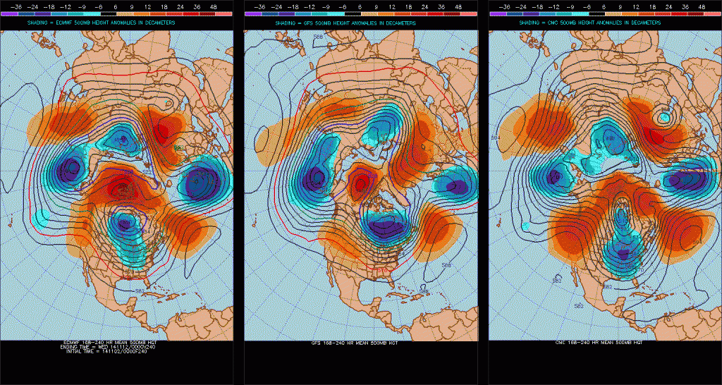
Deep upper air trough will dig into the SW US and northern MX early this week turning the flow over TX out of the SW aloft. This trough is starting to capture hurricane Vance off the SW MX coast turning the system northward and this trend should continue allowing mid and high level moisture to begin to spill northeastward into TX. Cold surface high pressure is moving eastward allowing Gulf moisture to begin its return at the low levels to the state. This is clearly noted by a dewpoint of 55 at Victoria versus 36 at Lufkin currently.

A cold front in association with the upper level trough will move into TX on Monday and enter SE TX late Tuesday and progress to the coast on Wednesday. By late Tuesday the air mass will saturate as moisture from both Vance and the Gulf combine over the state. The cold front becomes increasingly parallel to the upper level SW flow which will result in a favorable echo training pattern.

While the global models have converged on a more progressive system, moisture levels are forecasted to rise to a staggering 2.20 inches of PW at CRP which is +3 standard deviations above normal for early November. Strong frontal lift and favorable jet dynamics along the boundary working on a highly moist air mass paints a very wet mid week period. The threat for cell training induced flash flooding is high from late Tuesday into most of Wednesday. I am concerned with such moist values the models are and have been showing now for days and the potential for organized heavy training rainfall.

Frontal boundary should reach the coast late Wednesday, but base of the upper trough is slower to move eastward allowing moisture to flow up and over the surface cool pool resulting in continued light to moderate rainfall into Thursday.

Rainfall Amounts:
Still early to attempt to narrow down any one area that may see the greatest amounts. The event looks widespread over a large part of the state with widespread totals on average of 2-4 inches. Isolated amounts upwards of 6 inches are certainly possible and I would venture that a few locations will see a foot of rainfall before this event is done.

Short fused flash flooding will be the main concern under the training excessive rainfall cells in urban areas and across the hill country/flash flood alley area with a large scale hydrological response likely on all river basins due to the large QPF fields being predicted. While it is too early to be certain of the location of the highest rainfall amounts, the potential for rises of watersheds to flood stage is certainly possible by mid to late week.

It should be noted that WPC has outlooked a large part of TX and all of SE TX for excessive rainfall on their Day 3 outlook and an upgrade to a moderate or even high risk is possible as the event onset nears and confidence increases on the location of the greatest rainfall.

Flash Flood Watches will likely be needed for large portions of the state including most if not all of SE TX by Tuesday evening into Wednesday.
0 likes   
Carla/Alicia/Jerry(In The Eye)/Michelle/Charley/Ivan/Dennis/Katrina/Rita/Wilma/Ike/Harvey

Member: National Weather Association
Wx Infinity Forums
http://wxinfinity.com/index.php

Facebook.com/WeatherInfinity
Twitter @WeatherInfinity

gpsnowman
S2K Supporter
S2K Supporter
Posts: 3185
Joined: Fri Jan 07, 2011 10:35 am
Location: Grand Prairie Tx

#778 Postby gpsnowman » Mon Nov 03, 2014 5:46 am

Morning gang. Really looking forward to the rain this week. The posts on the last couple pages has got me very excited about the rest of November into winter. I told my daughter yesterday that it will snow this winter so I can't let her down. Should be a fun season.
0 likes   

User avatar
Portastorm
Storm2k Moderator
Storm2k Moderator
Posts: 9914
Age: 63
Joined: Fri Jul 11, 2003 9:16 am
Location: Round Rock, TX
Contact:

#779 Postby Portastorm » Mon Nov 03, 2014 7:47 am

This week will have its share of wild weather, but how about what the 0z GFS operational run is showing for mid month?! :lol:

That's just filthy!!!
0 likes   
Any forecasts under my name are to be taken with a grain of salt. Get your best forecasts from the National Weather Service and National Hurricane Center.

User avatar
Ntxw
Storm2k Moderator
Storm2k Moderator
Posts: 22785
Joined: Wed Oct 21, 2009 6:34 pm
Location: DFW, Texas

#780 Postby Ntxw » Mon Nov 03, 2014 7:48 am

Folks after it's been trying and trying, the Euro is sending down a large blast to the CONUS plains east in the medium to long range with something coming out of the southwest. This is the time period we are talking about (beginning mid to late next week, Mid November weeks 2/3). No one on in their right minds would call for "wintery precipitation" but this is where you would start looking.

This will be BOTH severe -EPO/-AO driven. It is tanking, and big time. Get ready.
0 likes   
The above post and any post by Ntxw is NOT an official forecast and should not be used as such. It is just the opinion of the poster and may or may not be backed by sound meteorological data. It is NOT endorsed by any professional institution including Storm2k. For official information, please refer to NWS products.


  Help support Storm2K!

Help Support Storm2K


Return to “USA & Caribbean Weather”

Who is online

Users browsing this forum: No registered users and 18 guests