Haven't seen this in a while:
Hydrologic Outlook
HYDROLOGIC OUTLOOK
TXC013-019-021-029-031-053-055-091-123-127-137-149-163-171-177-
187-209-255-259-265-271-285-287-299-323-325-385-453-463-465-491-
493-507-041900-
HYDROLOGIC OUTLOOK
NATIONAL WEATHER SERVICE AUSTIN/SAN ANTONIO TX
810 PM CST MON NOV 3 2014
...HEAVY RAINFALL EXPECTED ACROSS A GOOD PORTION OF SOUTH CENTRAL
TEXAS TUESDAY THROUGH NOON WEDNESDAY...
..RIVER FLOOD OUTLOOK FOR PORTIONS OF SOUTH CENTRAL TEXAS...
A SLOW MOVING UPPER LEVEL DISTURBANCE AND COLD FRONT WILL
INTERACT WITH A TROPICAL CYCLONE OVER THE EASTERN PACIFIC TO
PRODUCE A THREAT OF HEAVY RAINS ACROSS MUCH OF SOUTH CENTRAL TEXAS
TUESDAY THROUGH NOON WEDNESDAY. ALTHOUGH RAINFALL AMOUNTS ACROSS
THE REGION HAVE BEEN BELOW NORMAL FOR THE PAST FEW MONTHS...THE
EXPECTED HEAVY RAINFALL AND POSSIBLE FLASH FLOODING COULD BE
SIGNIFICANT ENOUGH TO PRODUCE RAPID RISES ALONG RIVERS...CREEKS
AND STREAMS.
...FOR THE COLORADO AND SAN GABRIEL RIVER BASINS...
EXPECT WIDESPREAD RAINFALL AMOUNTS OF 2-4 INCHES WITH ISOLATED
TOTALS OF 5-7 INCHES BETWEEN TUESDAY AND NOON WEDNESDAY. THESE
HEAVY RAINS COULD PRODUCE MINOR RIVER FLOODING. SMALLER CREEKS
AND STREAMS...ESPECIALLY THOSE IN THE URBAN AREAS COULD SEE
MODERATE FLOODING.
...FOR THE GUADALUPE RIVER BASIN...
EXPECT WIDESPREAD RAINFALL AMOUNTS OF 2-4 INCHES WITH ISOLATED
TOTALS OF 5-7 INCHES BETWEEN TUESDAY AND NOON WEDNESDAY. THESE
HEAVY RAINS COULD PRODUCE MINOR RIVER FLOODING.
...FOR THE SAN ANTONIO RIVER BASIN...
EXPECT WIDESPREAD RAINFALL AMOUNTS OF 2-4 INCHES WITH ISOLATED
TOTALS OF 5-7 INCHES BETWEEN TUESDAY AND NOON WEDNESDAY. THESE
HEAVY RAINS COULD PRODUCE MINOR RIVER FLOODING. SMALLER CREEKS
AND STREAMS...ESPECIALLY THOSE IN THE URBAN AREAS COULD SEE
MODERATE FLOODING.
...FOR THE NUECES AND FRIO RIVER BASINS...
EXPECT WIDESPREAD RAINFALL AMOUNTS OF 1-3 INCHES WITH ISOLATED
TOTALS OVER 5 INCHES BETWEEN TUESDAY AND NOON WEDNESDAY. THESE
HEAVY RAINS COULD PRODUCE MINOR RIVER FLOODING.
...FOR THE RIO GRANDE AND PECOS RIVER BASINS...
EXPECT WIDESPREAD RAINFALL AMOUNTS OF 1-3 INCHES WITH ISOLATED
TOTALS OVER 5 INCHES BETWEEN TUESDAY AND WEDNESDAY AFTERNOON.
THESE HEAVY RAINS COULD PRODUCE MINOR RIVER FLOODING.
A RIVER FLOOD OUTLOOK MEANS THERE IS A POTENTIAL FOR RIVER
FLOODING...BUT IT IS NOT IMMINENT. FORECAST RAINFALL MAY CAUSE
RIVERS AND STREAMS TO RISE TO CRITICAL STAGES. PERSONS WITH
INTERESTS ALONG THE AREAS MENTIONED ABOVE SHOULD REMAIN INFORMED OF
THE LATEST WEATHER AND RIVER INFORMATION AND BE PREPARED TO TAKE
ACTION AS NECESSARY.
PLEASE REFER TO NATIONAL WEATHER SERVICE RIVER FLOOD WARNINGS AND
STATEMENTS FOR THE LATEST INFORMATION IN YOUR AREA. YOU MAY ALSO
VISIT OUR AHPS PAGE AT THE FOLLOWING LINK (ALL LOWER CASE):
WATER.WEATHER.GOV/AHPS2/INDEX.PHP?WFO=EWX
FOR THE LATEST CURRENT AND FORECAST INFORMATION FOR RIVER GAUGES
ACROSS SOUTH CENTRAL TEXAS.
$$
Texas Fall-2014
Moderator: S2k Moderators
Forum rules

The posts in this forum are NOT official forecast and should not be used as such. They are just the opinion of the poster and may or may not be backed by sound meteorological data. They are NOT endorsed by any professional institution or STORM2K.
-
weatherdude1108
- Category 5

- Posts: 4228
- Joined: Tue Dec 13, 2011 1:04 pm
- Location: Northwest Austin/Cedar Park, TX
0 likes
The preceding post is NOT an official forecast, and should not be used as such. It is only the opinion of the poster and may or may not be backed by sound meteorological data. It is NOT endorsed by any professional institution including storm2k.org. For Official Information please refer to the NHC and NWS products.
-
TheProfessor

- Professional-Met

- Posts: 3506
- Age: 29
- Joined: Tue Dec 03, 2013 10:56 am
- Location: Wichita, Kansas

Re: Texas Fall-2014
somethingfunny wrote::double:
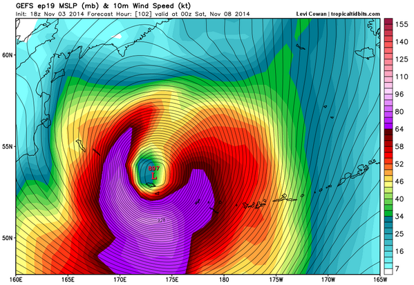
This is gonna have major impacts on the downstream pattern. Even the Euro has 913mb... and I don't think the models have fully reconciled the effects on the jet stream yet.
http://img.photobucket.com/albums/v126/ ... -og2_1.png
The result is going to be some extreme blocking as it pumps up ridging in front of it in NW Canada. Probably some extreme troughing down the CONUS but you are probably right the models probably don't have full respect for it until it's much closer in range.
lol @ Crazy Canadian.
0 likes
The above post and any post by Ntxw is NOT an official forecast and should not be used as such. It is just the opinion of the poster and may or may not be backed by sound meteorological data. It is NOT endorsed by any professional institution including Storm2k. For official information, please refer to NWS products.
Help support Storm2K!

-
gboudx

- S2K Supporter

- Posts: 4090
- Joined: Thu Sep 04, 2003 1:39 pm
- Location: Rockwall, Tx but from Harvey, La
Morning update from jeff, mostly for you Central and Southern TX folks.
***Significant rainfall event underway across TX***
Large scale upper pattern remains favorable for the development of heavy rainfall across a large part of TX today-Thursday. A large band of widespread moderate to heavy rainfall has focused this morning along a slow moving frontal boundary from S OK to SW TX with good rainfall coverage across the hard hit drought areas of the WC and NW TX. Across SE TX moisture return off the Gulf of Mexico is resulting in streamer showers moving inland over Matagorda, Wharton, and Fort Bend Counties and this should continue today and expand some as the air mass moistens. Morning soundings from CRP and DRT came is a bit drier than expected with a fairly large mid level dry layer noted. Most of the moisture from Vance is being depicted in the high levels while Gulf moisture is shown in the low levels. Water vapor images show a clearly defined moisture tap from the eastern Pacific with the main shield of Vance’s moisture starting to move across MX toward SW TX. Models may have been overdoing moisture levels some as an upstream look over the SW Gulf of Mexico shows PW values running in the 1.25 inches range. While moisture will pool along the frontal boundary, not sure if the 1.9-2.1 inch values will verify.
Cold front will very slowly move southward today as the upper flow is already running fairly parallel to the boundary supporting very slow forward progress. Forecast models generally bring the boundary southward and into central and SE TX overnight and slow it even more. The upper flow parallel to the boundary strongly supports repeat cell training tonight into Wednesday.
QPF fields have been cut back some overnight with the main focus of excessive rainfall over SW and SC TX. With this said the same factors over SC TX will be in place over SE TX late tonight and on Wednesday. Some of the meso scale guidance is showing a rainfall void over the central sections of SE TX on Wednesday with maximum totals being focused mainly NW of a line from Columbus to Lake Livingston possibly between the surface and 850mb cold fronts. I am not overly confident on any one location being more favored over another given the potential for cell training and meso scale influences.
Expecting widespread rainfall amounts of 1-3 inches with isolated totals of 4-5 inches. Amounts of 7 inches are possible over SC TX and SW TX. While most of the watersheds will be able to handle this amount of rainfall, the potential for excessive short term rainfall is high leading to rapid flash flooding and urban flooding. The widespread nature of the event will certainly support large scale river responses into the end of the week.
River Flood Outlook:
The following river basins are being monitored for rises based on the expected rainfall amounts to possible flood stage:
Colorado River: minor flooding possible
San Gabriel River: minor flood possible
Guadalupe River: minor flooding possible
San Antonio River: minor flooding possible
Frio River: minor flooding possible
Rio Grande River: minor flooding possible
0 likes
DFW airport has picked up 0.62 inches of rainfall this morning from the leading edge of the rain shield
0 likes
The above post and any post by Ntxw is NOT an official forecast and should not be used as such. It is just the opinion of the poster and may or may not be backed by sound meteorological data. It is NOT endorsed by any professional institution including Storm2k. For official information, please refer to NWS products.
Help support Storm2K!
Help support Storm2K!
For those who haven't checked it out, NCEP has incorporated the HRRR and it looks amazing on their site. Looks like quite a wet day for the state.
I like to use the sim_radar option
http://mag.ncep.noaa.gov/model-guidance ... =M&ps=area
I like to use the sim_radar option
http://mag.ncep.noaa.gov/model-guidance ... =M&ps=area
0 likes
The above post and any post by Ntxw is NOT an official forecast and should not be used as such. It is just the opinion of the poster and may or may not be backed by sound meteorological data. It is NOT endorsed by any professional institution including Storm2k. For official information, please refer to NWS products.
Help support Storm2K!
Help support Storm2K!
-
TeamPlayersBlue

- Category 5
- Posts: 3530
- Joined: Tue Feb 02, 2010 1:44 am
- Location: Denver/Applewood, CO
Goodness thats a lot of beneficial rain for you guys. Absolutely awesome. I still stand by thinking we/Texas will get much more than we expect with this system.
Driving to SA tomorrow. Hopefully not too eventful.
Driving to SA tomorrow. Hopefully not too eventful.
0 likes
Personal Forecast Disclaimer:
The posts in this forum are NOT official forecast and should not be used as such. They are just the opinion of the poster and may or may not be backed by sound meteorological data. They are NOT endorsed by any professional institution or storm2k.org. For official information, please refer to the NHC and NWS products.
The posts in this forum are NOT official forecast and should not be used as such. They are just the opinion of the poster and may or may not be backed by sound meteorological data. They are NOT endorsed by any professional institution or storm2k.org. For official information, please refer to the NHC and NWS products.
-
weatherdude1108
- Category 5
- Posts: 4228
- Joined: Tue Dec 13, 2011 1:04 pm
- Location: Northwest Austin/Cedar Park, TX
-
Ralph's Weather
- S2K Supporter
- Posts: 3371
- Age: 38
- Joined: Fri Dec 13, 2013 11:55 am
- Location: Lindale, TX
- Contact:
Re:
Ntxw wrote:For those who haven't checked it out, NCEP has incorporated the HRRR and it looks amazing on their site. Looks like quite a wet day for the state.
I like to use the sim_radar option
http://mag.ncep.noaa.gov/model-guidance ... =M&ps=area
Awesome, this will be a great tool this winter.
0 likes
Follow on Facebook at Ralph's Weather.
-
Portastorm

- Storm2k Moderator

- Posts: 9955
- Age: 63
- Joined: Fri Jul 11, 2003 9:16 am
- Location: Round Rock, TX
- Contact:
Re: Texas Fall-2014
Some of the 12z guidance seems to be slowing frontal progression in the southern half of the state even further. Things tonight/tomorrow might get really ugly in portions of south central/southeast/south Texas if this verifies.
0 likes
Any forecasts under my name are to be taken with a grain of salt. Get your best forecasts from the National Weather Service and National Hurricane Center.
-
wxman57

- Moderator-Pro Met

- Posts: 23174
- Age: 68
- Joined: Sat Jun 21, 2003 8:06 pm
- Location: Houston, TX (southwest)
Re: Texas Fall-2014
Looking beyond the heavy rainfall event, the new GFS (parallel run) is predicting freezing temps across much of Texas next Thursday (highs in the 40s in Houston on Wednesday). Fine with me, as I have the earliest date in our first freeze contest (Nov. 21). It can warm up afterward...

0 likes
-
Tireman4

- S2K Supporter
- Posts: 5903
- Age: 60
- Joined: Fri Jun 30, 2006 1:08 pm
- Location: Humble, Texas
- Contact:
Re: Texas Fall-2014
wxman57 wrote:Looking beyond the heavy rainfall event, the new GFS (parallel run) is predicting freezing temps across much of Texas next Thursday (highs in the 40s in Houston on Wednesday). Fine with me, as I have the earliest date in our first freeze contest (Nov. 21). It can warm up afterward...
I have two SUPER duty propane heaters coming your way. I can deliver them myself sir. They have adjusted climate control just for you:
1. Warm
2. Hot
3. Winter, go away bring back Summer.
I figured you would like the third setting. Ha ha ha
0 likes
-
wxman57
- Moderator-Pro Met
- Posts: 23174
- Age: 68
- Joined: Sat Jun 21, 2003 8:06 pm
- Location: Houston, TX (southwest)
Re: Texas Fall-2014
The 3rd setting will be perfect, Tireman4. I just want IAH to hit 32F once prior to November 21st so that I can win the contest. After that, lows of 70F or higher will be fine...
0 likes
-
TeamPlayersBlue
- Category 5
- Posts: 3530
- Joined: Tue Feb 02, 2010 1:44 am
- Location: Denver/Applewood, CO
Model runs look crazy. JB just posted the experimental run that had the PV in Minnesota. Crazy.
0 likes
Personal Forecast Disclaimer:
The posts in this forum are NOT official forecast and should not be used as such. They are just the opinion of the poster and may or may not be backed by sound meteorological data. They are NOT endorsed by any professional institution or storm2k.org. For official information, please refer to the NHC and NWS products.
The posts in this forum are NOT official forecast and should not be used as such. They are just the opinion of the poster and may or may not be backed by sound meteorological data. They are NOT endorsed by any professional institution or storm2k.org. For official information, please refer to the NHC and NWS products.
-
ColdFusion

- S2K Supporter
- Posts: 452
- Joined: Wed Feb 13, 2008 3:46 pm
- Location: Addison, TX
Re: Texas Fall-2014
I guess it's taking its time moving east - here in North Dallas (at the tollway) , its after 2pm - and its all been extremely light rain - and plenty of dry periods. I walked to get lunch 30 minutes ago.
0 likes

Re: Texas Fall-2014
WOW just WOW look at JMA 850 mb temps for next week. Truly severe arctic air mass. 850 mb temps forecasted around -22 degrees for Wisconsin.
Image courtesy of Tropical Tidbits

Image courtesy of Tropical Tidbits
0 likes
This post is NOT AN OFFICIAL FORECAST and should not be used as such. It is just the opinion of the poster and may or may not be backed by sound meteorological data. It is NOT endorsed by any professional institution including storm2k.org. For Official Information please refer to the NHC and NWS products.

I saw the leading edge on radar this morning headed to the metroplex, with a nice edge of moderate/heavy rain. I knew what was going to happen, and it did. Amazingly, yet again, the leading edge significantly weakened as it crossed Dallas county.
Shock and awe, I'm up to a grand total of 0.34 - I doubt that I will reach 1" today.
But at least it's rain.
Shock and awe, I'm up to a grand total of 0.34 - I doubt that I will reach 1" today.
But at least it's rain.
0 likes
The above post and any post by dhweather is NOT an official forecast and should not be used as such. It is just the opinion of the poster and may or may not be backed by sound meteorological data. It is NOT endorsed by any professional institution including storm2k.org. For official information, please refer to NWS products.


