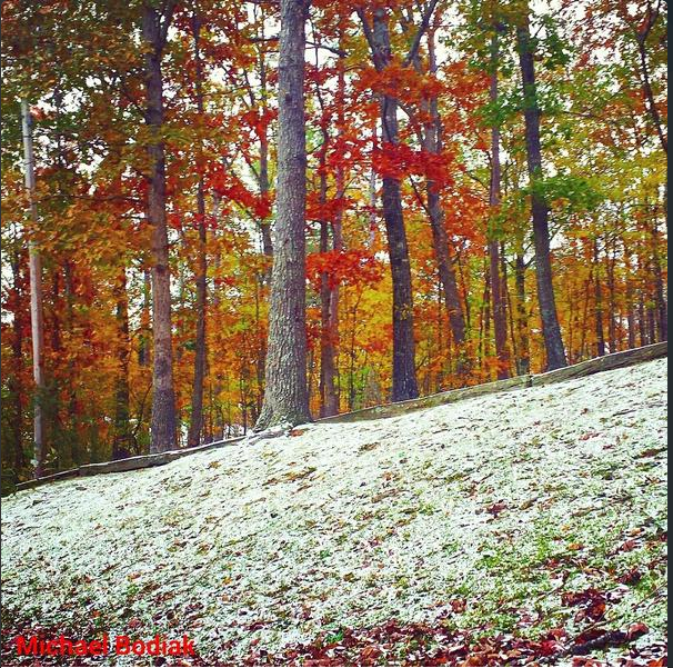
Texas Fall-2014

U.S. & Caribbean Weather Discussions and Severe Weather Events

Moderator: S2k Moderators

Forum rules

The posts in this forum are NOT official forecast and should not be used as such. They are just the opinion of the poster and may or may not be backed by sound meteorological data. They are NOT endorsed by any professional institution or STORM2K.

Help Support Storm2K
Message
Author
User avatar
iorange55
Category 5
Category 5
Posts: 2388
Joined: Thu Nov 13, 2008 9:47 pm
Location: Big D

Re: Texas Fall-2014

#1261 Postby iorange55 » Thu Nov 13, 2014 2:58 pm

SouthernMet wrote:Eh I don't think 6" is in play this time around, but I do think the models are struggling for whatever reason, like Orangeblood pointed out. IMO the gfs parallel is nailing it, not an abundance of moisture... But just enough lift, with the potential for mesoscale enhancement like the nws pointed out this morning.


Well said. That's a great explanation of where we stand at the moment. Still believe there will be enough to write a message to wxman57 on the windshield of my car.
0 likes   

Ralph's Weather
S2K Supporter
S2K Supporter
Posts: 3269
Age: 37
Joined: Fri Dec 13, 2013 11:55 am
Location: Lindale, TX
Contact:

#1262 Postby Ralph's Weather » Thu Nov 13, 2014 3:12 pm

I am thinking my area has a decent chance at at least minor accumulations after dark Sunday. We may be a bit warmer than DFW, but there should be more moisture to work with. I am hoping for something like we got a couple Christmases ago when we were forecasted for minor accumulations after dark, but got a heavy burst during the afternoon and ended up with like 3 inches by the evening.
0 likes   
Follow on Facebook at Ralph's Weather.

User avatar
SouthernMet
Category 3
Category 3
Posts: 857
Joined: Sun Aug 29, 2010 8:23 pm
Location: fort worth, tx

Re: Texas Fall-2014

#1263 Postby SouthernMet » Thu Nov 13, 2014 3:20 pm

Another hard freeze forecast for tonight, NWS has Keller getting down to 22. I don't know if it will get that cold, but another night in the 20's will help bring road/soil temps down a little bit more for Sunday...

Edit : 3pm & dfw still at a balmy 37..
Last edited by SouthernMet on Thu Nov 13, 2014 4:16 pm, edited 1 time in total.
0 likes   
Nothing that SouthernMet posts, is an official forecast,nor does it reflect views of STORM2K.. SouthernMet is just adding to the great discussions on STORM2K.. Refer to NWS for official forecasts.

aggiecutter
Category 5
Category 5
Posts: 1751
Joined: Thu Oct 14, 2004 9:22 pm
Location: Texarkana

Re: Texas Fall-2014

#1264 Postby aggiecutter » Thu Nov 13, 2014 3:35 pm

Little Rock, Arkansas received their earliest measurable snowfall since 1993 last night:

Image
0 likes   

Ralph's Weather
S2K Supporter
S2K Supporter
Posts: 3269
Age: 37
Joined: Fri Dec 13, 2013 11:55 am
Location: Lindale, TX
Contact:

#1265 Postby Ralph's Weather » Thu Nov 13, 2014 5:46 pm

18Z PGFS and GFS are not very promising as far as snow though the PGFS does show a tiny bit at the end. From the limited free version of the 12Z ECMWF it looks like it may be coming on though. 18Z NAM has some showers but looks to be too warm for much of anything. Overall nothing to get excited about from anything I looked at, but we still have time as these systems get analyzed more by the models.
0 likes   
Follow on Facebook at Ralph's Weather.

User avatar
dhweather
S2K Supporter
S2K Supporter
Posts: 6199
Joined: Sat Aug 14, 2004 9:29 pm
Location: Heath, TX
Contact:

#1266 Postby dhweather » Thu Nov 13, 2014 6:52 pm

Oh for the days of CAT 5 IN THE GULF !!!!!

:cheesy:


It IS this cold, it BETTER snow!
0 likes   
The above post and any post by dhweather is NOT an official forecast and should not be used as such. It is just the opinion of the poster and may or may not be backed by sound meteorological data. It is NOT endorsed by any professional institution including storm2k.org. For official information, please refer to NWS products.

Ralph's Weather
S2K Supporter
S2K Supporter
Posts: 3269
Age: 37
Joined: Fri Dec 13, 2013 11:55 am
Location: Lindale, TX
Contact:

#1267 Postby Ralph's Weather » Thu Nov 13, 2014 7:18 pm

FWD had another great discussion this afternoon.
0 likes   
Follow on Facebook at Ralph's Weather.

rw1984
S2K Supporter
S2K Supporter
Posts: 25
Joined: Fri Aug 17, 2012 5:28 pm

Re: Texas Fall-2014

#1268 Postby rw1984 » Thu Nov 13, 2014 8:11 pm

Somewhat off topic question. I have to fly from Beaumont-Port Arthur to Tulsa, OK for work. Was planning on flying up Sunday evening, but looking at the forecast I'm thinking I may be better flying out Monday morning. Any thoughts?
0 likes   

User avatar
Ntxw
Storm2k Moderator
Storm2k Moderator
Posts: 22731
Joined: Wed Oct 21, 2009 6:34 pm
Location: DFW, Texas

Re:

#1269 Postby Ntxw » Thu Nov 13, 2014 8:16 pm

TeamPlayersBlue wrote:Ntx, what dynamics are you seeing ANOTHER SSW event? Or is it what was left over from the last one? Already seeing warming in the 10MB layer again?

Also my low here in SL was 35.5F. Temps really crashed with the rain.


I see warming being forecast from the top down in the stratosphere 10mb and above. The recent -AO dive was induced by the troposphere (Siberia) bottom up. In a way it's kind of easy to forecast given the second highest SAI advancement in October previously held by 2009. The top 5 years generally all had early SSW events that kicked off December. So it would make sense. We're going to keep seeing it repeat with -AO dives at least once a month.

This -AO showed us how it can be effective. With the NAO being weak, and the help of the EPO the -AO dumped cold air over North America. As Long as the Pacific cooperates we're in good shape.
0 likes   
The above post and any post by Ntxw is NOT an official forecast and should not be used as such. It is just the opinion of the poster and may or may not be backed by sound meteorological data. It is NOT endorsed by any professional institution including Storm2k. For official information, please refer to NWS products.

  Help support Storm2K!
Help Support Storm2K

AggieSpirit
Tropical Storm
Tropical Storm
Posts: 223
Joined: Sat Nov 29, 2003 5:18 am
Location: Midlothian, TX

Re: Texas Fall-2014

#1270 Postby AggieSpirit » Thu Nov 13, 2014 9:31 pm

Please post charts, graphs that non-meteorologist simpletons like me can understand when talking about GFS, stratospheric warming, snow chances for DFW, etc --- I am a visual learner.
0 likes   

User avatar
SouthernMet
Category 3
Category 3
Posts: 857
Joined: Sun Aug 29, 2010 8:23 pm
Location: fort worth, tx

Re: Texas Fall-2014

#1271 Postby SouthernMet » Fri Nov 14, 2014 5:55 am

AggieSpirit wrote:Please post charts, graphs that non-meteorologist simpletons like me can understand when talking about GFS, stratospheric warming, snow chances for DFW, etc --- I am a visual learner.


Just when it looked like models had shifted north & drier gfs parallel oddly back to what it was showing for about 3 days straight and this looks identical to a couple of yesterday's runs.

6z gfs parallel snow accumulations : http://www.tropicaltidbits.com/analysis ... _us_15.png

Canadian & Euro also on board with light frozen precip. Right now models are favoring San Angelo/Abilene for the 1-3", looks like dusting for dfw.
0 likes   
Nothing that SouthernMet posts, is an official forecast,nor does it reflect views of STORM2K.. SouthernMet is just adding to the great discussions on STORM2K.. Refer to NWS for official forecasts.

User avatar
wxman57
Moderator-Pro Met
Moderator-Pro Met
Posts: 22951
Age: 67
Joined: Sat Jun 21, 2003 8:06 pm
Location: Houston, TX (southwest)

Re: Texas Fall-2014

#1272 Postby wxman57 » Fri Nov 14, 2014 6:47 am

rw1984 wrote:Somewhat off topic question. I have to fly from Beaumont-Port Arthur to Tulsa, OK for work. Was planning on flying up Sunday evening, but looking at the forecast I'm thinking I may be better flying out Monday morning. Any thoughts?


All I see is a chance for very light snow in Tulsa Sunday evening. That shouldn't be enough for any issues landing in Tulsa.
0 likes   

User avatar
srainhoutx
S2K Supporter
S2K Supporter
Posts: 6919
Age: 67
Joined: Sun Jan 14, 2007 11:34 am
Location: Haywood County, NC
Contact:

Re: Texas Fall-2014

#1273 Postby srainhoutx » Fri Nov 14, 2014 6:49 am

No official freeze at IAH overnight so wxman57 has to wait for another chance on early Tuesday to win that office pool... :wink:
0 likes   
Carla/Alicia/Jerry(In The Eye)/Michelle/Charley/Ivan/Dennis/Katrina/Rita/Wilma/Ike/Harvey

Member: National Weather Association
Wx Infinity Forums
http://wxinfinity.com/index.php

Facebook.com/WeatherInfinity
Twitter @WeatherInfinity

weatherdude1108
Category 5
Category 5
Posts: 4228
Joined: Tue Dec 13, 2011 1:04 pm
Location: Northwest Austin/Cedar Park, TX

#1274 Postby weatherdude1108 » Fri Nov 14, 2014 7:34 am

Looks like it bottomed out at 31.7 degrees at 3:18am according to my weather station at my place.
At 6:15 this morning, it has risen to 33.1 degrees.

The weather service admitted the models did a bad job of not accounting for expanding cloud coverage. I saw the clouds moving in last night from the north, and suspected they would play a factor with insulation. It was totally clear when I went to bed. Maybe EL NIÑO was a factor? Live and learn. I'm glad it didn't get to mid 20s. Not ready yet, especially if not snowing!
&&

http://forecast.weather.gov/product.php ... glossary=1

.PREV DISCUSSION... /ISSUED 348 AM CST FRI NOV 14 2014/

SHORT TERM (TODAY THROUGH SATURDAY)...MANY OF THE MODELS DID A
VERY POOR JOB YESTERDAY AT ERODING THE CLOUD DECK. NOT ONLY DID
THE CLOUD DECK NOT COMPLETELY ERODE YESTERDAY AFTERNOON AND
EVENING...IT HAS EXPANDED IN COVERAGE OVERNIGHT...WITH NOW JUST
FAR NORTHEAST AREAS AND A POCKET OVER VAL VERDE CLEAR.
UNFORTUNATELY THIS HAS RESULTED IN WARMER OVERNIGHT TEMPS THAN
WERE PREVIOUSLY ADVERTISED.
0 likes   
The preceding post is NOT an official forecast, and should not be used as such. It is only the opinion of the poster and may or may not be backed by sound meteorological data. It is NOT endorsed by any professional institution including storm2k.org. For Official Information please refer to the NHC and NWS products.

User avatar
Ntxw
Storm2k Moderator
Storm2k Moderator
Posts: 22731
Joined: Wed Oct 21, 2009 6:34 pm
Location: DFW, Texas

#1275 Postby Ntxw » Fri Nov 14, 2014 8:04 am

Hmm, a lot of mostly cloudy and overcast conditions rolled in overnight which prevented plunging of temps over the state. Didn't see that coming, was supposed to be clear.

Freeze number 3 for DFW
0 likes   
The above post and any post by Ntxw is NOT an official forecast and should not be used as such. It is just the opinion of the poster and may or may not be backed by sound meteorological data. It is NOT endorsed by any professional institution including Storm2k. For official information, please refer to NWS products.


  Help support Storm2K!

Help Support Storm2K


User avatar
TeamPlayersBlue
Category 5
Category 5
Posts: 3444
Joined: Tue Feb 02, 2010 1:44 am
Location: Denver/Applewood, CO

#1276 Postby TeamPlayersBlue » Fri Nov 14, 2014 9:26 am

Yeah i thin k i hit 37 lol. Not even close. All good, ill take the moisture in the air for when its cold enough!
0 likes   
Personal Forecast Disclaimer:
The posts in this forum are NOT official forecast and should not be used as such. They are just the opinion of the poster and may or may not be backed by sound meteorological data. They are NOT endorsed by any professional institution or storm2k.org. For official information, please refer to the NHC and NWS products.

User avatar
Tireman4
S2K Supporter
S2K Supporter
Posts: 5851
Age: 59
Joined: Fri Jun 30, 2006 1:08 pm
Location: Humble, Texas
Contact:

Re:

#1277 Postby Tireman4 » Fri Nov 14, 2014 9:47 am

TeamPlayersBlue wrote:Yeah i thin k i hit 37 lol. Not even close. All good, ill take the moisture in the air for when its cold enough!


It hit at least 34 at Bush.....
0 likes   

User avatar
Ntxw
Storm2k Moderator
Storm2k Moderator
Posts: 22731
Joined: Wed Oct 21, 2009 6:34 pm
Location: DFW, Texas

#1278 Postby Ntxw » Fri Nov 14, 2014 10:05 am

NAM is trying, lets get us a stronger shortwave. Anyway man that air mass is cold, and deep on it. I think models will bust again across the conus temps late this weekend and early next week.

And that 'warmer' 6-10 days out they keep showing looks a little muted, low heights and storminess remains over Texas on ENS. I guess anything warmer than now counts!
0 likes   
The above post and any post by Ntxw is NOT an official forecast and should not be used as such. It is just the opinion of the poster and may or may not be backed by sound meteorological data. It is NOT endorsed by any professional institution including Storm2k. For official information, please refer to NWS products.


  Help support Storm2K!

Help Support Storm2K


User avatar
Texas Snowman
Storm2k Moderator
Storm2k Moderator
Posts: 6151
Joined: Fri Jan 25, 2008 11:29 am
Location: Denison, Texas

#1279 Postby Texas Snowman » Fri Nov 14, 2014 10:23 am

Clouds didn't move in as quickly in Grayson County and we bottomed out at 25 degrees overnight.

Feels like early January outside this morning.

Now if only it will look like early January in a couple of days! :D :froze:
0 likes   
The above post and any post by Texas Snowman is NOT an official forecast and should not be used as such. It is just the opinion of the poster and may or may not be backed by sound meteorological data. It is NOT endorsed by any professional institution including storm2k.org. For official information, please refer to NWS products.

User avatar
CaptinCrunch
S2K Supporter
S2K Supporter
Posts: 8725
Age: 57
Joined: Mon Nov 03, 2003 4:33 pm
Location: Lake Worth, TX (Tarrant Co.)

#1280 Postby CaptinCrunch » Fri Nov 14, 2014 10:35 am

It was 26 degrees this morning at the house, dogs wasn't to happy about going potty....lol :cold:
0 likes   


Return to “USA & Caribbean Weather”

Who is online

Users browsing this forum: Cpv17, cstrunk, Killjoy12, Storm861 and 43 guests