Texas Winter 2014-2015
Moderator: S2k Moderators
Forum rules
 The posts in this forum are NOT official forecast and should not be used as such. They are just the opinion of the poster and may or may not be backed by sound meteorological data. They are NOT endorsed by any professional institution or STORM2K.

The posts in this forum are NOT official forecast and should not be used as such. They are just the opinion of the poster and may or may not be backed by sound meteorological data. They are NOT endorsed by any professional institution or STORM2K.
-
SouthernMet

- Category 3

- Posts: 857
- Joined: Sun Aug 29, 2010 8:23 pm
- Location: fort worth, tx
Re: Texas Winter 2014-2015
Light Snow approaching Abilene.. Wouldn't be surprised if a few people woke up to some flurries after looking at the latest rap/hrrr. It has very light precip passing close to the dfw area in a few hours.
0 likes
Nothing that SouthernMet posts, is an official forecast,nor does it reflect views of STORM2K.. SouthernMet is just adding to the great discussions on STORM2K.. Refer to NWS for official forecasts.
-
TheProfessor

- Professional-Met

- Posts: 3506
- Age: 29
- Joined: Tue Dec 03, 2013 10:56 am
- Location: Wichita, Kansas
-
SouthernMet
- Category 3
- Posts: 857
- Joined: Sun Aug 29, 2010 8:23 pm
- Location: fort worth, tx
Re: Texas Winter 2014-2015
STRONG UPPER LEVEL SHORTWAVE WILL MOVE
THROUGH THE REGION MIDDAY SUNDAY. AHEAD OF THIS SYSTEM...LOTS OF
MOISTURE/LIFT WILL RESULT IN PRECIPITATION ORIGINATING AT AN
UNUSUALLY HIGH LEVEL...NEAR 22000FT. THIS PRECIP WILL BE FALLING
INTO DRY AIR BELOW IT...SO MOSTLY VIRGA IS EXPECTED IN THE
METROPLEX. HOWEVER SOME SATURATION WILL OCCUR WHICH WILL BRING
CIGS DOWN TO NEAR 10000FT BY SUNRISE. IF PRECIP INTENSITY IS
GREATER THAN EXPECTED OVER THE METROPLEX...WET BULB COOLING WOULD
RESULT IN THERMAL PROFILE FAVORABLE FOR SLEET OR SNOW. BUT THERE
IS CURRENTLY NO MODEL SHOWING THIS MUCH PRECIPITATION
AVAILABLE...WHICH WOULD BE REQUIRED TO BOTH COOL AND SATURATE
BEFORE ANY NON-LIQUID PRECIP REACHES THE GROUND. WE WILL CONTINUE
TO WATCH TRENDS TO MONITOR FOR THIS VERY REMOTE POSSIBILITY.
0 likes
Nothing that SouthernMet posts, is an official forecast,nor does it reflect views of STORM2K.. SouthernMet is just adding to the great discussions on STORM2K.. Refer to NWS for official forecasts.
-
SouthernMet
- Category 3
- Posts: 857
- Joined: Sun Aug 29, 2010 8:23 pm
- Location: fort worth, tx
Re: Texas Winter 2014-2015
0 likes
Nothing that SouthernMet posts, is an official forecast,nor does it reflect views of STORM2K.. SouthernMet is just adding to the great discussions on STORM2K.. Refer to NWS for official forecasts.
-
Rgv20

- S2K Supporter

- Posts: 2466
- Age: 39
- Joined: Wed Jan 05, 2011 5:42 pm
- Location: Edinburg/McAllen Tx
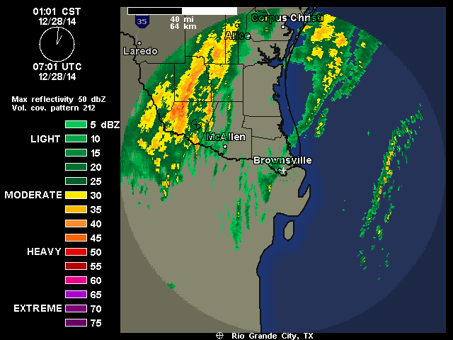
Temperature right at 50 with moderate rain falling down!

0 likes
The following post is NOT an official forecast and should not be used as such. It is just the opinion of the poster and may or may not be backed by sound meteorological data. It is NOT endorsed by any professional institution including storm2k.org For Official Information please refer to the NHC and NWS products.
-
SouthernMet
- Category 3
- Posts: 857
- Joined: Sun Aug 29, 2010 8:23 pm
- Location: fort worth, tx
Re: Texas Winter 2014-2015
I know im not the only one staying up for 6z model data & morning forecast discussions lol.. 
0 likes
Nothing that SouthernMet posts, is an official forecast,nor does it reflect views of STORM2K.. SouthernMet is just adding to the great discussions on STORM2K.. Refer to NWS for official forecasts.
-
SouthernMet
- Category 3
- Posts: 857
- Joined: Sun Aug 29, 2010 8:23 pm
- Location: fort worth, tx
Re: Texas Winter 2014-2015
06z nam light-years different from 00z run, breaks out winter precip shield similar to CMC, but even earlier, in 72 hours.
sref on board, breaking out frozen precip across tx wednesday morning. sref showing freezing rain & IP as the dominant precip type.
sref on board, breaking out frozen precip across tx wednesday morning. sref showing freezing rain & IP as the dominant precip type.
Last edited by SouthernMet on Sun Dec 28, 2014 4:18 am, edited 1 time in total.
0 likes
Nothing that SouthernMet posts, is an official forecast,nor does it reflect views of STORM2K.. SouthernMet is just adding to the great discussions on STORM2K.. Refer to NWS for official forecasts.
-
TheProfessor
- Professional-Met
- Posts: 3506
- Age: 29
- Joined: Tue Dec 03, 2013 10:56 am
- Location: Wichita, Kansas
-
SouthernMet
- Category 3
- Posts: 857
- Joined: Sun Aug 29, 2010 8:23 pm
- Location: fort worth, tx
Re:
TheProfessor wrote::uarrow: The 6z Nam is a lot drier for most of Texas except for west it seems.
Wrong.. Compare the 6z nam too 00z nam, 00z nam had zero precip through 84 hours, 6z run has precip as early as 69 hours.
0 likes
Nothing that SouthernMet posts, is an official forecast,nor does it reflect views of STORM2K.. SouthernMet is just adding to the great discussions on STORM2K.. Refer to NWS for official forecasts.
-
TheProfessor
- Professional-Met
- Posts: 3506
- Age: 29
- Joined: Tue Dec 03, 2013 10:56 am
- Location: Wichita, Kansas
Re: Re:
SouthernMet wrote:TheProfessor wrote::uarrow: The 6z Nam is a lot drier for most of Texas except for west it seems.
Wrong.. Compare the 6z nam too 00z nam, 00z nam had zero precip through 84 hours, 6z run has precip as early as 69 hours.
I was comparing to the CMC not the other Nam runs, btw The NavGem is extremely wet for North and East Texas, Oklahoma, Arkansas and Louisiana, It will be interesting to see if it keeps that precip with a colder trend.
0 likes
An alumnus of The Ohio State University.
Your local National Weather Service office is your best source for weather information.
Your local National Weather Service office is your best source for weather information.
-
SouthernMet
- Category 3
- Posts: 857
- Joined: Sun Aug 29, 2010 8:23 pm
- Location: fort worth, tx
Re: Texas Winter 2014-2015
seeing some higher returns near sonora tx, will be interesting to see if that holds together.
0 likes
Nothing that SouthernMet posts, is an official forecast,nor does it reflect views of STORM2K.. SouthernMet is just adding to the great discussions on STORM2K.. Refer to NWS for official forecasts.
-
TheProfessor
- Professional-Met
- Posts: 3506
- Age: 29
- Joined: Tue Dec 03, 2013 10:56 am
- Location: Wichita, Kansas
0 likes
An alumnus of The Ohio State University.
Your local National Weather Service office is your best source for weather information.
Your local National Weather Service office is your best source for weather information.
-
TheProfessor
- Professional-Met
- Posts: 3506
- Age: 29
- Joined: Tue Dec 03, 2013 10:56 am
- Location: Wichita, Kansas
-
somethingfunny

- ChatStaff

- Posts: 3926
- Age: 37
- Joined: Thu May 31, 2007 10:30 pm
- Location: McKinney, Texas
Re: Texas Winter 2014-2015
Regarding this morning:
AREA FORECAST DISCUSSION
NATIONAL WEATHER SERVICE FORT WORTH TX
404 AM CST SUN DEC 28 2014
.DISCUSSION...
AN UPPER LEVEL TROUGH TO OUR WEST CONTINUES MOVING EAST AND WILL
PROVIDE LIFT FOR ADDITIONAL RAIN ACROSS OUR SOUTH AND SOUTHEASTERN
COUNTIES TODAY. THE RADAR ACROSS CENTRAL AND SOUTHEAST TEXAS HAS
LOOKED ACTIVE ALL NIGHT BUT A LEVEL OF DRY AIR IN THE LOWER LEVELS
OF THE ATMOSPHERE HAS PREVENTED MUCH PRECIPITATION FROM REACHING
THE GROUND SO FAR. EVEN THOUGH THE RADAR HAS GIVEN THE APPEARANCE
THAT IT HAS BEEN RAINING ALMOST ALL NIGHT SOUTH OF A GATESVILLE TO
ATHENS LINE...NONE OF THE AUTOMATED WEATHER STATIONS HAVE
REPORTED ANY RAIN UNTIL AN HOUR AGO. HEARNE /KLHB/ FINALLY REPORTED
RAIN ON THEIR 3 AM HOURLY OB INDICATING THAT THE LOWER LEVELS OF
THE ATMOSPHERE ARE FINALLY STARTING TO SATURATE DOWN. EXPECT OTHER
SITES IN THAT AREA TO BEGIN REPORTING LIGHT RAIN BEFORE SUNRISE.
LIGHT TO MODERATE RAIN WILL OCCUR SOUTHEAST OF A LAMPASAS TO
MIDLOTHIAN TO SULPHUR SPRINGS LINE TODAY WITH THE BEST RAIN
CHANCES IN THE MORNING HOURS. RAINFALL AMOUNTS WILL BE LIGHT AND
THE RAIN IS EXPECTED TO END THIS AFTERNOON. FORECAST SOUNDINGS
INDICATE THAT THE PRECIPITATION WILL REMAIN LIQUID WITH NO FROZEN
PRECIPITATION MIXING...EVEN AS THE UPPER LEVEL LOW APPROACHES
LATER TODAY. HOWEVER...WILL BE MONITORING FOR ANY CHANGES TO THE
LOW LEVEL TEMPERATURE PROFILE FOR POSSIBLY SOME SLEET MIXING IN.
And then for the big show....
OVERALL...THE FORECAST FOR THE TUESDAY THROUGH FRIDAY TIME FRAME
HAS NOT CHANGED MUCH BUT DID MAKE SOME ADJUSTMENTS TO THE WINTER
WEATHER PRECIPITATION DURING THIS TIME PERIOD. THE ARCTIC FRONT IS
STILL EXPECTED TO ARRIVE MONDAY NIGHT/TUESDAY MORNING. IT WILL
STEADILY SPREAD ACROSS THE REGION WITH WINDS OF 10-15 MPH BEHIND
IT. THE AIR MASS WILL BE MODIFIED A LITTLE DURING THE DAY ON
TUESDAY DUE TO SOUTH AND EAST 850 MB WINDS ABOVE THE FRONT AND
WEST WINDS ABOVE 850 MB. HOWEVER...TUESDAY THROUGH WEDNESDAY NIGHT
WILL STILL BE A RATHER COLD PERIOD WITH HIGHS ONLY IN THE 30S AND
40S AND LOWS IN THE 20S AND 30S.
WE CONTINUE TO MAINTAIN A DRY FORECAST MONDAY NIGHT THROUGH
TUESDAY NIGHT AS THERE IS A LACK OF LIFT ACROSS THE REGION. WE
WILL BE IN NEAR ZONAL FLOW ALOFT AS A STRONG UPPER LEVEL LOW MOVES
DOWN THE WEST COAST BUT IT WILL STILL BE TOO FAR WEST AT THAT TIME
TO SPREAD ANY LARGE SCALE LIFT OVER OUR AREA. ISENTROPIC CHARTS
ALSO INDICATE A LACK OF LIFT IN OUR AREA DURING THIS PERIOD. WE
START TO NOTICE SOME WEAK ISENTROPIC LIFT BETWEEN THE 800-700 MB
LAYER BEGINNING WEDNESDAY IN OUR SOUTHERN ZONES. ANALYZING THIS
LAYER IN THE FORECASTED SOUNDINGS...WE SEE MOISTURE IN THE LAYER
WHERE THE LIFT IS OCCURRING...BUT THE LAYER BELOW 800 MB...AND IN
PARTICULAR BELOW 900 MB...IS DRY AND WOULD LIKELY EVAPORATE ANY
PRECIPITATION BEFORE IT REACHES THE GROUND. SO THE CHALLENGE NOW
IS WILL THE LOWER LAYER SATURATE ENOUGH FROM TOP-DOWN PROCESSES TO
ALLOW ANY PRECIPITATION TO REACH THE GROUND? THIS APPEARS TO BE A
LOW CHANCE AS THE LIFT DOES NOT LOOK STRONG ENOUGH TO GENERATE
ENOUGH PRECIPITATION TO SATURATE THE LAYER ALL THE WAY DOWN TO THE
SURFACE. THE RADAR MAY SHOW A LOT OF ECHOES ON WEDNESDAY...BUT DO
NOT ANTICIPATE PRECIPITATION WILL REACH THE GROUND. HOWEVER...WILL
LEAVE 20 POPS FOR DRIZZLE SOUTHWEST OF A CISCO TO HILLSBORO TO
FREESTONE LINE IN CASE SOME LIGHT RAIN DOES REACH THE GROUND.
DEPENDING ON THE TIME AND TEMPERATURES...THERE COULD BE A BRIEF
PERIOD OF FREEZING DRIZZLE WEST OF I-35.
OUR MAIN TIME FRAME OF CONCERN FOR FROZEN PRECIPITATION IS
WEDNESDAY NIGHT/EARLY THURSDAY MORNING AS THE ISENTROPIC LIFT
CONTINUES BUT ALSO SPREADS NORTH OVER MORE OF THE REGION AND
STRENGTHENS. THE MODELS ARE NOT OUTPUTTING ANY QPF DURING THIS 12
HOUR PERIOD FROM 6 PM WEDNESDAY TO 6 AM THURSDAY BECAUSE THEY
CONTINUE TO KEEP THE LOWER LEVELS OF THE ATMOSPHERE DRY /AS
INDICATED ON THE FORECASTED SOUNDINGS/. THE LOWER LEVELS OF THE
ATMOSPHERE WILL EVENTUALLY SATURATE DOWN AS THE ISENTROPIC LIFT
CONTINUES BUT THE QUESTION AND CHALLENGE IS WHEN WILL THAT OCCUR.
THE DETERMINISTIC MODELS SUGGEST THIS WILL NOT HAPPEN UNTIL AFTER
6 AM THURSDAY WHEN TEMPERATURES ARE ALREADY ABOVE FREEZING
/TEMPERATURES ARE EXPECTED TO EVENTUALLY RISE WEDNESDAY NIGHT UNDER
THE INFLUENCE OF WARM AIR ADVECTION DUE TO THE ISENTROPIC
LIFT/...BUT IT IS POSSIBLE THIS COULD OCCUR DURING THE NIGHT
WEDNESDAY. SO WILL KEEP A LOW CHANCE FOR LIGHT RAIN AND/OR LIGHT
FREEZING RAIN ALONG AND SOUTH OF A LINE FROM BRECKENRIDGE TO DFW
TO EMORY. THE FREEZING RAIN WILL BE MENTIONED ALONG AND WEST OF A
LINE FROM WEATHERFORD TO LAMPASAS. IF FREEZING RAIN OCCURS DURING
THE TIME FROM 6 PM WEDNESDAY TO 6 AM THURSDAY...WE DO NOT EXPECT
SIGNIFICANT IMPACTS AS TEMPERATURES WILL BE WARMING OVERNIGHT AND
THE CHANGEOVER TO LIQUID RAIN SHOULD MELT ANY MINIMAL ICE
ACCUMULATIONS. HOWEVER...IF TEMPERATURES THAT NIGHT ARE COLDER
THAN THEY ARE CURRENTLY FORECAST TO BE AND ARE REALIZED IN THE
UPPER 20S...THERE COULD BE SOME MINOR ACCUMULATIONS AND POSSIBLY
MINOR IMPACTS FOR A SHORT PERIOD OF TIME DURING THE NIGHT. IF
TEMPERATURES WERE TO FALL INTO THE UPPER 20S...THE MOST LIKELY
LOCATION FOR THIS TO HAPPEN WOULD BE WEST ON I-35.
RAIN CHANCES ARE STILL LOOKING DECENT ACROSS THE REGION ON
THURSDAY AND FRIDAY AS THE UPPER LEVEL LOW ALONG THE WEST COAST
FINALLY MOVES INTO THE SOUTHERN PLAINS. AGAIN...THIS IS EXPECTED
TO REMAIN AS LIQUID RAIN. THERE ARE SOME DIFFERENCES WITHIN THE
MODELS REGARDING THE BEST TIMING FOR RAIN CHANCES ON THESE DAYS
AND WE WILL HOPEFULLY BE ABLE TO REFINE THEM OVER THE NEXT FEW
DAYS. ONE INTERESTING FEATURE TO WATCH WILL BE THE POSSIBILITY OF
A SHORTWAVE AHEAD OF THE UPPER LOW ON THURSDAY. THE GFS DEVELOPS
THIS SHORTWAVE GIVING US BETTER RAIN CHANCES ON THURSDAY AS A
RESULT. THE ECMWF DOES NOT HAVE THIS SHORTWAVE AND THEREFORE HAS
BETTER RAIN CHANCES ON FRIDAY AS THE UPPER LEVEL LOW MOVES OVER
THE AREA. SOME THUNDER WILL BE POSSIBLE THURSDAY NIGHT AND
FRIDAY. ANOTHER FRONT IS EXPECTED BEHIND THIS SYSTEM ON SATURDAY
AND IT IS STARTING TO LOOK LIKE THE AIR BEHIND THIS FRONT COULD BE
PRETTY COLD AS WELL.
0 likes
I am not a meteorologist, and any posts made by me are not official forecasts or to be interpreted as being intelligent. These posts are just my opinions and are probably silly opinions.
-
Ralph's Weather
- S2K Supporter
- Posts: 3371
- Age: 38
- Joined: Fri Dec 13, 2013 11:55 am
- Location: Lindale, TX
- Contact:
A 1050 high on the Plains plus an inch of moisture equals big trouble.
0 likes
Follow on Facebook at Ralph's Weather.

Re: Texas Winter 2014-2015
King Euro is painting snowfall across Central Texas and some parts of the Metroplex in the 24hr forecast!!!! #thetrendismyfriend. It's also sniffing out something in longer range....with trace amounts....still, there was nothing present before.....I think we may get Thundersleet/Thundersnow next week based on the Austin FD...which is wrong in most aspects I think because of snowcover......Good morning y'all!!!! Bring on the snow!!!!!! 


_____________________________________________________________________________________________________________________________________________
Just my two shillingsworth! I am not a meteorlogist, but I had several classes and did well in them! The NWS knows best!!!
_____________________________________________________________________________________________________________________________________________
Just my two shillingsworth! I am not a meteorlogist, but I had several classes and did well in them! The NWS knows best!!!
0 likes
Re: Texas Winter 2014-2015
Interesting, their trend should be waaay colder soon...
AREA FORECAST DISCUSSION
NATIONAL WEATHER SERVICE GREAT FALLS MT
450 AM MST Sun Dec 28 2014
UPDATED AVIATION SECTION
.DISCUSSION...
Sunday through Tuesday...Snow continues to increase in coverage
this morning and will fall across Central Montana through the
day. Snow totals look very similar to the last storm with amounts
highest over the Continental Divide. The best period for seeing
heavy snowfall looks to be Sunday morning. Most moisture exits the
region early Monday morning but some light snow showers may
linger into the day Monday. Skies begin to clear from the north
Monday night as very cold temperatures move into the region. With
clearing skies and fresh snow, the possibility of widespread low
temperatures around 20 degrees below zero exists Tuesday morning.
Tuesday night through Sunday...The medium range period begins with a
strong upper ridge over the eastern Pacific and a closed upper low
over northern California/western Nevada. The resulting northerly
flow aloft over the area will be dry but cool and will continue
through Wednesday. By Thursday, weak shortwave energy rounding the
top of the upper ridge, along with a plume of moisture, will bring
light snow to the Hi-Line. Pacific moisture will override the cool
air-mass east of the Continental Divide on Friday resulting in a
large area of snow that will continue into Saturday. Another push of
cold air into the area Sunday will allow scattered snow showers to
continue. Temperatures will remain well below seasonal averages. Lows
Saturday and Sunday will be below zero for most of northern and
North Central Montana. GFS model hinting at very cold readings
Monday morning.
&&
.AVIATION...
UPDATED 1150Z.
A surface cold front will continue to move south across the area
through the afternoon. Widespread snow along with gusty north winds
will accompany the front. Increasing MVFR/IFR conditions due to low
ceilings and snow. These conditions continuing beyond 00z. Mountains
obscured.
0 likes
Re: Texas Winter 2014-2015
There are SNOW returns on the HAMWEATHER site's radar for Central Texas!!! Especially in Cedar Park right now!!! Dripping Springs & Burnet County too! Any ground truthers out there? I'm going outside to have a looksee....
0 likes
Re: Texas Winter 2014-2015
Rain mixed with unknown precip!!!! I'll go back out and check next radar update....It's probably mist, dainty, drifty mist?!! Promets is it possible for mist to be dainty in falling??? (mimics tiny flurries?) It is COLD in the Longhorn WX Center!!! Telltale signs of whats to come!!!
0 likes
-
wxman57

- Moderator-Pro Met

- Posts: 23169
- Age: 68
- Joined: Sat Jun 21, 2003 8:06 pm
- Location: Houston, TX (southwest)
Re:
Ntxw wrote:Euro has a mammoth 1059mb high in Western Canada in about 48hrs and sinks to Montana at 1056mb in 72 yet its trying to hold up the cold air. I smell bust left and right with temperatures, the NAM looks better to me at the surface drilling the dense air mass. Im with wxman57 the front will be down to the Yucatan not stop at Brownsville.
Note that I said "western Bay of Campeche", not the Yucatan. It won't reach the Yucatan.
0 likes
Who is online
Users browsing this forum: Harp.1, Sambucol2024, Yukon Cornelius and 105 guests