
Great weekend weather!!! Is starting to get to that time during the winter that the sun's angle is getting much higher than late December, even with temps getting only into the low 70s like today and yesterday it feels great under the sun.
I don't see major changes coming for us, rainy and cool at times with mild daytime highs when the rain leaves our area.
Ensembles still show no major dip in the NAO for the rest of the month.
Florida Weather
Moderator: S2k Moderators
Forum rules

The posts in this forum are NOT official forecast and should not be used as such. They are just the opinion of the poster and may or may not be backed by sound meteorological data. They are NOT endorsed by any professional institution or STORM2K.
Re: Florida Weather
0 likes
-
HURRICANELONNY
- Category 5

- Posts: 1392
- Joined: Wed May 07, 2003 6:48 am
- Location: HOLLYWOOD.FL
Re: Florida Weather
Not that I think will see anything more below norm the rest of the winter but I'll post the !/19 NWS discussion for giggles. If some haven't read it yet. That would be around 1/26
The 19.00z
operational runs of the GFS and European model (ecmwf) are signaling a much
stronger cold front to move across Florida early next week as a
longwave trough amplifies over the eastern states, but this is
over 7 days away and much can change. /Gregoria
The 19.00z
operational runs of the GFS and European model (ecmwf) are signaling a much
stronger cold front to move across Florida early next week as a
longwave trough amplifies over the eastern states, but this is
over 7 days away and much can change. /Gregoria
0 likes
hurricanelonny
Re: Florida Weather
With the EPO going negative again by the end of the month is probably going to be the Central US again going into the deep freeze.
0 likes
-
HURRICANELONNY
- Category 5
- Posts: 1392
- Joined: Wed May 07, 2003 6:48 am
- Location: HOLLYWOOD.FL
Re: Florida Weather
Still biting for now........
Both the European model (ecmwf)/GFS are on board with a stronger cold front with a
potentially better shot of cold air into Tuesday of next week.
Although in the long range, the gefs and the naefs are forecasting
500 mb heights 2 Standard deviations below normal across central Florida by
12z Tuesday 27th. We'll see if this agreement continues in later long
range model suites.
0 likes
hurricanelonny
-
northjaxpro

- S2K Supporter

- Posts: 8900
- Joined: Mon Sep 27, 2010 11:21 am
- Location: Jacksonville, FL
We will watch it HURRICANELONNY, but I am not completely yet on board. The models have been hinting long range at the possibility of a longwave trough taking shape across the Eastern CONUS. However, as already discussed, the teleconnections just have not aligned to bring a significant cold spell peninsula wide just yet. Now, there is still time to see this change, and the NAO doen't have to sharply dip negative, just a slight to modest dip can bring an significant arctic airmass down across the Eastern U.S.
We have about 4-6 weeks left of a window to see at least another significant arctic outbreak to infiltrate the CONUS. We have been extremely fortunate to say the least of being spared these intrusions from impacting the entire peninsula, so let's see if Mother Nature will continue her mercy upon us the rest of the meteorological winter season.
0 likes
NEVER, EVER SAY NEVER in the tropics and weather in general, and most importantly, with life itself!!
________________________________________________________________________________________
Fay 2008 Beryl 2012 Debby 2012 Colin 2016 Hermine 2016 Julia 2016 Matthew 2016 Irma 2017 Dorian 2019
________________________________________________________________________________________
Fay 2008 Beryl 2012 Debby 2012 Colin 2016 Hermine 2016 Julia 2016 Matthew 2016 Irma 2017 Dorian 2019

Re: Florida Weather
12z Euro run coming into line on the long wave pattern. Deep trough with mid-level cold core low into the Carolinas in about a week.
12z ECM
12z ECM
0 likes
-
northjaxpro
- S2K Supporter
- Posts: 8900
- Joined: Mon Sep 27, 2010 11:21 am
- Location: Jacksonville, FL
Nov 1, 2014
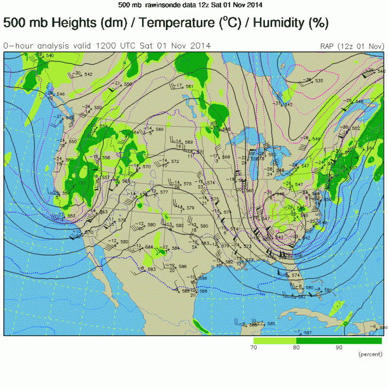
Now, a pattern like this would bring a pretty good cool down for the peninsula, but still the core of the arctic air still looks to stay bottled up across Canada based on that EURO 192 hour run you posted above ronjon. NAO still not showing indications of a negative dip just yet.
Last edited by northjaxpro on Wed Jan 21, 2015 7:10 am, edited 1 time in total.
0 likes
NEVER, EVER SAY NEVER in the tropics and weather in general, and most importantly, with life itself!!
________________________________________________________________________________________
Fay 2008 Beryl 2012 Debby 2012 Colin 2016 Hermine 2016 Julia 2016 Matthew 2016 Irma 2017 Dorian 2019
________________________________________________________________________________________
Fay 2008 Beryl 2012 Debby 2012 Colin 2016 Hermine 2016 Julia 2016 Matthew 2016 Irma 2017 Dorian 2019
Re: Florida Weather
Yeah northjax, the core of artic air still stays north but this is January, not November with a pretty decent snow pack over the Midwest and Canada. Thinking at least freezing temps in central Florida with that setup.
0 likes
-
northjaxpro
- S2K Supporter
- Posts: 8900
- Joined: Mon Sep 27, 2010 11:21 am
- Location: Jacksonville, FL
Well, If we had a snowpack over the TN Valley and Mid Atlantic region with a potential set-up liike the EURO is showing' that would be more beneficial in helping the airmass from moderating much. But, unfortunately that is not the case currently. But, this could change as the EURO is hinting at a potent Alberta Clipper shortwave diving down into the TN Valley and into The Carolinas/Mid-Atlantic regions by Tuesday of next week. A potential deepening of a upper trough across the Eastern US by that time, the air aloft could be cold enough to produce snow in those regions.
As I pointed out earlier ronjon, a potential set up would bring a signficant cool down to the peninsula, possibly a freeze to the northern FL peninsula. If the trends with the EURO continues with regards to next week, we may have temps colder farther down the state as well. Heck, we already had a similar pattern which I pointed out back on Nov. 1. But, it will not likely be extreme cold as it appears the core of the coldest air will remain well north of our region. However, closely monitor the teleconnections of course as to not continue to beat that dead horse.
As I pointed out earlier ronjon, a potential set up would bring a signficant cool down to the peninsula, possibly a freeze to the northern FL peninsula. If the trends with the EURO continues with regards to next week, we may have temps colder farther down the state as well. Heck, we already had a similar pattern which I pointed out back on Nov. 1. But, it will not likely be extreme cold as it appears the core of the coldest air will remain well north of our region. However, closely monitor the teleconnections of course as to not continue to beat that dead horse.
0 likes
NEVER, EVER SAY NEVER in the tropics and weather in general, and most importantly, with life itself!!
________________________________________________________________________________________
Fay 2008 Beryl 2012 Debby 2012 Colin 2016 Hermine 2016 Julia 2016 Matthew 2016 Irma 2017 Dorian 2019
________________________________________________________________________________________
Fay 2008 Beryl 2012 Debby 2012 Colin 2016 Hermine 2016 Julia 2016 Matthew 2016 Irma 2017 Dorian 2019

Re: Florida Weather
Like I said before, as long as the NAO remains positive I am not expecting a freeze for the I-4 corridor, especially with the ensembles show the PNA going down to at least neutral.
0 likes

Re: Florida Weather
I'm officially cancelling winter which never started this season for South Florida and the only shot we have is if the NAO goes negative
0 likes
-
HURRICANELONNY
- Category 5
- Posts: 1392
- Joined: Wed May 07, 2003 6:48 am
- Location: HOLLYWOOD.FL
Re: Florida Weather
Just because the NAO does not go Neg. doesn't mean we won't get cool or perhaps cold. He's probably right that we won't get a freeze but atleast some cool air before our winter is over. Next week looks to be cool all week and perhaps cold by the end of the week. The NWS has been mentioning it.
By Sunday...much cooler and drier conditions are expected...with
maxima struggling to reach 70f. The upper-level trough will remain
anchored over the eastern Continental U.S. Through much of next week. Near the
surface...low pressure off mid-Atlantic/New England...combined
with high pressure centered over southern plans...will keep
northerly flow in place over Florida Peninsula. Thus...below
average temperatures will prevail for extended period...and perhaps even
cooler conditions by very end of long term period.
0 likes
hurricanelonny
-
northjaxpro
- S2K Supporter
- Posts: 8900
- Joined: Mon Sep 27, 2010 11:21 am
- Location: Jacksonville, FL
Historic day in weather for many areas this date, January 21, 1985.
Courtesy of the NWS Jax site:

I remember it like yesterday. By far, the coldest I have ever been and seen here in these parts. Everything froze over from pipes to car radiators. 7 degrees was the low temperature that morning 30 years ago, the all-time record here. It was the single coldest day of the 20th century for so many across the Eastern CONUS. It truly ranks in my top 3 extreme weather events of my lifetime in which I have experienced, along with Tropical Storm Fay for bringing historic flooding rainfall here and the massive March 1993 Superstorm.
Well folks, will we ever see a synotic set-up like this again in our lifetime as it was on this date 30 years ago:
[img] http://www.erh.noaa.gov/mhx/EventReview ... 850121.php[/img]
Incredible seeing how far south the polar vortex was that day, all the way down into Maine! That incredible bitter cold dove directly from Siberia all the way basically through the entire Florida peninsula and its effects was felt all the way down to Cuba and parts of the Caribbean! (LOL). Just an amazing event.
It was that event that launched my interest and endeavors with the weather. Just had to reflect back to that amazing day folks!
Courtesy of the NWS Jax site:
I remember it like yesterday. By far, the coldest I have ever been and seen here in these parts. Everything froze over from pipes to car radiators. 7 degrees was the low temperature that morning 30 years ago, the all-time record here. It was the single coldest day of the 20th century for so many across the Eastern CONUS. It truly ranks in my top 3 extreme weather events of my lifetime in which I have experienced, along with Tropical Storm Fay for bringing historic flooding rainfall here and the massive March 1993 Superstorm.
Well folks, will we ever see a synotic set-up like this again in our lifetime as it was on this date 30 years ago:
[img] http://www.erh.noaa.gov/mhx/EventReview ... 850121.php[/img]
Incredible seeing how far south the polar vortex was that day, all the way down into Maine! That incredible bitter cold dove directly from Siberia all the way basically through the entire Florida peninsula and its effects was felt all the way down to Cuba and parts of the Caribbean! (LOL). Just an amazing event.
It was that event that launched my interest and endeavors with the weather. Just had to reflect back to that amazing day folks!
0 likes
NEVER, EVER SAY NEVER in the tropics and weather in general, and most importantly, with life itself!!
________________________________________________________________________________________
Fay 2008 Beryl 2012 Debby 2012 Colin 2016 Hermine 2016 Julia 2016 Matthew 2016 Irma 2017 Dorian 2019
________________________________________________________________________________________
Fay 2008 Beryl 2012 Debby 2012 Colin 2016 Hermine 2016 Julia 2016 Matthew 2016 Irma 2017 Dorian 2019
Re: Florida Weather
It's a long way off but the overall 500 mb pattern is one of persistent western US ridging and eastern US trough. A cool down this weekend and early next week but the air mass now doesn't look particularly cold as canadian air remains over the northeast. 00z ECM does now show a pool of very cold air gathering over Canada in the 8-10 day time frame making its way south into the Ohio valley by day 10. This will be another bitter artic outbreak for the Midwest and northeast. We'll have to see how far south this gets. For grins and giggles, the 00z GFS shows the 0 deg isotherm at 850 mb down into central Florida at 300 hours (early February) and down to Ft Myers at 348 hrs. Haven't seen that type of cold in any model run this winter for Florida.
0 likes
-
HURRICANELONNY
- Category 5
- Posts: 1392
- Joined: Wed May 07, 2003 6:48 am
- Location: HOLLYWOOD.FL
Re: Florida Weather
With the pattern staying progressive starting Sat. and atleast lasting a week. Sounds good to me. Should stay cooler then normal down here for at least a week maybe longer. That's all I want:
This moisture will quickly push off to the
east and be mostly over the Atlantic waters by 18z Saturday. The
highest probability of precipitation will be Saturday between 12z and 18z. This front
quickly pushes through and cooler air moves in Saturday evening.
By Sunday 12z, the low will northeast of main and the front should
be well to the east, with high pressure temporarily building over
the region.
Being the active pattern that it is, another low quickly moves
down, digging into the Great Lakes. This low will be associated
with a dry cold front that will move across the region Tuesday,
bringing a reinforcing shot of cooler air. Behind this front, high
pressure sets up once again for the remainder of the week,
although another low will be developing and poising itself to
cause another frontal passage possibly for next weekend.
&&
0 likes
hurricanelonny
-
northjaxpro
- S2K Supporter
- Posts: 8900
- Joined: Mon Sep 27, 2010 11:21 am
- Location: Jacksonville, FL
Well, on the 12Z EURO run it shows a decent penetration of cold air across the Eastern U.S. and coming into Florida 144 hours out (1/28/15), in response to the deepening longwave trough which has been forecasted to develop by EURO the past several days.

0 likes
NEVER, EVER SAY NEVER in the tropics and weather in general, and most importantly, with life itself!!
________________________________________________________________________________________
Fay 2008 Beryl 2012 Debby 2012 Colin 2016 Hermine 2016 Julia 2016 Matthew 2016 Irma 2017 Dorian 2019
________________________________________________________________________________________
Fay 2008 Beryl 2012 Debby 2012 Colin 2016 Hermine 2016 Julia 2016 Matthew 2016 Irma 2017 Dorian 2019

Return to “USA & Caribbean Weather”
Who is online
Users browsing this forum: Cpv17, Iceresistance and 128 guests