Florida Weather

U.S. & Caribbean Weather Discussions and Severe Weather Events

Moderator: S2k Moderators

Forum rules

The posts in this forum are NOT official forecast and should not be used as such. They are just the opinion of the poster and may or may not be backed by sound meteorological data. They are NOT endorsed by any professional institution or STORM2K.

Help Support Storm2K
Message
Author
User avatar
gatorcane
S2K Supporter
S2K Supporter
Posts: 23693
Age: 47
Joined: Sun Mar 13, 2005 3:54 pm
Location: Boca Raton, FL

Re:

#9181 Postby gatorcane » Thu Jan 22, 2015 8:47 pm

TheStormExpert wrote::uarrow: That's not the same timeframe or trough as the Euro.


Looks like the same trough to me but like I said it is 288 hours instead of 240. Basically both these reliable models are telling me some strong trough is going to develop along the eastern seaboard in the 8-12 day timeframe. Details will be worked out as we get closer.
0 likes   

User avatar
NDG
S2K Supporter
S2K Supporter
Posts: 15469
Joined: Sun Jul 09, 2006 10:14 pm
Location: Orlando, FL

Re: Florida Weather

#9182 Postby NDG » Thu Jan 22, 2015 9:40 pm

To me sypnotics continue to show more of the same, cold cores staying north of the FL Peninsula in the short to medium range forecast, with the EPO going negative and the PNA going down closer to neutral if not negative the middle of the country will eventually go into the deep freeze and FL will go back to a warmer pattern in the 7-14 day range.
0 likes   

psyclone
S2K Supporter
S2K Supporter
Posts: 4773
Joined: Wed Aug 24, 2005 9:04 pm
Location: palm harbor fl

#9183 Postby psyclone » Thu Jan 22, 2015 9:52 pm

:uarrow: And the HPC agrees as they hold the core of the cold anomalies well north of us (per both the 6-10 and 8-14 day outlooks). Probably another glancing blow. the theme of this Winter. Freeze season is quickly running out of gas for the peninsula..once we get past mid Feb the window begins to close quickly.
0 likes   

User avatar
ronjon
Category 5
Category 5
Posts: 4839
Joined: Fri Aug 19, 2005 5:17 pm
Location: Hernando Beach, FL

Re:

#9184 Postby ronjon » Fri Jan 23, 2015 6:41 am

psyclone wrote::uarrow: And the HPC agrees as they hold the core of the cold anomalies well north of us (per both the 6-10 and 8-14 day outlooks). Probably another glancing blow. the theme of this Winter. Freeze season is quickly running out of gas for the peninsula..once we get past mid Feb the window begins to close quickly.


I'm not so sure - looks like a real pattern change to me. The long wave pattern out at least the next 10 days is western ridging and eastern trough per the European model. The GFS says even past the 10 day mark that pattern stays. I think there's a real possibility for a severe freeze for central FL at the beginning of February. There may also be a light freeze the middle of next week. Temps are forecast to be below normal the next 7 days. I don't see any evidence of the Caribbean-Bahamas 500 mb ridge rebuilding like in December.
0 likes   

User avatar
NDG
S2K Supporter
S2K Supporter
Posts: 15469
Joined: Sun Jul 09, 2006 10:14 pm
Location: Orlando, FL

Re: Florida Weather

#9185 Postby NDG » Fri Jan 23, 2015 2:50 pm

:uarrow: I wouldn't put too much stock on the Euro past its 120-144 hr forecast, it has been running cold bias for us here in FL. A week ago it was forecasting temps in the 50s and 60s for central FL today, instead we got into the 80s.
For next week it has been backing away from the very cold solution it was showing the last few days little by little.
Its Feb 1st forecast I would take it with a grain of salt.
0 likes   

psyclone
S2K Supporter
S2K Supporter
Posts: 4773
Joined: Wed Aug 24, 2005 9:04 pm
Location: palm harbor fl

#9186 Postby psyclone » Fri Jan 23, 2015 3:51 pm

there's a couple of pretty hefty thunderstorms offshore the nature coast. should they hold together they may come onshore south of cedar key and north of tarpon springs a bit later.
0 likes   

HURRICANELONNY
Category 5
Category 5
Posts: 1383
Joined: Wed May 07, 2003 6:48 am
Location: HOLLYWOOD.FL

Re: Florida Weather

#9187 Postby HURRICANELONNY » Fri Jan 23, 2015 4:05 pm

We never get any action down in S.Fl. from these cold fronts. Should be much cooler all week that's all I know. :cold:

http://www.wunderground.com/DisplayDisc ... =Hollywood
0 likes   
hurricanelonny

User avatar
boca
Category 5
Category 5
Posts: 6372
Age: 60
Joined: Mon Dec 15, 2003 8:49 am
Location: Boca Raton,FL

Re: Florida Weather

#9188 Postby boca » Fri Jan 23, 2015 9:27 pm

HURRICANELONNY wrote:We never get any action down in S.Fl. from these cold fronts. Should be much cooler all week that's all I know. :cold:

http://www.wunderground.com/DisplayDisc ... =Hollywood


I couldnt agree more this is our dry season but the weather here in South Florida is extremely boring,we are too south to get weather from mid latitude systems usually.
0 likes   

User avatar
NDG
S2K Supporter
S2K Supporter
Posts: 15469
Joined: Sun Jul 09, 2006 10:14 pm
Location: Orlando, FL

Re: Florida Weather

#9189 Postby NDG » Sat Jan 24, 2015 10:02 am

Next 7 days look for below average temps for Central and Southern FL, a good 5-10 degrees below average at times, especially for overnight lows, but nothing close to any freezing temps for the I-4 corridor as the core of the cold air will stay in the Mid Atlantic and NE US.
Nothing new from the ensembles on the NAO, forecasted to stay positive to slightly neutral through the next 14 days.
They are still persistent in the PNA going slightly negative for brief period time near the 7 day range which may help us with any Arctic intrusions into the northern Plains with the EPO still forecasted to go negative in the 5-14 day range. If that is the case I would expect 80s to be back as soon as next weekend for at least southern FL.
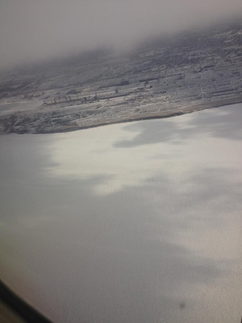
Meanwhile I will be spending a whole week next week in Buffalo NY, experiencing the coldest temps I have experienced in a long time, but it will be neat looking at the frozen Lake Erie.
0 likes   

User avatar
gatorcane
S2K Supporter
S2K Supporter
Posts: 23693
Age: 47
Joined: Sun Mar 13, 2005 3:54 pm
Location: Boca Raton, FL

#9190 Postby gatorcane » Sat Jan 24, 2015 11:45 am

Yeah looks like most of the Eastern half of the country east of the Rockies will be seeing below normal to much below normal temps for the foreseeable future with multiple arctic intrusions coming down from Canada as the long-wave pattern is currently shifting to a persistent east coast trough pattern. But it does appear the core of the arctic air stays well to the north of Florida.

Looking at the wintery mess going on along the eastern seaboard right now, I am certainly glad I am not there. Looking forward to the extended period of below normal temps across South Florida this week starting today. It will be great window opening weather down here!
0 likes   

User avatar
ronjon
Category 5
Category 5
Posts: 4839
Joined: Fri Aug 19, 2005 5:17 pm
Location: Hernando Beach, FL

Re: Florida Weather

#9191 Postby ronjon » Sat Jan 24, 2015 5:32 pm

12z Euro showing major artic outbreak in early FEB over the eastern half of the US. Temps forecast -30 deg C at 850 mb over the Midwest and northeast. Zero deg at 850 mb down into the north-central GOM.
0 likes   

TheStormExpert

Re: Florida Weather

#9192 Postby TheStormExpert » Sat Jan 24, 2015 8:29 pm

ronjon wrote:12z Euro showing major artic outbreak in early FEB over the eastern half of the US. Temps forecast -30 deg C at 850 mb over the Midwest and northeast. Zero deg at 850 mb down into the north-central GOM.

Unless the NAO dips negative odds are it will not reach the Florida peninsula (probably not even Florida at all).
0 likes   

User avatar
gatorcane
S2K Supporter
S2K Supporter
Posts: 23693
Age: 47
Joined: Sun Mar 13, 2005 3:54 pm
Location: Boca Raton, FL

#9193 Postby gatorcane » Sat Jan 24, 2015 9:30 pm

Yeah the Euro and GFS are both showing an extremely cold arctic airmass invading the Eastern 2/3 of the country starting next weekend into the first week of February. In fact both reliable models are in remarkable agreement for being this far out. Will need to watch if this decides to head a bit further south in future model runs into at least Northern or Central Florida:

ECMWF:
Image

GFS:
Image
0 likes   

User avatar
NDG
S2K Supporter
S2K Supporter
Posts: 15469
Joined: Sun Jul 09, 2006 10:14 pm
Location: Orlando, FL

Re: Florida Weather

#9194 Postby NDG » Sun Jan 25, 2015 3:50 am

I have never seen the Euro been so inconsistent on its 144-240 hr forecast. The 12z runs have been brutally cold for the Deep South while the 0z runs have been much warmer for FL.
0 likes   

User avatar
northjaxpro
S2K Supporter
S2K Supporter
Posts: 8900
Joined: Mon Sep 27, 2010 11:21 am
Location: Jacksonville, FL

#9195 Postby northjaxpro » Sun Jan 25, 2015 7:49 am

Good morning. I am in NDG's neck of the woods this morning as I am in Orlando enjoying the weekend at Universal Studios for like it seems the umpteenth time LOL. It never gets old coming here and having a great time.

My goodness it was a cool, windy day and evening here in Orlando yesterday with temps max in the low-mid 60s. Hopefully, the wind will slacken some today while out at the park today.

Well, obviously I am not home and I have not seen the model runs for a couple of days. However, I will say to everyone that the models going out 10 days have been inconsistent at times this winter season. I would just wait for within 5 days for better consistency. Also, I will not bit yet gatorcane and others regarding the arctic airmass impacting the Deep South and FL oeninsula for the first week of February. The core of the coldest air just does not want to dive southward this winter. However, we will see if any changes with the teleconnections(especially the NAO) will occur in the next couple of weeks.
0 likes   
NEVER, EVER SAY NEVER in the tropics and weather in general, and most importantly, with life itself!!

________________________________________________________________________________________

Fay 2008 Beryl 2012 Debby 2012 Colin 2016 Hermine 2016 Julia 2016 Matthew 2016 Irma 2017 Dorian 2019

psyclone
S2K Supporter
S2K Supporter
Posts: 4773
Joined: Wed Aug 24, 2005 9:04 pm
Location: palm harbor fl

#9196 Postby psyclone » Sun Jan 25, 2015 10:47 am

We still have time to be plunged into a deep freeze as early Feb can really deliver the frigid stuff. As usual my inclination is to lean against any extreme events until they enter a much closer range...just too many false alarms and extreme events are, by definition, rare.
0 likes   

HURRICANELONNY
Category 5
Category 5
Posts: 1383
Joined: Wed May 07, 2003 6:48 am
Location: HOLLYWOOD.FL

Re: Florida Weather

#9197 Postby HURRICANELONNY » Sun Jan 25, 2015 3:47 pm

I'm taking a blend of both since there is no real signal for artic surge the far out. I say it stalls right over me next weekend. :roll:


Long range models diverge on their depiction of another cold front
for next weekend. The European model (ecmwf) digs an 500 mb shortwave trough southward
into central and southern Georgia late Friday. This allows a cold
front to push through South Florida into Saturday. The GFS on the
other hand keeps the upper energy well to the north thus stalling
the surface cold front across northern Florida during the same
time frame.
0 likes   
hurricanelonny

User avatar
NDG
S2K Supporter
S2K Supporter
Posts: 15469
Joined: Sun Jul 09, 2006 10:14 pm
Location: Orlando, FL

Re: Florida Weather

#9198 Postby NDG » Mon Jan 26, 2015 8:49 pm

Hello from the frozen tundra in Buffalo NY, brrrrrr!!!!! It has been in the teens since I got here yesterday with snow off and on.
Like I said a few days ago, the Euro has not been its best in its 6-10 day range, not sure why it has been so inconsistent.
0 likes   

psyclone
S2K Supporter
S2K Supporter
Posts: 4773
Joined: Wed Aug 24, 2005 9:04 pm
Location: palm harbor fl

#9199 Postby psyclone » Mon Jan 26, 2015 11:29 pm

:uarrow: Too bad lake Erie is shut down for the season due to ice cover.
0 likes   

User avatar
NDG
S2K Supporter
S2K Supporter
Posts: 15469
Joined: Sun Jul 09, 2006 10:14 pm
Location: Orlando, FL

Re: Florida Weather

#9200 Postby NDG » Tue Jan 27, 2015 4:13 am

:uarrow: Yes, too bad, but even if it wasn't frozen the winds have been of a northerly direction ever since I got here, which actually when i got here Sunday around noon there was some light lake effect snow off of Lake Ontario. It was snowing with the sun out, what an experience.
Below is a pix of Lake Erie as we flew over it before landing, very neat.

Image
0 likes   


Return to “USA & Caribbean Weather”

Who is online

Users browsing this forum: No registered users and 17 guests