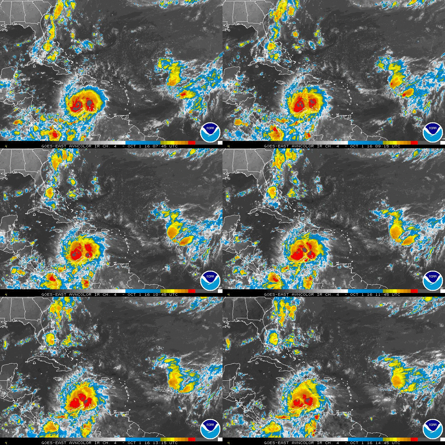
Area of Disturbed Weather in the NW Caribbean

This is the general tropical discussion area. Anyone can take their shot at predicting a storms path.

Moderator: S2k Moderators

Forum rules

The posts in this forum are NOT official forecasts and should not be used as such. They are just the opinion of the poster and may or may not be backed by sound meteorological data. They are NOT endorsed by any professional institution or STORM2K. For official information, please refer to products from the National Hurricane Center and National Weather Service.

Help Support Storm2K
Message
Author
floridasun78
Category 5
Category 5
Posts: 3755
Joined: Sun May 17, 2009 10:16 pm
Location: miami fl

Re: Area of Disturbed Weather in Caribbean

#21 Postby floridasun78 » Sat May 30, 2015 8:47 pm

sunnyday wrote:Thank you, Floridasun78.

you welcome i got more news for you i talk to forecast from Miami weather office their told me not sure we get 10 inch rain this week their waiting for models data coming in to see if we get high amount rain
0 likes   

User avatar
gatorcane
S2K Supporter
S2K Supporter
Posts: 23691
Age: 47
Joined: Sun Mar 13, 2005 3:54 pm
Location: Boca Raton, FL

#22 Postby gatorcane » Sat May 30, 2015 9:16 pm

The 18Z GFS Ensembles (GEFS) are showing a bit stronger of low forming than the 12Z run. Will be interested to see if the 00Z GFS operational trends that way too:

Image
Image
0 likes   

Dean4Storms
S2K Supporter
S2K Supporter
Posts: 6358
Age: 62
Joined: Sun Aug 31, 2003 1:01 pm
Location: Miramar Bch. FL

#23 Postby Dean4Storms » Sat May 30, 2015 9:39 pm

It's still too early to know for sure how developed this system gets. Systems moving in tandem with the direction of the shear can still develop depending on forward surface speed vs the shear. Will be a good one to watch!
0 likes   

User avatar
Hammy
Category 5
Category 5
Posts: 5849
Age: 41
Joined: Fri May 25, 2012 5:25 pm
Contact:

Re: Area of Disturbed Weather in Caribbean

#24 Postby Hammy » Sat May 30, 2015 10:00 pm

Interesting to note that the system has disappeared now from the Euro as we approach the 5-6 day time frame, as it seems to do so often.
0 likes   
The above post is not official and should not be used as such. It is the opinion of the poster and may or may not be backed by sound meteorological data. It is not endorsed by any professional institution or storm2k.org. For official information, please refer to the NHC and NWS products.

floridasun78
Category 5
Category 5
Posts: 3755
Joined: Sun May 17, 2009 10:16 pm
Location: miami fl

Re: Area of Disturbed Weather in Caribbean

#25 Postby floridasun78 » Sat May 30, 2015 11:08 pm

best thing say now wait and see how week go
0 likes   

User avatar
NDG
S2K Supporter
S2K Supporter
Posts: 15446
Joined: Sun Jul 09, 2006 10:14 pm
Location: Orlando, FL

Re: Area of Disturbed Weather in Caribbean

#26 Postby NDG » Sun May 31, 2015 6:21 am

The GFS has been trending drier for at least eastern central FL, keeping the heaviest rains south and east of FL, for the next 7-10 days.
0 likes   

User avatar
ronjon
Category 5
Category 5
Posts: 4822
Joined: Fri Aug 19, 2005 5:17 pm
Location: Hernando Beach, FL

Re: Area of Disturbed Weather in Caribbean

#27 Postby ronjon » Sun May 31, 2015 6:54 am

Yeah NDG, but pattern will reverse with a SW wind developing in the mid-levels which will steer afternoon storms toward the east coast in the pm. Hang in there, east coasters, summer rains are coming.
0 likes   

User avatar
gatorcane
S2K Supporter
S2K Supporter
Posts: 23691
Age: 47
Joined: Sun Mar 13, 2005 3:54 pm
Location: Boca Raton, FL

#28 Postby gatorcane » Sun May 31, 2015 7:41 am

Yeah the models seem to be trending towards keeping the low and associated moisture east of Florida though the ECMWF still keeps a lot of moisture over Florida.

By the way the GEM has suddenly become really bullish with development in the NW Caribbean. It's good to see the GEM on board though we all know it's usually way too bullish. Has hurricane approaching the Carolinas as it turns NW:

Image

Image
0 likes   

User avatar
boca
Category 5
Category 5
Posts: 6367
Age: 60
Joined: Mon Dec 15, 2003 8:49 am
Location: Boca Raton,FL

Re: Area of Disturbed Weather in Caribbean

#29 Postby boca » Sun May 31, 2015 8:29 am

It looks like the rain will miss South Florida and nail the Bahamas. The GFS makes a hard right with the Caribbean system.
0 likes   

CYCLONE MIKE
Category 5
Category 5
Posts: 2183
Joined: Tue Aug 31, 2004 6:04 pm
Location: Gonzales, LA

Re: Area of Disturbed Weather in Caribbean

#30 Postby CYCLONE MIKE » Sun May 31, 2015 8:31 am

Has to be one of the most useless models I have ever seen. Can't believe with technology in this day and age the Canadian still continues to blow up every tstorm cell into a hurricane.

Well guess on the bright side it doesn't hasn't shown new Orleans getting pounded by a cat 5 yet or am I thinking gfs? Doesn't really matter anyway :roll:
0 likes   

User avatar
tropicwatch
Category 5
Category 5
Posts: 3386
Age: 61
Joined: Sat Jun 02, 2007 10:01 am
Location: Panama City Florida
Contact:

#31 Postby tropicwatch » Sun May 31, 2015 9:30 am

Looking at increased moisture in the Bay of Campeche this morning. Looks like it is being pushed eastward by the front coming off of the Texas coast. This could be a player later this week if it can maintain the moisture.

Image
0 likes   
Tropicwatch


Agnes 72', Eloise 75, Elena 85', Kate 85', Charley 86', Florence 88', Beryl 94', Dean 95', Erin 95', Opal 95', Earl 98', Georges 98', Ivan 2004', Arlene 2005', Dennis 2005', Ida 2009' Debby 2012' Irma 2017' Michael 2018'

User avatar
boca
Category 5
Category 5
Posts: 6367
Age: 60
Joined: Mon Dec 15, 2003 8:49 am
Location: Boca Raton,FL

Re: Area of Disturbed Weather in Caribbean

#32 Postby boca » Sun May 31, 2015 9:40 am

It's just a matter of time before NWS Miami drops are rain chances for the middle of next week I'm anticipating that to happen within the next day or so,it's too bad because we are dry as a bone here in SE Florida.
0 likes   

User avatar
WPBWeather
S2K Supporter
S2K Supporter
Posts: 535
Age: 67
Joined: Thu Jul 18, 2013 12:33 pm

Re: Area of Disturbed Weather in Caribbean

#33 Postby WPBWeather » Sun May 31, 2015 11:21 am

Still too soon to say what's going to happen one way or another. Didn't someone-maybe even a Pro Met- say on this blog long ago that one model run is never really the final answer.
0 likes   

User avatar
NDG
S2K Supporter
S2K Supporter
Posts: 15446
Joined: Sun Jul 09, 2006 10:14 pm
Location: Orlando, FL

Re: Area of Disturbed Weather in Caribbean

#34 Postby NDG » Sun May 31, 2015 12:46 pm

12z CMC/GEM continues to entertain us.

Image
Image
Image
0 likes   

User avatar
NDG
S2K Supporter
S2K Supporter
Posts: 15446
Joined: Sun Jul 09, 2006 10:14 pm
Location: Orlando, FL

Re:

#35 Postby NDG » Sun May 31, 2015 12:59 pm

panamatropicwatch wrote:Looking at increased moisture in the Bay of Campeche this morning. Looks like it is being pushed eastward by the front coming off of the Texas coast. This could be a player later this week if it can maintain the moisture.

http://tropicwatch.info/avn-animated.gif


The way I see it is a combination of this shortwave trough pushing eastward along the lower MS River valley and a tropical wave/tropical moisture surge coming across the Caribbean that may trigger the formation of a weak surface low in the NW Caribbean/Bahamas area, perhaps that moisture you pointed out at the BOC may play a roll as well.
0 likes   

floridasun78
Category 5
Category 5
Posts: 3755
Joined: Sun May 17, 2009 10:16 pm
Location: miami fl

#36 Postby floridasun78 » Sun May 31, 2015 1:33 pm

we see how Caribbean look by tue right now their no big storm area in nw Caribbean
0 likes   

floridasun78
Category 5
Category 5
Posts: 3755
Joined: Sun May 17, 2009 10:16 pm
Location: miami fl

#37 Postby floridasun78 » Sun May 31, 2015 1:37 pm

here is lastest from miami weather office THE LOW OVER THE CENTRAL PORTIONS OF THE US IS FORECAST TO BRING
NORTHWARD A SUBSTANTIAL AMOUNT OF MOISTURE FROM THE CARIBBEAN SEA
BY MONDAY-TUESDAY TIME FRAME. HOWEVER, AT THE MOMENT THE FORECAST
IS SOMEWHAT UNCERTAIN AFTER TUESDAY REGARDING THE EXACT LOCATION
OF THIS MOISTURE...WOULD THE MOISTURE STAY EAST OF FLORIDA OR
WOULD IT AFFECT US MORE DIRECTLY? THIS IS IMPORTANT BECAUSE IT HAS
BEEN OBSERVED IN THE PAST THAT A VERY WIDESPREAD INCREASE IN
MOISTURE OVER SOUTH FLORIDA HAS DECREASED THE THUNDERSTORM
ACTIVITY IN FAVOR OF MORE SHOWER ACTIVITY. ALSO, THE ECMWF IS NOW
MORE IN LINE WITH THE GFS SHOWING THE BULK OF THE MOISTURE OVER
THE ATLANTIC WATERS. THE LATEST 12Z MODEL DATA SHOWS AN INCREASE
IN CONFIDENCE WITH THE LOCATION OF THE MOISTURE PLUME FROM THE
CARIBBEAN SEA WITH LESS MEMBERS OF THE NAEFS FORECASTING EXTREME
VALUES.
0 likes   

MiamiensisWx

Re: Area of Disturbed Weather in Caribbean

#38 Postby MiamiensisWx » Sun May 31, 2015 2:43 pm

Regarding the models showing a weak system east of FL: interestingly, since 1950, only two tropical cyclones have formed NE of the Bahamas (within 200 n mi of 28N 74W) in June. Both of those storms--TS Andrew (1986) and a subtropical storm in 1997--both formed when the April-May and May-June Multivariate Niño Index (MEI) was over .300. (Positive MEI values are generally correlated with Niños and negatives with Niñas.) Both storms immediately preceded a moderate to strong Niño (1986-87 and 1997-98). Currently, the MEI for April-May 2015 is likely to end up as the most negative since 1997. Even if the value decreases, the May-June value is likely to be equal to or greater than .300. Even more interestingly, since 1851, Andrew 1986 and the subtropical storm in 1997 are the only systems to actually form within 200 n mi of 28N 74W and obtain TS or greater status. Given that we are likely to see a moderate or strong Niño later this year, the coincidence is a very interesting one. So if history is any guide, 1986 and 1997 might well be good analogs for this season. Indeed, not only did both seasons feature very similar tracks, but also an absence of development in the deep tropics. Storms obtained hurricane status outside the deep tropics, and--interestingly--the sole U.S. hurricane hits occurred on the northern Gulf Coast (Bonnie 1986, Danny 1997) or along the Outer Banks (Charley 1986).

Image
Image
0 likes   

User avatar
Hammy
Category 5
Category 5
Posts: 5849
Age: 41
Joined: Fri May 25, 2012 5:25 pm
Contact:

Re: Area of Disturbed Weather in Caribbean

#39 Postby Hammy » Sun May 31, 2015 3:14 pm

MiamiensisWx wrote:Regarding the models showing a weak system east of FL: interestingly, since 1950, only two tropical cyclones have formed NE of the Bahamas (within 200 n mi of 28N 74W) in June.]


Just pointing out there were three, Arthur in 1996 formed in the same area in June.
Image
0 likes   
The above post is not official and should not be used as such. It is the opinion of the poster and may or may not be backed by sound meteorological data. It is not endorsed by any professional institution or storm2k.org. For official information, please refer to the NHC and NWS products.

Alyono
Professional-Met
Professional-Met
Posts: 6961
Joined: Fri Apr 26, 2013 3:52 pm
Location: Texas Coast

#40 Postby Alyono » Sun May 31, 2015 3:32 pm

Arthur last year also formed in the area, even though it officially become a depression at 0Z July 1
0 likes   


Return to “Talkin' Tropics”

Who is online

Users browsing this forum: BobHarlem, cajungal, eyesontropics and 30 guests