2015 WPAC Season
Moderator: S2k Moderators
Forum rules

The posts in this forum are NOT official forecasts and should not be used as such. They are just the opinion of the poster and may or may not be backed by sound meteorological data. They are NOT endorsed by any professional institution or STORM2K. For official information, please refer to products from the National Hurricane Center and National Weather Service.
-
1900hurricane

- Category 5

- Posts: 6063
- Age: 34
- Joined: Fri Feb 06, 2015 12:04 pm
- Location: Houston, TX
- Contact:
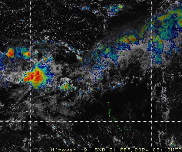
Both the modeled tropical cyclones are developing out of the same monsoon trough currently in the vicinity of the Marshall Islands. The western portion has already been designated 97W and I imagine the eastern portion will be tagged as a second invest in the future.
0 likes
Contract Meteorologist. TAMU & MSST. Fiercely authentic, one of a kind. We are all given free will, so choose a life meant to be lived. We are the Masters of our own Stories.
Opinions expressed are mine alone.
Follow me on Twitter at @1900hurricane : Read blogs at https://1900hurricane.wordpress.com/
Opinions expressed are mine alone.
Follow me on Twitter at @1900hurricane : Read blogs at https://1900hurricane.wordpress.com/
-
euro6208
Re: 2015 WPAC Season
EURO develops Atsani in less than 96 hours and passing over the Northern Marianas, a bit north than the last update, as a strong 934 mb STY and bottoming out at 927 mb southeast of Okinawa...
12Z GFS has Typhoon Atsani in less than 162 hours and peaks it at 889 mb as it recurves!
12Z GFS has Typhoon Atsani in less than 162 hours and peaks it at 889 mb as it recurves!
0 likes
-
cycloneye

- Admin

- Posts: 148721
- Age: 69
- Joined: Thu Oct 10, 2002 10:54 am
- Location: San Juan, Puerto Rico
Re: 2015 WPAC Season
0 likes
Visit the Caribbean-Central America Weather Thread where you can find at first post web cams,radars
and observations from Caribbean basin members Click Here
and observations from Caribbean basin members Click Here

-
euro6208


-
euro6208
Re: 2015 WPAC Season


We've often see el nino with all that warm waters churned up over in the CPAC and EPAC with cool waters over the WPAC but that won't stop TC activity. This basin still is the most active and most devastating. Storms form very near the dateline where the warmest waters are at and travel long distances with many islands in the path especially the Marianas which hits increasing 300% reaching Asia. Many of these become Super Typhoons...
0 likes
-
euro6208
Re: 2015 WPAC Season
What an amazing show the WPAC will deliver...Goni and Atsani coming up Cat 5's...Too bad the western system will hit and affect alot of people...
0 likes
-
1900hurricane
- Category 5
- Posts: 6063
- Age: 34
- Joined: Fri Feb 06, 2015 12:04 pm
- Location: Houston, TX
- Contact:
Goni and Atsani have developed, but there still is some convection flaring up with the monsoon trough back at the Dateline. Models aren't too enthusiastic about anything developing there, but it couldn't hurt to keep an eye on it.
0 likes
Contract Meteorologist. TAMU & MSST. Fiercely authentic, one of a kind. We are all given free will, so choose a life meant to be lived. We are the Masters of our own Stories.
Opinions expressed are mine alone.
Follow me on Twitter at @1900hurricane : Read blogs at https://1900hurricane.wordpress.com/
Opinions expressed are mine alone.
Follow me on Twitter at @1900hurricane : Read blogs at https://1900hurricane.wordpress.com/
-
TheAustinMan

- Category 5
- Posts: 1049
- Joined: Mon Jul 08, 2013 4:26 pm
- Location: Central TX / United States

-
xtyphooncyclonex

- Category 5
- Posts: 3889
- Age: 24
- Joined: Sat Dec 08, 2012 9:07 am
- Location: Cebu City
- Contact:
Re: 2015 WPAC Season
So far, the average longitude of TD formation (JTWC's first advisory) is at 151.3E, which is much farther east than any other year on records since it began in 1951, surpassing 2002's longitude of 145.9E
0 likes
REMINDER: My opinions that I, or any other NON Pro-Met in this forum, are unofficial. Please do not take my opinions as an official forecast and warning. I am NOT a meteorologist. Following my forecasts blindly may lead to false alarm, danger and risk if official forecasts from agencies are ignored.
-
1900hurricane
- Category 5
- Posts: 6063
- Age: 34
- Joined: Fri Feb 06, 2015 12:04 pm
- Location: Houston, TX
- Contact:
According to JTWC's annual tropical cyclone report from 1997, 1972 (another strong El Nino year) was also right about 150*E. This is just based on the graphic on page 33 though; I can't say I've crunched any numbers myself. 1992 and 1997 were also quite far east, but not quite to 150*E.
0 likes
Contract Meteorologist. TAMU & MSST. Fiercely authentic, one of a kind. We are all given free will, so choose a life meant to be lived. We are the Masters of our own Stories.
Opinions expressed are mine alone.
Follow me on Twitter at @1900hurricane : Read blogs at https://1900hurricane.wordpress.com/
Opinions expressed are mine alone.
Follow me on Twitter at @1900hurricane : Read blogs at https://1900hurricane.wordpress.com/
-
1900hurricane
- Category 5
- Posts: 6063
- Age: 34
- Joined: Fri Feb 06, 2015 12:04 pm
- Location: Houston, TX
- Contact:
Numerical guidance is beginning to hint at a storm crossing over from the CPac a week to 10 days out. Still a long way out, but it could be our next thing to watch after the WonderTwins clear out.
0 likes
Contract Meteorologist. TAMU & MSST. Fiercely authentic, one of a kind. We are all given free will, so choose a life meant to be lived. We are the Masters of our own Stories.
Opinions expressed are mine alone.
Follow me on Twitter at @1900hurricane : Read blogs at https://1900hurricane.wordpress.com/
Opinions expressed are mine alone.
Follow me on Twitter at @1900hurricane : Read blogs at https://1900hurricane.wordpress.com/
-
galaxy401

- Category 5
- Posts: 2446
- Age: 30
- Joined: Sat Aug 25, 2012 9:04 pm
- Location: Casa Grande, Arizona
Re: 2015 WPAC Season
euro6208 wrote:Models now hinting on Krovanh after Etau and Vamco...
Are you certain that storm will be Krovanh? What if that one is Etau or Vamco?
0 likes
Got my eyes on moving right into Hurricane Alley: Florida.


Re: 2015 WPAC Season
Still soaking in the Super twins

0 likes
The above post and any post by Ntxw is NOT an official forecast and should not be used as such. It is just the opinion of the poster and may or may not be backed by sound meteorological data. It is NOT endorsed by any professional institution including Storm2k. For official information, please refer to NWS products.
Help support Storm2K!
-
dexterlabio
- Category 5
- Posts: 3499
- Joined: Sat Oct 24, 2009 11:50 pm
Re: 2015 WPAC Season
It's amazing how this basin is still able to spawn 2 major cyclones when the CCKW is situated in the Western Hemisphere, so it means sinking air must somehow be dominating the Western Pacific but no...  It will be much more interesting if these two will make it to Cat 5 as what the models are predicting...
0 likes
Personal Forecast Disclaimer:
The posts in this forum are NOT official forecast and should not be used as such. They are just the opinion of the poster and may or may not be backed by sound meteorological data. They are NOT endorsed by any professional institution or storm2k.org. For official information, please refer to the NHC and NWS products.
The posts in this forum are NOT official forecast and should not be used as such. They are just the opinion of the poster and may or may not be backed by sound meteorological data. They are NOT endorsed by any professional institution or storm2k.org. For official information, please refer to the NHC and NWS products.
-
euro6208
Re: 2015 WPAC Season
dexterlabio wrote:It's amazing how this basin is still able to spawn 2 major cyclones when the CCKW is situated in the Western Hemisphere, so it means sinking air must somehow be dominating the Western Pacific but no...
Ivan Joan Part II...
0 likes
Who is online
Users browsing this forum: No registered users and 70 guests