Texas Summer-2015
Moderator: S2k Moderators
Forum rules
The posts in this forum are NOT official forecast and should not be used as such. They are just the opinion of the poster and may or may not be backed by sound meteorological data. They are NOT endorsed by any professional institution or STORM2K.
- TheProfessor
- Professional-Met

- Posts: 3506
- Age: 29
- Joined: Tue Dec 03, 2013 10:56 am
- Location: Wichita, Kansas
-
weatherdude1108
- Category 5

- Posts: 4228
- Joined: Tue Dec 13, 2011 1:04 pm
- Location: Northwest Austin/Cedar Park, TX
-
aggiecutter
- Category 5

- Posts: 1755
- Joined: Thu Oct 14, 2004 9:22 pm
- Location: Texarkana
- South Texas Storms
- Professional-Met

- Posts: 4256
- Joined: Thu Jun 24, 2010 12:28 am
- Location: Houston, TX
Re:
TheProfessor wrote:I'm going to be applying for an internship to be a part-time weather observer at Port Columbus International Airport in Ohio. Wish me luck!
Good luck!
0 likes
-
weatherdude1108
- Category 5

- Posts: 4228
- Joined: Tue Dec 13, 2011 1:04 pm
- Location: Northwest Austin/Cedar Park, TX
Re: Re:
South Texas Storms wrote:TheProfessor wrote:I'm going to be applying for an internship to be a part-time weather observer at Port Columbus International Airport in Ohio. Wish me luck!
Good luck!
Yeah, good luck!
0 likes
A little update on statistics
As it stands DFW, none is expected the next 5-7 days which takes us to the end of August, has 12 official days of 100+. 2014 had 15 days, is the lowest since 2007's 5.
Admittedly this is much higher than <5 I was expecting due to the El Nino. The other three Super El Nino's had the following count.
1997-2
1982-10
1972-13
So the 12 so far is within similar proximity to 1982 and 1972, However DFW did see some days right at 99 during the stretch so really it could've been closer to 15-20 which makes it more on par to 1957's 20, 1965's 15, and 1987's 19 the other three strong Nino's since 1950.
Annual average of 100+ days in DFW is 18
Most was 2011 at 71
Least was 1906/1973 with 0
_______________
Interestingly 1957 had Hurricane Audrey effect the state mid to late June. After her passage the heat and dry conditions prevailed in July and early August. Similarly in 2015, though not in that magnitude of a system, Bill effected the state mid to late June thus was followed by the same conditions July and early August.
0 likes
The above post and any post by Ntxw is NOT an official forecast and should not be used as such. It is just the opinion of the poster and may or may not be backed by sound meteorological data. It is NOT endorsed by any professional institution including Storm2k. For official information, please refer to NWS products.
Now for model's, Euro seasonal forecast is predicting above normal precipitation Sept-Oct-Nov for our region

It is also showing lower than normal pressures, which equates to bigger and stronger storm systems. A week ago I mentioned the CFSv2 was showing a wetter period in September possibly beginning the last week of August, still on track
Also for horselatitudesfarm relating to SOI post, in the image notice the dry conditions (higher pressures) at Darwin, Australia and Indonesia and wet rising air (lower pressures) across the tropical Pacific. -SOI dominates.
0 likes
The above post and any post by Ntxw is NOT an official forecast and should not be used as such. It is just the opinion of the poster and may or may not be backed by sound meteorological data. It is NOT endorsed by any professional institution including Storm2k. For official information, please refer to NWS products.
Third update, mostly tropical Pacific. The current changes in the weather pattern ongoing I would give credit to Molave the recent recurving Pacific system that is turning up in the Aleutians (reference to Brent's McCauley post).
Notice the cyclone to the north
View from Himawari 8

Down south there is a pair of twin Super-Typhoons-to-be Goni and Atsani. The eastern one Atsani will be a major recurve and alter the north Pacific Jet down the road. A much more active weather period will come early Sept.
Notice the cyclone to the north
View from Himawari 8

Down south there is a pair of twin Super-Typhoons-to-be Goni and Atsani. The eastern one Atsani will be a major recurve and alter the north Pacific Jet down the road. A much more active weather period will come early Sept.
0 likes
The above post and any post by Ntxw is NOT an official forecast and should not be used as such. It is just the opinion of the poster and may or may not be backed by sound meteorological data. It is NOT endorsed by any professional institution including Storm2k. For official information, please refer to NWS products.
-
aggiecutter
- Category 5

- Posts: 1755
- Joined: Thu Oct 14, 2004 9:22 pm
- Location: Texarkana
Re: Texas Summer-2015
Rain on the way:
WednesdayShowers and thunderstorms likely. Partly sunny, with a high near 90. Chance of precipitation is 60%.
Wednesday NightShowers and thunderstorms likely. Mostly cloudy, with a low around 69. Chance of precipitation is 60%.
ThursdayA 40 percent chance of showers and thunderstorms. Partly sunny, with a high near 90.
Thursday NightA 20 percent chance of showers and thunderstorms. Mostly cloudy, with a low around 71.
0 likes
-
Brent
- S2K Supporter

- Posts: 38737
- Age: 37
- Joined: Sun May 16, 2004 10:30 pm
- Location: Tulsa Oklahoma
- Contact:
Re: Texas Summer-2015
From FWD:
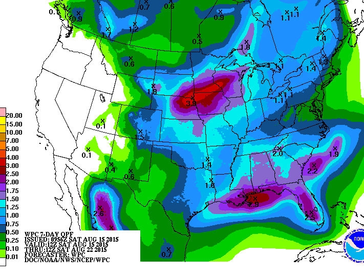
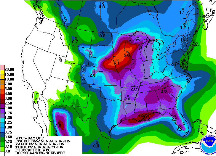
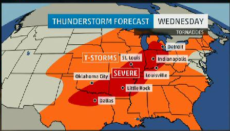
A BIGGER CHANGE IN THE WEATHER PATTERN WILL OCCUR NEXT WEEK AS AN
UPPER LEVEL TROUGH MOVES INTO THE PACIFIC NORTHWEST MONDAY. THIS
SYSTEM WILL SWING SOUTHEAST ACROSS THE CENTRAL ROCKIES TUESDAY
AND ACROSS THE CENTRAL AND SOUTHERN PLAINS WEDNESDAY AND THURSDAY.
THIS WILL DRIVE A WEAK COLD FRONT INTO NORTH TEXAS. THE REGION
WILL HAVE THE BEST CHANCES OF SHOWERS AND THUNDERSTORMS THAT WE
HAVE SEEN IN OVER A MONTH. CURRENTLY...IT LOOKS LIKE RAINFALL
AMOUNTS WILL AVERAGE AROUND 1/3 INCH ACROSS THE WEST TO AROUND AN
INCH ACROSS THE EAST. SINCE MOST LOCATIONS HAVE RECEIVED LITTLE
OF NO RAIN DURING THE LAST MONTH...SO ANY AMOUNT WILL LIKELY BE
APPRECIATED. A FEW STRONG TO POSSIBLY SEVERE STORMS WILL BE
POSSIBLE AHEAD OF THE FRONT.
0 likes
#neversummer
- TheProfessor
- Professional-Met

- Posts: 3506
- Age: 29
- Joined: Tue Dec 03, 2013 10:56 am
- Location: Wichita, Kansas
Re:
TheProfessor wrote:Looks like I'm going to get to see one last Texas thunderstorm before I leave for Ohio next Friday!
I hope you do Professor, I hope we all do. The low 90's we could have here next week are going to feel brutal to you while in Columbus in future summers. Ha!!! Remember where you came from when all the native Ohioans(is that correct?) complain about the heat. While you are up there, send some of the cold and snow guaranteed to see you, down south to us in Texas. Keep tabs on us down here and continue to work on your spelling!!
0 likes
- horselattitudesfarm
- Category 1

- Posts: 315
- Joined: Thu Jul 16, 2009 5:55 pm
- Location: Asheville, NC (formerly from Dallas, TX)
Re: Texas Summer-2015
Ntxw wrote:horselattitudesfarm wrote:Hopefully one of you great weather-minds can help me with a question about the SOI. As I understand it, everytime the SOI peaks and starts to drop there seems to be episodes of flooding or extreme weather of some sort. From the charts I saw on Accuweather, the SOI looks like it is coming up after being in negative territory for a while. When it peaks and starts to drop again, wet weather is expected in Texas and the central part of the country again from what I heard. My question is this:
How is the SOI related to El Nino, La Nina and really....what is the SOI?
This is a very complex question and requires a lot of explaining. The SOI or southern oscillation index is a measure of pressures between Darwin (Australia) and Tahiti (southern Pacific Ocean). It is heavily influenced by El Nino and La Nina especially the long term SOI (30 and 90 day measurements) and is used as one of the indexes by the CPC to declare events. The basic idea is this, when pressures are higher across Australia, convection is brewing across the central and eastern Pacific (raining etc in Tahiti), thus what El Nino loves to do and feeds into the subtropical jet. Days/weeks down the road it streams up to our neck of the woods. El Nino keeps SOI consistently below -8. Some of the biggest SOI negatives are seen during the biggest El Nino's thus some of our biggest rainy periods. A SOI crash, a term often used, means nosedive negative leading about 7-14 days down the road of potential wet period across the US due to the explosion of convection across the tropical Pacific, pineapple express.
Positive SOI is the opposite, lower pressures across Australia and higher in Tahiti. This means rain and tropical convection is over in the Western Pacific and Indonesia which does not link to the subtropical jet, thus dry across the central Pacific. La Nina loves high pressures in the east and squash Pacific rainfall thus we often experience drought as storms have no tropical feed. SOI for La Nina is consistently +8 or higher.
If you are wondering here are the SOI values of late, all consistent with a Major El Nino. Daily SOI fluctuates between positive and negative but over the months and seasons the favored ENSO event will tilt it towards their liking.
Link to daily SOI
Notice how the past month it has all been negative and sometimes very negative, this is consistent with El Nino. 30 day and 90 day values are well below -8. During a La Nina you can pretty much take out the - signs and switch to +. Neutral is within the +8/-8 threshold
So in simple terms
-SOI = lots of Pacific rainfall, lots of storms. the more negative the more storms
+SOI= Dry Pacific, weak subtropical jet and tranquil weather
Thank you for taking the time to explain this to us novices
0 likes
- TheProfessor
- Professional-Met

- Posts: 3506
- Age: 29
- Joined: Tue Dec 03, 2013 10:56 am
- Location: Wichita, Kansas
Re: Re:
gpsnowman wrote:TheProfessor wrote:Looks like I'm going to get to see one last Texas thunderstorm before I leave for Ohio next Friday!
I hope you do Professor, I hope we all do. The low 90's we could have here next week are going to feel brutal to you while in Columbus in future summers. Ha!!! Remember where you came from when all the native Ohioans(is that correct?) complain about the heat. While you are up there, send some of the cold and snow guaranteed to see you, down south to us in Texas. Keep tabs on us down here and continue to work on your spelling!!
Seriously though, enjoy college, do not drink too little and good luck with your education.
lol thanks, I'll be in Texas during the Summer and December unless I'm working on a project. I'll try to bring the snow with me lol.
0 likes
An alumnus of The Ohio State University.
Your local National Weather Service office is your best source for weather information.
Your local National Weather Service office is your best source for weather information.
0 likes
The above post and any post by Ntxw is NOT an official forecast and should not be used as such. It is just the opinion of the poster and may or may not be backed by sound meteorological data. It is NOT endorsed by any professional institution including Storm2k. For official information, please refer to NWS products.
-
aggiecutter
- Category 5

- Posts: 1755
- Joined: Thu Oct 14, 2004 9:22 pm
- Location: Texarkana
-
aggiecutter
- Category 5

- Posts: 1755
- Joined: Thu Oct 14, 2004 9:22 pm
- Location: Texarkana
Euro was showing rain and highs in the low to mid 80s by mid to late week. Talk about an unusual trof 
0 likes
The above post and any post by Ntxw is NOT an official forecast and should not be used as such. It is just the opinion of the poster and may or may not be backed by sound meteorological data. It is NOT endorsed by any professional institution including Storm2k. For official information, please refer to NWS products.
Return to “USA & Caribbean Weather”
Who is online
Users browsing this forum: Stratton23 and 80 guests


