ATL: ERIKA - Remnants - Discussion
Moderator: S2k Moderators
-
Evil Jeremy

- S2K Supporter

- Posts: 5463
- Age: 32
- Joined: Mon Apr 10, 2006 2:10 pm
- Location: Los Angeles, CA
Re: ATL: INVEST 98L - Discussion
I hope the Antilles enjoy their day off between TS watches/warnings.
0 likes
Frances 04 / Jeanne 04 / Katrina 05 / Wilma 05 / Fay 08 / Debby 12 / Andrea 13 / Colin 16 / Hermine 16 / Matthew 16 / Irma 17
-
wxman57

- Moderator-Pro Met

- Posts: 23172
- Age: 68
- Joined: Sat Jun 21, 2003 8:06 pm
- Location: Houston, TX (southwest)
Re: ATL: INVEST 98L - Discussion
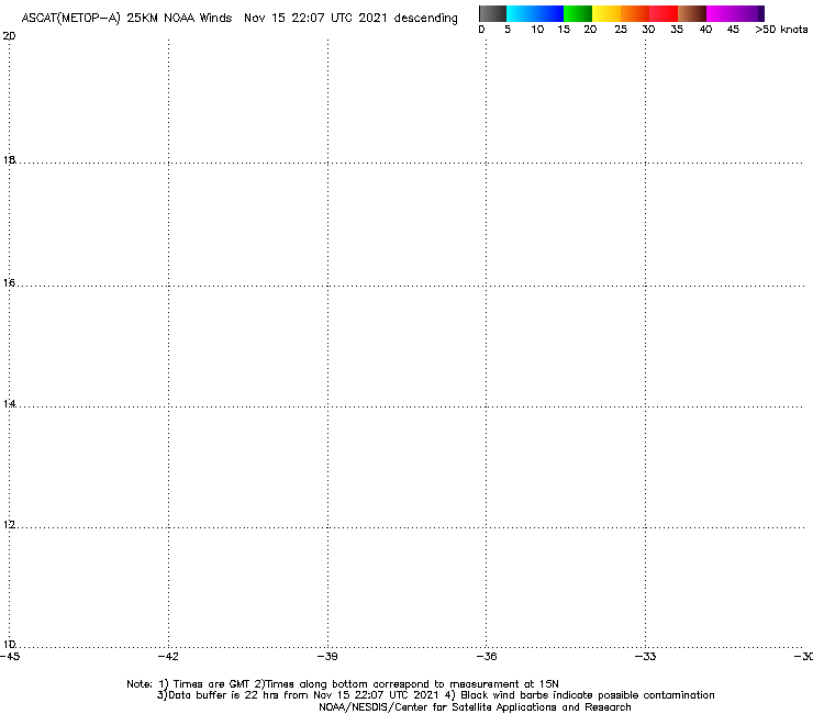
ASCAT indicates it's already a tropical storm. Very good circulation and plenty of 35kt winds. It's a lot more of a TS than Danny was yesterday. Plenty of hostile conditions in its path, however. I think it will fluctuate up and down in intensity/organization over the coming days. Shear will be an issue for the next 5-7 days. Can't rule out a track into the eastern Gulf, but the GFS indicates 40-50 kts of SW shear across much of the Gulf next week. It won't have an easy life...
0 likes
-
Gustywind

- Category 5

- Posts: 12334
- Joined: Mon Sep 03, 2007 7:29 am
- Location: Baie-Mahault, GUADELOUPE
Re: ATL: INVEST 98L - Discussion
Evil Jeremy wrote:I hope the Antilles enjoy their day off between TS watches/warnings.
? Why do you say day?
0 likes
Re: ATL: INVEST 98L - Discussion
Obviously starting to curl up. I guess the question is how much and where?
0 likes

-
floridasun78
- Category 5
- Posts: 3755
- Joined: Sun May 17, 2009 10:16 pm
- Location: miami fl
Re: ATL: INVEST 98L - Discussion
Gustywind when do you see watch post again for islands ? i bet people their dont want hear about other system coming
0 likes
-
Syx6sic
- Tropical Depression

- Posts: 84
- Age: 41
- Joined: Wed Jun 05, 2013 12:11 pm
- Location: Virginia beach VA
Re: ATL: INVEST 98L - Discussion
Conditions at 41041 as of
(1:50 pm EDT)
1750 GMT on 08/24/2015:
Unit of Measure: Time Zone:
Click on the graph icon in the table below to see a time series plot of the last five days of that observation.
5-day plot - Wind Direction Wind Direction (WDIR): N ( 360 deg true )
5-day plot - Wind Speed Wind Speed (WSPD): 9.0 m/s
5-day plot - Wind Gust Wind Gust (GST): 11.0 m/s
5-day plot - Wave Height Wave Height (WVHT): 2.5 m
5-day plot - Dominant Wave Period Dominant Wave Period (DPD): 7 sec
5-day plot - Average Period Average Period (APD): 6.3 sec
5-day plot - Mean Wave Direction Mean Wave Direction (MWD): NE ( 47 deg true )
5-day plot - Atmospheric Pressure Atmospheric Pressure (PRES): 1005.3 mb
5-day plot - Air Temperature Air Temperature (ATMP): 27.0 °C
5-day plot - Water Temperature Water Temperature (WTMP): 27.6 °C
5-day plot - Dew Point Dew Point (DEWP): 25.0 °C
5-day plot - Heat Index Heat Index (HEAT): 30.6 °C
5-day plot - Wind Speed at 10 Meters Wind Speed at 10 meters (WSPD10M): 10 m/s
5-day plot - Wind Speed at 10 Meters Wind Speed at 20 meters (WSPD20M): 10 m/s
5-day plot - Wind Speed, Wind Gust and Atmospheric Pressure Combined plot of Wind Speed, Gust, and Air Pressure
0 likes
Personal Forecast Disclaimer:
The posts in this forum are NOT official forecast and should not be used as such. They are just the opinion of the poster and may or may not be backed by sound meteorological data. They are NOT endorsed by any professional institution or storm2k.org. For official information, please refer to the NHC and NWS products.
The posts in this forum are NOT official forecast and should not be used as such. They are just the opinion of the poster and may or may not be backed by sound meteorological data. They are NOT endorsed by any professional institution or storm2k.org. For official information, please refer to the NHC and NWS products.

Re: ATL: INVEST 98L - Discussion
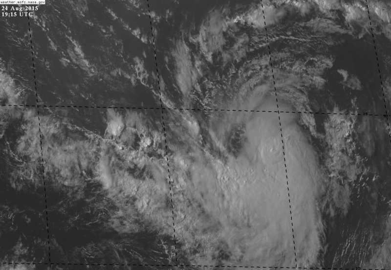
Has a low level circulation with some convection despite the dry conditions and somewhat swift track.
Its rare that a system at 14.5N that far east goes into the Caribbean.
Guess they are just expecting a small depression without much development.
Its rare that a system at 14.5N that far east goes into the Caribbean.
Guess they are just expecting a small depression without much development.
0 likes

Re: ATL: INVEST 98L - Discussion
Nimbus wrote:Has a low level circulation with some convection despite the dry conditions and somewhat swift track.
Its rare that a system at 14.5N that far east goes into the Caribbean.
Guess they are just expecting a small depression without much development.
Yep, I agree. I think we're looking at a depression at this point. Granted, there is no actual ship/buoy data to support my assertion, but i'd pretty much bet that 98L now has a weak circulation that is fully on the surface and co-located convection would imply to me that it is already a depression. I'm guessing that NHC could upgrade at 5:00pm, unless choosing to see if convection is persistent and wait for improved banding. Either way, i'd guess the trigger will be pulled sometime today/tonight.
0 likes
Andy D
(For official information, please refer to the NHC and NWS products.)
(For official information, please refer to the NHC and NWS products.)
-
Syx6sic
- Tropical Depression
- Posts: 84
- Age: 41
- Joined: Wed Jun 05, 2013 12:11 pm
- Location: Virginia beach VA
Re: ATL: INVEST 98L - Discussion
chaser1 wrote:Nimbus wrote:Has a low level circulation with some convection despite the dry conditions and somewhat swift track.
Its rare that a system at 14.5N that far east goes into the Caribbean.
Guess they are just expecting a small depression without much development.
Yep, I agree. I think we're looking at a depression at this point. Granted, there is no actual ship/buoy data to support my assertion, but i'd pretty much bet that 98L now has a weak circulation that is fully on the surface and co-located convection would imply to me that it is already a depression. I'm guessing that NHC could upgrade at 5:00pm, unless choosing to see if convection is persistent and wait for improved banding. Either way, i'd guess the trigger will be pulled sometime today/tonight.
http://www.ndbc.noaa.gov/station_page.p ... t=E&tz=EST
That's the closest buoy I think to it and pressure is dropping now down to 1005mb
0 likes
Personal Forecast Disclaimer:
The posts in this forum are NOT official forecast and should not be used as such. They are just the opinion of the poster and may or may not be backed by sound meteorological data. They are NOT endorsed by any professional institution or storm2k.org. For official information, please refer to the NHC and NWS products.
The posts in this forum are NOT official forecast and should not be used as such. They are just the opinion of the poster and may or may not be backed by sound meteorological data. They are NOT endorsed by any professional institution or storm2k.org. For official information, please refer to the NHC and NWS products.
-
Gustywind
- Category 5
- Posts: 12334
- Joined: Mon Sep 03, 2007 7:29 am
- Location: Baie-Mahault, GUADELOUPE
Re: ATL: INVEST 98L - Discussion
floridasun78 wrote:Gustywind when do you see watch post again for islands ? i bet people their dont want hear about other system coming
Waouw, man that's the 10000$ question???
I think that Guadeloupe want to have at least a small rest because of all the alerts who were exhausting for most of the citizens. Most of them tkink that "we wait Danny for nothing" but hopefully no damages have been reported that's the good news.
So i don't tkink that we want to speak about tropical system coming in our way

While Our Pro Mets (this morning) said that we monitor a perturbed area showings signs of organization but we're more focused on TS Danny. IMO they don't said much about it to prevent any panic
Whereas, the paradox is that we hope for decent amounts of water but without too much impacts in terms of winds and sea.
The other problematic is that school open Monday after 2 months of holidays. Dealing with another system is surely not the best way to begin September. We will see, but 98L seems to have a dangerous approach near the Leewards if it continues its race on a Westerly course.
0 likes
-
NCSTORMMAN
The one thing that 98L soon to be Erika has going for it is there is not as much dry air ahead of it as Danny had and that is thanks to Danny. The air is filled with more moisture. Erika will still have to make it past the magical shear that is in place though. Almost all intensity models show it reaching hurricane strength. We shall see.
0 likes
-
wxman57
- Moderator-Pro Met
- Posts: 23172
- Age: 68
- Joined: Sat Jun 21, 2003 8:06 pm
- Location: Houston, TX (southwest)
Re: ATL: INVEST 98L - Discussion
floridasun78 wrote:Gustywind when do you see watch post again for islands ? i bet people their dont want hear about other system coming
Since models are moving it into the NE Caribbean Wednesday evening, watches would go out tomorrow evening (48 hours prior).
0 likes
-
Gustywind
- Category 5
- Posts: 12334
- Joined: Mon Sep 03, 2007 7:29 am
- Location: Baie-Mahault, GUADELOUPE
Re: ATL: INVEST 98L - Discussion
wxman57 wrote:floridasun78 wrote:Gustywind when do you see watch post again for islands ? i bet people their dont want hear about other system coming
Since models are moving it into the NE Caribbean Wednesday evening, watches would go out tomorrow evening (48 hours prior).
Thanks for this info wxman57. So you think that Guadeloupe must keep an eye on this?
0 likes
-
ScottNAtlanta

- Category 5
- Posts: 2535
- Joined: Sat May 25, 2013 3:11 pm
- Location: Atlanta, GA
Re: ATL: INVEST 98L - Discussion
buoy 41041 had a pressure of 1004.7 and still falling 1 min wind speed of 21kts at 2:50p EST
0 likes
The posts in this forum are NOT official forecast and should not be used as such. They are just the opinion of the poster and may or may not be backed by sound meteorological data. They are NOT endorsed by any professional institution or storm2k.org. For official information, please refer to the NHC and NWS products.
-
floridasun78
- Category 5
- Posts: 3755
- Joined: Sun May 17, 2009 10:16 pm
- Location: miami fl
Re: ATL: INVEST 98L - Discussion
wxman57 wrote:floridasun78 wrote:Gustywind when do you see watch post again for islands ? i bet people their dont want hear about other system coming
Since models are moving it into the NE Caribbean Wednesday evening, watches would go out tomorrow evening (48 hours prior).
ok ty
0 likes

-
NCSTORMMAN
Re: ATL: INVEST 98L - Discussion
NDG wrote:I would be surprised if it is not upgraded to TD by 5 PM.
Hearing it will probably be upgraded to Erika. A couple of pro mets here in Carolina are saying so.
0 likes
Who is online
Users browsing this forum: No registered users and 96 guests