NCSTORMMAN wrote:NDG wrote:I would be surprised if it is not upgraded to TD by 5 PM.
Hearing it will probably be upgraded to Erika. A couple of pro mets here in Carolina are saying so.
ok ty for that info
Moderator: S2k Moderators

NCSTORMMAN wrote:NDG wrote:I would be surprised if it is not upgraded to TD by 5 PM.
Hearing it will probably be upgraded to Erika. A couple of pro mets here in Carolina are saying so.
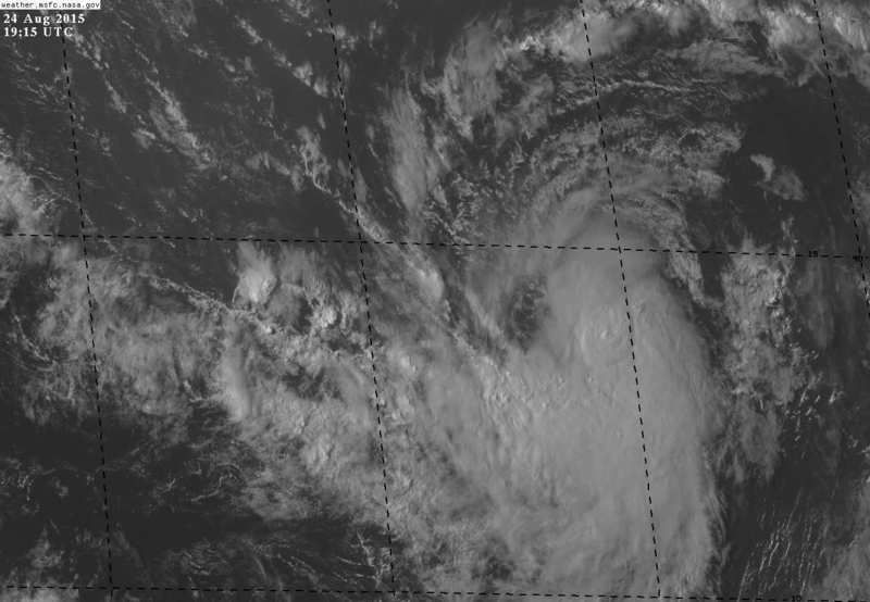
Alyono wrote:if the circ has closed off since the ASCAT, it will be a TS
Not too worried about it blowing up too strong in the short term. However, I am worried as it could move into the Gulf


loopHammy wrote:Alyono wrote:if the circ has closed off since the ASCAT, it will be a TS
Not too worried about it blowing up too strong in the short term. However, I am worried as it could move into the Gulf
I know someone who recently moved to coastal Mississippi ask me about this after the latest track shifts in the models. Is it too early at this point to rule out a hurricane?
Hammy wrote:Alyono wrote:if the circ has closed off since the ASCAT, it will be a TS
Not too worried about it blowing up too strong in the short term. However, I am worried as it could move into the Gulf
I know someone who recently moved to coastal Mississippi ask me about this after the latest track shifts in the models. Is it too early at this point to rule out a hurricane?

Alyono wrote:if the circ has closed off since the ASCAT, it will be a TS
Not too worried about it blowing up too strong in the short term. However, I am worried as it could move into the Gulf

Blown Away wrote:My prediction, 98L will be upgraded to TD or TS by 11pm and the 5 day cone will show a hurricane nearing the SE Bahamas!!! SFL news channel chaos will commence...
HURRICANELONNY wrote:Blown Away wrote:My prediction, 98L will be upgraded to TD or TS by 11pm and the 5 day cone will show a hurricane nearing the SE Bahamas!!! SFL news channel chaos will commence...
I wouldn't fret too much till the reliable models like euro and gfs say hurricane. I really don't see that type of enviroment in the carribean. Good to be ready and stocked for any reason though.


Blown Away wrote:My prediction, 98L will be upgraded to TD or TS by 11pm and the 5 day cone will show a hurricane nearing the SE Bahamas!!! SFL news channel chaos will commence...
gatorcane wrote:Blown Away wrote:My prediction, 98L will be upgraded to TD or TS by 11pm and the 5 day cone will show a hurricane nearing the SE Bahamas!!! SFL news channel chaos will commence...
Yeah things are going to start getting crazy here. The time of year, the track, and the synoptic setup is potential classic hit from the east. Still a long way out but seems like this could really be a legitimate threat for South Florida / Bahamas.


Gustywind wrote:wxman57 wrote:floridasun78 wrote:Gustywind when do you see watch post again for islands ? i bet people their dont want hear about other system coming
Since models are moving it into the NE Caribbean Wednesday evening, watches would go out tomorrow evening (48 hours prior).
Thanks for this info wxman57. So you think that Guadeloupe must keep an eye on this?
gatorcane wrote:Blown Away wrote:My prediction, 98L will be upgraded to TD or TS by 11pm and the 5 day cone will show a hurricane nearing the SE Bahamas!!! SFL news channel chaos will commence...
Yeah things are going to start getting crazy here when NHC shows this cone pointing at the SE Bahamas.
gatorcane wrote:Blown Away wrote:My prediction, 98L will be upgraded to TD or TS by 11pm and the 5 day cone will show a hurricane nearing the SE Bahamas!!! SFL news channel chaos will commence...
Yeah things are going to start getting crazy here when NHC shows this cone pointing at the SE Bahamas.

floridasun78 wrote:look nhc waiting longer to upgrade it because how thing wamt with danny east of island i still see shear a bit dry area
Users browsing this forum: No registered users and 92 guests


