
NWS Tampa Bay AFD:
THE NAM IS THE MOST AGGRESSIVE WITH A LOW DEVELOPMENT ALONG THE
REMNANT FRONTAL TROUGH OVER THE CENTRAL GULF OF MEXICO...AND APPEARS
TO BE AN OUTLIER AT THE MOMENT COMPARED TO THE WEAKER LOOKING
GFS/UKMET...AND EVEN WEAKER LOOKING 00Z ECMWF SOLUTION (WHICH SHOW
NO LOW DEVELOPMENT AT ALL) WHILE THE CANADIAN IS SIMILAR TO THE NAM.
GIVEN THE VARIOUS MODEL SOLUTIONS CONFIDENCE IN ANY ONE IS RATHER
LOW AT THE MOMENT WITH REGARDS TO THE PLACEMENT AND INTENSITY OF THE
LOW...SO FOR NOW WILL FAVOR A BLEND OF THE WEAKER GFS/UKMET WHICH
SEEMS TO BE A COMPROMISE BETWEEN THE STRONGER NAM/CANADIAN AND THE
MUCH WEAKER ECMWF SOLUTIONS.
REGARDLESS OF THE MODEL DIFFERENCES AT THIS TIME ABUNDANT TROPICAL
MOISTURE POOLING ALONG THE FRONTAL TROUGH ALONG WITH ENHANCED LOW
LEVEL CONVERGENCE AND A DIVERGENT FLOW ALOFT WILL ENHANCE THE RAIN
MAKING PROCESS OVER THE ENTIRE FORECAST AREA WITH NUMEROUS SHOWERS
AND SCATTERED STORMS EXPECTED DAILY...ALONG WITH THE POTENTIAL FOR
SOME LOCALLY HEAVY RAINFALL WHICH MAY CAUSE SOME FLOODING OF LOW
LYING AND POOR DRAINAGE AREAS...ESPECIALLY IN AREAS WHERE THE
TRAINING OF SHOWERS AND STORMS OCCUR.
Grace remnants (Is Invest 96L)
Moderator: S2k Moderators
Forum rules

The posts in this forum are NOT official forecasts and should not be used as such. They are just the opinion of the poster and may or may not be backed by sound meteorological data. They are NOT endorsed by any professional institution or STORM2K. For official information, please refer to products from the National Hurricane Center and National Weather Service.
Re: Grace remnants
0 likes
Re: Grace remnants
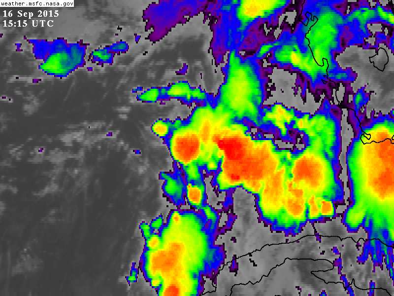
Interesting view on SAT this am. Looks like a piece of energy/moisture has broken off of 94L and will merge with the tropical wave (ex Grace) moving west across FL today in the eastern GOM.
http://www.ssd.noaa.gov/goes/east/gmex/flash-avn.html
http://www.ssd.noaa.gov/goes/east/gmex/flash-avn.html
0 likes
-
northjaxpro

- S2K Supporter

- Posts: 8900
- Joined: Mon Sep 27, 2010 11:21 am
- Location: Jacksonville, FL
0 likes
NEVER, EVER SAY NEVER in the tropics and weather in general, and most importantly, with life itself!!
________________________________________________________________________________________
Fay 2008 Beryl 2012 Debby 2012 Colin 2016 Hermine 2016 Julia 2016 Matthew 2016 Irma 2017 Dorian 2019
________________________________________________________________________________________
Fay 2008 Beryl 2012 Debby 2012 Colin 2016 Hermine 2016 Julia 2016 Matthew 2016 Irma 2017 Dorian 2019

Re: Grace remnants
Still looks like way too much shear for Grace's remnants to organize much if at all, the same shear from a short wave UL trough that will light it up will keep it from organizing into a tropical system with the UL trough staying put in the eastern GOM.
Biggest threat that I see from it is more heavy rains for parts of FL, especially the west coast of FL needs to keep an eye on it where the ground is still saturated.
Biggest threat that I see from it is more heavy rains for parts of FL, especially the west coast of FL needs to keep an eye on it where the ground is still saturated.
0 likes
Re: Grace remnants
18z NAM develops low pressure in SE GOM in 36 hours. Brings it to 1005 mb drifting it NW in central GOM. This is what we need to watch now over the next few days.
0 likes
-
Hurricaneman

- Category 5

- Posts: 7404
- Age: 45
- Joined: Tue Aug 31, 2004 3:24 pm
- Location: central florida
Looks like something might be trying to get going at 25N 85W but shear is still 30kts which if anything does get going it will in the short term slow to occur
The posts in this forum are NOT official forecast and should not be used as such. They are just the opinion of the poster and may or may not be backed by sound meteorological data. They are NOT endorsed by any professional institution or storm2k.org. For official information, please refer to the NHC and NWS products
The posts in this forum are NOT official forecast and should not be used as such. They are just the opinion of the poster and may or may not be backed by sound meteorological data. They are NOT endorsed by any professional institution or storm2k.org. For official information, please refer to the NHC and NWS products
0 likes
Re: Grace remnants
Lots of model consensus for at least weak low pressure development in the southern GOM in two days. CMC, NAVGEM, NAM, ECM, and GFS all show varying degrees of development.
0 likes

Re: Grace remnants
Time for an Invest if the 00z models continue to show some development.
Radar showing disorganized showers.
http://radar.weather.gov/ridge/radar.ph ... 1&loop=yes
Radar showing disorganized showers.
http://radar.weather.gov/ridge/radar.ph ... 1&loop=yes
0 likes
The following post is NOT an official forecast and should not be used as such. It is just the opinion of the poster and may or may not be backed by sound meteorological data. It is NOT endorsed by any professional institution including storm2k.org For Official Information please refer to the NHC and NWS products.
Re: Grace remnants
I'm still sticking with only a 10% chance for Grace's remnants to regenerate into a TC either off of the SE coast or in the Gulf. The more reliable models still don't do much more than form a very weak low, which they were already doing more or less a couple of days ago. Shear looks pretty relentless for the most part. Regardless, I'm still keeping a 10% chance in my mind. The better chance is that it will, without becoming an actual TC but in combo with upper level energy. lead to very heavy rainfall totals over the next few days over parts of FL and possibly over parts of SE GA and SE SC. The 12Z Euro has a whopping 6" in the SAV area between now and Sun AM. The odds heavily favor this is way overdone although a couple of inches wouldn't be out of the realm of reasonable possibilities.
This will be an interesting mess to follow over the next few days for the SE CONUS.
Edit: The 0Z Wed Nutty Uncle gets whacky. It takes a piece of this mess to just off of the SE coast on Thu 9/17 and then suddenly strengthens it Fri-Sat 9/18-9 into a 992 mb TC as it heads slowly eastward out to sea after a near stall on 9/18. What a whacky model! This is the same model that twice threatened the CONUS east coast with hurricanes from Grace's remnants for ~9/18-20!
The CMC, NAM, and NAVGEM are all in the quite unreliable category imo (translation: almost always wrong when on their own) as regards TC's.
Edit 2: There's more from the 0Z Nutty Uncle. It stalls that TC again and has it move NNW and almost hits the coast of NC 9/23-4 before heading back out!
Until either the GFS or Euro do something more substantial than they've been showing, I'm going to keep chances low for a TC. But the mess may very well hang around for a good while. regardless.
0 likes
Personal Forecast Disclaimer:
The posts in this forum are NOT official forecasts and should not be used as such. They are just the opinion of the poster and may or may not be backed by sound meteorological data. They are NOT endorsed by any professional institution or storm2k.org. For official information, please refer to the NHC and NWS products.
The posts in this forum are NOT official forecasts and should not be used as such. They are just the opinion of the poster and may or may not be backed by sound meteorological data. They are NOT endorsed by any professional institution or storm2k.org. For official information, please refer to the NHC and NWS products.
Re: Grace remnants
Ah, the Canadian, pound for pound the most entertaining model out there. Fujiwara effect off the southeast coast.

0 likes
-
OuterBanker
- S2K Supporter
- Posts: 1761
- Joined: Wed Feb 26, 2003 10:53 am
- Location: Nags Head, NC
- Contact:
Re: Grace remnants
xironman wrote:Ah, the Canadian, pound for pound the most entertaining model out there. Fujiwara effect off the southeast coast.
http://i.imgur.com/5zAkELZ.png
You failed to say just how entertaining the CMC truly was. Wow, forms of Fl/Ga meanders for quite a while finally brushing the OBX and mid atlantic then heads se kicking the approaching monster out of the way (Fujiwara).
It's so good to see the Canadian of old.
No doubt would be a national number one best seller fiction.
0 likes
Re: Grace remnants
Way too much shear across the GOM and off of SE Coast, shortwave after shortwave is forecasted to keep shear in the area, UL environment is definitely in an El Niño mode since late July with no end in sight 
http://www.tropicaltidbits.com/analysis ... 11&ypos=34
http://www.tropicaltidbits.com/analysis ... 11&ypos=34
0 likes
Re: Grace remnants
yeah NDG..probably will hold these remnants in check. Looks like broad low pressure developing west of Cuba now.
http://www.aviationweather.gov/adds/satellite/displaySat.php?region=TPA&isingle=multiple&itype=vis
http://www.aviationweather.gov/adds/satellite/displaySat.php?region=TPA&isingle=multiple&itype=vis
0 likes
Re: Grace remnants
ronjon wrote:yeah NDG..probably will hold these remnants in check. Looks like broad low pressure developing west of Cuba now.
http://www.aviationweather.gov/adds/satellite/displaySat.php?region=TPA&isingle=multiple&itype=vis
None of this is a surprise as even the less unreliable model consensus has been suggesting since late last week that a very weak sfc low would form in the E GOM from Grace's remnants about now. The area now off of the SE coast that JB is now calling a potential mischief maker seems to be largely separate from this. The entire setup near the SE US is much more complicated than normal. Regardless, strong shear is dominating most of the area near the SE US and will make TC formation difficult.
0 likes
Personal Forecast Disclaimer:
The posts in this forum are NOT official forecasts and should not be used as such. They are just the opinion of the poster and may or may not be backed by sound meteorological data. They are NOT endorsed by any professional institution or storm2k.org. For official information, please refer to the NHC and NWS products.
The posts in this forum are NOT official forecasts and should not be used as such. They are just the opinion of the poster and may or may not be backed by sound meteorological data. They are NOT endorsed by any professional institution or storm2k.org. For official information, please refer to the NHC and NWS products.
Re: Grace remnants
0 likes
Re: Grace remnants
NDG wrote::uarrow: I don know why JB is being so bullish just going by SST's anomaly, he compares current anomaly to '97's anomaly but we all know that SSTs is not everything for tropical development. Windshear is ripping through most of the basin.
I'd say because he is largely influenced by a bullish bias these days anywhere near the CONUS, which would be consistent with his seasonal forecast. Also, let's face reality. It helps him get more traffic to WxBell to talk about potential "mischief" near the CONUS regardless of his seasonal forecast. Note that he doesn't seem to outrightly be forecasting it to become a TC though he did say it will "develop", whatever that exactly means. I think that it becoming a TC is iffy at best due to strong shear. If anything, wouldn't highly sheared/assymmetrical subtropical development have more of a chance than purely tropical? Any other opinions about this?
0 likes
Personal Forecast Disclaimer:
The posts in this forum are NOT official forecasts and should not be used as such. They are just the opinion of the poster and may or may not be backed by sound meteorological data. They are NOT endorsed by any professional institution or storm2k.org. For official information, please refer to the NHC and NWS products.
The posts in this forum are NOT official forecasts and should not be used as such. They are just the opinion of the poster and may or may not be backed by sound meteorological data. They are NOT endorsed by any professional institution or storm2k.org. For official information, please refer to the NHC and NWS products.
-
tropicwatch

- Category 5
- Posts: 3426
- Age: 62
- Joined: Sat Jun 02, 2007 10:01 am
- Location: Panama City Florida
- Contact:
Looks like the southern gulf will be the spot for the build up of convection possibly.

0 likes
Tropicwatch
Agnes 72', Eloise 75, Elena 85', Kate 85', Charley 86', Florence 88', Beryl 94', Dean 95', Erin 95', Opal 95', Earl 98', Georges 98', Ivan 2004', Arlene 2005', Dennis 2005', Ida 2009' Debby 2012' Irma 2017' Michael 2018'
Agnes 72', Eloise 75, Elena 85', Kate 85', Charley 86', Florence 88', Beryl 94', Dean 95', Erin 95', Opal 95', Earl 98', Georges 98', Ivan 2004', Arlene 2005', Dennis 2005', Ida 2009' Debby 2012' Irma 2017' Michael 2018'
Re: Grace remnants
LarryWx wrote:NDG wrote::uarrow: I don know why JB is being so bullish just going by SST's anomaly, he compares current anomaly to '97's anomaly but we all know that SSTs is not everything for tropical development. Windshear is ripping through most of the basin.
I'd say because he is largely influenced by a bullish bias these days anywhere near the CONUS, which would be consistent with his seasonal forecast. Also, let's face reality. It helps him get more traffic to WxBell to talk about potential "mischief" near the CONUS regardless of his seasonal forecast. Note that he doesn't seem to outrightly be forecasting it to become a TC though he did say it will "develop", whatever that exactly means. I think that it becoming a TC is iffy at best due to strong shear. If anything, wouldn't highly sheared/assymmetrical subtropical development have more of a chance than purely tropical? Any other opinions about this?
Yes I agree if any development it will be of a subtropical nature if not extratropical with an upper level trough becoming dominant over it or near it.
0 likes
-
wxman57

- Moderator-Pro Met

- Posts: 23172
- Age: 68
- Joined: Sat Jun 21, 2003 8:06 pm
- Location: Houston, TX (southwest)
Re: Grace remnants
Wind shear will be quite high across the eastern Gulf and off the East U.S. Coast, and it only increases with time.
0 likes
Re: Grace remnants
0 likes
Who is online
Users browsing this forum: gib and 111 guests