Grace remnants (Is Invest 96L)
Moderator: S2k Moderators
Forum rules
The posts in this forum are NOT official forecasts and should not be used as such. They are just the opinion of the poster and may or may not be backed by sound meteorological data. They are NOT endorsed by any professional institution or STORM2K. For official information, please refer to products from the National Hurricane Center and National Weather Service.
Re: Grace remnants
Actually the shear map i saw showed it dropping off in 48 hours. Can someone post a link?
0 likes
-
floridasun78
- Category 5

- Posts: 3755
- Joined: Sun May 17, 2009 10:16 pm
- Location: miami fl
Re: Grace remnants
caneman wrote:Actually the shear map i saw showed it dropping off in 48 hours. Can someone post a link?
0 likes
- tropicwatch
- Category 5

- Posts: 3426
- Age: 62
- Joined: Sat Jun 02, 2007 10:01 am
- Location: Panama City Florida
- Contact:
Vorticity and convection are increasing in the southern gulf just north west of the western tip of Cuba.
0 likes
Tropicwatch
Agnes 72', Eloise 75, Elena 85', Kate 85', Charley 86', Florence 88', Beryl 94', Dean 95', Erin 95', Opal 95', Earl 98', Georges 98', Ivan 2004', Arlene 2005', Dennis 2005', Ida 2009' Debby 2012' Irma 2017' Michael 2018'
Agnes 72', Eloise 75, Elena 85', Kate 85', Charley 86', Florence 88', Beryl 94', Dean 95', Erin 95', Opal 95', Earl 98', Georges 98', Ivan 2004', Arlene 2005', Dennis 2005', Ida 2009' Debby 2012' Irma 2017' Michael 2018'
Re:
panamatropicwatch wrote:Vorticity and convection are increasing in the southern gulf just north west of the western tip of Cuba.
Yes it is and it should be watched but this was largely predicted by even the more reliable models unless I'm missing something. So, as of now, I'm not anticipating TC genesis anytime too soon. Any other opinions?
0 likes
Personal Forecast Disclaimer:
The posts in this forum are NOT official forecasts and should not be used as such. They are just the opinion of the poster and may or may not be backed by sound meteorological data. They are NOT endorsed by any professional institution or storm2k.org. For official information, please refer to the NHC and NWS products.
The posts in this forum are NOT official forecasts and should not be used as such. They are just the opinion of the poster and may or may not be backed by sound meteorological data. They are NOT endorsed by any professional institution or storm2k.org. For official information, please refer to the NHC and NWS products.
- wxman57
- Moderator-Pro Met

- Posts: 23172
- Age: 68
- Joined: Sat Jun 21, 2003 8:06 pm
- Location: Houston, TX (southwest)
Re: Grace remnants
caneman wrote:Actually the shear map i saw showed it dropping off in 48 hours. Can someone post a link?
Best place is Tropical Tidbits. Select either the Atlantic or West Atlantic map. Choose "Upper Dynamics" and select "200-850mb Wind Shear".
Like this for 12Z today:
http://www.tropicaltidbits.com/analysis/models/?model=gfs®ion=watl&pkg=shear&runtime=2015091612&fh=0&xpos=0&ypos=204
0 likes
- gatorcane
- S2K Supporter

- Posts: 23708
- Age: 48
- Joined: Sun Mar 13, 2005 3:54 pm
- Location: Boca Raton, FL
Yep it is mentioned:
A large area of disturbed weather, extending from the southeastern
Gulf of Mexico northeastward across Florida, is associated with a
broad trough of low pressure. This system is expected to move
northeastward and spread heavy rains over portions of the Florida
peninsula during the next day or two. Upper-level winds are not
favorable for tropical cyclone formation at this time, but
conditions could become a little more conducive for tropical
or subtropical development during the weekend when the system
reaches the western Atlantic.
* Formation chance through 48 hours...low...0 percent
* Formation chance through 5 days...low...20 percent
&&

0 likes
- northjaxpro
- S2K Supporter

- Posts: 8900
- Joined: Mon Sep 27, 2010 11:21 am
- Location: Jacksonville, FL
Well, I have already picked up nearly 5 inches of rain since Monday evening for this event to this point. Flood watches posted across Northeast Florida through tomorrow night. Slight chance a hybrid system of some sort could develop the next few days, but nothing significant due to the shear imo. Lots of rain still to move through North and Central Florida.
0 likes
NEVER, EVER SAY NEVER in the tropics and weather in general, and most importantly, with life itself!!
________________________________________________________________________________________
Fay 2008 Beryl 2012 Debby 2012 Colin 2016 Hermine 2016 Julia 2016 Matthew 2016 Irma 2017 Dorian 2019
________________________________________________________________________________________
Fay 2008 Beryl 2012 Debby 2012 Colin 2016 Hermine 2016 Julia 2016 Matthew 2016 Irma 2017 Dorian 2019
- northjaxpro
- S2K Supporter

- Posts: 8900
- Joined: Mon Sep 27, 2010 11:21 am
- Location: Jacksonville, FL
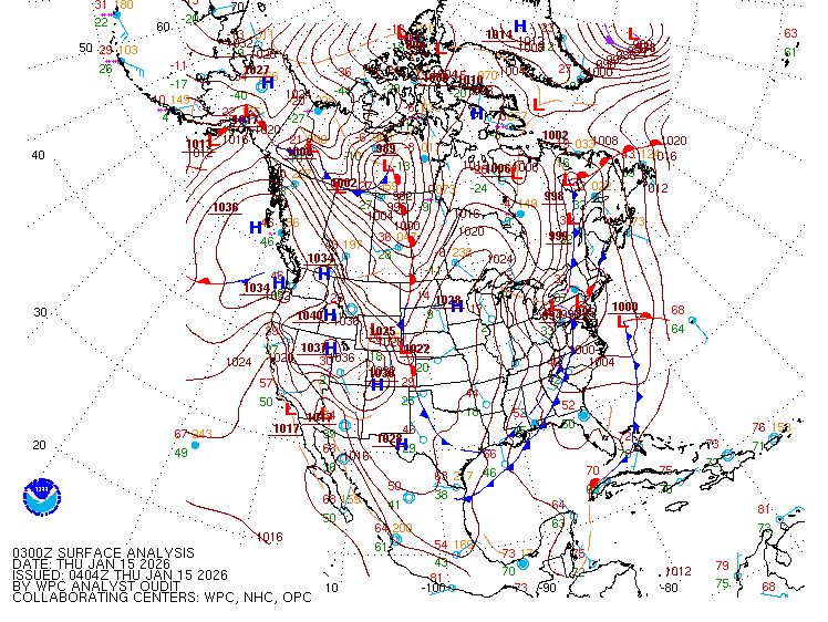
WPC and NHC surface analysis at 21Z shows the 1013 mb Low Pressure area estimated about 150 miles north of the Yucatan Peninsula
along the surface trough axis across the Eastern GOM.

along the surface trough axis across the Eastern GOM.

0 likes
NEVER, EVER SAY NEVER in the tropics and weather in general, and most importantly, with life itself!!
________________________________________________________________________________________
Fay 2008 Beryl 2012 Debby 2012 Colin 2016 Hermine 2016 Julia 2016 Matthew 2016 Irma 2017 Dorian 2019
________________________________________________________________________________________
Fay 2008 Beryl 2012 Debby 2012 Colin 2016 Hermine 2016 Julia 2016 Matthew 2016 Irma 2017 Dorian 2019
Re: Grace remnants
Looking very interesting on SAT in the SE GOM tonite. Might see an INVEST soon.
0 likes
- northjaxpro
- S2K Supporter

- Posts: 8900
- Joined: Mon Sep 27, 2010 11:21 am
- Location: Jacksonville, FL
I think it will be designated an invest on tomorrow.
0 likes
NEVER, EVER SAY NEVER in the tropics and weather in general, and most importantly, with life itself!!
________________________________________________________________________________________
Fay 2008 Beryl 2012 Debby 2012 Colin 2016 Hermine 2016 Julia 2016 Matthew 2016 Irma 2017 Dorian 2019
________________________________________________________________________________________
Fay 2008 Beryl 2012 Debby 2012 Colin 2016 Hermine 2016 Julia 2016 Matthew 2016 Irma 2017 Dorian 2019
Re: Grace remnants
I am not an expert in weather, but doesn't a 1003 mb low pressure center combined with a closed strong, vorticity equal a tropical system? Surface winds don't look that impressive though. Maybe looks like barely a weak depression?
Image Courtesy of Tropical Tidbits, Note sw of Tampa Bay:

Image Courtesy of Tropical Tidbits, Note sw of Tampa Bay:

0 likes
This post is NOT AN OFFICIAL FORECAST and should not be used as such. It is just the opinion of the poster and may or may not be backed by sound meteorological data. It is NOT endorsed by any professional institution including storm2k.org. For Official Information please refer to the NHC and NWS products.
Re: Grace remnants
The disturbance is very disorganized, there's no LLC near the deep convection approaching the Keys now, nothing more than a vorticity.
The broad surface low pressure is north of the Yucatan, shear is pushing the convection east away from the surface low.
The broad surface low pressure is north of the Yucatan, shear is pushing the convection east away from the surface low.
0 likes
- northjaxpro
- S2K Supporter

- Posts: 8900
- Joined: Mon Sep 27, 2010 11:21 am
- Location: Jacksonville, FL
0 likes
NEVER, EVER SAY NEVER in the tropics and weather in general, and most importantly, with life itself!!
________________________________________________________________________________________
Fay 2008 Beryl 2012 Debby 2012 Colin 2016 Hermine 2016 Julia 2016 Matthew 2016 Irma 2017 Dorian 2019
________________________________________________________________________________________
Fay 2008 Beryl 2012 Debby 2012 Colin 2016 Hermine 2016 Julia 2016 Matthew 2016 Irma 2017 Dorian 2019
Re: Grace remnants
00z GFS now showing vorticity in Gulf through 24hrs versus previous runs.
http://www.tropicaltidbits.com/analysis ... watl_5.png
http://www.tropicaltidbits.com/analysis ... watl_5.png
0 likes
The following post is NOT an official forecast and should not be used as such. It is just the opinion of the poster and may or may not be backed by sound meteorological data. It is NOT endorsed by any professional institution including storm2k.org For Official Information please refer to the NHC and NWS products.
- Extratropical94
- Professional-Met

- Posts: 3545
- Age: 31
- Joined: Wed Oct 20, 2010 6:36 am
- Location: Hamburg, Germany
- Contact:
A large area of disturbed weather, extending from the southeastern
Gulf of Mexico northeastward across Florida, is associated with a
broad trough of low pressure. This system is expected to move
northeastward and spread heavy rains over portions of the Florida
peninsula during the next day or two. A low pressure area may
form over the western Atlantic over the weekend, when conditions
could become a little more conducive for tropical or subtropical
cyclone development.
* Formation chance through 48 hours...low...10 percent
* Formation chance through 5 days...low...30 percent
0 likes
54° 11' 59'' N, 9° 9' 20'' E
Boomer Sooner!
Go Broncos! Go Cards!
Clinching counties, one at a time: https://mob-rule.com/user-gifs/USA/xtrp94.gif
- Daniel
Boomer Sooner!
Go Broncos! Go Cards!
Clinching counties, one at a time: https://mob-rule.com/user-gifs/USA/xtrp94.gif
- Daniel
Re: Grace remnants
Starting to look impressive about 125 miles west of Naples this morning on Radar. We should have an INVEST soon IMO.
http://radar.weather.gov/radar.php?product=N0Z&rid=TBW&loop=yes
http://radar.weather.gov/radar.php?product=N0Z&rid=TBW&loop=yes
0 likes
Who is online
Users browsing this forum: Google Adsense [Bot], Ulf and 124 guests


