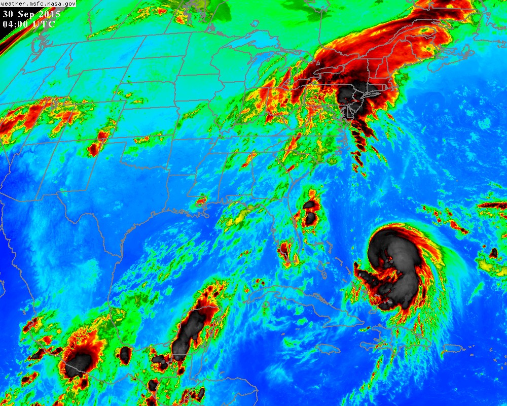
Alyono wrote:to be honest, cat 5 is not impossible. I know its early. However, everything looks incredibly favorable
especially given is smaller size...
Moderator: S2k Moderators

Alyono wrote:to be honest, cat 5 is not impossible. I know its early. However, everything looks incredibly favorable


hurricanedude wrote:wouldnt a cat 4 or five almost certainly move more out.....stronger may be better for east coast?


HurricaneBelle wrote:northjaxpro wrote:
Well, Joaquin did originate from the large ULL whcih was north of the Leewards, Puerto Rico and Hispaniola throughout all last week. The large ULL then interacted with a surface trough and found an area of less hospitable shear to allow for the rare transition of ULL to tropical cyclone. I take some pride in being the first to call for such development from the ULL to possibly take place last week.
The upper low originated from a trough that came off the NC coast on September 15: http://i.imwx.com/web/multimedia/images ... rigin.html
And yes, you do take pride in that call, mentioning it every chance you can.

Hurricaneman wrote:That GFS run would bring 100mph+ winds to DC which would be a national disaster possibly
The posts in this forum are NOT official forecast and should not be used as such. They are just the opinion of the poster and may or may not be backed by sound meteorological data. They are NOT endorsed by any professional institution or storm2k.org. For official information, please refer to the NHC and NWS products


Aric Dunn wrote:Hammy wrote:I noted earlier so I'm wondering if it sucked in a bit of dry air--the overall appearance reminds me a bit of Erin in 1995 as it approached Florida.
THe surrounding environment is incredibly moist dewpoints from recon and soundings show a very condusive environment


floridasun78 wrote:so Bahamas may get pretty good by hurr if gfs right could chance may turn between Bahamas and fl coast line?
panamatropicwatch wrote:Aric Dunn wrote:Hammy wrote:I noted earlier so I'm wondering if it sucked in a bit of dry air--the overall appearance reminds me a bit of Erin in 1995 as it approached Florida.
THe surrounding environment is incredibly moist dewpoints from recon and soundings show a very condusive environment
Does look like some dry air did make it into it.

AutoPenalti wrote:What's amazing is how fast this exploded into a well defined system, under El Niño conditions.


Users browsing this forum: No registered users and 94 guests