Here is the text of the CPC weekly update up to +2.5C.
http://www.cpc.ncep.noaa.gov/products/a ... ts-web.pdf
ENSO Updates (2007 thru 2023)
Moderator: S2k Moderators
Forum rules

The posts in this forum are NOT official forecasts and should not be used as such. They are just the opinion of the poster and may or may not be backed by sound meteorological data. They are NOT endorsed by any professional institution or STORM2K. For official information, please refer to products from the National Hurricane Center and National Weather Service.
-
cycloneye

- Admin

- Posts: 149520
- Age: 69
- Joined: Thu Oct 10, 2002 10:54 am
- Location: San Juan, Puerto Rico
0 likes
Visit the Caribbean-Central America Weather Thread where you can find at first post web cams,radars
and observations from Caribbean basin members Click Here
and observations from Caribbean basin members Click Here
-
cycloneye
- Admin
- Posts: 149520
- Age: 69
- Joined: Thu Oct 10, 2002 10:54 am
- Location: San Juan, Puerto Rico
Re: ENSO: CPC Weekly update of 10/26/15: Nino 3.4 up to +2.5C
Eric Blake @EricBlake12 · 3m3 minutes ago
.@antmasiello October 2015 westerly winds have been 2nd highest on record, only 97 higher! Crushes everything else

.@antmasiello October 2015 westerly winds have been 2nd highest on record, only 97 higher! Crushes everything else
0 likes
Visit the Caribbean-Central America Weather Thread where you can find at first post web cams,radars
and observations from Caribbean basin members Click Here
and observations from Caribbean basin members Click Here


We will know in a few weeks but October PDO will be very high, top 5 or 3 high. The horsehoe of warmth strengthened in the east.
0 likes
The above post and any post by Ntxw is NOT an official forecast and should not be used as such. It is just the opinion of the poster and may or may not be backed by sound meteorological data. It is NOT endorsed by any professional institution including Storm2k. For official information, please refer to NWS products.
Help support Storm2K!
Will be 2.7C this week, now only 0.1C below 1997's peak weekly reading. The same centered week at 3.4 in 97 was 2.6C
0 likes
The above post and any post by Ntxw is NOT an official forecast and should not be used as such. It is just the opinion of the poster and may or may not be backed by sound meteorological data. It is NOT endorsed by any professional institution including Storm2k. For official information, please refer to NWS products.
Help support Storm2K!
Help support Storm2K!
-
cycloneye
- Admin
- Posts: 149520
- Age: 69
- Joined: Thu Oct 10, 2002 10:54 am
- Location: San Juan, Puerto Rico
Re: ENSO Updates
Text of CPC update that has Nino 3.4 up to 2.7C.
http://www.cpc.ncep.noaa.gov/products/a ... ts-web.pdf
http://www.cpc.ncep.noaa.gov/products/a ... ts-web.pdf
0 likes
Visit the Caribbean-Central America Weather Thread where you can find at first post web cams,radars
and observations from Caribbean basin members Click Here
and observations from Caribbean basin members Click Here
-
Hurricaneman

- Category 5

- Posts: 7404
- Age: 45
- Joined: Tue Aug 31, 2004 3:24 pm
- Location: central florida
SOI index
90 day: -18.11
30 day: -18.47
Nov 2: -4.65
The last 3 days have been in the - single digits which signals less westerly winds due to less pressure difference, could this be the start of El Nino has peaked or slowly declines or will we get some major - numbers again we shall see
The posts in this forum are NOT official forecast and should not be used as such. They are just the opinion of the poster and may or may not be backed by sound meteorological data. They are NOT endorsed by any professional institution or storm2k.org. For official information, please refer to the NHC and NWS products
0 likes
Re:
Hurricaneman wrote:SOI index
90 day: -18.11
30 day: -18.47
Nov 2: -4.65
The last 3 days have been in the - single digits which signals less westerly winds due to less pressure difference, could this be the start of El Nino has peaked or slowly declines or will we get some major - numbers again we shall see
The posts in this forum are NOT official forecast and should not be used as such. They are just the opinion of the poster and may or may not be backed by sound meteorological data. They are NOT endorsed by any professional institution or storm2k.org. For official information, please refer to the NHC and NWS products
It's more reflective I think of the MJO in the Indian Ocean phases. Once that passes the more negatives will return. But the base state SOI is so low event a decent MJO doesn't go much positive which shows you the magnitude of the El Nino. The weeklies may see peak readings here within the next several weeks possible perhaps, but ONI (where longterm records is) won't peak until after January is through at the very earliest due to it's nature of being a trimonthly reading.
In large part though CFSv2 850 U wind does show that the greatest WWB's of 2015 have passed. The rest of the way should be steady with weakened trades.It doesn't have a major WWB until Feb 2016 but that is way way into the future. But the damage has already been done, now it's just some semantics. Will we top or tie 2.8C? How far above 2C will ONI get?

0 likes
The above post and any post by Ntxw is NOT an official forecast and should not be used as such. It is just the opinion of the poster and may or may not be backed by sound meteorological data. It is NOT endorsed by any professional institution including Storm2k. For official information, please refer to NWS products.
Help support Storm2K!
Help support Storm2K!
-
1900hurricane

- Category 5
- Posts: 6063
- Age: 34
- Joined: Fri Feb 06, 2015 12:04 pm
- Location: Houston, TX
- Contact:
Re:
Hurricaneman wrote:SOI index
90 day: -18.11
30 day: -18.47
Nov 2: -4.65
The last 3 days have been in the - single digits which signals less westerly winds due to less pressure difference, could this be the start of El Nino has peaked or slowly declines or will we get some major - numbers again we shall see
The posts in this forum are NOT official forecast and should not be used as such. They are just the opinion of the poster and may or may not be backed by sound meteorological data. They are NOT endorsed by any professional institution or storm2k.org. For official information, please refer to the NHC and NWS products
It's worth noting that the Madden-Julian Oscillation has become active for the first time since late June/early July, meaning that there really hasn't been much other than the El Nino base state since then. With subsidence from Madden-Julian overspreading the Pacific right now, it is likely tampering with the SOI index. Should the pulse continue eastwards or even dissipate, it's likely that we'll see a return to a largely negative SOI in about two weeks or so.
0 likes
Contract Meteorologist. TAMU & MSST. Fiercely authentic, one of a kind. We are all given free will, so choose a life meant to be lived. We are the Masters of our own Stories.
Opinions expressed are mine alone.
Follow me on Twitter at @1900hurricane : Read blogs at https://1900hurricane.wordpress.com/
Opinions expressed are mine alone.
Follow me on Twitter at @1900hurricane : Read blogs at https://1900hurricane.wordpress.com/

Re: ENSO: CPC update of 11/2/15 has Nino 3.4 up to +2.7C
The ONI for ASO just came in at 1.70C
ERRSTv4 monthly nino3.4 for October was 1.86C-up from 1.75C in September. In comparison, the October 1997 monthly was 2.25C.
ERRSTv4 monthly nino3.4 for October was 1.86C-up from 1.75C in September. In comparison, the October 1997 monthly was 2.25C.
0 likes
All posts by Dean_175 are NOT official forecasts and should not be used as such. They are just the opinion of the poster and may or may not be backed by sound meteorological data. They are NOT endorsed by any professional institution or storm2k.org. For official information, please refer to the NHC and NWS products.
-
Hurricaneman
- Category 5
- Posts: 7404
- Age: 45
- Joined: Tue Aug 31, 2004 3:24 pm
- Location: central florida
I could see a +3c El Nino by early December but a steady decline to +2c in late December and like no more that +1c by late Februaryand a decline to -numbers by May but we shall see and who knows as this El Nino may fade slower than I expect
The posts in this forum are NOT official forecast and should not be used as such. They are just the opinion of the poster and may or may not be backed by sound meteorological data. They are NOT endorsed by any professional institution or storm2k.org. For official information, please refer to the NHC and NWS products
The posts in this forum are NOT official forecast and should not be used as such. They are just the opinion of the poster and may or may not be backed by sound meteorological data. They are NOT endorsed by any professional institution or storm2k.org. For official information, please refer to the NHC and NWS products
0 likes
Re: ENSO: CPC update of 11/2/15 has Nino 3.4 up to +2.7C
Dean_175 wrote:The ONI for ASO just came in at 1.70C
ERRSTv4 monthly nino3.4 for October was 1.86C-up from 1.75C in September. In comparison, the October 1997 monthly was 2.25C.
Did you noticed they revised Sept up to that 1.75 from 1.68 before? Clearly ERSSTv4 has underestimated
0 likes
The above post and any post by Ntxw is NOT an official forecast and should not be used as such. It is just the opinion of the poster and may or may not be backed by sound meteorological data. It is NOT endorsed by any professional institution including Storm2k. For official information, please refer to NWS products.
Help support Storm2K!
Help support Storm2K!
8C anomalies now showing up below the surface. Now we are talking going into Super, if not already. ONi notwithstanding (yet)
0 likes
The above post and any post by Ntxw is NOT an official forecast and should not be used as such. It is just the opinion of the poster and may or may not be backed by sound meteorological data. It is NOT endorsed by any professional institution including Storm2k. For official information, please refer to NWS products.
Help support Storm2K!
Help support Storm2K!
-
cycloneye
- Admin
- Posts: 149520
- Age: 69
- Joined: Thu Oct 10, 2002 10:54 am
- Location: San Juan, Puerto Rico
Re: ENSO: CPC update of 11/2/15 has Nino 3.4 up to +2.7C
0 likes
Visit the Caribbean-Central America Weather Thread where you can find at first post web cams,radars
and observations from Caribbean basin members Click Here
and observations from Caribbean basin members Click Here
Re: ENSO: CPC update of 11/2/15 has Nino 3.4 up to +2.7C
cycloneye wrote::uarrow: Looks like the peak has not been reached yet.
Curious if we tie or top 2.8 and make history next monday
0 likes
The above post and any post by Ntxw is NOT an official forecast and should not be used as such. It is just the opinion of the poster and may or may not be backed by sound meteorological data. It is NOT endorsed by any professional institution including Storm2k. For official information, please refer to NWS products.
Help support Storm2K!
Help support Storm2K!
-
1900hurricane
- Category 5
- Posts: 6063
- Age: 34
- Joined: Fri Feb 06, 2015 12:04 pm
- Location: Houston, TX
- Contact:
As crazy as it sounds, if the upward pulse of Madden Julian can make it across the Pacific, it could possibly enhance El Nino even more. We're still at least two weeks off of that since the center of the pulse is over the Bay of Bengal currently, but it hasn't appeared to have issued propagating east so far, constantly exceeding the expectations of numerical guidence.
0 likes
Contract Meteorologist. TAMU & MSST. Fiercely authentic, one of a kind. We are all given free will, so choose a life meant to be lived. We are the Masters of our own Stories.
Opinions expressed are mine alone.
Follow me on Twitter at @1900hurricane : Read blogs at https://1900hurricane.wordpress.com/
Opinions expressed are mine alone.
Follow me on Twitter at @1900hurricane : Read blogs at https://1900hurricane.wordpress.com/

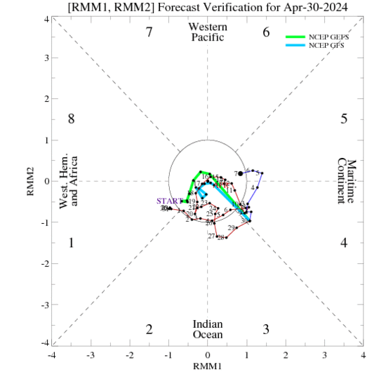
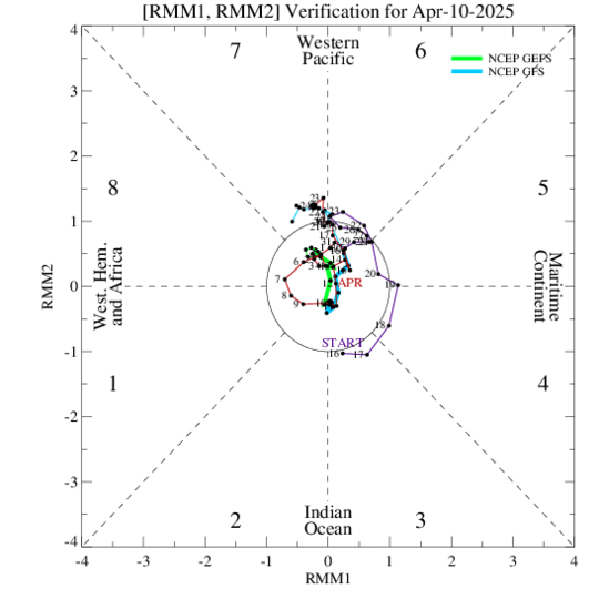
^The Euro ens, unlike the GEFS, correctly had it going into phase 3. The EPS usually does better and it has it going into the circle in 10 days.
0 likes
Personal Forecast Disclaimer:
The posts in this forum are NOT official forecasts and should not be used as such. They are just the opinion of the poster and may or may not be backed by sound meteorological data. They are NOT endorsed by any professional institution or storm2k.org. For official information, please refer to the NHC and NWS products.
The posts in this forum are NOT official forecasts and should not be used as such. They are just the opinion of the poster and may or may not be backed by sound meteorological data. They are NOT endorsed by any professional institution or storm2k.org. For official information, please refer to the NHC and NWS products.
-
Hurricaneman
- Category 5
- Posts: 7404
- Age: 45
- Joined: Tue Aug 31, 2004 3:24 pm
- Location: central florida
The ENSO 3-4 is probably about +2.9C and most likely will peak above +3C
The posts in this forum are NOT official forecast and should not be used as such. They are just the opinion of the poster and may or may not be backed by sound meteorological data. They are NOT endorsed by any professional institution or storm2k.org. For official information, please refer to the NHC and NWS products.
The posts in this forum are NOT official forecast and should not be used as such. They are just the opinion of the poster and may or may not be backed by sound meteorological data. They are NOT endorsed by any professional institution or storm2k.org. For official information, please refer to the NHC and NWS products.
0 likes
-
cycloneye
- Admin
- Posts: 149520
- Age: 69
- Joined: Thu Oct 10, 2002 10:54 am
- Location: San Juan, Puerto Rico
Re: ENSO Updates
Breaking news:
Eric Blake @EricBlake12 · 3m3 minutes ago
2015 has tied 1997's weekly peak value in Nino 3.4 of 2.8C - Nino 4 (1.7) now warmest on record #climate #ElNino

Eric Blake @EricBlake12 · 3m3 minutes ago
2015 has tied 1997's weekly peak value in Nino 3.4 of 2.8C - Nino 4 (1.7) now warmest on record #climate #ElNino
0 likes
Visit the Caribbean-Central America Weather Thread where you can find at first post web cams,radars
and observations from Caribbean basin members Click Here
and observations from Caribbean basin members Click Here

-
cycloneye
- Admin
- Posts: 149520
- Age: 69
- Joined: Thu Oct 10, 2002 10:54 am
- Location: San Juan, Puerto Rico
Text of CPC weekly update at +2.8C and ties the peak of the 1997 event. ONI is up to +1.7C as of ASO.
http://www.cpc.ncep.noaa.gov/products/a ... ts-web.pdf
http://www.cpc.ncep.noaa.gov/products/a ... ts-web.pdf
0 likes
Visit the Caribbean-Central America Weather Thread where you can find at first post web cams,radars
and observations from Caribbean basin members Click Here
and observations from Caribbean basin members Click Here
Who is online
Users browsing this forum: gib and 117 guests