Ntxw wrote:Yeah Nuri likely derailed last December dumping all the cold too early and messing with the AO. We have been spared the mildness the rest of the country east of the Rockies. 60s and mostly cloudy sure has more nip than 60s and bright sunshine.
Exactly... there has been temperatures near 80 in Alabama with dewpoints in the mid 70s. I can't really think of worse weather in November lol. They usually have a freeze by now and not even close really.
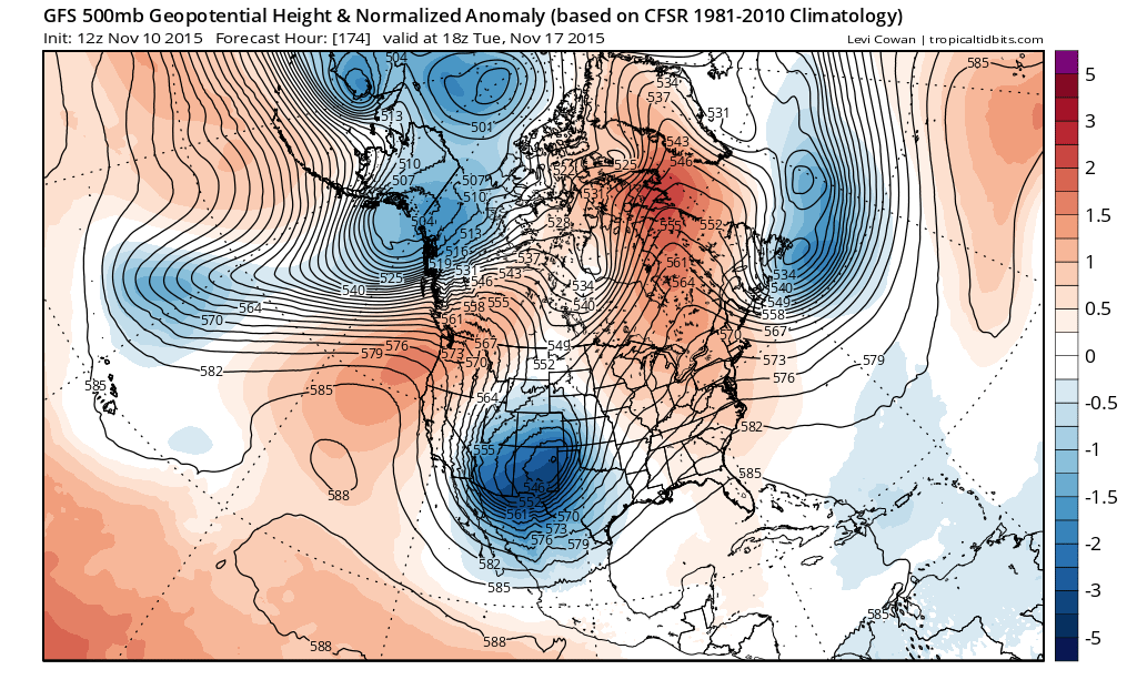
This is pretty freaking good considering where we were a month ago...
honestly I was totally prepared for a few days pushing 80 here considering it's not even that unusual in November, and other than the severe weather day last week I don't see any signs of it and it becomes more unlikely the later it gets.