
WPAC: MELOR - Post-Tropical
Moderator: S2k Moderators
-
cycloneye

- Admin

- Posts: 149843
- Age: 69
- Joined: Thu Oct 10, 2002 10:54 am
- Location: San Juan, Puerto Rico
WPAC: MELOR - Post-Tropical
96W INVEST 151207 1200 6.5N 151.2E WPAC 15 NA
0 likes
Visit the Caribbean-Central America Weather Thread where you can find at first post web cams,radars
and observations from Caribbean basin members Click Here
and observations from Caribbean basin members Click Here
-
1900hurricane

- Category 5

- Posts: 6063
- Age: 34
- Joined: Fri Feb 06, 2015 12:04 pm
- Location: Houston, TX
- Contact:
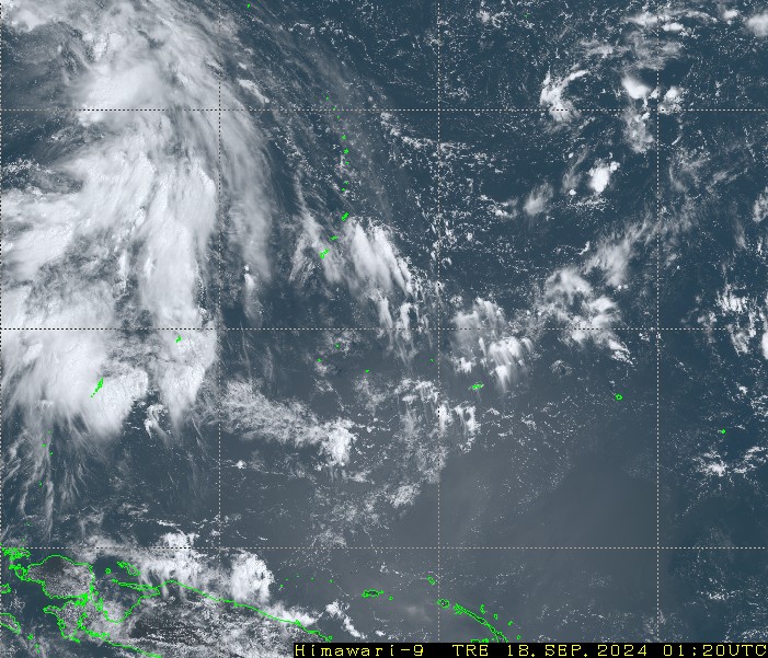
It's not atrocious looking, but there's not much going on organization-wise. Low level vorticity is fairly diffuse.
0 likes
Contract Meteorologist. TAMU & MSST. Fiercely authentic, one of a kind. We are all given free will, so choose a life meant to be lived. We are the Masters of our own Stories.
Opinions expressed are mine alone.
Follow me on Twitter at @1900hurricane : Read blogs at https://1900hurricane.wordpress.com/
Opinions expressed are mine alone.
Follow me on Twitter at @1900hurricane : Read blogs at https://1900hurricane.wordpress.com/
-
RobWESTPACWX
- WestPACMet

- Posts: 1616
- Joined: Fri Sep 17, 2010 2:26 am
- Location: Tokyo, Japan
- Contact:

-
euro6208
Re: WPAC: INVEST 96W
NWS:
SATELLITE IMAGERY SHOWS INTENSE DEEP CONVECTION WITHIN A REGION
OF STRONG LOW-LEVEL CONVERGENCE NORTHEAST OF A TROPICAL
DISTURBANCE SURROUNDING CHUUK. MODEL AGREEMENT IS GOOD IN BOTH THE
SPATIAL DEPICTION OF SHOWER COVERAGE AND PLACEMENT AS WELL AS THE
RUN-TO-RUN CONSISTENCY REGARDING THE WIDESPREAD CONVECTIVE EVENT
CURRENTLY OVER CHUUK STATE. SHOWERS AND THUNDERSTORMS ARE EXPECTED
TO CONTINUE THROUGH TONIGHT ON CHUUK BEFORE TAPERING OFF AROUND
NOON WEDNESDAY. RIDGING WILL BUILD IN BEHIND THE EXITING
DISTURBANCE SOUTHWEST OF CHUUK...USHERING IN DRIER CONDITIONS FOR
WEDNESDAY NIGHT THROUGH MUCH OF FRIDAY BEFORE THE NEXT SYSTEM
BEGINS TO AFFECT THE STATE.
A ZONE OF SHOWERS AND THUNDERSTORMS IS SEEN IN SATELLITE IMAGERY
DRAPED OVER PALAU BUT SOUTH OF YAP. THIS ACTIVITY IS EXPECTED TO
INCREASE AND AFFECT KOROR TONIGHT AND WEDNESDAY BEFORE SHIFTING
BACK SOUTH OF KOROR COASTAL WATERS WEDNESDAY NIGHT.
MEANWHILE...QUIET WEATHER WILL PERSIST ON YAP UNTIL EFFECTS FROM
THE DISTURBANCE SOUTHWEST OF CHUUK BEGIN TO INFLUENCE THE WEATHER
OVER YAP WATERS BEGINNING THURSDAY. MODELS MAINTAIN THE FEATURE AS
A WEAK CIRCULATION WHILE MOVING THROUGH YAP STATE THURSDAY AND
THURSDAY NIGHT. NONETHELESS...SITUATION WILL HAVE TO MONITORED
CLOSELY FOR POTENTIAL DEVELOPMENT OF THE DISTURBANCE INTO A
STRONGER TROPICAL SYSTEM OVER THE NEXT 48 HOURS. MOST OF THE
SHOWER ACTIVITY ASSOCIATED WITH THIS SYSTEM IS ANTICIPATED TO PASS
NORTH OF KOROR OVER THE WEEKEND.
0 likes
-
cycloneye
- Admin
- Posts: 149843
- Age: 69
- Joined: Thu Oct 10, 2002 10:54 am
- Location: San Juan, Puerto Rico
Re: WPAC: INVEST 96W
JMA marks a low pressure to Invest 96W but no TD at this time.
LOW PRESSURE AREA 1006 HPA NEAR 04N 150E WEST SLOWLY.
LOW PRESSURE AREA 1006 HPA NEAR 04N 150E WEST SLOWLY.
0 likes
Visit the Caribbean-Central America Weather Thread where you can find at first post web cams,radars
and observations from Caribbean basin members Click Here
and observations from Caribbean basin members Click Here
-
euro6208
Re: WPAC: INVEST 96W
JMA doesn't develop this at all as it passes over southern Visayas.
NAVGEM was developing this into a typhoon taking it to Manila and Luzon but latest backed off. Only shows a weak disturbance now.
CMC on the other hand has been consistent in developing this to a full blown typhoon for the past ten runs as it crosses over the Philippines with a track taking it south of Manila.
Very interesting EURO run. 12Z takes this into Samar and strengthens it to Melor over the Philippines and eventually into a typhoon in the SCS while doing a possible Fujiwhara with strengthening Nepartak east of the P.I. Now 00Z doesn't develop this with little to no strengthening as it passes over Samar while the second system makes landfall over the aforementioned island.
GFS still doesn't develop this at all.
0 likes
-
cycloneye
- Admin
- Posts: 149843
- Age: 69
- Joined: Thu Oct 10, 2002 10:54 am
- Location: San Juan, Puerto Rico
Re: WPAC: INVEST 96W
JMA upgrades to minor TD.
TROPICAL DEPRESSION 1010 HPA AT 08N 149E WEST SLOWLY.
TROPICAL DEPRESSION 1010 HPA AT 08N 149E WEST SLOWLY.
0 likes
Visit the Caribbean-Central America Weather Thread where you can find at first post web cams,radars
and observations from Caribbean basin members Click Here
and observations from Caribbean basin members Click Here
-
euro6208
Re: WPAC: Tropical Depression 96W
NWS

We're watching a disturbance, Invest 96W, centered west of Chuuk near 7N149E. This system is expected to pass south of Guam the next couple of days, but it will bring showers and a few thunderstorms to the Marianas later on Thursday. Drier weather is expected by the weekend.
0 likes
-
dexterlabio
- Category 5
- Posts: 3521
- Joined: Sat Oct 24, 2009 11:50 pm
Re: WPAC: Tropical Depression 96W
If this one is heading towards Manila I hope it will freeze things a bit in here. There are times when I feel the typical June-August summer heat instead of the cool December breeze that we should be feeling right now. 
0 likes
Personal Forecast Disclaimer:
The posts in this forum are NOT official forecast and should not be used as such. They are just the opinion of the poster and may or may not be backed by sound meteorological data. They are NOT endorsed by any professional institution or storm2k.org. For official information, please refer to the NHC and NWS products.
The posts in this forum are NOT official forecast and should not be used as such. They are just the opinion of the poster and may or may not be backed by sound meteorological data. They are NOT endorsed by any professional institution or storm2k.org. For official information, please refer to the NHC and NWS products.
-
1900hurricane
- Category 5
- Posts: 6063
- Age: 34
- Joined: Fri Feb 06, 2015 12:04 pm
- Location: Houston, TX
- Contact:
I'm surprised JTWC hasn't given it a mention yet. Looks like the vorticity is in the process of consolidating.
0 likes
Contract Meteorologist. TAMU & MSST. Fiercely authentic, one of a kind. We are all given free will, so choose a life meant to be lived. We are the Masters of our own Stories.
Opinions expressed are mine alone.
Follow me on Twitter at @1900hurricane : Read blogs at https://1900hurricane.wordpress.com/
Opinions expressed are mine alone.
Follow me on Twitter at @1900hurricane : Read blogs at https://1900hurricane.wordpress.com/
-
dexterlabio
- Category 5
- Posts: 3521
- Joined: Sat Oct 24, 2009 11:50 pm
Re: WPAC: Tropical Depression 96W
finally a mention from JTWC
ABPW10 PGTW 100600
MSGID/GENADMIN/JOINT TYPHOON WRNCEN PEARL HARBOR HI//
SUBJ/SIGNIFICANT TROPICAL WEATHER ADVISORY FOR THE WESTERN AND
/SOUTH PACIFIC OCEANS/100600Z-110600ZDEC2015//
RMKS/
1. WESTERN NORTH PACIFIC AREA (180 TO MALAY PENINSULA):
A. TROPICAL CYCLONE SUMMARY: NONE.
B. TROPICAL DISTURBANCE SUMMARY:
(1) AN AREA OF CONVECTION HAS PERSISTED NEAR 7.4N 144.3E,
APPROXIMATELY 360 NM SOUTH OF GUAM. ANIMATED INFRARED SATELLITE
IMAGERY SHOWS DEVELOPING CONVECTION BUILDING OVER AN AREA OF REVERSE-
ORIENTED TROUGHING. A RECENT 092344Z ASCAT PASS SUPPORTS WIND SPEEDS
OF 10 TO 15 KNOTS WITHIN THE TROUGH. SEA SURFACE TEMPERATURES ARE
FAVORABLE AT 29 TO 30 CELSIUS, PROVIDING SUPPORT TO FURTHER
DEVELOPMENT. UPPER LEVEL ANALYSIS INDICATES THE DISTURBANCE IS
LOCATED WITHIN AN AXIS OF LOW VERTICAL WIND SHEAR WITH A RECENT
SURGE OF POLEWARD OUTFLOW AS A MID-LATITUDE TROUGH TRACKS TO THE
NORTH OF THE TROUGH. MAXIMUM SUSTAINED SURFACE WINDS ARE ESTIMATED
AT 10 TO 15 KNOTS. MINIMUM SEA LEVEL PRESSURE IS ESTIMATED TO BE
NEAR 1008 MB. BASED ON THE IMPROVING DEEP CONVECTION WITH FAVORABLE
SURFACE AND UPPER LEVEL ENVIRONMENT, THE POTENTIAL FOR THE
DEVELOPMENT OF A SIGNIFICANT TROPICAL CYCLONE WITHIN THE NEXT 24
HOURS IS LOW.
(2) NO OTHER SUSPECT AREAS.
2. SOUTH PACIFIC AREA (WEST COAST OF SOUTH AMERICA TO 135 EAST):
A. TROPICAL CYCLONE SUMMARY: NONE.
B. TROPICAL DISTURBANCE SUMMARY: NONE.//
NNNN
0 likes
Personal Forecast Disclaimer:
The posts in this forum are NOT official forecast and should not be used as such. They are just the opinion of the poster and may or may not be backed by sound meteorological data. They are NOT endorsed by any professional institution or storm2k.org. For official information, please refer to the NHC and NWS products.
The posts in this forum are NOT official forecast and should not be used as such. They are just the opinion of the poster and may or may not be backed by sound meteorological data. They are NOT endorsed by any professional institution or storm2k.org. For official information, please refer to the NHC and NWS products.
-
euro6208
Re: WPAC: Tropical Depression 96W
NWS
A NARROW BAND OF SHOWERS AND THUNDERSTORMS PASSES SOUTH OF KOROR
ALONG THE NEAR-EQUATORIAL TROUGH THAT CURVES INTO INVEST 96W NEAR
6N140E. MORE WIDESPREAD CONVECTION IS SEEN DISPLACED TO THE
NORTHEAST OF 96W. NORTHEAST TRADES WILL PERSIST AT YAP AND KOROR
IN THE SHORT TERM...THEN SHOWERS WILL INCREASE...PARTICULARLY AT
YAP...ON FRIDAY. YAP IS STILL EXPECTED TO SEE THE BULK OF SHOWERS
AND COULD SEE 2 TO 4 INCHES BETWEEN FRIDAY AND FRIDAY NIGHT. 96W
MAY CONTINUE TO SLOWLY DEVELOP...BUT MOST LIKELY AFTER IS PASSES
WEST OF THE TWO LOCATIONS.
0 likes
-
euro6208
Re: WPAC: Tropical Depression 96W
Bringing widespread showers to the Guam, the CNMI, and Micronesia.


0 likes
-
euro6208
Re: WPAC: Tropical Depression 96W
18Z NAVGEM had a typhoon making landfall over Luzon but 00Z no longer develops this. Anywhere from Luzon to Mindanao will be the track.
CMC for the past runs takes a typhoon through Northern Visayas and does a fujiwhara with another TC to it's east which results in a track to the southwest through Northern Mindanao and Palawan...Interesting...
CMC for the past runs takes a typhoon through Northern Visayas and does a fujiwhara with another TC to it's east which results in a track to the southwest through Northern Mindanao and Palawan...Interesting...
0 likes
-
euro6208
Re: WPAC: Tropical Depression 96W
Whatever develops out of this possible Fujiwhara guarantees a huge flooding potential for the Philippines.
12Z EURO has a strengthening Melor passing south of Manila as a typhoon and stalls it.
00Z is much further east as it makes the turn earlier near Catanduanes with the interaction weaker but strengthening.
12Z EURO has a strengthening Melor passing south of Manila as a typhoon and stalls it.
00Z is much further east as it makes the turn earlier near Catanduanes with the interaction weaker but strengthening.
0 likes

Strange that JTWC has so little confidence in this given the satellite appearance, while JMA is now expecting this to be Melor in 24hr.
WTPQ20 RJTD 101200
RSMC TROPICAL CYCLONE ADVISORY
NAME TD
ANALYSIS
PSTN 101200UTC 06.9N 142.8E POOR
MOVE W SLOWLY
PRES 1006HPA
MXWD 030KT
GUST 045KT
FORECAST
24HF 111200UTC 09.7N 137.8E 120NM 70%
MOVE WNW 14KT
PRES 1002HPA
MXWD 035KT
GUST 050KT =
WTPQ20 RJTD 101200
RSMC TROPICAL CYCLONE ADVISORY
NAME TD
ANALYSIS
PSTN 101200UTC 06.9N 142.8E POOR
MOVE W SLOWLY
PRES 1006HPA
MXWD 030KT
GUST 045KT
FORECAST
24HF 111200UTC 09.7N 137.8E 120NM 70%
MOVE WNW 14KT
PRES 1002HPA
MXWD 035KT
GUST 050KT =
0 likes
-
1900hurricane
- Category 5
- Posts: 6063
- Age: 34
- Joined: Fri Feb 06, 2015 12:04 pm
- Location: Houston, TX
- Contact:
An ASCAT pass from about three hours ago shows a circulation that is elongated to the SW and maybe not quite closed yet. I do think within the next 18 hours or so 96W will be organized enough to be classified as a JTWC depression, whether it is classified as such or not.

0 likes
Contract Meteorologist. TAMU & MSST. Fiercely authentic, one of a kind. We are all given free will, so choose a life meant to be lived. We are the Masters of our own Stories.
Opinions expressed are mine alone.
Follow me on Twitter at @1900hurricane : Read blogs at https://1900hurricane.wordpress.com/
Opinions expressed are mine alone.
Follow me on Twitter at @1900hurricane : Read blogs at https://1900hurricane.wordpress.com/
-
1900hurricane
- Category 5
- Posts: 6063
- Age: 34
- Joined: Fri Feb 06, 2015 12:04 pm
- Location: Houston, TX
- Contact:
Hopefully the upcoming RSCAT pass is a clean one. Himawari-8 seems to show 96W organizing quickly, and I imagine scatterometer data will show the same.
0 likes
Contract Meteorologist. TAMU & MSST. Fiercely authentic, one of a kind. We are all given free will, so choose a life meant to be lived. We are the Masters of our own Stories.
Opinions expressed are mine alone.
Follow me on Twitter at @1900hurricane : Read blogs at https://1900hurricane.wordpress.com/
Opinions expressed are mine alone.
Follow me on Twitter at @1900hurricane : Read blogs at https://1900hurricane.wordpress.com/
-
1900hurricane
- Category 5
- Posts: 6063
- Age: 34
- Joined: Fri Feb 06, 2015 12:04 pm
- Location: Houston, TX
- Contact:
I'm surprised to see JMA as far south as they are with their center fix. RSCAT from over 4.5 hours ago clearly showed the center (at that time, still open to the SW) at about 8*N, and even more recent microwave imagery shows the developing center even north of that now.


0 likes
Contract Meteorologist. TAMU & MSST. Fiercely authentic, one of a kind. We are all given free will, so choose a life meant to be lived. We are the Masters of our own Stories.
Opinions expressed are mine alone.
Follow me on Twitter at @1900hurricane : Read blogs at https://1900hurricane.wordpress.com/
Opinions expressed are mine alone.
Follow me on Twitter at @1900hurricane : Read blogs at https://1900hurricane.wordpress.com/
Who is online
Users browsing this forum: No registered users and 26 guests