WPAC: MELOR - Post-Tropical
Moderator: S2k Moderators
-
mrbagyo

- Category 5

- Posts: 3963
- Age: 33
- Joined: Thu Apr 12, 2012 9:18 am
- Location: 14.13N 120.98E
- Contact:
Re: WPAC: MELOR - Typhoon
About to make landfall in Mindoro island (highest point : Mount Halcon - 2500+ masl)
0 likes
The posts in this forum are NOT official forecast and should not be used as such. They are just the opinion of the poster and may or may not be backed by sound meteorological data. They are NOT endorsed by any professional institution or storm2k.org. For official information, please refer to RSMC, NHC and NWS products.
-
dexterlabio
- Category 5
- Posts: 3503
- Joined: Sat Oct 24, 2009 11:50 pm
Re: WPAC: MELOR - Typhoon
JTWC seems so strange lately with this storm. But really, I didn't expect to look at a Cat3-looking typhoon after it made landfall yesterday. I agree with 1900hurricane, the fact that it is staying in the waters of Central Philippines supports the idea of maintaining its intensity, but one would think that the effects of land friction and cold surge from the monsoon will disrupt Melor somehow..
0 likes
Personal Forecast Disclaimer:
The posts in this forum are NOT official forecast and should not be used as such. They are just the opinion of the poster and may or may not be backed by sound meteorological data. They are NOT endorsed by any professional institution or storm2k.org. For official information, please refer to the NHC and NWS products.
The posts in this forum are NOT official forecast and should not be used as such. They are just the opinion of the poster and may or may not be backed by sound meteorological data. They are NOT endorsed by any professional institution or storm2k.org. For official information, please refer to the NHC and NWS products.
-
1900hurricane

- Category 5
- Posts: 6063
- Age: 34
- Joined: Fri Feb 06, 2015 12:04 pm
- Location: Houston, TX
- Contact:
00Z trackfile update is up to 125 kt, wihc matches up with their DT of 6.5. This is the strongest yet from JTWC.

Last edited by 1900hurricane on Mon Dec 14, 2015 8:04 pm, edited 1 time in total.
0 likes
Contract Meteorologist. TAMU & MSST. Fiercely authentic, one of a kind. We are all given free will, so choose a life meant to be lived. We are the Masters of our own Stories.
Opinions expressed are mine alone.
Follow me on Twitter at @1900hurricane : Read blogs at https://1900hurricane.wordpress.com/
Opinions expressed are mine alone.
Follow me on Twitter at @1900hurricane : Read blogs at https://1900hurricane.wordpress.com/
-
dexterlabio
- Category 5
- Posts: 3503
- Joined: Sat Oct 24, 2009 11:50 pm
Re:
1900hurricane wrote:00Z trackfile update is up to 125 kt, the strongest yet from JTWC.
Where can I find the file? Thanks.
0 likes
Personal Forecast Disclaimer:
The posts in this forum are NOT official forecast and should not be used as such. They are just the opinion of the poster and may or may not be backed by sound meteorological data. They are NOT endorsed by any professional institution or storm2k.org. For official information, please refer to the NHC and NWS products.
The posts in this forum are NOT official forecast and should not be used as such. They are just the opinion of the poster and may or may not be backed by sound meteorological data. They are NOT endorsed by any professional institution or storm2k.org. For official information, please refer to the NHC and NWS products.

WTPQ20 RJTD 150000
RSMC TROPICAL CYCLONE ADVISORY
NAME TY 1527 MELOR (1527)
ANALYSIS
PSTN 150000UTC 13.0N 121.8E GOOD
MOVE W 09KT
PRES 950HPA
MXWD 085KT
GUST 120KT
50KT 40NM
30KT 120NM NORTH 90NM SOUTH
FORECAST
24HF 160000UTC 13.5N 119.6E 70NM 70%
MOVE W SLOWLY
PRES 975HPA
MXWD 065KT
GUST 095KT
48HF 170000UTC 12.0N 117.7E 160NM 70%
MOVE SW 06KT
PRES 990HPA
MXWD 050KT
GUST 070KT
72HF 180000UTC 09.2N 113.6E 250NM 70%
MOVE WSW 12KT
PRES 996HPA
MXWD 040KT
GUST 060KT =
0 likes
-
1900hurricane
- Category 5
- Posts: 6063
- Age: 34
- Joined: Fri Feb 06, 2015 12:04 pm
- Location: Houston, TX
- Contact:
RAMMB usually updates with the data shortly after it is put out. You can also get them nearly instantaneously from the NRL. For example, here is Melor's.
0 likes
Contract Meteorologist. TAMU & MSST. Fiercely authentic, one of a kind. We are all given free will, so choose a life meant to be lived. We are the Masters of our own Stories.
Opinions expressed are mine alone.
Follow me on Twitter at @1900hurricane : Read blogs at https://1900hurricane.wordpress.com/
Opinions expressed are mine alone.
Follow me on Twitter at @1900hurricane : Read blogs at https://1900hurricane.wordpress.com/
-
1900hurricane
- Category 5
- Posts: 6063
- Age: 34
- Joined: Fri Feb 06, 2015 12:04 pm
- Location: Houston, TX
- Contact:
Melor looks about ready to come ashore once again.
0 likes
Contract Meteorologist. TAMU & MSST. Fiercely authentic, one of a kind. We are all given free will, so choose a life meant to be lived. We are the Masters of our own Stories.
Opinions expressed are mine alone.
Follow me on Twitter at @1900hurricane : Read blogs at https://1900hurricane.wordpress.com/
Opinions expressed are mine alone.
Follow me on Twitter at @1900hurricane : Read blogs at https://1900hurricane.wordpress.com/

-
1900hurricane
- Category 5
- Posts: 6063
- Age: 34
- Joined: Fri Feb 06, 2015 12:04 pm
- Location: Houston, TX
- Contact:
ADT showed the eye temp spike above 15*C just before landfall.
0 likes
Contract Meteorologist. TAMU & MSST. Fiercely authentic, one of a kind. We are all given free will, so choose a life meant to be lived. We are the Masters of our own Stories.
Opinions expressed are mine alone.
Follow me on Twitter at @1900hurricane : Read blogs at https://1900hurricane.wordpress.com/
Opinions expressed are mine alone.
Follow me on Twitter at @1900hurricane : Read blogs at https://1900hurricane.wordpress.com/
-
1900hurricane
- Category 5
- Posts: 6063
- Age: 34
- Joined: Fri Feb 06, 2015 12:04 pm
- Location: Houston, TX
- Contact:
Melor also just got a microwave score of 97.0 from CIMSS, which is their second highest all year (Noul got a 99.1). Now, I'm not sure how they calculate their numbers or how well they actually correlate to a storm's intensity, but that is very impressive indeed.

0 likes
Contract Meteorologist. TAMU & MSST. Fiercely authentic, one of a kind. We are all given free will, so choose a life meant to be lived. We are the Masters of our own Stories.
Opinions expressed are mine alone.
Follow me on Twitter at @1900hurricane : Read blogs at https://1900hurricane.wordpress.com/
Opinions expressed are mine alone.
Follow me on Twitter at @1900hurricane : Read blogs at https://1900hurricane.wordpress.com/
-
ManilaTC

- WesternPacificWeather.com

- Posts: 593
- Age: 47
- Joined: Mon Oct 26, 2009 5:13 am
- Location: Mandaluyong City, Philippines
- Contact:
Re: WPAC: MELOR - Typhoon
The reintensification reminded me of TY Fengshen (Frank) when it traversed the Sibuyan Sea before zipping to the north.
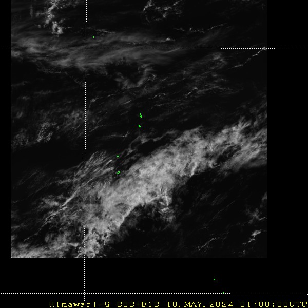
Eye now making landfall over Pinamalayan, Oriental Mindoro province
Eye now making landfall over Pinamalayan, Oriental Mindoro province
0 likes
The above post is NOT official and should not be used as such. It is my opinion and may or may not be backed by sound meteorological data. It is not endorsed by any professional institution or storm2k.org. Please refer to your official national weather agency.
WEB http://goo.gl/JDiKXB | FB https://goo.gl/N5sIle | @ManilaTC
WEB http://goo.gl/JDiKXB | FB https://goo.gl/N5sIle | @ManilaTC
-
1900hurricane
- Category 5
- Posts: 6063
- Age: 34
- Joined: Fri Feb 06, 2015 12:04 pm
- Location: Houston, TX
- Contact:
Typhoon Utor '06 is another typhoon that intensified within the Philippine Archipelago, and in a similar location and at a similar time of year.
JTWC is forecasting a 130 kt super typhoon at 12Z, which in all likelihood won't verify considering Melor will have just crossed that island, but I guess we'll find out when we get there. I'll readily admit that I'm quite curious how their next discussion will read once it's released.
JTWC is forecasting a 130 kt super typhoon at 12Z, which in all likelihood won't verify considering Melor will have just crossed that island, but I guess we'll find out when we get there. I'll readily admit that I'm quite curious how their next discussion will read once it's released.
0 likes
Contract Meteorologist. TAMU & MSST. Fiercely authentic, one of a kind. We are all given free will, so choose a life meant to be lived. We are the Masters of our own Stories.
Opinions expressed are mine alone.
Follow me on Twitter at @1900hurricane : Read blogs at https://1900hurricane.wordpress.com/
Opinions expressed are mine alone.
Follow me on Twitter at @1900hurricane : Read blogs at https://1900hurricane.wordpress.com/
WTPN51 PGTW 150300
WARNING ATCG MIL 28W NWP 151215015911
2015121500 28W MELOR 015 01 280 07 SATL 010
T000 130N 1218E 125 R064 025 NE QD 025 SE QD 025 SW QD 025 NW QD R050 065 NE QD 065 SE QD 065 SW QD 065 NW QD R034 135 NE QD 075 SE QD 075 SW QD 110 NW QD
T012 132N 1206E 130
T024 136N 1193E 120 R064 035 NE QD 035 SE QD 035 SW QD 035 NW QD R050 070 NE QD 065 SE QD 065 SW QD 070 NW QD R034 135 NE QD 100 SE QD 100 SW QD 120 NW QD
T036 140N 1184E 100 R064 035 NE QD 030 SE QD 035 SW QD 035 NW QD R050 065 NE QD 060 SE QD 065 SW QD 065 NW QD R034 130 NE QD 105 SE QD 105 SW QD 125 NW QD
T048 137N 1175E 075 R064 025 NE QD 025 SE QD 025 SW QD 025 NW QD R050 050 NE QD 050 SE QD 050 SW QD 050 NW QD R034 115 NE QD 100 SE QD 105 SW QD 115 NW QD
T072 118N 1153E 040 R034 080 NE QD 070 SE QD 070 SW QD 080 NW QD
T096 094N 1125E 020
AMP
072HR DISSIPATING AS A SIGNIFICANT TROPICAL CYCLONE OVER WATER
096HR DISSIPATED AS A SIGNIFICANT TROPICAL CYCLONE OVER WATER
SUBJ: TYPHOON 28W (MELOR) WARNING NR 015
<rest omitted>
WDPN31 PGTW 150300
MSGID/GENADMIN/JOINT TYPHOON WRNCEN PEARL HARBOR HI//
SUBJ/PROGNOSTIC REASONING FOR TYPHOON 28W (MELOR) WARNING NR 15//
RMKS//
1. FOR METEOROLOGISTS.
2. 6 HOUR SUMMARY AND ANALYSIS.
TYPHOON (TY) 28W (MELOR), LOCATED APPROXIMATELY 107 NM SOUTH-
SOUTHEAST OF MANILA, PHILIPPINES, HAS TRACKED WESTWARD AT 7 KNOTS
OVER THE PAST SIX HOURS. ANIMATED MULTISPECTRAL SATELLITE IMAGERY
(MSI) INDICATES THE TYPHOON IS UNDERGOING RAPID INTENSIFICATION
(RI), AS THE CENTRAL CORE HAS EXPANDED AND A 14 NM DIAMETER EYE HAS
APPEARED. A 142254Z SSMIS 91GHZ MICROWAVE IMAGE REVEALS AN
INPRESSIVE SOLID CONVECTIVE CORE EXTENDING 45-50 NM FROM THE
CENTER. THE INITIAL POSITION IS BASED ON THE MSI EYE WITH HIGH
CONFIDENCE. THE INITIAL INTENSITY AT THE 150000Z SYNOPTIC TIME IS
ASSESSED AT 125 KNOTS, BASED ON THE PGTW T6.5 DVORAK ESTIMATE.
SUBSEQUENT ANALYSIS INDICATES THE CYCLONE FURTHER INTENSIFIED,
HOWEVER, THE LATEST IMAGE SHOWS SIGNS THAT THIS PHASE MAY HAVE
STALLED OR ENDED.TY 28W IS UNDER THE STEERING INFLUENCE OF A DEEP
LAYERED SUBTROPICAL RIDGE (STR) TO THE NORTH.
3. FORECAST REASONING.
A. THE FORECAST INTENSITIES WERE INCREASED DUE TO THE CLEAR
INDICATION OF RI. THE FORECAST TRACK HAS ALSO BEEN MODIFIED AS A
RESULT OF THE INTENSIFICATION, WITH TY 28W NOW EXPECTED TO TRACK
FURTHER WESTWARD BEFORE TRANSITIONING TO LOW LEVEL STEERING FLOW.
THE FORECAST TRACK HAS ALSO BEEN EXTENDED TO 96 HOURS.
B. TY MELOR WILL CONTINUE TO TRACK GENERALLY WESTWARD TO WEST-
NORTHWESTWARD UNDER THE STEERING INFLUENCE OF THE STR OVER THE NEXT
36 HOURS. AFTERWARDS, THE CYCLONE WILL TURN SOUTHWESTWARD WITH THE
LOW LEVEL WIND FLOW IN THE SOUTH CHINA SEA. BASED ON SLIGHT
INTENSIFICATION, NOTED IN THE SATELLITE ANALYSIS, TY 28W IS FORECAST
TO REACH A PEAK OF 130 KNOTS WITHIN THE NEXT 12 HOURS BEFORE
BEGINNING A DISSIPATION TREND. COLD DRY AIR ASSOCIATED WITH A STRONG
CONTINENTAL COLD SURGE IN THE SOUTH CHINA SEA WILL ACCELERATE ITS
DECAY AFTER TAU 36.
C. TY MELOR IS FORECAST TO BECOME FULLY EMBEDDED IN THE COLD SURGE
FLOW AND DISSIPATE BY TAU 96. DUE THE UNCERTAINTY IN THE TIMING OF
STEERING FLOW MECHANISMS, THERE IS LOW CONFIDENCE IN THE JTWC
FORECAST.
//
NNNN
WTPQ30 RJTD 150000
RSMC TROPICAL CYCLONE PROGNOSTIC REASONING
REASONING NO. 9 FOR TY 1527 MELOR (1527)
1.GENERAL COMMENTS
REASONING OF PROGNOSIS THIS TIME IS SIMILAR TO PREVIOUS ONE.
POSITION FORECAST IS MAINLY BASED ON NWP AND PERSISTENCY.
2.SYNOPTIC SITUATION
NOTHING PARTICULAR TO EXPLAIN.
3.MOTION FORECAST
POSITION ACCURACY AT 150000 UTC IS GOOD.
TY WILL DECELERATE FOR THE NEXT 24 HOURS THEN ACCELERATE.
TY WILL MOVE WEST FOR THE NEXT 24 HOURS THEN MOVE TO WEST-SOUTHWEST.
4.INTENSITY FORECAST
TY WILL KEEP PRESENT INTENSITY FOR NEXT 24 HOURS.
FI-NUMBER WILL BE 4.5 AFTER 24 HOURS.=
0 likes
-
dexterlabio
- Category 5
- Posts: 3503
- Joined: Sat Oct 24, 2009 11:50 pm
Re: WPAC: MELOR - Typhoon
ECMWF nailed this one both in track and intensity forecast. If we were to believe its entire solution, Melor won't be weakening drastically just yet until it starts shooting to the southwest tomorrow..
0 likes
Personal Forecast Disclaimer:
The posts in this forum are NOT official forecast and should not be used as such. They are just the opinion of the poster and may or may not be backed by sound meteorological data. They are NOT endorsed by any professional institution or storm2k.org. For official information, please refer to the NHC and NWS products.
The posts in this forum are NOT official forecast and should not be used as such. They are just the opinion of the poster and may or may not be backed by sound meteorological data. They are NOT endorsed by any professional institution or storm2k.org. For official information, please refer to the NHC and NWS products.
-
ManilaTC
- WesternPacificWeather.com
- Posts: 593
- Age: 47
- Joined: Mon Oct 26, 2009 5:13 am
- Location: Mandaluyong City, Philippines
- Contact:
Haha, Melor seemes to be avoiding the mountains of mindoro and is skirting the coast of NE Mindoro Island
0 likes
The above post is NOT official and should not be used as such. It is my opinion and may or may not be backed by sound meteorological data. It is not endorsed by any professional institution or storm2k.org. Please refer to your official national weather agency.
WEB http://goo.gl/JDiKXB | FB https://goo.gl/N5sIle | @ManilaTC
WEB http://goo.gl/JDiKXB | FB https://goo.gl/N5sIle | @ManilaTC
-
dexterlabio
- Category 5
- Posts: 3503
- Joined: Sat Oct 24, 2009 11:50 pm
Re: WPAC: MELOR - Typhoon
^Seems to be the case...
http://rammb.cira.colostate.edu/ramsdis/online/loop.asp?data_folder=himawari-8/himawari-8_band_03_sector_04&width=1020&height=720&number_of_images_to_display=48&loop_speed_ms=100
http://rammb.cira.colostate.edu/ramsdis/online/loop.asp?data_folder=himawari-8/himawari-8_band_03_sector_04&width=1020&height=720&number_of_images_to_display=48&loop_speed_ms=100
0 likes
Personal Forecast Disclaimer:
The posts in this forum are NOT official forecast and should not be used as such. They are just the opinion of the poster and may or may not be backed by sound meteorological data. They are NOT endorsed by any professional institution or storm2k.org. For official information, please refer to the NHC and NWS products.
The posts in this forum are NOT official forecast and should not be used as such. They are just the opinion of the poster and may or may not be backed by sound meteorological data. They are NOT endorsed by any professional institution or storm2k.org. For official information, please refer to the NHC and NWS products.

I'm in Batangas. It seems to be veering up north to here. 
0 likes
The above post is not official and should not be used as such. It is the opinion of the poster and may or may not be backed by sound meteorological data. It is not endorsed by any professional institution or storm2k.org. For official information, please refer to the NHC and NWS products.
-
mrbagyo
- Category 5
- Posts: 3963
- Age: 33
- Joined: Thu Apr 12, 2012 9:18 am
- Location: 14.13N 120.98E
- Contact:
Re: WPAC: MELOR - Typhoon
ManilaTC wrote:Haha, Melor seemes to be avoiding the mountains of mindoro and is skirting the coast of NE Mindoro Island
yeah, Melor doesn't want to make a full-on landfall. With that, the mountains of Mindoro will only have marginal effect...
But, have you seen the latest JTWC forecast track
0 likes
The posts in this forum are NOT official forecast and should not be used as such. They are just the opinion of the poster and may or may not be backed by sound meteorological data. They are NOT endorsed by any professional institution or storm2k.org. For official information, please refer to RSMC, NHC and NWS products.
-
dexterlabio
- Category 5
- Posts: 3503
- Joined: Sat Oct 24, 2009 11:50 pm
Re:
ejeraldmc wrote:I'm in Batangas. It seems to be veering up north to here.
Where are you exactly in Batangas? And how is the weather in your area?
0 likes
Personal Forecast Disclaimer:
The posts in this forum are NOT official forecast and should not be used as such. They are just the opinion of the poster and may or may not be backed by sound meteorological data. They are NOT endorsed by any professional institution or storm2k.org. For official information, please refer to the NHC and NWS products.
The posts in this forum are NOT official forecast and should not be used as such. They are just the opinion of the poster and may or may not be backed by sound meteorological data. They are NOT endorsed by any professional institution or storm2k.org. For official information, please refer to the NHC and NWS products.
Who is online
Users browsing this forum: No registered users and 28 guests