Texas Spring 2016

U.S. & Caribbean Weather Discussions and Severe Weather Events

Moderator: S2k Moderators

Forum rules

The posts in this forum are NOT official forecast and should not be used as such. They are just the opinion of the poster and may or may not be backed by sound meteorological data. They are NOT endorsed by any professional institution or STORM2K.

Help Support Storm2K
Message
Author
User avatar
1900hurricane
Category 5
Category 5
Posts: 6059
Age: 34
Joined: Fri Feb 06, 2015 12:04 pm
Location: Houston, TX
Contact:

Re: Texas Spring 2016

#781 Postby 1900hurricane » Sun Apr 17, 2016 10:58 pm

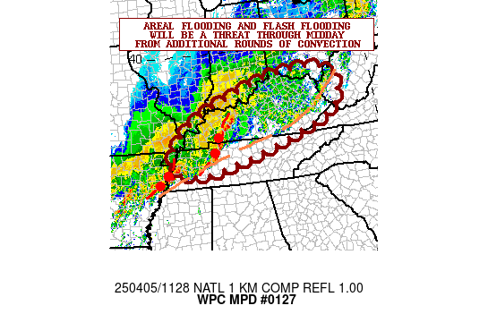
From WPC:

Image

MESOSCALE PRECIPITATION DISCUSSION 0127
NWS WEATHER PREDICTION CENTER COLLEGE PARK MD
1149 PM EDT SUN APR 17 2016

AREAS AFFECTED...SE TEXAS

CONCERNING...HEAVY RAINFALL...FLASH FLOODING LIKELY

VALID 180349Z - 180949Z

SUMMARY...MCV/COLD POOL WITHIN WARM SECTOR TO ESTABLISH REINFORCED
BOUNDARY WITH THE POTENTIAL FOR EXTREME TOTALS AND LIFE
THREATENING FLASH FLOODING THROUGH THE OVERNIGHT.


DISCUSSION...EXCELLENT UPPER LEVEL DIVERGENCE/DIFFLUENCE EXISTS
ACROSS E TX TO MAINTAIN MCS COMPLEX WITH WELL DEFINED MCV LIFTING
INTO NE TEXAS...WITH A CONVECTIVE QLCS WITH EFFICIENT HIGH RATES
UP TO 2.0"/HR AND WILL CONTINUE TO POSE A SHORT TERM FLASH
FLOODING THREAT THOUGH IT IS MOVING INTO HIGHER GUIDANCE... THIS
AREA WILL ALSO BE INCREASINGLY OBSTRUCTED BY THE COMPLEX
DEVELOPING SOUTH OF IT ACROSS NEAR/NW OF THE HOUSTON METRO ATTM.

IN THE LOW LEVELS THE BROAD 40-45KT SELY LLJ HAD BEEN TRANSPORTING
HIGH MOISTURE INTO THE LARGER COMPLEX TOWARD THE NORTH...BUT
ENOUGH CONVERGENCE LEAD TO CONVECTIVE DEVELOPMENT WHICH DUE TO
LATENT HEAT RELEASE DEVELOPED A DECENT MCV AND COLD POOL...THIS
MCV LIFTING NORTH WITH ATTENDANT COLD POOL/OUTFLOW BOUNDARY HAS
ESTABLISHED A CONVECTIVE LINE FROM COLORADO TO MONTGOMERY COUNTY
WHICH DUE TO ORIENTATION WITH THE MCV TO THE NORTH SHOULD CONTINUE
TO REINFORCE THE ALIGNMENT OF THE BOUNDARY AND ACT AS A NEARLY
STATIONARY CONVECTIVE INITIATION POINT FOR DEEP MST FLUX WITH TPWS
TO 1.75-2.0" AND SBCAPES MAINTAINED FROM THE GULF IN THE 1500-2000
J/KG RANGE WITHIN A ENVIRONMENT FOR WARM CLOUD HVY RAINFALL
PRODUCTION WITH RATES IN EXCESS OF 3"/HR WITH POTENTIAL FOR 4"/HR
OR HIGHER NOT OUT OF THE REALM OF POSSIBILITY. WITH LITTLE
MOVEMENT...EXTREME TOTALS AND LIFE THREATENING FLASH FLOODING ARE
LIKELY.

THE SIGNAL FOR 6HR TOTALS IN EXCESS OF 7" HAS BEEN FAIRLY
CONSISTENT WITHIN LARGE SCALE GUIDANCE FOR A FEW DAYS...JUST NOT
SURE IN EXACT LOCATION. RECENT HI-RES CAMS...SUCH AS THE HRRR AND
ESRL EXP. HURR OVER 9" BY 10Z...THOUGH GIVEN RADAR TRENDS THIS IS
A FEW COUNTIES NORTH AND WEST OF CURRENT SETUP.


GALLINA

ATTN...WFO...EWX...FWD...HGX...LCH...SHV...

ATTN...RFC...WGRFC...

LAT...LON 31849591 31849495 30849445 29709479 28949631
29569742 30489749 31149667
0 likes   
Contract Meteorologist. TAMU & MSST. Fiercely authentic, one of a kind. We are all given free will, so choose a life meant to be lived. We are the Masters of our own Stories.
Opinions expressed are mine alone.

Follow me on Twitter at @1900hurricane : Read blogs at https://1900hurricane.wordpress.com/

User avatar
Texas Snowman
Storm2k Moderator
Storm2k Moderator
Posts: 6179
Joined: Fri Jan 25, 2008 11:29 am
Location: Denison, Texas

Re: Texas Spring 2016

#782 Postby Texas Snowman » Mon Apr 18, 2016 3:34 am

@hcfcd -- Incredible 1.64 inches in 15 minutes over NW Harris County. Total nearing 13 in. Devastating event. #houwx #hounews
0 likes   
The above post and any post by Texas Snowman is NOT an official forecast and should not be used as such. It is just the opinion of the poster and may or may not be backed by sound meteorological data. It is NOT endorsed by any professional institution including storm2k.org. For official information, please refer to NWS products.

User avatar
Texas Snowman
Storm2k Moderator
Storm2k Moderator
Posts: 6179
Joined: Fri Jan 25, 2008 11:29 am
Location: Denison, Texas

Re: Texas Spring 2016

#783 Postby Texas Snowman » Mon Apr 18, 2016 3:38 am

@JeffLindner1 -- Flash flood emergency NW Harris County. Stay where you are. This is a life threatening situation # houwx #hounews
0 likes   
The above post and any post by Texas Snowman is NOT an official forecast and should not be used as such. It is just the opinion of the poster and may or may not be backed by sound meteorological data. It is NOT endorsed by any professional institution including storm2k.org. For official information, please refer to NWS products.

User avatar
Texas Snowman
Storm2k Moderator
Storm2k Moderator
Posts: 6179
Joined: Fri Jan 25, 2008 11:29 am
Location: Denison, Texas

Re: Texas Spring 2016

#784 Postby Texas Snowman » Mon Apr 18, 2016 3:42 am

FLASH FLOOD WARNING
TXC201-181000-
/O.NEW.KHGX.FF.W.0010.160418T0704Z-160418T1000Z/
/00000.0.ER.000000T0000Z.000000T0000Z.000000T0000Z.OO/

BULLETIN - EAS ACTIVATION REQUESTED
FLASH FLOOD WARNING
NATIONAL WEATHER SERVICE HOUSTON/GALVESTON TX
204 AM CDT MON APR 18 2016

...FLASH FLOOD EMERGENCY...

THE NATIONAL WEATHER SERVICE IN LEAGUE CITY HAS ISSUED A

* FLASH FLOOD WARNING FOR...
NORTHWESTERN HARRIS COUNTY IN SOUTHEASTERN TEXAS...

* UNTIL 500 AM CDT

* AT 157 AM CDT...FLASH FLOODING IS ALREADY OCCURRING. NUMEROUS HIGH WATER
RESCUES ARE OCCURRING DUE TO 5 TO 9 INCHES OF RAINFALL WITH ADDITIONAL
HEAVY RAINFALL POSSIBLE. NUMEROUS HOMES ARE BEING AFFECTED NEAR HORSEPEN CREEK.

THIS IS A FLASH FLOOD EMERGENCY. THIS IS A PARTICULARLY DANGEROUS SITUATION.

* SOME LOCATIONS THAT WILL EXPERIENCE FLOODING INCLUDE...
TOMBALL...JERSEY VILLAGE...ADDICKS PARK TEN...NORTHERN ELDRIDGE / WEST
OAKS...WILLOWBROOK.

PRECAUTIONARY/PREPAREDNESS ACTIONS...

THIS IS AN EXTREMELY DANGEROUS AND LIFE-THREATENING SITUATION. DO NOT
ATTEMPT TO TRAVEL UNLESS YOU ARE FLEEING AN AREA SUBJECT TO FLOODING
OR UNDER AN EVACUATION ORDER.

TURN AROUND...DON`T DROWN WHEN ENCOUNTERING FLOODED ROADS. MOST FLOOD
DEATHS OCCUR IN VEHICLES.

BE ESPECIALLY CAUTIOUS AT NIGHT WHEN IT IS HARDER TO RECOGNIZE THE
DANGERS OF FLOODING.

&&

LAT...LON 2999 9553 2988 9556 2976 9567 2977 9570
2979 9574 2997 9567 3012 9562 3014 9558
3004 9555
0 likes   
The above post and any post by Texas Snowman is NOT an official forecast and should not be used as such. It is just the opinion of the poster and may or may not be backed by sound meteorological data. It is NOT endorsed by any professional institution including storm2k.org. For official information, please refer to NWS products.

User avatar
Texas Snowman
Storm2k Moderator
Storm2k Moderator
Posts: 6179
Joined: Fri Jan 25, 2008 11:29 am
Location: Denison, Texas

Re: Texas Spring 2016

#785 Postby Texas Snowman » Mon Apr 18, 2016 3:47 am

@JeffLindner1 -- Average just over 7 in or 32.4 billion gallons over Cypress Creek in last 12 hrs. #houwx #hounews #txwx
0 likes   
The above post and any post by Texas Snowman is NOT an official forecast and should not be used as such. It is just the opinion of the poster and may or may not be backed by sound meteorological data. It is NOT endorsed by any professional institution including storm2k.org. For official information, please refer to NWS products.

User avatar
Texas Snowman
Storm2k Moderator
Storm2k Moderator
Posts: 6179
Joined: Fri Jan 25, 2008 11:29 am
Location: Denison, Texas

Re: Texas Spring 2016

#786 Postby Texas Snowman » Mon Apr 18, 2016 3:48 am

@NWSHouston -- Tornado Warning for Harris County until 415AM. Any tornado from this storm may be rain wrapped. #houwx #txwx weather.gov/images/crh/imp…
0 likes   
The above post and any post by Texas Snowman is NOT an official forecast and should not be used as such. It is just the opinion of the poster and may or may not be backed by sound meteorological data. It is NOT endorsed by any professional institution including storm2k.org. For official information, please refer to NWS products.

User avatar
jasons2k
Storm2k Executive
Storm2k Executive
Posts: 8245
Age: 51
Joined: Wed Jul 06, 2005 12:32 pm
Location: The Woodlands, TX

Re: Texas Spring 2016

#787 Postby jasons2k » Mon Apr 18, 2016 4:15 am

Incredible rains and lightning here. Nonstop for hours. Power has been on and off - off again. It's also hailing in the heavier downpours. Wow.
0 likes   

User avatar
Annie Oakley
Category 5
Category 5
Posts: 1103
Joined: Tue Jul 31, 2007 12:54 pm
Location: Texas

Re: Texas Spring 2016

#788 Postby Annie Oakley » Mon Apr 18, 2016 4:27 am

Houston is getting hammered-and more to come.
http://alerts.weather.gov/cap/tx.php?x=1
0 likes   

User avatar
1900hurricane
Category 5
Category 5
Posts: 6059
Age: 34
Joined: Fri Feb 06, 2015 12:04 pm
Location: Houston, TX
Contact:

Re: Texas Spring 2016

#789 Postby 1900hurricane » Mon Apr 18, 2016 5:05 am

Don't think I've ever seen a PDS Flash Flood Emergency before.
0 likes   
Contract Meteorologist. TAMU & MSST. Fiercely authentic, one of a kind. We are all given free will, so choose a life meant to be lived. We are the Masters of our own Stories.
Opinions expressed are mine alone.

Follow me on Twitter at @1900hurricane : Read blogs at https://1900hurricane.wordpress.com/

User avatar
Texas Snowman
Storm2k Moderator
Storm2k Moderator
Posts: 6179
Joined: Fri Jan 25, 2008 11:29 am
Location: Denison, Texas

Re: Texas Spring 2016

#790 Postby Texas Snowman » Mon Apr 18, 2016 5:08 am

@JeffLindner1 -- Langham Creek nearing 500-yr level
0 likes   
The above post and any post by Texas Snowman is NOT an official forecast and should not be used as such. It is just the opinion of the poster and may or may not be backed by sound meteorological data. It is NOT endorsed by any professional institution including storm2k.org. For official information, please refer to NWS products.

User avatar
Texas Snowman
Storm2k Moderator
Storm2k Moderator
Posts: 6179
Joined: Fri Jan 25, 2008 11:29 am
Location: Denison, Texas

Re: Texas Spring 2016

#791 Postby Texas Snowman » Mon Apr 18, 2016 5:09 am

@NWSHouston -- Rainfall through 430 am. Over 16 inches measured nr county border. dangerous flooding. stay off roads where flooded.
0 likes   
The above post and any post by Texas Snowman is NOT an official forecast and should not be used as such. It is just the opinion of the poster and may or may not be backed by sound meteorological data. It is NOT endorsed by any professional institution including storm2k.org. For official information, please refer to NWS products.

User avatar
Texas Snowman
Storm2k Moderator
Storm2k Moderator
Posts: 6179
Joined: Fri Jan 25, 2008 11:29 am
Location: Denison, Texas

Re: Texas Spring 2016

#792 Postby Texas Snowman » Mon Apr 18, 2016 5:11 am

@NWSHouston -- FLASH FLOOD EMERGENCY has been issued for much of SE TX until 9AM! This is a very dangerous situation! #houwx #txwx
0 likes   
The above post and any post by Texas Snowman is NOT an official forecast and should not be used as such. It is just the opinion of the poster and may or may not be backed by sound meteorological data. It is NOT endorsed by any professional institution including storm2k.org. For official information, please refer to NWS products.

User avatar
Texas Snowman
Storm2k Moderator
Storm2k Moderator
Posts: 6179
Joined: Fri Jan 25, 2008 11:29 am
Location: Denison, Texas

Re: Texas Spring 2016

#793 Postby Texas Snowman » Mon Apr 18, 2016 5:12 am

@weatherchannel -- 4:50 am CT: At least 60 water rescues ongoing in parts of Harris County, Texas (Houston metro area).
0 likes   
The above post and any post by Texas Snowman is NOT an official forecast and should not be used as such. It is just the opinion of the poster and may or may not be backed by sound meteorological data. It is NOT endorsed by any professional institution including storm2k.org. For official information, please refer to NWS products.

User avatar
Annie Oakley
Category 5
Category 5
Posts: 1103
Joined: Tue Jul 31, 2007 12:54 pm
Location: Texas

Re: Texas Spring 2016

#794 Postby Annie Oakley » Mon Apr 18, 2016 5:29 am

HCFCD ‏@hcfcd 12m12 minutes ago

Flash flood emergency until 9 am - life threatening flooding ongoing throughout Harris County. #hounews

https://twitter.com/hcfcd?ref_src=twsrc^tfw
0 likes   

User avatar
Annie Oakley
Category 5
Category 5
Posts: 1103
Joined: Tue Jul 31, 2007 12:54 pm
Location: Texas

Re: Texas Spring 2016

#795 Postby Annie Oakley » Mon Apr 18, 2016 6:00 am

Message: NOAA-NWS-ALERTS-TX1255F68F4964.FlashFloodWarning.1255F68FCF60TX.HGXFFWHGX.d4a182f2513be30f8dcfdfeb847e7f8d from w-nws.webmaster@noaa.gov
Sent: 05:57 CDT on 04-18-2016
Effective: 05:57 CDT on 04-18-2016
Expires: 09:00 CDT on 04-18-2016
Event: Flash Flood Warning
Alert:

...FLASH FLOOD EMERGENCY EXPANDED TO THE EAST...

THE NATIONAL WEATHER SERVICE IN LEAGUE CITY HAS ISSUED A

* FLASH FLOOD WARNING FOR...
SOUTHEASTERN MONTGOMERY COUNTY IN SOUTHEASTERN TEXAS...
NORTHWESTERN HARRIS COUNTY IN SOUTHEASTERN TEXAS...

* UNTIL 900 AM CDT

* AT 552 AM CDT...DOPPLER RADAR CONTINUED TO INDICATE HEAVY RAIN ACROSS THE WARNED
AREA. FLASH FLOODING IS OCCURRING. BUSH INTERCONTINENTAL AIRPORT IS APPROACHING
9 INCHES OF RAINFALL.
RAINFALL RATES ARE RANGING BETWEEN 2 TO 4 INCHES AN HOUR.
THIS IS A FLASH FLOOD EMERGENCY. THIS IS A PARTICULARLY DANGEROUS SITUATION.

* SOME LOCATIONS THAT WILL EXPERIENCE FLOODING INCLUDE...
HUMBLE...KATY...JERSEY VILLAGE...SPRING...THE WOODLANDS...ELDRIDGE /
WEST OAKS...GREATER GREENSPOINT...SOUTHEASTERN ADDICKS PARK TEN...
SPRING BRANCH NORTH...SPRING BRANCH WEST...ALDINE...KINGWOOD...OAK
RIDGE NORTH...SHENANDOAH...WOODLOCH...GREATER INWOOD...WESTBRANCH...BUSH
INTERCONTINENTAL AIRPORT...PORTER HEIGHTS AND SPLASHTOWN.
0 likes   

CajunMama
Retired Staff
Retired Staff
Posts: 10791
Joined: Thu Feb 06, 2003 9:57 pm
Location: 30.22N, 92.05W Lafayette, LA

Re: Texas Spring 2016

#796 Postby CajunMama » Mon Apr 18, 2016 6:23 am

Vbhoutex has water in his utility room. Yankeegirl has water almost in her home and she also experienced hail. I'm not sure how others are faring.
0 likes   

User avatar
Annie Oakley
Category 5
Category 5
Posts: 1103
Joined: Tue Jul 31, 2007 12:54 pm
Location: Texas

Re: Texas Spring 2016

#797 Postby Annie Oakley » Mon Apr 18, 2016 6:48 am

Live news from Houston

http://abc13.com/live/23374/
0 likes   

User avatar
TeamPlayersBlue
Category 5
Category 5
Posts: 3445
Joined: Tue Feb 02, 2010 1:44 am
Location: Denver/Applewood, CO

Re: Texas Spring 2016

#798 Postby TeamPlayersBlue » Mon Apr 18, 2016 7:06 am

I have a pic of 5" per hour rain rate on my PWS. I've NEVER seen it that high before. Saw 4" per hour last May and thought i would never see that
0 likes   
Personal Forecast Disclaimer:
The posts in this forum are NOT official forecast and should not be used as such. They are just the opinion of the poster and may or may not be backed by sound meteorological data. They are NOT endorsed by any professional institution or storm2k.org. For official information, please refer to the NHC and NWS products.

User avatar
gboudx
S2K Supporter
S2K Supporter
Posts: 4080
Joined: Thu Sep 04, 2003 1:39 pm
Location: Rockwall, Tx but from Harvey, La

Re: Texas Spring 2016

#799 Postby gboudx » Mon Apr 18, 2016 7:23 am

Jeff has posted many updates overnight and this is the most recent:

THIS IS A LIFE THREATENING SITUATION

Rainfall last 12-hrs of 10-15 inches over NW Harris County leading to very significant flash flood event. Numerous reports of house flooding from at least 40 different subdivisions from both rainfall and channels. Many homes are flooding that have likely not flooded before based on channel water levels in the Addicks watershed.

Major flooding (structures)

Greens Bayou
White Oak Bayou
Cypress Creek
Horsepen Creek
Langham Creek
South Mayde Creek
Bear Creek
Little Cypress Creek
Willow Creek
Spring Creek
Halls Bayou

Tremendous number of calls requesting water rescue from many different areas.

Forecast:
Catastrophic training event refuses to end with new development to the west which may come up over already hard hit areas of Waller and N Harris County. Storm totals for 12-18 hours could push 15-20 inches.


Prayers for folks affected by this flooding. I only have to deal with a new roof from hail. This is much worse.
0 likes   

User avatar
wxman57
Moderator-Pro Met
Moderator-Pro Met
Posts: 22979
Age: 67
Joined: Sat Jun 21, 2003 8:06 pm
Location: Houston, TX (southwest)

Re: Texas Spring 2016

#800 Postby wxman57 » Mon Apr 18, 2016 7:26 am

Mark Sudduth put out some cameras yesterday. The one over Brays Bayou at rice is near my house. It's the area that flooded badly last year. Brays Bayou is nearing the top of its banks now, and more rain is coming.

http://hurricanetrack.com/flood/
0 likes   


Return to “USA & Caribbean Weather”

Who is online

Users browsing this forum: Google Adsense [Bot] and 30 guests