#129 Postby northjaxpro » Thu Jun 02, 2016 5:27 pm
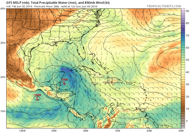
I am inclined to believe those of you who are using T.S. Debby in 2012 as an analog for this potential system that may impact the Florida peninsula next week. This potential system has the similar make-up as to what Debby had, which was a development from a monsoonal gyre which propagated northward. Like Debby in 2012, this potential system I believe will be lopsided due to increasing westerly shear beginning on Monday as a front approaches from the NW GOM. Also, just like Debby, this system next week has to potential to drop a substantial amount of rain across Florida. However, the saving grace this time, as opposed to Debby in 2012, will be that this system should get picked up and move quickly across Florida with the upper trough early week. This should hopefully prevent a repeat of the massive flooding event which occured with Debby across a good portion of the peninsula, including my locale, which picked up over 15 inches during that event.
I have noticed the recent EURO runs have shifted a bit more north and west with this potential system, showing a TS nearing the NE GOM region on 12Z Tuesday morning. Interesting there for that run, as if it were to verify, that would shift the heaviest rain north up the peninsula into Central and portions of North and Northeast Florida on Tuesday into Wednesday of next week with the system moving over the peninsula. Very interesting times ahead. 2016 Atlantic Hurricane Season is alive and roaring here at the start for sure in our region of the basin!
0 likes
NEVER, EVER SAY NEVER in the tropics and weather in general, and most importantly, with life itself!!
________________________________________________________________________________________
Fay 2008 Beryl 2012 Debby 2012 Colin 2016 Hermine 2016 Julia 2016 Matthew 2016 Irma 2017 Dorian 2019


