http://www.ndbc.noaa.gov/station_page.php?station=42056
Moderator: S2k Moderators


caneman wrote:What is everyone's guess on max intensity in the gulf?


NHC Atlantic Ops
@NHC_Atlantic
Today’s recon flight for the northwestern Caribbean Sea disturbance has been cancelled. Another one planned for Sunday afternoon.
NHC Atlantic Ops
@NHC_Atlantic
Today’s recon flight for the northwestern Caribbean Sea disturbance has been cancelled. Another one planned for Sunday afternoon.


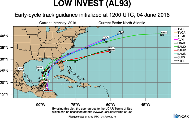
northjaxpro wrote:Based on the tightly clustered track guidance by the models within 72-96 hours of potential impact and landfall on the Florida peninsula, I can safely assume that the center will make landfall anywhere from Apalachicola down to Fort Myers. I am inclined to take the EURO's solution of a landfall farther north from Appalachicola to Cedar Key currently. But regardless as to where the center will make landfall, shear will likely make 93L/Colin a very lopsided cyclone, with the heaviest weather to the east of the COC, which will cover 80% of the peninsula. The only exception may be the extreme western Panhandle areas west of the Apalachicola River, which may miss most of the storm's rain/turbulent action being on its western side. However, if the EURO keeps trending north and west, the folks in the extreme western panhandle will have to monitor this as well as time progresses.
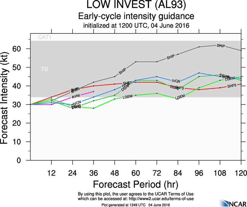
wxman57 wrote:TC forecasts rarely seem as straightforward as this one. Steering currents are well-established to take this disturbance to the Florida Peninsula a bit north of (or near) Tampa Monday night/Tuesday morning as a sheared tropical storm with winds 35-40 kts (over water). There should be little in the way of squalls to the left of the track (like in Georgia, as someone inquired). Heaviest rain will occur from Tampa/Orlando southward across the Peninsula from Monday afternoon through Tuesday. I doubt any locations on land will record sustained TS winds, perhaps some coastal buoys will.
Users browsing this forum: No registered users and 9 guests