Moderator: S2k Moderators


tarheelprogrammer wrote:GFS seems to be taking a weak TD into FL/GA. Hmmm.
TheStormExpert wrote:tarheelprogrammer wrote:GFS seems to be taking a weak TD into FL/GA. Hmmm.
Weakens upon approach which can be questionable with the Gulf Stream, but interestingly strengthens rapidly upon leaving the SC Coast on approach towards the Canadian Maritimes in the Long-Range.
tarheelprogrammer wrote:TheStormExpert wrote:tarheelprogrammer wrote:GFS seems to be taking a weak TD into FL/GA. Hmmm.
Weakens upon approach which can be questionable with the Gulf Stream, but interestingly strengthens rapidly upon leaving the SC Coast on approach towards the Canadian Maritimes in the Long-Range.
Yeah I seen that. Still need to see more runs to believe it though and see the Euro come on board.
TheStormExpert wrote:tarheelprogrammer wrote:TheStormExpert wrote:Weakens upon approach which can be questionable with the Gulf Stream, but interestingly strengthens rapidly upon leaving the SC Coast on approach towards the Canadian Maritimes in the Long-Range.
Yeah I seen that. Still need to see more runs to believe it though and see the Euro come on board.
This mornings 00z Euro run hints very slightly of something but we need to see future runs for sure.
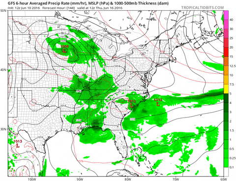
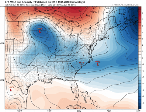
Alyono wrote:MU isn't a weak TD
It is probably a decent TS. Look at the strong pressure gradient
Alyono wrote:MU isn't a weak TD
It is probably a decent TS. Look at the strong pressure gradient
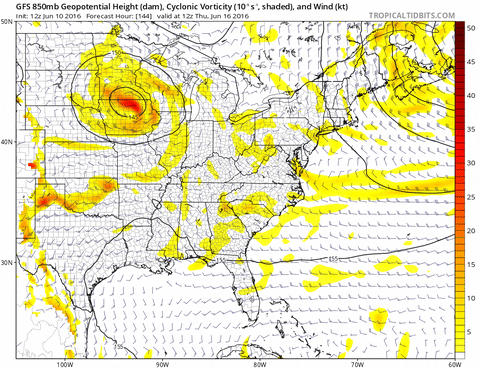
NDG wrote::uarrow: 12z Euro does show the potential for tropical or subtropical development with the trough dropping down east of the US east coast with plenty of vorticity and good UL conditions, but it still early in the game to know for sure since this is in the 7-10 day range which is still in the fantasy land.
TheStormExpert wrote:Alyono wrote:MU isn't a weak TD
It is probably a decent TS. Look at the strong pressure gradient
Into NE Florida it's a Weak TD at best, but exiting the Carolinas it is likely no doubt a Strong TS.
Users browsing this forum: No registered users and 340 guests


