
ATL: DANIELLE - Remnants - Discussion
Moderator: S2k Moderators
-
cycloneye

- Admin

- Posts: 149472
- Age: 69
- Joined: Thu Oct 10, 2002 10:54 am
- Location: San Juan, Puerto Rico
Re: ATL: INVEST 94L - Models
0 likes
Visit the Caribbean-Central America Weather Thread where you can find at first post web cams,radars
and observations from Caribbean basin members Click Here
and observations from Caribbean basin members Click Here
-
Yellow Evan

- Professional-Met

- Posts: 16240
- Age: 27
- Joined: Fri Jul 15, 2011 12:48 pm
- Location: Henderson, Nevada/Honolulu, HI
- Contact:
ATL: INVEST 94L - Discussion
Code: Select all
                    * ATLANTIC     SHIPS INTENSITY FORECAST          *
                    * IR SAT DATA AVAILABLE,       OHC AVAILABLE     *
                    *  INVEST      AL942016  06/19/16  00 UTC        *

TIME (HR)          0     6    12    18    24    36    48    60    72    84    96   108   120
V (KT) NO LAND    25    27    28    29    30    32    33    33    33    36    38    41    43
V (KT) LAND       25    27    28    29    30    32    28    27    27    32    34    37    39
V (KT) LGEM       25    26    27    27    26    25    23    26    26    31    33    35    37
Storm Type      TROP  TROP  TROP  TROP  TROP  TROP  TROP  TROP  TROP  TROP  TROP  TROP  TROP

SHEAR (KT)        27    27    22    20    20    12     8     5    10    10    14    12    10
SHEAR ADJ (KT)    -1     0    -2    -3    -2     0    -3     8     3     5     4     2     1
SHEAR DIR        243   254   253   252   256   307   311   359    15    47    55    67    76
SST (C)         29.4  29.6  29.6  29.5  29.3  28.9  28.5  28.5  28.3  26.3  24.1  24.1  24.1
POT. INT. (KT)   157   160   161   160   156   150   145   146   143   118   100   100   100
ADJ. POT. INT.   143   146   148   148   143   139   136   139   136   111    94    95    94
200 MB T (C)   -52.9 -53.1 -53.6 -53.6 -53.4 -53.6 -53.1 -53.4 -53.3 -53.6 -53.2 -53.4 -53.5
200 MB VXT (C)  -0.2  -0.2  -0.3  -0.2  -0.2  -0.2  -0.2   0.0  -0.1   0.0   0.0   0.0   0.0
TH_E DEV (C)      10     9     7     8    10     8    12     9    11     5     5     2     1
700-500 MB RH     69    70    69    70    73    70    69    68    62    59    52    51    43
MODEL VTX (KT)    11    11    11    10     9     9     6     4     2  LOST  LOST  LOST  LOST
850 MB ENV VOR     6     2   -22   -21    -6   -18   -14   -20   -24   -23   -36   -48   -46
200 MB DIV        39    27    11     0    19    16    22    -5    -4   -25   -17   -33    -9
700-850 TADV      -3   -11   -11     0     3    -7    -5     0    -3     5    -3     3     3
LAND (KM)         88   144   180   254   264   103   -95  -367   -47   221   276   501   738
LAT (DEG N)     19.6  19.9  20.2  20.7  21.2  21.7  21.7  21.3  20.9  20.7  20.5  20.1  19.7
LONG(DEG W)     91.7  92.2  92.8  93.6  94.4  96.2  98.7 101.6 104.8 107.8 110.7 113.8 116.9
STM SPEED (KT)     6     6     8     9     8    10    13    15    15    14    14    15    14
HEAT CONTENT      29    22    20    24    26    28     7     0    18     0     0     0     0
0 likes


Re: ATL: INVEST 94L - Discussion
tatertawt24 wrote:Nice blowup of convection but you can tell it's fighting shear to the west.
Convection has weakened significantly, but is this D-min?
0 likes
The above post is not official and should not be used as such. It is the opinion of the poster and may or may not be backed by sound meteorological data. It is not endorsed by any professional institution or storm2k.org. For official information, please refer to the NHC and NWS products.

Re: ATL: INVEST 94L - Discussion
I think we'll start seeing some big convective blow up's shortly. As a footnote, HWRF seems to initialize 94L a full degree further north, though I can see that this might be a bit more "centered" within the broader low pressure center. Perhaps this is simply an expression of the near term motion of the already identified tight center seen earlier on vis. satellite. Additionally, this model seems to be particularly quick in moving the system briskly towards the WNW
0 likes
Andy D
(For official information, please refer to the NHC and NWS products.)
(For official information, please refer to the NHC and NWS products.)
Re: ATL: INVEST 94L - Discussion
the convection will likely dissipate tonight. However, I'd expect another blow up in the morning as the low continues to become better defined
0 likes
-
stormwise

-
Yellow Evan
- Professional-Met
- Posts: 16240
- Age: 27
- Joined: Fri Jul 15, 2011 12:48 pm
- Location: Henderson, Nevada/Honolulu, HI
- Contact:
Re: ATL: INVEST 94L - Discussion
Convection is decreasing and shear looks toxic, but I still expect this to develop, thanks to the curvature of the coastline.


0 likes
-
wxman57

- Moderator-Pro Met

- Posts: 23174
- Age: 68
- Joined: Sat Jun 21, 2003 8:06 pm
- Location: Houston, TX (southwest)
Re: ATL: INVEST 94L - Discussion
Zero convection tonight, but the NHC seems intent on naming something eventually. Could be called a depression before it moves into Mexico on Monday. No big deal unless it manages to build some squalls before then, resulting in some heavy rainfall for Mexico.
0 likes
-
tarheelprogrammer

- S2K Supporter

- Posts: 1793
- Joined: Mon Mar 28, 2016 9:25 pm
- Location: Raleigh, NC area (Garner, NC)
Re: ATL: INVEST 94L - Discussion
Giving this a 20 % chance now. Down from 50 % earlier. Shear will probably win again like it has for so many years now. Good news for Mexico. They could use some good news after the beating their men's soccer team just took.
0 likes
My posts are not official forecasts. They are just my opinion and may or may not be backed by sound meteorological data. They are NOT endorsed by any professional institution or storm2k.org. For official information, please refer to the NHC and NWS products.
Re: ATL: INVEST 94L - Discussion
Up to 70%.
1. A large low pressure system, centered over the central Bay of
Campeche about 300 miles east-southeast of Tuxpan, Mexico, is
producing widespread cloudiness and disorganized showers and
thunderstorms over much of the Bay of Campeche, southern Gulf of
Mexico, and the Yucatan peninsula. The low is moving westward to
west-northwestward at around 10 mph and is forecast to reach the
coast of eastern Mexico on Monday. Although upper-level winds are
only marginally conducive, a tropical depression is still expected
to form during the next day or so. An Air Force Reserve Hurricane
Hunter aircraft is scheduled to investigate the low this afternoon,
if necessary. For additional information on this system, see High
Seas Forecasts issued by the National Weather Service.
* Formation chance through 48 hours...high...70 percent
* Formation chance through 5 days...high...70 percent
0 likes
Personal Forecast Disclaimer:
The posts in this forum are NOT official forecast and should not be used as such. They are just the opinion of the poster and may or may not be backed by sound meteorological data. They are NOT endorsed by any professional institution or storm2k.org. For official information, please refer to RSMC and NWS products.
The posts in this forum are NOT official forecast and should not be used as such. They are just the opinion of the poster and may or may not be backed by sound meteorological data. They are NOT endorsed by any professional institution or storm2k.org. For official information, please refer to RSMC and NWS products.
-
stormwise
Re: ATL: INVEST 94L - Discussion
I had a look at 51 EPS ens members for nada to a TD, EC 00Z deterministic also no TC. Likely just rain if the ens and 00z determistic verify.
Did not look at the GFS.
Did not look at the GFS.
0 likes

Re: ATL: INVEST 94L - Discussion
Convection building this morning, shear is dropping. I agree with the NHC of this becoming at least a TD before moving inland. We have seen it time and time again systems form over the BOC with very little if any global model support.
0 likes
-
cycloneye
- Admin
- Posts: 149472
- Age: 69
- Joined: Thu Oct 10, 2002 10:54 am
- Location: San Juan, Puerto Rico
Re: ATL: INVEST 94L - Discussion
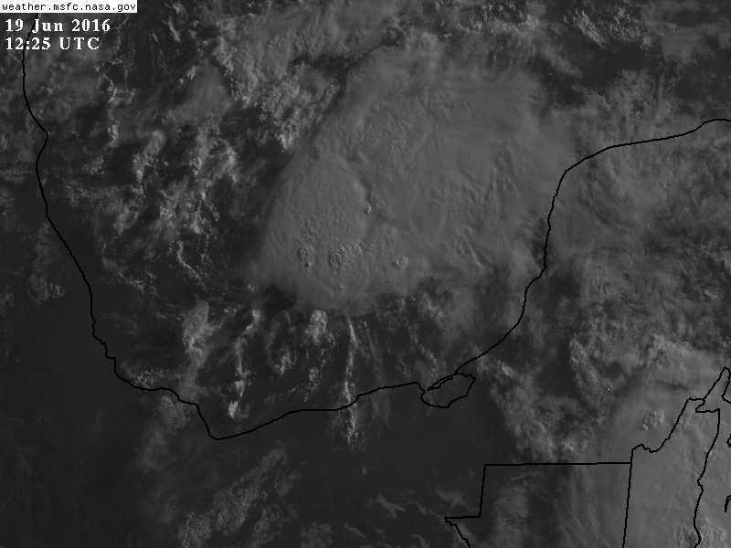
TROPICAL WEATHER OUTLOOK
NWS NATIONAL HURRICANE CENTER MIAMI FL
800 AM EDT SUN JUN 19 2016
For the North Atlantic...Caribbean Sea and the Gulf of Mexico:
A low pressure system located over the central Bay of Campeche
about 200 miles east of Tuxpan, Mexico is producing an area of
showers and thunderstorms over the southwestern Gulf of Mexico.
The low is moving westward to west-northwestward at around 10 mph
and is forecast to reach the coast of eastern Mexico on Monday.
Although upper-level winds are only marginally conducive, a tropical
depression is still likely to form later today or on Monday.
An Air Force Reserve Hurricane Hunter aircraft is scheduled to
investigate the low this afternoon, if necessary. Regardless of
whether or not a tropical cyclone develops, areas of heavy rain are
expected over portions of eastern Mexico tonight through Tuesday.
These rains could could cause life-threatening flash floods and
mud slides, especially in areas of high terrain. For additional
information on this system, see High Seas Forecasts issued by the
National Weather Service.
* Formation chance through 48 hours...high...70 percent
* Formation chance through 5 days...high...70 percent
&&
High Seas Forecasts issued by the National Weather Service are
available under AWIPS header NFDHSFAT1, WMO header FZNT01 KWBC, and
on the Web at http://www.opc.ncep.noaa.gov/shtml/NFDHSFAT1.shtml.
$$
Forecaster Cangialosi
0 likes
Visit the Caribbean-Central America Weather Thread where you can find at first post web cams,radars
and observations from Caribbean basin members Click Here
and observations from Caribbean basin members Click Here
-
cycloneye
- Admin
- Posts: 149472
- Age: 69
- Joined: Thu Oct 10, 2002 10:54 am
- Location: San Juan, Puerto Rico
Re: ATL: INVEST 94L - Discussion
Up to 30kts at 12z Best Track.
AL, 94, 2016061912, , BEST, 0, 203N, 943W, 30, 1008, LO
AL, 94, 2016061912, , BEST, 0, 203N, 943W, 30, 1008, LO
0 likes
Visit the Caribbean-Central America Weather Thread where you can find at first post web cams,radars
and observations from Caribbean basin members Click Here
and observations from Caribbean basin members Click Here
Re: ATL: INVEST 94L - Discussion
I think is a TD already, LLC appears to be right on the left edge of the convection.

0 likes
-
tarheelprogrammer
- S2K Supporter
- Posts: 1793
- Joined: Mon Mar 28, 2016 9:25 pm
- Location: Raleigh, NC area (Garner, NC)
Re: ATL: INVEST 94L - Recon
Recon cancelled?
0 likes
My posts are not official forecasts. They are just my opinion and may or may not be backed by sound meteorological data. They are NOT endorsed by any professional institution or storm2k.org. For official information, please refer to the NHC and NWS products.
Re: ATL: INVEST 94L - Recon
tarheelprogrammer wrote:Recon cancelled?
Still scheduled to go this afternoon.
0 likes
-
SouthDadeFish

- Professional-Met
- Posts: 2835
- Joined: Thu Sep 23, 2010 2:54 pm
- Location: Miami, FL
- Contact:
Re: ATL: INVEST 94L - Discussion
The odds of 94L becoming a TC are at least 80% in my opinion. My thinking is recon will confirm a TC has formed this afternoon, although the NHC could call it at 15Z, but I doubt they will. If convection can persist, I wouldn't be surprised if recon finds some TS force winds in the squalls. Even if not, the GFS suggests upper-level winds will lighten over the next few hours and TS formation could still occur prior to landfall in Mexico. Regardless, the main threat will be heavy rainfall, particularly in the mountainous regions. Hopefully, dissipation will occur quickly.
0 likes
-
tarheelprogrammer
- S2K Supporter
- Posts: 1793
- Joined: Mon Mar 28, 2016 9:25 pm
- Location: Raleigh, NC area (Garner, NC)
Re: ATL: INVEST 94L - Recon
NDG wrote:tarheelprogrammer wrote:Recon cancelled?
Still scheduled to go this afternoon.
Okay thanks as always.
0 likes
My posts are not official forecasts. They are just my opinion and may or may not be backed by sound meteorological data. They are NOT endorsed by any professional institution or storm2k.org. For official information, please refer to the NHC and NWS products.
-
cycloneye
- Admin
- Posts: 149472
- Age: 69
- Joined: Thu Oct 10, 2002 10:54 am
- Location: San Juan, Puerto Rico
Re: ATL: INVEST 94L - Recon
Plane will fly this afternoon with the departure at 15:30 UTC.
WEATHER RECONNAISSANCE FLIGHTS
CARCAH, NATIONAL HURRICANE CENTER, MIAMI, FL.
0945 AM EDT SUN 19 JUNE 2016
SUBJECT: TROPICAL CYCLONE PLAN OF THE DAY (TCPOD)
VALID 20/1100Z TO 21/1100Z JUNE 2016
TCPOD NUMBER.....16-024
I. ATLANTIC REQUIREMENTS
1. NEGATIVE RECONNAISSANCE REQUIREMENTS.
2. OUTLOOK FOR SUCCEEDING DAY.....NEGATIVE.
3. REMARK: THE LOW-LEVEL INVEST MISSION FOR 19/1800Z TASKED IN
TCPOD 16-023 WILL FLY TODAY AS SCHEDULED.
0 likes
Visit the Caribbean-Central America Weather Thread where you can find at first post web cams,radars
and observations from Caribbean basin members Click Here
and observations from Caribbean basin members Click Here
Who is online
Users browsing this forum: No registered users and 41 guests