If this thing becomes fully annular it shouldn't have a problem handling the cooler waters.
Looks like the GFS solution may verify. Stronger storm + the motion being NW (weaker ridge).
CPAC: DARBY - Post-Tropical
Moderator: S2k Moderators
-
Kingarabian

- S2K Supporter

- Posts: 16373
- Joined: Sat Aug 08, 2009 3:06 am
- Location: Honolulu, Hawaii
-
Kingarabian
- S2K Supporter
- Posts: 16373
- Joined: Sat Aug 08, 2009 3:06 am
- Location: Honolulu, Hawaii
Re: EPAC: DARBY - Hurricane

Eyewall strongest in the NW quad despite the cooler cloud tops being elsewhere.
0 likes
RIP Kobe Bryant
-
Yellow Evan

- Professional-Met

- Posts: 16242
- Age: 27
- Joined: Fri Jul 15, 2011 12:48 pm
- Location: Henderson, Nevada/Honolulu, HI
- Contact:
Re: EPAC: DARBY - Hurricane
----- Current Analysis -----
Date : 16 JUL 2016 Time : 003000 UTC
Lat : 17:13:52 N Lon : 121:50:38 W
CI# /Pressure/ Vmax
5.4 / 962.5mb/ 99.6kt
Final T# Adj T# Raw T#
5.4 5.1 5.1
Estimated radius of max. wind based on IR :N/A km
Center Temp : -26.4C Cloud Region Temp : -60.5C
Scene Type : EYE
Date : 16 JUL 2016 Time : 003000 UTC
Lat : 17:13:52 N Lon : 121:50:38 W
CI# /Pressure/ Vmax
5.4 / 962.5mb/ 99.6kt
Final T# Adj T# Raw T#
5.4 5.1 5.1
Estimated radius of max. wind based on IR :N/A km
Center Temp : -26.4C Cloud Region Temp : -60.5C
Scene Type : EYE
0 likes

Re: EPAC: DARBY - Hurricane
Consensus is that by this time tomorrow it will be back to Cat 1, Tropical Storm strength by Monday.

0 likes
-
Yellow Evan
- Professional-Met
- Posts: 16242
- Age: 27
- Joined: Fri Jul 15, 2011 12:48 pm
- Location: Henderson, Nevada/Honolulu, HI
- Contact:
Re: EPAC: DARBY - Hurricane
----- Current Analysis -----
Date : 16 JUL 2016 Time : 013000 UTC
Lat : 17:15:22 N Lon : 121:56:55 W
CI# /Pressure/ Vmax
5.4 / 962.5mb/ 99.6kt
Final T# Adj T# Raw T#
5.4 5.6 5.6
Estimated radius of max. wind based on IR : 20 km
Center Temp : -8.7C Cloud Region Temp : -63.2C
Scene Type : EYE
Date : 16 JUL 2016 Time : 013000 UTC
Lat : 17:15:22 N Lon : 121:56:55 W
CI# /Pressure/ Vmax
5.4 / 962.5mb/ 99.6kt
Final T# Adj T# Raw T#
5.4 5.6 5.6
Estimated radius of max. wind based on IR : 20 km
Center Temp : -8.7C Cloud Region Temp : -63.2C
Scene Type : EYE
0 likes
-
Kingarabian
- S2K Supporter
- Posts: 16373
- Joined: Sat Aug 08, 2009 3:06 am
- Location: Honolulu, Hawaii
Re: EPAC: DARBY - Hurricane
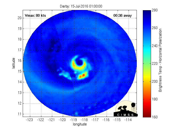
You can see how some of the dry air has been wrapping around it and in the past couple of hours it has disrupted its southern eyewall.
0 likes
-
Yellow Evan
- Professional-Met
- Posts: 16242
- Age: 27
- Joined: Fri Jul 15, 2011 12:48 pm
- Location: Henderson, Nevada/Honolulu, HI
- Contact:
Re: EPAC: DARBY - Hurricane
----- Current Analysis -----
Date : 16 JUL 2016 Time : 020000 UTC
Lat : 17:17:19 N Lon : 122:00:56 W
CI# /Pressure/ Vmax
5.4 / 962.4mb/ 99.6kt
Final T# Adj T# Raw T#
5.4 5.7 5.7
Estimated radius of max. wind based on IR : 21 km
Center Temp : -10.5C Cloud Region Temp : -64.4C
Scene Type : EYE
Date : 16 JUL 2016 Time : 020000 UTC
Lat : 17:17:19 N Lon : 122:00:56 W
CI# /Pressure/ Vmax
5.4 / 962.4mb/ 99.6kt
Final T# Adj T# Raw T#
5.4 5.7 5.7
Estimated radius of max. wind based on IR : 21 km
Center Temp : -10.5C Cloud Region Temp : -64.4C
Scene Type : EYE
0 likes
-
cycloneye

- Admin

- Posts: 149555
- Age: 69
- Joined: Thu Oct 10, 2002 10:54 am
- Location: San Juan, Puerto Rico
Re: EPAC: DARBY - Hurricane
HURRICANE DARBY DISCUSSION NUMBER 18
NWS NATIONAL HURRICANE CENTER MIAMI FL EP052016
800 PM PDT FRI JUL 15 2016
Darby's eye became a little less well-defined and central
convection weakened somewhat a few hours ago, and Dvorak data
T-number from both TAFB and SAB were lowered to 4.5. Recently,
however, cloud tops have been cooling around the eye and based on
the Dvorak Current Intensity rules the maximum winds are kept at 90
kt for this advisory. The hurricane has well-defined upper-level
outflow over all but the southeastern portion of the circulation.
The tropical cyclone is in a weak-shear environment and is likely
to remain so for the next several days. Whereas this would seem to
favor the system to maintain strength or even intensify further,
the future thermodynamic environment is not favorable. Darby is
approaching a cold tongue in the ocean and should pass over SSTs
near 24 deg C within a couple of days. Satellite imagery also shows
an extensive stratocumulus field ahead of the hurricane, which is
indicative of stabler air. These factors should cause Darby to
be on a weakening trend very soon. The official intensity forecast
is in close agreement with the model consensus, IVCN, and with the
previous NHC forecast.
Darby has moved a little more to the right of the previous track
over the past several hours, but using a 12-hour average yields a
motion estimate of 295/8. The mid-level flow on the south side of
a subtropical ridge should cause the tropical cyclone to turn
westward over the next several days. A slight northward adjustment
was made to the official forecast, mainly due to the more northward
short-term motion of Darby. The new official forecast lies on the
southern side of the guidance envelope and is close to the latest
GFS and ECMWF solutions, which are themselves in close agreement.
FORECAST POSITIONS AND MAX WINDS
INIT 16/0300Z 17.3N 122.1W 90 KT 105 MPH
12H 16/1200Z 17.7N 123.4W 85 KT 100 MPH
24H 17/0000Z 18.1N 125.1W 80 KT 90 MPH
36H 17/1200Z 18.4N 126.7W 75 KT 85 MPH
48H 18/0000Z 18.7N 128.8W 70 KT 80 MPH
72H 19/0000Z 19.3N 133.3W 55 KT 65 MPH
96H 20/0000Z 20.0N 138.0W 45 KT 50 MPH
120H 21/0000Z 20.0N 142.5W 40 KT 45 MPH
$$
Forecaster Pasch
0 likes
Visit the Caribbean-Central America Weather Thread where you can find at first post web cams,radars
and observations from Caribbean basin members Click Here
and observations from Caribbean basin members Click Here
-
Yellow Evan
- Professional-Met
- Posts: 16242
- Age: 27
- Joined: Fri Jul 15, 2011 12:48 pm
- Location: Henderson, Nevada/Honolulu, HI
- Contact:
-
Kingarabian
- S2K Supporter
- Posts: 16373
- Joined: Sat Aug 08, 2009 3:06 am
- Location: Honolulu, Hawaii
Re: EPAC: DARBY - Hurricane
Yellow Evan wrote::uarrow: Don't like how Pasch failed to mention the rising ADT values.
All about that verification.'
But I don't fault them. Darby has been underwhelming everytime it showed to intensify, it stops. So good to eere on the conservative side.
Last edited by Kingarabian on Fri Jul 15, 2016 9:55 pm, edited 1 time in total.
0 likes
RIP Kobe Bryant


Re: EPAC: DARBY - Hurricane
Eye is definitely warming. It's been trying on that.

0 likes
The above post and any post by Ntxw is NOT an official forecast and should not be used as such. It is just the opinion of the poster and may or may not be backed by sound meteorological data. It is NOT endorsed by any professional institution including Storm2k. For official information, please refer to NWS products.
Help support Storm2K!

-
Kingarabian
- S2K Supporter
- Posts: 16373
- Joined: Sat Aug 08, 2009 3:06 am
- Location: Honolulu, Hawaii
Re: EPAC: DARBY - Hurricane
UW - CIMSS
ADVANCED DVORAK TECHNIQUE
ADT-Version 8.2.1
Tropical Cyclone Intensity Algorithm
----- Current Analysis -----
Date : 16 JUL 2016 Time : 033000 UTC
Lat : 17:16:43 N Lon : 122:19:35 W
CI# /Pressure/ Vmax
5.5 / 960.5mb/102.0kt
Final T# Adj T# Raw T#
5.5 5.6 5.6
Estimated radius of max. wind based on IR : 27 km
Center Temp : -6.6C Cloud Region Temp : -62.3C
Scene Type : EYE
0 likes
RIP Kobe Bryant
-
1900hurricane

- Category 5

- Posts: 6063
- Age: 34
- Joined: Fri Feb 06, 2015 12:04 pm
- Location: Houston, TX
- Contact:
Re: EPAC: DARBY - Hurricane
Nailed it.

1 likes
Contract Meteorologist. TAMU & MSST. Fiercely authentic, one of a kind. We are all given free will, so choose a life meant to be lived. We are the Masters of our own Stories.
Opinions expressed are mine alone.
Follow me on Twitter at @1900hurricane : Read blogs at https://1900hurricane.wordpress.com/
Opinions expressed are mine alone.
Follow me on Twitter at @1900hurricane : Read blogs at https://1900hurricane.wordpress.com/
-
Yellow Evan
- Professional-Met
- Posts: 16242
- Age: 27
- Joined: Fri Jul 15, 2011 12:48 pm
- Location: Henderson, Nevada/Honolulu, HI
- Contact:
Re: EPAC: DARBY - Hurricane
Eye cooling again.
----- Current Analysis -----
Date : 16 JUL 2016 Time : 040000 UTC
Lat : 17:24:23 N Lon : 122:23:46 W
CI# /Pressure/ Vmax
5.6 / 958.3mb/104.6kt
Final T# Adj T# Raw T#
5.6 5.5 5.5
Estimated radius of max. wind based on IR : 28 km
Center Temp : -7.6C Cloud Region Temp : -61.2C
Scene Type : EYE
Date : 16 JUL 2016 Time : 040000 UTC
Lat : 17:24:23 N Lon : 122:23:46 W
CI# /Pressure/ Vmax
5.6 / 958.3mb/104.6kt
Final T# Adj T# Raw T#
5.6 5.5 5.5
Estimated radius of max. wind based on IR : 28 km
Center Temp : -7.6C Cloud Region Temp : -61.2C
Scene Type : EYE
0 likes
-
Yellow Evan
- Professional-Met
- Posts: 16242
- Age: 27
- Joined: Fri Jul 15, 2011 12:48 pm
- Location: Henderson, Nevada/Honolulu, HI
- Contact:

-
Kingarabian
- S2K Supporter
- Posts: 16373
- Joined: Sat Aug 08, 2009 3:06 am
- Location: Honolulu, Hawaii
Re: EPAC: DARBY - Hurricane

0 likes
RIP Kobe Bryant
-
Kingarabian
- S2K Supporter
- Posts: 16373
- Joined: Sat Aug 08, 2009 3:06 am
- Location: Honolulu, Hawaii

-
Yellow Evan
- Professional-Met
- Posts: 16242
- Age: 27
- Joined: Fri Jul 15, 2011 12:48 pm
- Location: Henderson, Nevada/Honolulu, HI
- Contact:

-
Kingarabian
- S2K Supporter
- Posts: 16373
- Joined: Sat Aug 08, 2009 3:06 am
- Location: Honolulu, Hawaii
Re: EPAC: DARBY - Hurricane
UW - CIMSS
ADVANCED DVORAK TECHNIQUE
ADT-Version 8.2.1
Tropical Cyclone Intensity Algorithm
----- Current Analysis -----
Date : 16 JUL 2016 Time : 043000 UTC
Lat : 17:26:00 N Lon : 122:28:00 W
CI# /Pressure/ Vmax
5.6 / 958.3mb/104.6kt
Final T# Adj T# Raw T#
5.5 5.5 5.5
Estimated radius of max. wind based on IR : 28 km
Center Temp : +2.8C Cloud Region Temp : -59.3C
Scene Type : EYE
0 likes
RIP Kobe Bryant
Who is online
Users browsing this forum: No registered users and 23 guests