
Wouldn't be surprised to see Darby maintain its intensity longer than expected given the low shear ahead of it.
Moderator: S2k Moderators


Code: Select all
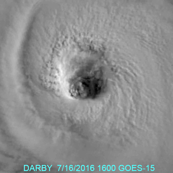
TXPZ24 KNES 161832
TCSENP

A.  05E (DARBY)

B.  16/1800Z

C.  18.0N

D.  124.4W

E.  ONE/GOES-W

F.  T6.0/6.0/D1.5/24HRS

G.  IR/EIR/VIS

H.  REMARKS...WMG EYE (283K) EMBEDDED IN LG AND SURROUNDED BY B YIELDS
A DT OF 6.0 WHICH INCLUDES 1.0 ADDED FOR EYE ADJUSTMENT.  MET = 5.5 AND
PT = 6.0.  FT IS BASED ON DT.

I.  ADDL POSITIONS

    NIL


...KIBLER Code: Select all
EP, 05, 201607161800, 10, DVTS, CI, , 1790N, 12440W, , 1, 102, 2, 960, 2, DVRK, , , , , , , , , , , , , 20, E, TAFB, EC, VI, 1, 5555 /////, , , GOES15, CSC, T,

Users browsing this forum: No registered users and 18 guests


