CPAC: DARBY - Post-Tropical

Moderator: S2k Moderators

Message
Author
User avatar
cycloneye
Admin
Admin
Posts: 145307
Age: 68
Joined: Thu Oct 10, 2002 10:54 am
Location: San Juan, Puerto Rico

Re: EPAC: DARBY - Hurricane

#281 Postby cycloneye » Mon Jul 18, 2016 3:34 pm

HURRICANE DARBY DISCUSSION NUMBER 29
NWS NATIONAL HURRICANE CENTER MIAMI FL EP052016
200 PM PDT MON JUL 18 2016

Visible and enhanced BD-curve infrared imagery show that Darby has
developed a banding eye feature during the past six hours.
Consequently, Dvorak subjective intensity CI-numbers from TAFB
and SAB support maintaining Darby at 65 kt for this advisory.
Darby is currently moving over a slightly warmer ocean and is
expected to remain over these marginally warm SSTs through the
period. Accordingly, only gradual weakening is forecast during the
next several days. Beyond the 48 hour period, however, gradually
increasing west-southwesterly shear and a more stable thermodynamic
environment could potentially hasten the weakening trend, similar to
what the LGEM and the Decay SHIPS models are indicating. The NHC
intensity forecast is based primarily on the IVCN multi-model
consensus, but remains above the Decay SHIPS and LGEM models beyond
day 2.

The initial motion estimate is 280/10 kt, as Darby is being steered
westward by a narrow subtropical ridge to the north. There has been
no change in the philosophy of the track forecast. A generally
westward to west-northwestward motion is expected through
the period, with a brief turn slightly to the south of west
around day 3. The official NHC forecast is similar to the
previous advisory and sides with the TVCE multi-model consensus.

FORECAST POSITIONS AND MAX WINDS

INIT 18/2100Z 19.0N 132.0W 65 KT 75 MPH
12H 19/0600Z 19.4N 133.7W 60 KT 70 MPH
24H 19/1800Z 19.9N 135.9W 55 KT 65 MPH
36H 20/0600Z 20.2N 138.1W 45 KT 50 MPH
48H 20/1800Z 20.1N 140.4W 40 KT 45 MPH
72H 21/1800Z 19.4N 145.1W 35 KT 40 MPH
96H 22/1800Z 18.9N 149.5W 35 KT 40 MPH
120H 23/1800Z 19.4N 152.4W 30 KT 35 MPH

$$
Forecaster Roberts
0 likes   
Visit the Caribbean-Central America Weather Thread where you can find at first post web cams,radars
and observations from Caribbean basin members Click Here

User avatar
Kingarabian
S2K Supporter
S2K Supporter
Posts: 15980
Joined: Sat Aug 08, 2009 3:06 am
Location: Honolulu, Hawaii

Re: EPAC: DARBY - Hurricane

#282 Postby Kingarabian » Mon Jul 18, 2016 3:36 pm

The NHC for the 2nd discussion in a row are ignoring the sharp recurve.

Could be because they believe this won't be strong enough to feel the weakness.
0 likes   
RIP Kobe Bryant

User avatar
wxman57
Moderator-Pro Met
Moderator-Pro Met
Posts: 22978
Age: 67
Joined: Sat Jun 21, 2003 8:06 pm
Location: Houston, TX (southwest)

Re: EPAC: DARBY - Hurricane

#283 Postby wxman57 » Mon Jul 18, 2016 3:49 pm

Kingarabian wrote:The NHC for the 2nd discussion in a row are ignoring the sharp recurve.

Could be because they believe this won't be strong enough to feel the weakness.


I think they're waiting for better model agreement. Note that the 12Z EC has Darby at 21.7N / 149.7W at 18Z on Saturday (with 60kt winds). The NHC has the center well south and west of there at 19.4N / 152.4W with 30kt winds. I think their next advisory will indicate more of a turn, as the EC & Euro are coming into better agreement on the turn, though the GFS is farther west and much weaker than the EC.
1 likes   

Alyono
Professional-Met
Professional-Met
Posts: 6961
Joined: Fri Apr 26, 2013 3:52 pm
Location: Texas Coast

Re: EPAC: DARBY - Hurricane

#284 Postby Alyono » Mon Jul 18, 2016 5:25 pm

18Z MU has higher shear
0 likes   

User avatar
Kingarabian
S2K Supporter
S2K Supporter
Posts: 15980
Joined: Sat Aug 08, 2009 3:06 am
Location: Honolulu, Hawaii

Re: EPAC: DARBY - Hurricane

#285 Postby Kingarabian » Mon Jul 18, 2016 7:53 pm

Steering:
500mb:
Image
400mb:
Image
0 likes   
RIP Kobe Bryant

User avatar
Kingarabian
S2K Supporter
S2K Supporter
Posts: 15980
Joined: Sat Aug 08, 2009 3:06 am
Location: Honolulu, Hawaii

Re: EPAC: DARBY - Hurricane

#286 Postby Kingarabian » Mon Jul 18, 2016 8:01 pm

Mid level shear will be a problem:

Image
0 likes   
RIP Kobe Bryant

stormwise

Re: EPAC: DARBY - Hurricane

#287 Postby stormwise » Mon Jul 18, 2016 8:05 pm

Image
on the last run i could find.
0 likes   

User avatar
cycloneye
Admin
Admin
Posts: 145307
Age: 68
Joined: Thu Oct 10, 2002 10:54 am
Location: San Juan, Puerto Rico

Re: EPAC: DARBY - Hurricane

#288 Postby cycloneye » Mon Jul 18, 2016 9:37 pm

HURRICANE DARBY DISCUSSION NUMBER 30
NWS NATIONAL HURRICANE CENTER MIAMI FL EP052016
800 PM PDT MON JUL 18 2016

Darby still appears as a well-organized tropical cyclone on
geostationary imagery, with a symmetric CDO and occasional eye
showing up on enhanced infrared imagery. Microwave imagery,
however, shows that the system has a slight northward tilt with
height with the mid-level center located a few tenths of a degree
north of the low-level center. Dvorak classifications from SAB and
TAFB still support hurricane strength, so the official intensity
estimate remains at 65 kt. Darby will be moving over marginal SSTs
and into drier air with increasing shear during the next several
days. Therefore, the cyclone is forecast to gradually weaken during
the forecast period. The official forecast is a blend of the
latest SHIPS and LGEM model output through 72 hours and is a
little above that guidance at days 4 and 5.

Based on the microwave images, the center is positioned slightly
south of the fixes from GOES imagery, and the resulting motion
estimate is 280/11 kt. The track forecast reasoning is about the
same as in the previous advisory. Darby should continue on a
generally westward heading to the south of a zonally-oriented
mid-level subtropical ridge for the next couple of days. Later in
the period, the cyclone should slow its forward speed as it nears a
weakness in the ridge. The official track forecast lies roughly in
the middle of the dynamical guidance.

FORECAST POSITIONS AND MAX WINDS

INIT 19/0300Z 19.1N 133.2W 65 KT 75 MPH
12H 19/1200Z 19.6N 134.9W 60 KT 70 MPH
24H 20/0000Z 20.0N 136.9W 55 KT 65 MPH
36H 20/1200Z 20.1N 139.1W 50 KT 60 MPH
48H 21/0000Z 19.9N 141.3W 45 KT 50 MPH
72H 22/0000Z 19.5N 145.5W 35 KT 40 MPH
96H 23/0000Z 19.0N 150.0W 35 KT 40 MPH
120H 24/0000Z 20.0N 152.5W 30 KT 35 MPH

$$
Forecaster Pasch
0 likes   
Visit the Caribbean-Central America Weather Thread where you can find at first post web cams,radars
and observations from Caribbean basin members Click Here

User avatar
Kingarabian
S2K Supporter
S2K Supporter
Posts: 15980
Joined: Sat Aug 08, 2009 3:06 am
Location: Honolulu, Hawaii

Re: EPAC: DARBY - Hurricane

#289 Postby Kingarabian » Mon Jul 18, 2016 11:45 pm

00z GFS is a super close call with the big Island. Thinking the track is independent of strength.
0 likes   
RIP Kobe Bryant

CrazyC83
Professional-Met
Professional-Met
Posts: 34002
Joined: Tue Mar 07, 2006 11:57 pm
Location: Deep South, for the first time!

Re: EPAC: DARBY - Hurricane

#290 Postby CrazyC83 » Mon Jul 18, 2016 11:53 pm

Does the G-IV fly out of Hawaii ever? I doubt any kind of missions would take place before the storm reaches 140W though.
0 likes   

User avatar
Yellow Evan
Professional-Met
Professional-Met
Posts: 16143
Age: 27
Joined: Fri Jul 15, 2011 12:48 pm
Location: Henderson, Nevada/Honolulu, HI
Contact:

Re: EPAC: DARBY - Hurricane

#291 Postby Yellow Evan » Tue Jul 19, 2016 12:03 am

CrazyC83 wrote:Does the G-IV fly out of Hawaii ever? I doubt any kind of missions would take place before the storm reaches 140W though.


Yes. They did missions for Oho and Guillermo last year and Iselle/Julio and Ana in 2014, even in Iselle's case around the time of crossing 140W.
0 likes   

User avatar
Kingarabian
S2K Supporter
S2K Supporter
Posts: 15980
Joined: Sat Aug 08, 2009 3:06 am
Location: Honolulu, Hawaii

Re: EPAC: DARBY - Hurricane

#292 Postby Kingarabian » Tue Jul 19, 2016 12:27 am

Will Estelle play a role in the ridges weakness?
0 likes   
RIP Kobe Bryant

stormwise

Re: EPAC: DARBY - Hurricane

#293 Postby stormwise » Tue Jul 19, 2016 4:04 am

Best Track Position and Intensity as of:
Tuesday, Jul. 19, 2016 6:00 Z
Wind (1 min. avg.):
65 knots (75 mph | 33 m/s | 120 km/h)
Gusts:
80 knots (92 mph | 41 m/s | 148 km/h)
Pressure:
988 mb (29.18 inHg | 988 hPa)
Location at the time:
1,403 statute miles (2,257 km) to the SW (223°) from Los Angeles, CA, USA.
Coordinates:
19.3N 133.9W

Image


Image
0 likes   

User avatar
cycloneye
Admin
Admin
Posts: 145307
Age: 68
Joined: Thu Oct 10, 2002 10:54 am
Location: San Juan, Puerto Rico

Re: EPAC: DARBY - Hurricane

#294 Postby cycloneye » Tue Jul 19, 2016 4:57 am

HURRICANE DARBY DISCUSSION NUMBER 31
NWS NATIONAL HURRICANE CENTER MIAMI FL EP052016
200 AM PDT TUE JUL 19 2016

Although deep convection has been decreasing since the previous
advisory, Darby still has a well-defined and tight circulation. The
initial intensity is held at 65 kt, in agreement with the Dvorak
CI-numbers from TAFB and SAB, but the automated values from CIMSS at
the University of Wisconsin suggest that this estimate could be a
little generous.

Microwave data indicate that the low-level center of Darby is
located to the south of the eye feature seen in infrared satellite
images, which is likely the result of southerly shear. Using the
microwave fixes, the initial motion estimate is 285/11 kt. A
continued west-northwestward motion is expected today, followed by a
motion slightly south of due west on Wednesday while Darby is
steered by a narrow mid-level ridge to its north. By the end of the
forecast period, a turn to the northwest is predicted when Darby
approaches a trough to the north of the Hawaiian Islands. The new
NHC track forecast is slightly faster than the previous one to
come in line with latest runs of the GFS and ECMWF models.

Darby is expected to remain over cool water for the next few days,
before it tracks over SSTs around 26 deg C to the east of the
Hawaiian Islands. However, the system will also be moving into an
environment of increasing southwesterly shear by the time it reaches
the warmer water. Therefore, gradual weakening is predicted through
the period. This forecast is the same as the previous one and is in
best agreement with the LGEM guidance.

An ASCAT-B pass from around 0600 UTC was helpful in estimating the
size of Darby's wind field.

FORECAST POSITIONS AND MAX WINDS

INIT 19/0900Z 19.4N 134.4W 65 KT 75 MPH
12H 19/1800Z 19.8N 136.1W 60 KT 70 MPH
24H 20/0600Z 20.0N 138.3W 55 KT 65 MPH
36H 20/1800Z 20.0N 140.5W 50 KT 60 MPH
48H 21/0600Z 19.8N 142.8W 45 KT 50 MPH
72H 22/0600Z 19.3N 147.3W 35 KT 40 MPH
96H 23/0600Z 19.4N 150.9W 35 KT 40 MPH
120H 24/0600Z 20.5N 153.0W 30 KT 35 MPH

$$
Forecaster Cangialosi
0 likes   
Visit the Caribbean-Central America Weather Thread where you can find at first post web cams,radars
and observations from Caribbean basin members Click Here

Alyono
Professional-Met
Professional-Met
Posts: 6961
Joined: Fri Apr 26, 2013 3:52 pm
Location: Texas Coast

Re: EPAC: DARBY - Hurricane

#295 Postby Alyono » Tue Jul 19, 2016 5:44 am

if NHC/CPHC keeps ignoring the global models and only uses LGEM/SHIPS, there won't even be recon at all
0 likes   

User avatar
NDG
S2K Supporter
S2K Supporter
Posts: 15446
Joined: Sun Jul 09, 2006 10:14 pm
Location: Orlando, FL

Re: EPAC: DARBY - Hurricane

#296 Postby NDG » Tue Jul 19, 2016 6:50 am

Darby will be moving into a very stable airmass with increasing windshear, I doubt she will be much of anything left other than a TD or TS by the time it nears the Hawaiian Islands.
0 likes   

Alyono
Professional-Met
Professional-Met
Posts: 6961
Joined: Fri Apr 26, 2013 3:52 pm
Location: Texas Coast

Re: EPAC: DARBY - Hurricane

#297 Postby Alyono » Tue Jul 19, 2016 6:52 am

NDG wrote:Darby will be moving into a very stable airmass with increasing windshear, I doubt she will be much of anything left other than a TD or TS by the time it nears the Hawaiian Islands.


Only GFS has the shear, and only on some of the runs. EC has lower shear.

Also, the GFS shear is about 15 kts. It's not that much
0 likes   

User avatar
NDG
S2K Supporter
S2K Supporter
Posts: 15446
Joined: Sun Jul 09, 2006 10:14 pm
Location: Orlando, FL

Re: EPAC: DARBY - Hurricane

#298 Postby NDG » Tue Jul 19, 2016 6:59 am

Alyono wrote:
NDG wrote:Darby will be moving into a very stable airmass with increasing windshear, I doubt she will be much of anything left other than a TD or TS by the time it nears the Hawaiian Islands.


Only GFS has the shear, and only on some of the runs. EC has lower shear.

Also, the GFS shear is about 15 kts. It's not that much


The Euro might be right but all I know is that it has been too aggressive at times over the EPAC this season.
0 likes   

Alyono
Professional-Met
Professional-Met
Posts: 6961
Joined: Fri Apr 26, 2013 3:52 pm
Location: Texas Coast

Re: EPAC: DARBY - Hurricane

#299 Postby Alyono » Tue Jul 19, 2016 7:02 am

NDG wrote:
Alyono wrote:
NDG wrote:Darby will be moving into a very stable airmass with increasing windshear, I doubt she will be much of anything left other than a TD or TS by the time it nears the Hawaiian Islands.


Only GFS has the shear, and only on some of the runs. EC has lower shear.

Also, the GFS shear is about 15 kts. It's not that much


The Euro might be right but all I know is that it has been too aggressive at times over the EPAC this season.


6Z MU has winds of around 60 kts near Hawaii as well
0 likes   

User avatar
NDG
S2K Supporter
S2K Supporter
Posts: 15446
Joined: Sun Jul 09, 2006 10:14 pm
Location: Orlando, FL

Re: EPAC: DARBY - Hurricane

#300 Postby NDG » Tue Jul 19, 2016 7:10 am

Alyono wrote:
NDG wrote:
Alyono wrote:
Only GFS has the shear, and only on some of the runs. EC has lower shear.

Also, the GFS shear is about 15 kts. It's not that much


The Euro might be right but all I know is that it has been too aggressive at times over the EPAC this season.


6Z MU has winds of around 60 kts near Hawaii as well


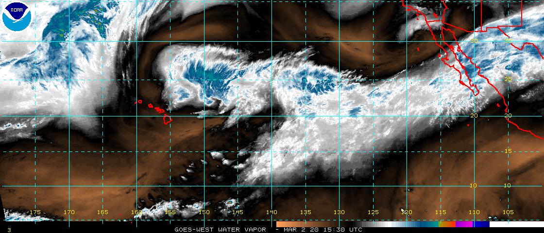
I guess will see over the next few days what models were right, the hurricane models or the global models. All I know that it has a lot of dry air to go through before getting to Hawaii.
Image
0 likes   


Return to “2016”

Who is online

Users browsing this forum: No registered users and 6 guests