ATL: EARL - Remnants - Discussion
Moderator: S2k Moderators
-
znel52
Re: ATL: INVEST 97L - Discussion
When/if this thing closes off an LLC I think it makes the jump straight to TS. If it maintains current appearance that is.
2 likes
Re: ATL: INVEST 97L - Discussion
JaxGator wrote:It's close on having a closed center imo.
http://manati.star.nesdis.noaa.gov/wind ... 0_noaa.png
I saw the E half of the ASACT and was wondering .I tell you these Mets on the board always have an inside scoop kinda like inside trading
1 likes
-
tarheelprogrammer

- S2K Supporter

- Posts: 1793
- Joined: Mon Mar 28, 2016 9:25 pm
- Location: Raleigh, NC area (Garner, NC)
Re: ATL: INVEST 97L - Models
NAM 32km is much more intense.
18z:

0z:

18z:
0z:
0 likes
My posts are not official forecasts. They are just my opinion and may or may not be backed by sound meteorological data. They are NOT endorsed by any professional institution or storm2k.org. For official information, please refer to the NHC and NWS products.
-
TheAustinMan

- Category 5

- Posts: 1060
- Joined: Mon Jul 08, 2013 4:26 pm
- Location: Central TX / United States
Re: ATL: INVEST 97L - Discussion
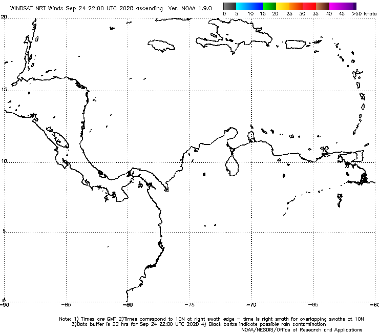
ASCAT METOP-A pass of Invest 97L.

High-resolution:

High-resolution:
Last edited by TheAustinMan on Sun Jul 31, 2016 11:24 pm, edited 1 time in total.
1 likes
Treat my opinions with a grain of salt. For official information see your local weather service.
“It's tough to make predictions, especially about the future.”
“It's tough to make predictions, especially about the future.”
-
ozonepete
- Professional-Met

- Posts: 4743
- Joined: Mon Sep 07, 2009 3:23 pm
- Location: From Ozone Park, NYC / Now in Brooklyn, NY
Re: ATL: INVEST 97L - Discussion
The CDO is certainly impressive. The CDO will likely intensify and expand overnight during DMAX. And right over where the low level center should be forming.


2 likes

Re: ATL: INVEST 97L - Discussion
znel52 wrote:When/if this thing closes off an LLC I think it makes the jump straight to TS. If it maintains current appearance that is.
Exactly. Winds gusts are already tropical storm strength, and sustained winds are nearing it as well. All it needs is a well defined center and it's a TS. It could form earlier than predicted, if it slows down a bit.
0 likes
Igor 2010, Sandy 2012, Fay 2014, Gonzalo 2014, Joaquin 2015, Nicole 2016, Humberto 2019, Imelda 2025
I am only a tropical weather enthusiast. My predictions are not official and may or may not be backed by sound meteorological data. For official information, please refer to the NHC and NWS products.
I am only a tropical weather enthusiast. My predictions are not official and may or may not be backed by sound meteorological data. For official information, please refer to the NHC and NWS products.
-
TheAustinMan
- Category 5
- Posts: 1060
- Joined: Mon Jul 08, 2013 4:26 pm
- Location: Central TX / United States
Re: ATL: INVEST 97L - Discussion
I made an overlay of the METOP-A AMSU 89GHz microwave pass over the infrared satellite imagery. The scatterometer data from earlier suggested that this is still an open (albeit sharp) wave, but it certainly is attempting to solidify some sort of circulation within the dense convective envelope.

1 likes
Treat my opinions with a grain of salt. For official information see your local weather service.
“It's tough to make predictions, especially about the future.”
“It's tough to make predictions, especially about the future.”

Re: ATL: INVEST 97L - Discussion
MAN . 97 is on fire . NHC should upgrade at 2? mabey even name it ?
0 likes
-
znel52
Re: ATL: INVEST 97L - Discussion
whatacane wrote:MAN . 97 is on fire . NHC should upgrade at 2? mabey even name it ?
Doubtful, there is still no strong evidence of a closed LLC. Though I suppose stranger things have happened. I don't know the hurricane hunters protocol but hopefully they bump up the recon mission to tomorrow if this storm maintains. I don't think they are currently scheduled to fly into the storm until Tues or Wed.
Last edited by znel52 on Sun Jul 31, 2016 11:22 pm, edited 2 times in total.
0 likes
Re: ATL: INVEST 97L - Discussion
whatacane wrote:MAN . 97 is on fire . NHC should upgrade at 2? mabey even name it ?
We shall have to see, but I don't know if the center is well defined enough, and if it is organized enough to be upgraded. It has winds nearing tropical storm strength, though.
0 likes
Igor 2010, Sandy 2012, Fay 2014, Gonzalo 2014, Joaquin 2015, Nicole 2016, Humberto 2019, Imelda 2025
I am only a tropical weather enthusiast. My predictions are not official and may or may not be backed by sound meteorological data. For official information, please refer to the NHC and NWS products.
I am only a tropical weather enthusiast. My predictions are not official and may or may not be backed by sound meteorological data. For official information, please refer to the NHC and NWS products.
-
AxaltaRacing24
- Category 5
- Posts: 1774
- Age: 25
- Joined: Wed Jul 27, 2016 11:14 am
- Location: Jupiter, FL
Re: ATL: INVEST 97L - Discussion
whatacane wrote:MAN . 97 is on fire . NHC should upgrade at 2? mabey even name it ?
Just needs that closed LLC and it will be golden.
0 likes
-
floridasun78
- Category 5
- Posts: 3755
- Joined: Sun May 17, 2009 10:16 pm
- Location: miami fl
Re: ATL: INVEST 97L - Discussion
this year we have QuickSCAT on ssi to help get wind data for nhc remember we loss of QuikSCAT in 2009. this was big lost for nhc thast help get nhc when no weather station near by or buoys this helping nhc keep eye wind with 97l could use to upgrade to td that plane not gone into 97l yet
Last edited by floridasun78 on Sun Jul 31, 2016 11:21 pm, edited 1 time in total.
0 likes
Re: ATL: INVEST 97L - Discussion
Kazmit_ wrote:whatacane wrote:MAN . 97 is on fire . NHC should upgrade at 2? mabey even name it ?
We shall have to see, but I don't know if the center is well defined enough, and if it is organized enough to be upgraded. It has winds nearing tropical storm strength, though.
Thank you ! I
0 likes
Re: ATL: INVEST 97L - Discussion
Kazmit_ wrote:znel52 wrote:When/if this thing closes off an LLC I think it makes the jump straight to TS. If it maintains current appearance that is.
Exactly. Winds gusts are already tropical storm strength, and sustained winds are nearing it as well. All it needs is a well defined center and it's a TS. It could form earlier than predicted, if it slows down a bit.
Someone calculated earlier a page or to back that it appears the forward speed has slowed some.Maybe one of the Mets can chime in on my thoughts and confirm or deny the effects.I see these systems as mass air=fluid air is treated as fluid in engineering capacities.So as this system starts to consolidate it is bring together many more particles and accumulating mass/weight requiring more energy for forward movement.The afforded energy that is present did not change but the mass of the system did.That's the way I view it maybe off base some?
0 likes
-
tarheelprogrammer
- S2K Supporter
- Posts: 1793
- Joined: Mon Mar 28, 2016 9:25 pm
- Location: Raleigh, NC area (Garner, NC)
Re: ATL: INVEST 97L - Models
GFS is stronger but weird movements up to landfall in Mexico. I don't see the ridge if I am not mistaken but still pushed into Mexico? Low pressure hangs around in B.O.C? 
0 likes
My posts are not official forecasts. They are just my opinion and may or may not be backed by sound meteorological data. They are NOT endorsed by any professional institution or storm2k.org. For official information, please refer to the NHC and NWS products.

Re: ATL: INVEST 97L - Discussion
There wasn't much storm relative shear earlier so this convection could persist I suppose.
I'm kind of hoping a LLC tries to race out from underneath that CDO this morning otherwise maybe a recon for the sake of Jamaica might be in order..
I'm kind of hoping a LLC tries to race out from underneath that CDO this morning otherwise maybe a recon for the sake of Jamaica might be in order..
0 likes
-
znel52
Re: ATL: INVEST 97L - Discussion
Nimbus wrote:There wasn't much storm relative shear earlier so this convection could persist I suppose.
I'm kind of hoping a LLC tries to race out from underneath that CDO this morning otherwise maybe a recon for the sake of Jamaica might be in order..
I'm interested to see what happens when it gets south of DR/Haiti. Will the terrain there disrupt some of the storms 'flow' and result in some weakening? Right now it isn't looking good it appears to be getting better organized with every new satellite image.
0 likes
Re: ATL: INVEST 97L - Discussion
looking at the sat image there appears to be a white speck starting to show what is this ?
0 likes
-
znel52
Re: ATL: INVEST 97L - Discussion
whatacane wrote:looking at the sat image there appears to be a white speck starting to show what is this ?
Are you looking at the colored RBTOP imagery? If so the white areas are intense storms firing off in the storms CDO. I'm i'm not mistaken white is -80C cloud tops. Intense storms...
0 likes
-
Hurricaneman

- Category 5
- Posts: 7404
- Age: 45
- Joined: Tue Aug 31, 2004 3:24 pm
- Location: central florida
Re: ATL: INVEST 97L - Discussion
whatacane wrote:looking at the sat image there appears to be a white speck starting to show what is this ?
its convective in nature as in higher thunderstorm tops
The posts in this forum are NOT official forecast and should not be used as such. They are just the opinion of the poster and may or may not be backed by sound meteorological data. They are NOT endorsed by any professional institution or STORM2K. For official information, please refer to products from the National Hurricane Center and National Weather Service
0 likes
Who is online
Users browsing this forum: No registered users and 42 guests