
ATL: EARL - Remnants - Discussion
Moderator: S2k Moderators
-
cycloneye

- Admin

- Posts: 149298
- Age: 69
- Joined: Thu Oct 10, 2002 10:54 am
- Location: San Juan, Puerto Rico
Re: ATL: INVEST 97L - Recon
0 likes
Visit the Caribbean-Central America Weather Thread where you can find at first post web cams,radars
and observations from Caribbean basin members Click Here
and observations from Caribbean basin members Click Here
-
cycloneye
- Admin
- Posts: 149298
- Age: 69
- Joined: Thu Oct 10, 2002 10:54 am
- Location: San Juan, Puerto Rico
Re: ATL: INVEST 97L - Recon
Plane decending.
URNT15 KNHC 021324
AF303 02DDA INVEST HDOB 21 20160802
131500 1855N 08311W 4172 07314 0430 -153 -215 038007 007 020 000 00
131530 1854N 08309W 4293 07100 0420 -140 -180 059009 010 019 000 03
131600 1853N 08306W 4409 06896 0407 -127 -166 057011 012 017 001 00
131630 1852N 08304W 4522 06702 0395 -114 -186 076011 012 021 000 00
131700 1851N 08302W 4638 06504 0381 -102 -228 073009 010 021 000 00
131730 1851N 08259W 4652 06475 0373 -099 -205 072009 010 023 000 00
131800 1850N 08257W 4658 06464 0371 -099 -172 078013 014 022 000 00
131830 1850N 08255W 4655 06466 0370 -098 -162 074013 014 022 000 00
131900 1849N 08252W 4656 06464 0370 -094 -174 078013 014 020 001 00
131930 1848N 08250W 4656 06465 0370 -090 -162 083012 013 020 000 00
132000 1848N 08248W 4658 06463 0370 -090 -166 086012 012 020 000 00
132030 1847N 08245W 4658 06463 0372 -090 -162 092014 016 021 000 00
132100 1847N 08243W 4733 06345 0368 -084 -164 092015 016 021 002 00
132130 1846N 08241W 4851 06153 0358 -071 -132 086015 017 022 001 00
132200 1845N 08238W 4967 05968 0346 -059 -125 055012 013 022 000 00
132230 1845N 08236W 5080 05791 0334 -045 -142 044013 013 022 000 00
132300 1844N 08234W 5183 05630 0324 -033 -139 043012 013 022 000 00
132330 1844N 08232W 5287 05475 0315 -027 -146 050015 018 021 000 00
132400 1843N 08229W 5394 05317 0306 -026 -096 063021 022 021 000 00
132430 1842N 08227W 5499 05163 0297 -012 -090 076019 020 021 000 00
0 likes
Visit the Caribbean-Central America Weather Thread where you can find at first post web cams,radars
and observations from Caribbean basin members Click Here
and observations from Caribbean basin members Click Here
-
cycloneye
- Admin
- Posts: 149298
- Age: 69
- Joined: Thu Oct 10, 2002 10:54 am
- Location: San Juan, Puerto Rico
Re: ATL: INVEST 97L - Recon - Discussion
Plane is decendingf.Let's see if it finds a closed circulation.
0 likes
Visit the Caribbean-Central America Weather Thread where you can find at first post web cams,radars
and observations from Caribbean basin members Click Here
and observations from Caribbean basin members Click Here
-
cycloneye
- Admin
- Posts: 149298
- Age: 69
- Joined: Thu Oct 10, 2002 10:54 am
- Location: San Juan, Puerto Rico
Re: ATL: INVEST 97L - Recon

0 likes
Visit the Caribbean-Central America Weather Thread where you can find at first post web cams,radars
and observations from Caribbean basin members Click Here
and observations from Caribbean basin members Click Here
-
tarheelprogrammer

- S2K Supporter

- Posts: 1793
- Joined: Mon Mar 28, 2016 9:25 pm
- Location: Raleigh, NC area (Garner, NC)
Re: ATL: INVEST 97L - Discussion
System has been a TC for the past 24 hours IMHO. Now it is taking on the new TC standard look in the Atlantic for the past few years a sheared mess. It probably peaked yesterday.
0 likes
My posts are not official forecasts. They are just my opinion and may or may not be backed by sound meteorological data. They are NOT endorsed by any professional institution or storm2k.org. For official information, please refer to the NHC and NWS products.
-
Florida1118
Re: ATL: INVEST 97L - Discussion
tarheelprogrammer wrote:System has been a TC for the past 24 hours IMHO. Now it is taking on the new TC standard look in the Atlantic for the past few years a sheared mess. It probably peaked yesterday.
All indications have been, and were, that this was not going to "peak" until much closer to central America. It's got plenty of time.
0 likes
-
cycloneye
- Admin
- Posts: 149298
- Age: 69
- Joined: Thu Oct 10, 2002 10:54 am
- Location: San Juan, Puerto Rico
Re: ATL: INVEST 97L - Recon
URNT15 KNHC 021334
AF303 02DDA INVEST HDOB 22 20160802
132500 1842N 08225W 5602 05013 0116 +001 -081 071017 018 021 000 00
132530 1841N 08223W 5705 04867 0112 +013 -087 066017 017 021 000 00
132600 1841N 08221W 5814 04715 0118 +021 -081 062019 021 020 000 00
132630 1840N 08219W 5936 04547 0118 +030 -058 058021 022 021 000 00
132700 1840N 08217W 6056 04390 0127 +039 -068 051023 024 022 000 00
132730 1839N 08215W 6181 04222 0125 +050 -035 057023 023 020 000 00
132800 1839N 08213W 6299 04069 0124 +061 -044 062021 023 021 000 00
132830 1838N 08211W 6421 03911 0128 +068 -019 063022 023 021 000 00
132900 1838N 08209W 6545 03752 0134 +073 +007 067020 021 019 000 00
132930 1837N 08207W 6664 03604 0133 +082 +020 067020 020 019 000 00
133000 1837N 08205W 6789 03450 0133 +091 +027 058019 020 021 000 00
133030 1836N 08203W 6914 03299 0128 +104 +032 058019 019 022 000 00
133100 1836N 08201W 7037 03152 0126 +116 +035 056021 022 022 001 00
133130 1835N 08159W 7165 03000 0127 +124 +037 064018 021 022 000 00
133200 1835N 08157W 7298 02845 0126 +135 +040 067022 024 021 000 00
133230 1834N 08155W 7431 02690 0121 +145 +044 068026 026 019 000 00
133300 1834N 08153W 7561 02540 0125 +149 +049 065021 025 019 000 00
133330 1833N 08151W 7657 02433 0131 +146 +054 060020 021 019 000 00
133400 1833N 08150W 7749 02332 0137 +149 +059 058020 021 020 000 00
133430 1832N 08148W 7839 02235 0139 +151 +063 056020 021 020 000 00
$$

0 likes
Visit the Caribbean-Central America Weather Thread where you can find at first post web cams,radars
and observations from Caribbean basin members Click Here
and observations from Caribbean basin members Click Here
-
tarheelprogrammer
- S2K Supporter
- Posts: 1793
- Joined: Mon Mar 28, 2016 9:25 pm
- Location: Raleigh, NC area (Garner, NC)
Re: ATL: INVEST 97L - Discussion
Florida1118 wrote:tarheelprogrammer wrote:System has been a TC for the past 24 hours IMHO. Now it is taking on the new TC standard look in the Atlantic for the past few years a sheared mess. It probably peaked yesterday.
All indications have been, and were, that this was not going to "peak" until much closer to central America. It's got plenty of time.
We will see. Hopefully it stays weak.
0 likes
My posts are not official forecasts. They are just my opinion and may or may not be backed by sound meteorological data. They are NOT endorsed by any professional institution or storm2k.org. For official information, please refer to the NHC and NWS products.
-
MGC

- S2K Supporter
- Posts: 5940
- Joined: Sun Mar 23, 2003 9:05 pm
- Location: Pass Christian MS, or what is left.
Re: ATL: INVEST 97L - Discussion
Is that a naked swirl I see out ahead of the convection?.......MGC
0 likes
-
cycloneye
- Admin
- Posts: 149298
- Age: 69
- Joined: Thu Oct 10, 2002 10:54 am
- Location: San Juan, Puerto Rico
Re: ATL: INVEST 97L - Recon
URNT15 KNHC 021344
AF303 02DDA INVEST HDOB 23 20160802
133500 1832N 08146W 7927 02138 0143 +153 +067 053020 021 021 000 00
133530 1831N 08144W 8022 02039 0144 +158 +070 053022 022 022 000 00
133600 1831N 08142W 8129 01924 0146 +161 +073 059021 022 022 000 00
133630 1830N 08140W 8235 01814 0147 +166 +076 066018 020 022 000 00
133700 1830N 08139W 8347 01698 0154 +163 +080 078019 020 021 000 00
133730 1829N 08137W 8477 01567 0157 +167 +084 085019 021 022 000 00
133800 1829N 08135W 8610 01435 0159 +173 +087 094020 021 023 000 00
133830 1828N 08133W 8742 01305 0157 +185 +090 101024 026 022 000 00
133900 1828N 08132W 8907 01147 0158 +197 +094 103028 029 024 001 00
133930 1827N 08130W 9131 00931 0158 +211 +100 100030 030 023 000 00
134000 1827N 08129W 9384 00693 0156 +229 +107 098025 029 024 000 00
134030 1827N 08127W 9600 00484 0144 +248 +115 099024 026 025 000 00
134100 1826N 08126W 9702 00384 0134 +255 +123 098023 024 025 000 00
134130 1826N 08124W 9758 00329 0131 +260 +133 099020 022 026 000 00
134200 1826N 08123W 9777 00311 0128 +260 +142 101021 022 025 000 00
134230 1825N 08122W 9770 00320 0130 +259 +150 101020 022 026 000 00
134300 1825N 08120W 9775 00310 0128 +260 +157 099022 023 028 000 00
134330 1824N 08119W 9772 00316 0128 +260 +162 099022 022 028 000 00
134400 1824N 08117W 9772 00316 0129 +260 +166 096022 023 027 000 00
134430 1824N 08116W 9770 00317 0128 +258 +169 096021 023 027 000 00
$$
0 likes
Visit the Caribbean-Central America Weather Thread where you can find at first post web cams,radars
and observations from Caribbean basin members Click Here
and observations from Caribbean basin members Click Here
-
cycloneye
- Admin
- Posts: 149298
- Age: 69
- Joined: Thu Oct 10, 2002 10:54 am
- Location: San Juan, Puerto Rico
Re: ATL: INVEST 97L - Recon

0 likes
Visit the Caribbean-Central America Weather Thread where you can find at first post web cams,radars
and observations from Caribbean basin members Click Here
and observations from Caribbean basin members Click Here
-
Dean4Storms
- S2K Supporter
- Posts: 6358
- Age: 63
- Joined: Sun Aug 31, 2003 1:01 pm
- Location: Miramar Bch. FL
Re: ATL: INVEST 97L - Discussion
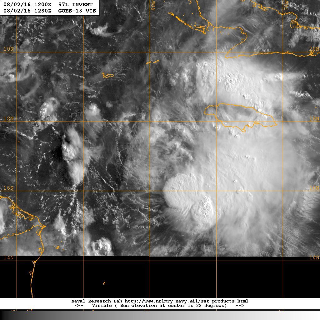
srainhoutx wrote:Early morning 1km zoomed visible imagery suggests 97L does have a low level circulation around 17N and 77W out ahead of the convection. RECON is en route and we should know if it is enough to upgrade within the hour. I do not expect intensification until the disturbance slows down as it nears Belize/Yucatan Peninsula later today into tomorrow when it may become more vertically stacked.
http://i228.photobucket.com/albums/ee29 ... W_80pc.jpg
I don't know if you made a mistake or have the wrong thing. The LLC is clearly at the edge of that latest deep convection near 16.5N 79.5W, I think some folks may have seen a small eddy get spit out but the overall low level rotation looks to be under that convection bomb.
0 likes


-
cycloneye
- Admin
- Posts: 149298
- Age: 69
- Joined: Thu Oct 10, 2002 10:54 am
- Location: San Juan, Puerto Rico
Re: ATL: INVEST 97L - Recon
URNT15 KNHC 021354
AF303 02DDA INVEST HDOB 24 20160802
134500 1823N 08115W 9772 00316 0129 +257 +172 097022 022 026 000 00
134530 1823N 08113W 9768 00320 0129 +258 +174 098021 022 027 000 00
134600 1823N 08112W 9772 00315 0128 +258 +176 098021 021 027 000 00
134630 1822N 08110W 9772 00316 0128 +255 +177 096019 021 026 000 00
134700 1822N 08109W 9770 00317 0127 +255 +178 093019 019 025 000 00
134730 1821N 08107W 9777 00310 0127 +255 +179 092019 020 025 000 00
134800 1821N 08106W 9772 00316 0128 +255 +179 090021 021 024 000 00
134830 1821N 08105W 9772 00316 0128 +255 +180 087021 022 025 000 00
134900 1820N 08103W 9773 00314 0127 +255 +180 087020 022 026 000 00
134930 1820N 08102W 9774 00314 0128 +255 +181 087020 021 025 000 00
135000 1819N 08100W 9772 00316 0128 +255 +182 089019 021 025 000 00
135030 1819N 08059W 9777 00310 0128 +255 +183 085018 019 022 000 00
135100 1818N 08058W 9772 00316 0128 +252 +183 085017 018 021 000 00
135130 1817N 08057W 9776 00311 0127 +251 +184 080017 018 021 000 00
135200 1816N 08056W 9770 00315 0126 +252 +184 074017 018 020 000 00
135230 1815N 08054W 9772 00312 0125 +251 +183 073017 017 019 000 00
135300 1814N 08053W 9772 00312 0125 +250 +184 073016 017 019 000 00
135330 1813N 08052W 9773 00311 0125 +251 +184 080015 016 019 000 00
135400 1812N 08051W 9773 00312 0125 +251 +184 077016 017 019 001 00
135430 1811N 08050W 9774 00314 0128 +249 +184 082017 017 022 000 00
0 likes
Visit the Caribbean-Central America Weather Thread where you can find at first post web cams,radars
and observations from Caribbean basin members Click Here
and observations from Caribbean basin members Click Here
-
cycloneye
- Admin
- Posts: 149298
- Age: 69
- Joined: Thu Oct 10, 2002 10:54 am
- Location: San Juan, Puerto Rico
Re: ATL: INVEST 97L - Recon

0 likes
Visit the Caribbean-Central America Weather Thread where you can find at first post web cams,radars
and observations from Caribbean basin members Click Here
and observations from Caribbean basin members Click Here
-
srainhoutx

- S2K Supporter
- Posts: 6919
- Age: 68
- Joined: Sun Jan 14, 2007 11:34 am
- Location: Haywood County, NC
- Contact:
Re: ATL: INVEST 97L - Discussion
Dean4Storms wrote:srainhoutx wrote:Early morning 1km zoomed visible imagery suggests 97L does have a low level circulation around 17N and 77W out ahead of the convection. RECON is en route and we should know if it is enough to upgrade within the hour. I do not expect intensification until the disturbance slows down as it nears Belize/Yucatan Peninsula later today into tomorrow when it may become more vertically stacked.
I don't know if you made a mistake or have the wrong thing. The LLC is clearly at the edge of that latest deep convection near 16.5N 79.5W, I think some folks may have seen a small eddy get spit out but the overall low level rotation looks to be under that convection bomb.
It may well be an eddy. Morning Coffee is finally working for my tired old eyes...
1 likes
Carla/Alicia/Jerry(In The Eye)/Michelle/Charley/Ivan/Dennis/Katrina/Rita/Wilma/Ike/Harvey
Member: National Weather Association
Wx Infinity Forums
http://wxinfinity.com/index.php
Facebook.com/WeatherInfinity
Twitter @WeatherInfinity
Member: National Weather Association
Wx Infinity Forums
http://wxinfinity.com/index.php
Facebook.com/WeatherInfinity
Twitter @WeatherInfinity

-
Gustywind

- Category 5

- Posts: 12334
- Joined: Mon Sep 03, 2007 7:29 am
- Location: Baie-Mahault, GUADELOUPE
Re: ATL: INVEST 97L - Discussion
Decreasing numbers for 97L:
North Atlantic Ocean Basin: Imagery
DATE/TIME LAT LON CLASSIFICATION STORM
02/1145 UTC 17.0N 79.3W T2.5/2.5 97L
02/0545 UTC 16.1N 77.4W T2.5/3.0 97L
North Atlantic Ocean Basin: Imagery
DATE/TIME LAT LON CLASSIFICATION STORM
02/1145 UTC 17.0N 79.3W T2.5/2.5 97L
02/0545 UTC 16.1N 77.4W T2.5/3.0 97L
0 likes
-
Aric Dunn
- Category 5
- Posts: 21238
- Age: 43
- Joined: Sun Sep 19, 2004 9:58 pm
- Location: Ready for the Chase.
- Contact:
Re: ATL: INVEST 97L - Discussion
pretty evident... convection starting to build back over the center again..

2 likes
Note: If I make a post that is brief. Please refer back to previous posts for the analysis or reasoning. I do not re-write/qoute what my initial post said each time.
If there is nothing before... then just ask
Space & Atmospheric Physicist, Embry-Riddle Aeronautical University,
I believe the sky is falling...
If there is nothing before... then just ask
Space & Atmospheric Physicist, Embry-Riddle Aeronautical University,
I believe the sky is falling...
-
cycloneye
- Admin
- Posts: 149298
- Age: 69
- Joined: Thu Oct 10, 2002 10:54 am
- Location: San Juan, Puerto Rico
Re: ATL: INVEST 97L - Recon
URNT15 KNHC 021404
AF303 02DDA INVEST HDOB 25 20160802
135500 1809N 08049W 9772 00315 0128 +245 +184 080017 017 023 000 00
135530 1808N 08048W 9772 00314 0126 +248 +184 079018 020 022 000 00
135600 1807N 08047W 9772 00312 0126 +251 +184 087018 019 021 000 00
135630 1806N 08046W 9772 00312 0125 +259 +183 092022 023 020 000 03
135700 1805N 08045W 9772 00312 0125 +259 +183 083024 024 020 000 00
135730 1804N 08044W 9770 00315 0125 +256 +184 084023 024 021 000 00
135800 1803N 08043W 9773 00314 0127 +251 +186 095017 022 020 000 00
135830 1802N 08042W 9765 00322 0129 +239 +187 103016 019 023 001 00
135900 1800N 08041W 9771 00312 0126 +238 +187 093014 016 023 001 00
135930 1759N 08040W 9771 00314 0126 +238 +186 090014 016 022 000 00
140000 1758N 08040W 9775 00310 0126 +241 +184 092018 018 026 000 00
140030 1757N 08039W 9772 00312 0126 +238 +183 095020 021 026 000 00
140100 1755N 08038W 9771 00315 0128 +238 +182 095022 023 025 001 00
140130 1754N 08037W 9769 00318 0131 +237 +181 097022 024 025 000 00
140200 1753N 08036W 9773 00317 0135 +233 +181 093025 025 025 000 00
140230 1752N 08036W 9772 00321 0135 +242 +180 082023 025 025 001 00
140300 1750N 08035W 9772 00320 0133 +250 +180 069022 023 026 001 00
140330 1749N 08034W 9774 00317 0133 +253 +180 063024 024 023 000 00
140400 1747N 08034W 9770 00320 0132 +255 +181 064023 024 023 000 00
140430 1746N 08033W 9773 00318 0133 +251 +183 072023 026 021 001 00
$$
;
0 likes
Visit the Caribbean-Central America Weather Thread where you can find at first post web cams,radars
and observations from Caribbean basin members Click Here
and observations from Caribbean basin members Click Here
Who is online
Users browsing this forum: No registered users and 36 guests