ATL: EARL - Remnants - Discussion
Moderator: S2k Moderators
-
gatorcane

- S2K Supporter

- Posts: 23708
- Age: 48
- Joined: Sun Mar 13, 2005 3:54 pm
- Location: Boca Raton, FL
Re: ATL: EARL - Models
12Z ECMWF out through 48 hours and is much weaker than 00Z. TS into Belize.
0 likes
-
cycloneye

- Admin

- Posts: 149304
- Age: 69
- Joined: Thu Oct 10, 2002 10:54 am
- Location: San Juan, Puerto Rico
Re: ATL: EARL - Advisories
BULLETIN
TROPICAL STORM EARL INTERMEDIATE ADVISORY NUMBER 1A
NWS NATIONAL HURRICANE CENTER MIAMI FL AL052016
200 PM EDT TUE AUG 02 2016
...EARL A LITTLE STRONGER...
SUMMARY OF 200 PM EDT...1800 UTC...INFORMATION
-----------------------------------------------
LOCATION...16.3N 80.8W
ABOUT 210 MI...340 KM S OF GRAND CAYMAN
MAXIMUM SUSTAINED WINDS...50 MPH...85 KM/H
PRESENT MOVEMENT...W OR 270 DEGREES AT 22 MPH...35 KM/H
MINIMUM CENTRAL PRESSURE...1002 MB...29.59 INCHES
WATCHES AND WARNINGS
--------------------
CHANGES WITH THIS ADVISORY:
NONE
SUMMARY OF WATCHES AND WARNINGS IN EFFECT:
A TROPICAL STORM WARNING IS IN EFFECT FOR...
* PUNTA ALLEN, MEXICO, SOUTHWARD TO THE BELIZE/GUATEMALA BORDER
* CABO GRACIAS A DIOS WESTWARD TO THE HONDURAS/GUATEMALA BORDER
INCLUDING THE BAY ISLANDS
A HURRICANE WATCH IS IN EFFECT FOR...
* EAST COAST OF THE YUCATAN PENINSULA FROM PUNTA ALLEN, MEXICO,
SOUTHWARD TO THE BELIZE/GUATEMALA BORDER
A TROPICAL STORM WATCH IS IN EFFECT FOR...
* THE CAYMAN ISLANDS
A TROPICAL STORM WARNING MEANS THAT TROPICAL STORM CONDITIONS ARE
EXPECTED SOMEWHERE WITHIN THE WARNING AREA WITHIN 36 HOURS.
A HURRICANE WATCH MEANS THAT HURRICANE CONDITIONS ARE POSSIBLE
WITHIN THE WATCH AREA. A WATCH IS TYPICALLY ISSUED 48 HOURS
BEFORE THE ANTICIPATED FIRST OCCURRENCE OF TROPICAL-STORM-FORCE
WINDS, CONDITIONS THAT MAKE OUTSIDE PREPARATIONS DIFFICULT OR
DANGEROUS.
FOR STORM INFORMATION SPECIFIC TO YOUR AREA, PLEASE MONITOR
PRODUCTS ISSUED BY YOUR NATIONAL METEOROLOGICAL SERVICE.
DISCUSSION AND 48-HOUR OUTLOOK
------------------------------
AT 200 PM EDT (1800 UTC), THE CENTER OF TROPICAL STORM EARL WAS
LOCATED NEAR LATITUDE 16.3 NORTH, LONGITUDE 80.8 WEST. EARL IS
MOVING TOWARD THE WEST NEAR 22 MPH (35 KM/H), AND THIS MOTION
WITH A DECREASE IN FORWARD SPEED IS EXPECTED DURING THE NEXT
COUPLE OF DAYS. ON THIS TRACK, THE CENTER OF EARL WILL BE MOVING
VERY CLOSE TO THE NORTH COAST OF HONDURAS LATE TONIGHT AND
WEDNESDAY AND APPROACH BELIZE AND THE YUCATAN PENINSULA LATE
WEDNESDAY.
MAXIMUM SUSTAINED WINDS HAVE INCREASED TO NEAR 50 MPH (85 KM/H)
WITH HIGHER GUSTS. SOME ADDITIONAL STRENGTHENING IS FORECAST
BEFORE EARL REACHES THE YUCATAN PENINSULA.
TROPICAL-STORM-FORCE WINDS EXTEND OUTWARD UP TO 80 MILES (130 KM)
FROM THE CENTER.
THE MINIMUM CENTRAL PRESSURE ESTIMATED FROM AN AIR FORCE PLANE WAS
1002 MB (29.59 INCHES).
HAZARDS AFFECTING LAND
----------------------
WIND: TROPICAL STORM CONDITIONS ARE EXPECTED TO FIRST REACH THE
COAST OF HONDURAS BY LATE TONIGHT, MAKING OUTSIDE PREPARATIONS
DIFFICULT OR DANGEROUS, AND WILL REACH MEXICO AND BELIZE WITHIN THE
WARNING AREA BY WEDNESDAY NIGHT. HURRICANE CONDITIONS COULD BEGIN
IN MEXICO AND BELIZE WITHIN THE HURRICANE WATCH AREA WEDNESDAY
NIGHT.
RAINFALL: EARL IS EXPECTED TO PRODUCE AN ADDITIONAL 2 TO 4 INCHES
OF RAINFALL OVER JAMAICA. TOTAL RAIN ACCUMULATIONS OF 8 TO 12 INCHES
ARE EXPECTED OVER PORTIONS OF BELIZE, HONDURAS, GUATEMALA, AND THE
YUCATAN PENINSULA OF MEXICO, WITH POSSIBLE ISOLATED MAXIMUM AMOUNTS
OF 16 INCHES IN MEXICO AND BELIZE. THESE RAINS COULD RESULT IN
LIFE-THREATENING FLASH FLOODS AND MUD SLIDES.
STORM SURGE: A STORM SURGE WILL RAISE WATER LEVELS BY AS MUCH AS 2
TO 4 FEET ABOVE NORMAL TIDE LEVELS ALONG THE IMMEDIATE COAST OF
BELIZE AND THE EASTERN YUCATAN PENINSULA TO THE NORTH OF WHERE THE
CENTER MAKES LANDFALL. NEAR THE COAST, THE SURGE WILL BE ACCOMPANIED
BY LARGE AND DAMAGING WAVES.
NEXT ADVISORY
-------------
NEXT COMPLETE ADVISORY AT 500 PM EDT.
$$
FORECASTER AVILA/BROWN
0 likes
Visit the Caribbean-Central America Weather Thread where you can find at first post web cams,radars
and observations from Caribbean basin members Click Here
and observations from Caribbean basin members Click Here
-
cycloneye
- Admin
- Posts: 149304
- Age: 69
- Joined: Thu Oct 10, 2002 10:54 am
- Location: San Juan, Puerto Rico
Re: ATL: EARL - Tropical Storm - Discussion
SUMMARY OF 200 PM EDT...1800 UTC...INFORMATION
-----------------------------------------------
LOCATION...16.3N 80.8W
ABOUT 210 MI...340 KM S OF GRAND CAYMAN
MAXIMUM SUSTAINED WINDS...50 MPH...85 KM/H
PRESENT MOVEMENT...W OR 270 DEGREES AT 22 MPH...35 KM/H
MINIMUM CENTRAL PRESSURE...1002 MB...29.59 INCHES
-----------------------------------------------
LOCATION...16.3N 80.8W
ABOUT 210 MI...340 KM S OF GRAND CAYMAN
MAXIMUM SUSTAINED WINDS...50 MPH...85 KM/H
PRESENT MOVEMENT...W OR 270 DEGREES AT 22 MPH...35 KM/H
MINIMUM CENTRAL PRESSURE...1002 MB...29.59 INCHES
0 likes
Visit the Caribbean-Central America Weather Thread where you can find at first post web cams,radars
and observations from Caribbean basin members Click Here
and observations from Caribbean basin members Click Here


Re: ATL: EARL - Tropical Storm - Discussion
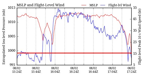
Aric Dunn wrote:Alyono wrote:JaxGator wrote:Recon measured 999-998mbs on a recent pass:
https://pbs.twimg.com/media/Co3xc6aW8AY0ZyA.jpg
not a valid reading as it was measured during a climb
officially the last pass was 1002 mb
and NHC raised winds to 50mph as expected.
Thank you. They must have been climbing to 10,000ft. Yep, it's stronger. Question is how strong can it get before landfall.
0 likes
The posts or stuff said are NOT an official forecast. Please look to the NHC and NWS for official forecasts and products.
Floyd-1999, Frances-2004, Jeanne-2004, Fay-2008, Beryl-2012, Debby-2012, Colin-2016, Hermine-2016, Julia-2016, Matthew-2016, Irma-2017, Elsa-2021, Idalia-2023, Debby-2024, Helene-2024.
Go Gators! Go Jags!
Floyd-1999, Frances-2004, Jeanne-2004, Fay-2008, Beryl-2012, Debby-2012, Colin-2016, Hermine-2016, Julia-2016, Matthew-2016, Irma-2017, Elsa-2021, Idalia-2023, Debby-2024, Helene-2024.
Go Gators! Go Jags!
-
TheStormExpert
Re: ATL: EARL - Models
gatorcane wrote:12Z ECMWF out through 48 hours and is much weaker than 00Z. TS into Belize.
Vorticity looks stronger after landfall so maybe it ramps up quickly just prior to landfall which the run does not show?

0 likes
-
weathaguyry

- Category 5

- Posts: 1273
- Age: 22
- Joined: Wed Jun 15, 2016 5:16 am
- Location: Long Island, NY
Re: ATL: EARL - Tropical Storm - Discussion
I think that it can reach minimal hurricane strength before landfall on the Yucatan, I'm not sure how strong it can get over the BOC because i'm not sure exactly where it will emerge, 65mph for Earl's peak seems too low, considering the new recon data, and that it will have the rest of today and most of tomorrow over extremely warm waters 
0 likes
My posts are only my opinions and NOT official forecasts. For official forecasts, consult the National Hurricane Center or the National Weather Service.
Irene 11', Sandy 12', Fay 20’, Isaias 20’, Elsa 21’, Henri 21’, Ida 21’
Irene 11', Sandy 12', Fay 20’, Isaias 20’, Elsa 21’, Henri 21’, Ida 21’
-
SouthDadeFish

- Professional-Met

- Posts: 2835
- Joined: Thu Sep 23, 2010 2:54 pm
- Location: Miami, FL
- Contact:
Re: ATL: EARL - Tropical Storm - Discussion
I don't really think the system is strengthening. Pressure has maintained at 1002 mb between the three passes. Winds only went up because the storm was not fully sampled at the 16Z advisory. The system is still very ragged on satellite imagery. The convective pattern needs to become more symmetric for significant strengthening to occur.
1 likes
-
TheStormExpert
Re: ATL: EARL - Models
EC has about 997mb at landfall
Shows major weakening during the next 12 hours before it reintensifies again
Shows major weakening during the next 12 hours before it reintensifies again
0 likes
-
Yellow Evan

- Professional-Met
- Posts: 16232
- Age: 27
- Joined: Fri Jul 15, 2011 12:48 pm
- Location: Henderson, Nevada/Honolulu, HI
- Contact:
Re: ATL: EARL - Models
Don't be surprised if Earl doesn't make it in the BOC for very long, if at all, ECMWF buries it, GFS has it moving in briefly and they have a northerly bias for these sort of systems. The UKMET is even more south.
0 likes
-
Tireman4

- S2K Supporter
- Posts: 5903
- Age: 60
- Joined: Fri Jun 30, 2006 1:08 pm
- Location: Humble, Texas
- Contact:
Re: ATL: EARL - Tropical Storm - Discussion
srainhoutx wrote:tarheelprogrammer wrote:Looks like LLC is about to become exposed. Classical Atlantic storm for the past 11 years for the most part. It keeps trying to fire convection but its speed and the wind shear around it are hindering it.
Wrong. How quickly we forget the 2008 Season.
Are you bringing up the I word? LOL
0 likes
Re: ATL: EARL - Tropical Storm - Discussion
Looks a bit messy. I feel like we've seen this movie before with fast-moving systems in the Caribbean in July and early August, they often have a hard time consolidating and really wrapping up. If this was W @ 15mph instead of W @ 22mph, I bet we'd be looking at something different.
0 likes
-
Aric Dunn
- Category 5
- Posts: 21238
- Age: 43
- Joined: Sun Sep 19, 2004 9:58 pm
- Location: Ready for the Chase.
- Contact:
Re: ATL: EARL - Tropical Storm - Discussion
Next recon is on its way.
0 likes
Note: If I make a post that is brief. Please refer back to previous posts for the analysis or reasoning. I do not re-write/qoute what my initial post said each time.
If there is nothing before... then just ask
Space & Atmospheric Physicist, Embry-Riddle Aeronautical University,
I believe the sky is falling...
If there is nothing before... then just ask
Space & Atmospheric Physicist, Embry-Riddle Aeronautical University,
I believe the sky is falling...

Re: ATL: EARL - Recon - Discussion
what time is the second recon flight due to depart in EST please still haven't figured out zulu time in relation to EST (which is currently 2 hours ahead of Belize) many thanks
0 likes
-
Tireman4
- S2K Supporter
- Posts: 5903
- Age: 60
- Joined: Fri Jun 30, 2006 1:08 pm
- Location: Humble, Texas
- Contact:
Re: ATL: EARL - Tropical Storm - Discussion
Sandy (HURAKAN) is on it...I hope he posts pictures..
0 likes
-
Aric Dunn
- Category 5
- Posts: 21238
- Age: 43
- Joined: Sun Sep 19, 2004 9:58 pm
- Location: Ready for the Chase.
- Contact:
Re: ATL: EARL - Tropical Storm - Discussion
Tireman4 wrote:Sandy (HURAKAN) is on it...I hope he posts pictures..
Yep.im sure he will if not during then after.
Convection firing right over center. low level cloud deck out ahead of it is starting to thicken could see a good sized convective burst
0 likes
Note: If I make a post that is brief. Please refer back to previous posts for the analysis or reasoning. I do not re-write/qoute what my initial post said each time.
If there is nothing before... then just ask
Space & Atmospheric Physicist, Embry-Riddle Aeronautical University,
I believe the sky is falling...
If there is nothing before... then just ask
Space & Atmospheric Physicist, Embry-Riddle Aeronautical University,
I believe the sky is falling...
Re: ATL: EARL - Recon - Discussion
Tireman4 wrote:Sandy (HURAKAN) is on one of the recons going in
now that is cool I remember Hurakan's posts when I first lurked here before getting the balls up to register and ask questions.
0 likes
Re: ATL: EARL - Models
TheStormExpert wrote:gatorcane wrote:12Z ECMWF out through 48 hours and is much weaker than 00Z. TS into Belize.
Vorticity looks stronger after landfall so maybe it ramps up quickly just prior to landfall which the run does not show?
if it comes in a little more south near Gails Point than the GFS then it will be like 24 October 2010 Hurricane Richard which ramped up "technically" on land as the coastline has lagoon swamp shallow and at this time of year HOT, Model could be using that archive data to show something similar occurring in the run
0 likes

Re: ATL: EARL - Tropical Storm - Discussion
Looks like 3-4 centers of ciruculation in this storm. One NW of Jamacia looks interesting. Near naked swirls SW corner, two more near the bursts of convection. Which will win? Bears Watching...
The posts in this forum are NOT official forecast and should not be used as such. They are just the opinion of the poster and may or may not be backed by sound meteorological data. They are NOT endorsed by any professional institution or STORM2K. For official information, please refer to products from the National Hurricane Center and National Weather Service.
The posts in this forum are NOT official forecast and should not be used as such. They are just the opinion of the poster and may or may not be backed by sound meteorological data. They are NOT endorsed by any professional institution or STORM2K. For official information, please refer to products from the National Hurricane Center and National Weather Service.
0 likes
Who is online
Users browsing this forum: No registered users and 22 guests