12z GFS=Nada.
https://twitter.com/philklotzbach/status/763783846273757184
2016 Global Model Runs Discussion (Out to Day 16)
Moderator: S2k Moderators
Forum rules

The posts in this forum are NOT official forecasts and should not be used as such. They are just the opinion of the poster and may or may not be backed by sound meteorological data. They are NOT endorsed by any professional institution or STORM2K. For official information, please refer to products from the National Hurricane Center and National Weather Service.
-
cycloneye

- Admin

- Posts: 149383
- Age: 69
- Joined: Thu Oct 10, 2002 10:54 am
- Location: San Juan, Puerto Rico
Re: 2016 Global Model Runs Discussion (Out to Day 16)
0 likes
Visit the Caribbean-Central America Weather Thread where you can find at first post web cams,radars
and observations from Caribbean basin members Click Here
and observations from Caribbean basin members Click Here


Re: 2016 Global Model Runs Discussion (Out to Day 16)
StormHunter72 wrote:Hope it stays quiet.
Ok and what is the reason we like to visit this board?
Not to watch nothing.
1 likes
-
alienstorm

- Category 1

- Posts: 496
- Joined: Tue Jul 31, 2007 1:29 pm
- Location: Miami Fla western suburb
Re: 2016 Global Model Runs Discussion (Out to Day 16)
Interesting that some west winds were reported in Barbados from the wave that going by.
http://rammb.cira.colostate.edu/ramsdis ... display=12
http://rammb.cira.colostate.edu/ramsdis ... display=12
0 likes
Personal Forecast Disclaimer:The posts in this forum are NOT official forecast and should not be used as such. They are just the opinion of the poster and may or may not be backed by sound meteorological data. They are NOT endorsed by any professional institution or storm2k.org. For official information, please refer to the NHC and NWS products.
-
Dean4Storms
- S2K Supporter

- Posts: 6358
- Age: 63
- Joined: Sun Aug 31, 2003 1:01 pm
- Location: Miramar Bch. FL
Re: 2016 Global Model Runs Discussion (Out to Day 16)
Some rotation starting to show up with the Wave entering the Carib. on MIMIC-TPW....
http://tropic.ssec.wisc.edu/real-time/mimic-tpw/natl/main.html
http://tropic.ssec.wisc.edu/real-time/mimic-tpw/natl/main.html
0 likes
-
tarheelprogrammer

- S2K Supporter
- Posts: 1793
- Joined: Mon Mar 28, 2016 9:25 pm
- Location: Raleigh, NC area (Garner, NC)
Re: 2016 Global Model Runs Discussion (Out to Day 16)
Dean4Storms wrote:Some rotation starting to show up with the Wave entering the Carib. on MIMIC-TPW....
http://tropic.ssec.wisc.edu/real-time/mimic-tpw/natl/main.html
Shear ahead of it. Death is almost a certainty. However, the tropics always have surprises.
0 likes
My posts are not official forecasts. They are just my opinion and may or may not be backed by sound meteorological data. They are NOT endorsed by any professional institution or storm2k.org. For official information, please refer to the NHC and NWS products.
-
Hurricaneman

- Category 5

- Posts: 7404
- Age: 45
- Joined: Tue Aug 31, 2004 3:24 pm
- Location: central florida
Re: 2016 Global Model Runs Discussion (Out to Day 16)
The 18zGFS has a wave come off of Africa at about 72hrs and develops a closed low at 192hrs, this may be something to watch but I think the GFS may be too slow with this feature
The posts in this forum are NOT official forecast and should not be used as such. They are just the opinion of the poster and may or may not be backed by sound meteorological data. They are NOT endorsed by any professional institution or STORM2K. For official information, please refer to products from the National Hurricane Center and National Weather Service
The posts in this forum are NOT official forecast and should not be used as such. They are just the opinion of the poster and may or may not be backed by sound meteorological data. They are NOT endorsed by any professional institution or STORM2K. For official information, please refer to products from the National Hurricane Center and National Weather Service
0 likes

Re: 2016 Global Model Runs Discussion (Out to Day 16)
GFS now developing that wave into a compact tropical storm:

0 likes
-
Hurricaneman
- Category 5
- Posts: 7404
- Age: 45
- Joined: Tue Aug 31, 2004 3:24 pm
- Location: central florida
Re: 2016 Global Model Runs Discussion (Out to Day 16)
Siker wrote:GFS now developing that wave into a compact tropical storm:
could be something that has to be watched farther west
The posts in this forum are NOT official forecast and should not be used as such. They are just the opinion of the poster and may or may not be backed by sound meteorological data. They are NOT endorsed by any professional institution or STORM2K. For official information, please refer to products from the National Hurricane Center and National Weather Service
1 likes
-
Hurricaneman
- Category 5
- Posts: 7404
- Age: 45
- Joined: Tue Aug 31, 2004 3:24 pm
- Location: central florida
Re: 2016 Global Model Runs Discussion (Out to Day 16)
The fact that the models are starting to pop tropical lows now is a sign that things may get cooking starting next week
The posts in this forum are NOT official forecast and should not be used as such. They are just the opinion of the poster and may or may not be backed by sound meteorological data. They are NOT endorsed by any professional institution or STORM2K. For official information, please refer to products from the National Hurricane Center and National Weather Service
The posts in this forum are NOT official forecast and should not be used as such. They are just the opinion of the poster and may or may not be backed by sound meteorological data. They are NOT endorsed by any professional institution or STORM2K. For official information, please refer to products from the National Hurricane Center and National Weather Service
0 likes
Re: 2016 Global Model Runs Discussion (Out to Day 16)
Eventually gets pretty sheared out north of the Caribbean by 384 hours as it follows an upper level low.
0 likes
-
stormwise
Re: 2016 Global Model Runs Discussion (Out to Day 16)
https://i.imgsafe.org/d78e268666.png
00ZGFS with what looks a closed off depression @234hrs, usually anything past 110hrs don't get my interest.
00ZGFS with what looks a closed off depression @234hrs, usually anything past 110hrs don't get my interest.
0 likes

Re: 2016 Global Model Runs Discussion (Out to Day 16)
You would think Dr Phil K would not be wasting his time on looking at the GFS windshear forecast when first of all it is so unpredictable and secondly the GFS has been too aggressive in forecasting higher than average windshear for the Caribbean in its medium to long range forecast all season long when in fact windshear has been below average over all.
https://twitter.com/philklotzbach/status/764079275079184385
https://twitter.com/philklotzbach/status/764079275079184385
0 likes
-
StormHunter72
- Tropical Storm

- Posts: 166
- Joined: Wed May 25, 2016 6:36 am
- Location: Nature Coast
Re: 2016 Global Model Runs Discussion (Out to Day 16)
To get information if something does form.MetroMike wrote:StormHunter72 wrote:Hope it stays quiet.
Ok and what is the reason we like to visit this board?
Not to watch nothing.
1 likes
The following post is NOT an official forecast and should not be used as such. It is just the opinion of the poster and may or may not be backed by sound meteorological data. It is NOT endorsed by any professional institution including storm2k.org For Official Information please refer to the NHC and NWS products.
Re: 2016 Global Model Runs Discussion (Out to Day 16)
I wonder if he is going to tweet this today, I doubt it because is forecast is for a quiet rest of August over the Atlantic:
0 likes
-
centuryv58

- Tropical Storm
- Posts: 233
- Age: 67
- Joined: Sat Jul 30, 2016 1:24 pm
- Location: Southeast Florida
Re: 2016 Global Model Runs Discussion (Out to Day 16)
NDG wrote:
I wonder if he is going to tweet this today, I doubt it because is forecast is for a quiet rest of August over the Atlantic:
Yes, he may be a bit at odds with NOAA. Somewhere, in all the predictions, the "truth" may lay. Still installing shutters though.
0 likes
-
Hurricaneman
- Category 5
- Posts: 7404
- Age: 45
- Joined: Tue Aug 31, 2004 3:24 pm
- Location: central florida
Re: 2016 Global Model Runs Discussion (Out to Day 16)
While not likely being the 384GFS at 6z but the steering current as modeled looks like the ridge builds back in beyond 384hrs and would be a threat to the southeastern US but what it may tell us is that starting around the 20th the tropical atlantic wakes up at about 120hrs
The posts in this forum are NOT official forecast and should not be used as such. They are just the opinion of the poster and may or may not be backed by sound meteorological data. They are NOT endorsed by any professional institution or STORM2K. For official information, please refer to products from the National Hurricane Center and National Weather Service
The posts in this forum are NOT official forecast and should not be used as such. They are just the opinion of the poster and may or may not be backed by sound meteorological data. They are NOT endorsed by any professional institution or STORM2K. For official information, please refer to products from the National Hurricane Center and National Weather Service
0 likes
-
gatorcane

- S2K Supporter
- Posts: 23708
- Age: 48
- Joined: Sun Mar 13, 2005 3:54 pm
- Location: Boca Raton, FL
Re: 2016 Global Model Runs Discussion (Out to Day 16)
NDG wrote:You would think Dr Phil K would not be wasting his time on looking at the GFS windshear forecast when first of all it is so unpredictable and secondly the GFS has been too aggressive in forecasting higher than average windshear for the Caribbean in its medium to long range forecast all season long when in fact windshear has been below average over all.
https://twitter.com/philklotzbach/statu ... 5079184385
It's tempting to look at model runs that go out to 384 hours and make predictions.
When it comes to genesis, model accuracy dramatically starts dropping especially after a week out.
I see signs digging into the model runs that things may gradually start becoming more favorable after about ~Aug 20th onward.
0 likes
-
TheStormExpert
Re: 2016 Global Model Runs Discussion (Out to Day 16)
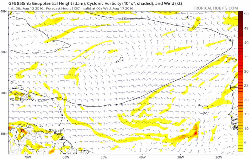
12z GFS doesn't develop the wave coming off Africa a week or so from now anymore but instead has two tropical cyclones traversing the Tropical Atlantic in the extreme long-range. What we might be able to take from this is a pickup in activity in the Atlantic(especially the Tropical Atlantic) by the end of this month.


1 likes

Re: 2016 Global Model Runs Discussion (Out to Day 16)
Curously, the NAV-GEM and CMC are continuing to indicate inactivity. I guess they've finally been neutered 
0 likes
Andy D
(For official information, please refer to the NHC and NWS products.)
(For official information, please refer to the NHC and NWS products.)
Re: 2016 Global Model Runs Discussion (Out to Day 16)
12z Euro ensembles are pretty enthusiastic about the wave coming off in a week, as well as the one behind it (to a lesser extent).
0 likes
Who is online
Users browsing this forum: Kingarabian and 165 guests