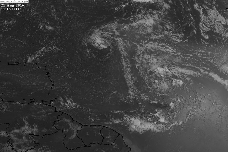
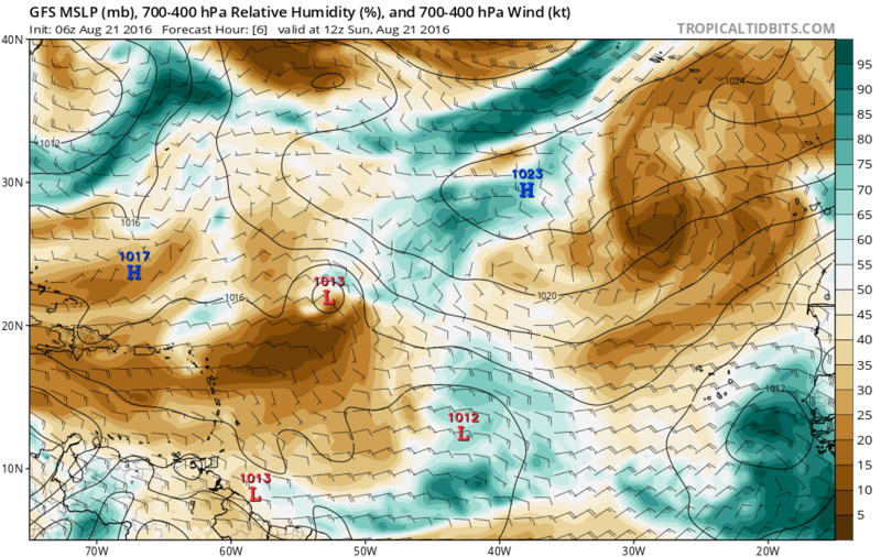
psyclone wrote:its best opportunity for development may still reside just beyond the 5 day forecast window. Nevertheless, it will need some persistent convection at some point. But it's a big circulation destined to encounter warmer waters in late August. I wouldn't write it off but it's likely a snooze fest for the next few days.
Warmers might help in instability but it still needs to get away from the capped atmosphere over it, may do that as it starts nearing the Leeward Islands, but there's still a lot of dry air over the Caribbean.
Is over a fairly stable environment right now:
Code: Select all
ate: 6 hour UKMET valid 18Z SUN 21 AUG 16
Station: 15,-45
Latitude:   15.00
Longitude: -45.00
-------------------------------------------------------------------------------
LEV PRES  HGHT  TEMP  DEWP  RH  DD   WETB DIR SPD THETA THE-V THE-W THE-E   W
     mb     m     C     C    %   C     C  deg knt   K     K     K     K    g/kg
-------------------------------------------------------------------------------
  0  850  1521  18.1  16.9  93  1.2  17.3  99  20 305.1 307.8 296.3 348.2 14.43
  1  700  3167  10.6   8.2  85  2.4   9.1  94  16 314.3 316.1 295.4 344.8  9.82
  2  600  4436   3.7  -0.4  75  4.0   1.5  83  11 320.4 321.6 294.4 340.4  6.22
  3  500  5899  -3.8 -13.4  47  9.6  -7.7  62   6 328.4 329.0 293.7 337.7  2.72
  4  400  7624 -15.0                       64   9 335.5
  5  300  9737 -30.2                       54  18 342.8
  6  250 11006 -40.4                       57  21 346.0
  7  200 12487 -52.8                       79  25 349.2
  8  150 14274 -68.8                       86  23 351.6
  9  100 16645 -76.4                      121  13 380.1
TRP                                             0
WND                                             0

Sounding variables and indices
Freezing level:          550.73 mb =  5157.07 m = 16919.31 ft
Wetbulb zero:            584.13 mb =  4651.44 m = 15260.44 ft
Precipitable water:        1.21 inches
700-500 lapse rate:        5.27 C/km
ThetaE index:            10347.21 C Layer  700.0-  -0.0 mb
Showalter Index:          -0.16 C Risk: Thunderstorms probable
Total Totals Index:       42.57 C Risk: None
  Vertical Totals Index:  21.86 C
  Cross Totals Index:     20.71 C
K Index:                  36.38   Risk: > 80 % chance of thunderstorms
Sweat Index:             247.80   Risk: None
Energy Index:             -2.06   Risk: Severe Thunderstorms probable

 Precip water view of 99L


