ATL: HERMINE - Post-Tropical - Discussion

Moderator: S2k Moderators

Message
Author
User avatar
northjaxpro
S2K Supporter
S2K Supporter
Posts: 8900
Joined: Mon Sep 27, 2010 11:21 am
Location: Jacksonville, FL

Re: ATL: INVEST 99L - Recon Discussion

#581 Postby northjaxpro » Tue Aug 23, 2016 5:07 am

RL3AO wrote:It's scheduled for take off at 13Z. I still don't think it needs to go today but maybe they want data.


Yes. We definitely need to get a better sampling of data with the environment surrounding 99L. Any new data imputed to the models should help give us better insight to what will evolve with this system hopefully down the road, especially for the next 5-7 days.
0 likes   
NEVER, EVER SAY NEVER in the tropics and weather in general, and most importantly, with life itself!!

________________________________________________________________________________________

Fay 2008 Beryl 2012 Debby 2012 Colin 2016 Hermine 2016 Julia 2016 Matthew 2016 Irma 2017 Dorian 2019

User avatar
AJC3
Admin
Admin
Posts: 3999
Age: 61
Joined: Tue Aug 31, 2004 7:04 pm
Location: Ballston Spa, New York
Contact:

Re: ATL: INVEST 99L - Discussion

#582 Postby AJC3 » Tue Aug 23, 2016 5:13 am

You probably thought that was said because of the text I highlighted.
0 likes   

User avatar
cycloneye
Admin
Admin
Posts: 145330
Age: 68
Joined: Thu Oct 10, 2002 10:54 am
Location: San Juan, Puerto Rico

Re: ATL: INVEST 99L - Discussion

#583 Postby cycloneye » Tue Aug 23, 2016 5:20 am

0 likes   
Visit the Caribbean-Central America Weather Thread where you can find at first post web cams,radars
and observations from Caribbean basin members Click Here

Nederlander
S2K Supporter
S2K Supporter
Posts: 1250
Joined: Sat Jul 19, 2008 4:28 pm
Location: Conroe, TX

Re: ATL: INVEST 99L - Discussion

#584 Postby Nederlander » Tue Aug 23, 2016 5:24 am

Image

The PW comparison of the 3 systems is amazing... Poor Fiona lol
0 likes   

User avatar
SFLcane
S2K Supporter
S2K Supporter
Posts: 10163
Age: 47
Joined: Sat Jun 05, 2010 1:44 pm
Location: Lake Worth Florida

Re: ATL: INVEST 99L - Discussion

#585 Postby SFLcane » Tue Aug 23, 2016 5:29 am

0 likes   

User avatar
SFLcane
S2K Supporter
S2K Supporter
Posts: 10163
Age: 47
Joined: Sat Jun 05, 2010 1:44 pm
Location: Lake Worth Florida

Re: ATL: INVEST 99L - Discussion

#586 Postby SFLcane » Tue Aug 23, 2016 5:34 am

0 likes   

jlauderdal
S2K Supporter
S2K Supporter
Posts: 7183
Joined: Wed May 19, 2004 5:46 am
Location: NE Fort Lauderdale
Contact:

Re: ATL: INVEST 99L - Discussion

#587 Postby jlauderdal » Tue Aug 23, 2016 5:38 am

yep, we will monitor closely... 8-)
0 likes   

User avatar
Gustywind
Category 5
Category 5
Posts: 12334
Joined: Mon Sep 03, 2007 7:29 am
Location: Baie-Mahault, GUADELOUPE

Re: ATL: INVEST 99L - Discussion

#588 Postby Gustywind » Tue Aug 23, 2016 5:41 am

First SSD appareance...

23/0545 UTC 15.9N 54.7W T1.0/1.0 99L
0 likes   

User avatar
Blinhart
Category 5
Category 5
Posts: 2081
Age: 48
Joined: Thu Sep 08, 2011 3:13 pm
Location: Crowley, La.

Re: ATL: INVEST 99L - Discussion

#589 Postby Blinhart » Tue Aug 23, 2016 5:45 am

So will this be a Katrina, Andrew or Lilly? or something totally different? I guess it all depends on where the center is located when it forms and many different things that can change in a heart beat.
0 likes   
Personal Forecast Disclaimer:
The posts in this forum are NOT official forecast and should not be used as such. They are just the opinion of the poster and may or may not be backed by sound meteorological data. They are NOT endorsed by any professional institution or storm2k.org. For official information, please refer to the NHC and NWS products.

User avatar
Gustywind
Category 5
Category 5
Posts: 12334
Joined: Mon Sep 03, 2007 7:29 am
Location: Baie-Mahault, GUADELOUPE

Re: ATL: INVEST 99L - Discussion

#590 Postby Gustywind » Tue Aug 23, 2016 5:45 am

Tropical Weather Discussion
NWS National Hurricane Center Miami FL

A tropical wave is located about 348 nm east-southeast of the
Leeward Islands extending from 11N to 21N with axis near 55W. The
wave is associated with a 1009 mb low located near 16N55W and has
been moving west at 15-20 kt within the last 24 hour
s. Moisture
has increased in the wave environment, which along with favorable
deep layer wind shear and upper level diffluence
support heavy showers
and isolated tstms from 13N to 20N between 53W and 58W. Conditions
are marginally conducive for some gradual development during the
next few days while the disturbance moves westward to west-
northwestward. Environmental conditions could become more
conducive for development late this week when the system is
expected to move near Hispaniola and Puerto Rico, and the
southeastern and central Bahamas.
0 likes   

User avatar
deltadog03
Professional-Met
Professional-Met
Posts: 3580
Joined: Tue Jul 05, 2005 6:16 pm
Location: Macon, GA

Re: ATL: INVEST 99L - Discussion

#591 Postby deltadog03 » Tue Aug 23, 2016 5:46 am

Looks pretty good for now. The daily blow ups will continue with that much moisture around...
0 likes   

User avatar
NDG
S2K Supporter
S2K Supporter
Posts: 15446
Joined: Sun Jul 09, 2006 10:14 pm
Location: Orlando, FL

Re: ATL: INVEST 99L - Discussion

#592 Postby NDG » Tue Aug 23, 2016 5:46 am

Morning satellite of all TD Fiona, 99L & TS Gaston.
Yeap, the GFS makes perfect sense that Fiona will absorb 99L, lol j/k

Image
0 likes   

User avatar
Blown Away
S2K Supporter
S2K Supporter
Posts: 10146
Joined: Wed May 26, 2004 6:17 am

Re: ATL: INVEST 99L - Discussion

#593 Postby Blown Away » Tue Aug 23, 2016 5:47 am

Image
TAFB... First appearance of "Possible Tropical Cyclone"
0 likes   
Hurricane Eye Experience: David 79, Irene 99, Frances 04, Jeanne 04, Wilma 05... EYE COMING MY WAY IN 2024…
Hurricane Brush Experience: Andrew 92, Erin 95, Floyd 99, Matthew 16, Irma 17, Ian 22, Nicole 22…

User avatar
NDG
S2K Supporter
S2K Supporter
Posts: 15446
Joined: Sun Jul 09, 2006 10:14 pm
Location: Orlando, FL

Re: ATL: INVEST 99L - Discussion

#594 Postby NDG » Tue Aug 23, 2016 6:15 am

Image
1 likes   

User avatar
MGC
S2K Supporter
S2K Supporter
Posts: 5899
Joined: Sun Mar 23, 2003 9:05 pm
Location: Pass Christian MS, or what is left.

Re: ATL: INVEST 99L - Discussion

#595 Postby MGC » Tue Aug 23, 2016 6:17 am

I've been looking at the first few visible frames, there is clearly a wind out of the north which then shift to a NW wind to 99L south. Looks to me a circulation might be forming to me. Recon will prove if I'm right or wrong......MGC
0 likes   

User avatar
NDG
S2K Supporter
S2K Supporter
Posts: 15446
Joined: Sun Jul 09, 2006 10:14 pm
Location: Orlando, FL

Re: ATL: INVEST 99L - Discussion

#596 Postby NDG » Tue Aug 23, 2016 6:23 am

Barbados has been reporting northerly winds this morning, no question it has had a broad circulation for days now but the question is if the Recon will find a well defined LLC. No such evidence this morning, IMO. Recon will answer it for us.
0 likes   

User avatar
JaxGator
Category 2
Category 2
Posts: 780
Joined: Sun Jun 12, 2016 3:33 pm
Location: Jacksonville Florida

Re: ATL: INVEST 99L - Discussion

#597 Postby JaxGator » Tue Aug 23, 2016 6:28 am

Hammy wrote:
JaxGator wrote:
Blown Away wrote:
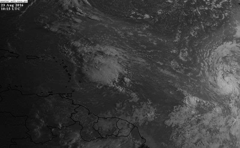
Very active TW... 99L has looked very healthy all day... The models initial points don't reflect a tropical low this healthy...


They might be underestimating it in its current healthy state.


I wouldn't say healthy, latest ASCAT pass shows there's little to no circulation left and it's flattened out quite a bit since yesterday.

Image


Humm..interesting. Well, they'll have to do a new pass overhead plus if recon goes in, they find out for sure if a low has formed or in the process of forming. Its huge moisture and engery supply it has is helping right now.
0 likes   
The posts or stuff said are NOT an official forecast. Please look to the NHC and NWS for official forecasts and products.

Floyd-1999, Frances-2004, Jeanne-2004, Fay-2008, Beryl-2012, Debby-2012, Colin-2016, Hermine-2016, Julia-2016, Matthew-2016, Irma-2017, Elsa-2021, Idalia-2023, Debby-2024, Helene-2024.


Go Gators! Go Jags!

User avatar
SouthDadeFish
Professional-Met
Professional-Met
Posts: 2835
Joined: Thu Sep 23, 2010 2:54 pm
Location: Miami, FL
Contact:

Re: ATL: INVEST 99L - Discussion

#598 Postby SouthDadeFish » Tue Aug 23, 2016 6:30 am

It does appear that convective outflow is improving in the western, southern, and eastern quadrants. This is a sign that the disturbance is becoming more aligned with the upper-tropospheric anticyclone, which will aid further convective development. At this time, I doubt a surface circulation exists, but there is clearly some cyclonic turning going on. I'm assuming it is primarily occurring in the mid-levels.

It will be a close call whether or not NHC sends out recon today. If convection persists, I would lean towards them sending out recon due to the disturbance's proximity to land.
2 likes   

User avatar
NDG
S2K Supporter
S2K Supporter
Posts: 15446
Joined: Sun Jul 09, 2006 10:14 pm
Location: Orlando, FL

Re: ATL: INVEST 99L - Discussion

#599 Postby NDG » Tue Aug 23, 2016 6:32 am

JaxGator wrote:
Hammy wrote:
JaxGator wrote:
They might be underestimating it in its current healthy state.


I wouldn't say healthy, latest ASCAT pass shows there's little to no circulation left and it's flattened out quite a bit since yesterday.

http://i.imgur.com/KhfWGKC.png


Humm..interesting. Well, they'll have to do a new pass overhead plus if recon goes in, they find out for sure if a low has formed or in the process of forming. Its huge moisture and engery supply it has is helping right now.


The pass is from 8:23 PM last night and it missed half of the system.
0 likes   

User avatar
JaxGator
Category 2
Category 2
Posts: 780
Joined: Sun Jun 12, 2016 3:33 pm
Location: Jacksonville Florida

Re: ATL: INVEST 99L - Discussion

#600 Postby JaxGator » Tue Aug 23, 2016 6:36 am

NDG wrote:
JaxGator wrote:
Hammy wrote:
I wouldn't say healthy, latest ASCAT pass shows there's little to no circulation left and it's flattened out quite a bit since yesterday.

http://i.imgur.com/KhfWGKC.png


Humm..interesting. Well, they'll have to do a new pass overhead plus if recon goes in, they find out for sure if a low has formed or in the process of forming. Its huge moisture and engery supply it has is helping right now.


The pass is from 8:23 PM last night and it missed half of the system.


I saw the time but didn't know it missed half of it. Thanks. It should look different this morning.
0 likes   
The posts or stuff said are NOT an official forecast. Please look to the NHC and NWS for official forecasts and products.

Floyd-1999, Frances-2004, Jeanne-2004, Fay-2008, Beryl-2012, Debby-2012, Colin-2016, Hermine-2016, Julia-2016, Matthew-2016, Irma-2017, Elsa-2021, Idalia-2023, Debby-2024, Helene-2024.


Go Gators! Go Jags!


Return to “2016”

Who is online

Users browsing this forum: No registered users and 8 guests