ATL: HERMINE - Post-Tropical - Discussion
Moderator: S2k Moderators
Re: ATL: NINE - Tropical Depression - Discussion
The 5 day HPC rainfall estimate lends credence to the idea of an symmetric, right loaded cyclone with all the heavy rain near and east of the center. the entire west coast gets a hefty dumping from Taylor county all the way to Collier. there is a dramatic cutoff in rain west of Taylor county. It will be worth watching these forecasts evolve for another perspective on thinking. I never discount the possibility of meaningful strengthening, especially in late August but there's another possibility here...which is that the storm remains weak and is ultimately an interesting break from the monotonous heat. that is a distinct possibility. it may not attain great strength and could be accelerating sufficiently to avoid inundating a particular region with excessive rain (I'm referencing florida here not Cuba which is getting bombed with heavy rain). I suspect we get a TS at landfall...but a category 1 seems within the realm of possibility as that's not much higher than the official forecast and the system looks much better (so far) today.
1 likes


Re: ATL: NINE - Tropical Depression - Discussion
Yesterday, Tireman4 wrote:Portastorm wrote:After viewing the projected NHC path, Storm 2K moderators are ordering extra coffee supplies for Monday anticipating the Monday night series of posts here of "it's turning NW" or "OMG ... it's not turning yet!"
You forgot the most famous phrase of all..." I see an eye" LOL
PerfectStorm wrote:Is that an eye feature at 14:45 (last frame or two) peeping out where COC/LLC?
TimeZone wrote:You knew it was only a matter of time before we had this post.
4 likes


Re: ATL: NINE - Tropical Depression - Discussion
Looking very healthy. I think upgrade to TS coming very soon...
2 likes
Re: ATL: NINE - Tropical Depression - Discussion
I agree! This thing looks waaay healthier than ever on this image:
https://earth.nullschool.net/#current/w ... 24.36,1024
https://earth.nullschool.net/#current/w ... 24.36,1024
4 likes
Cleo - 1964, Betsy - 1965, David - 1979, Andrew - 1992, Charlie (Francis, Ivan, Jeanne) - 2004, Irma - 2017, Ian - 2022, Milton - 2024

Re: ATL: NINE - Tropical Depression - Discussion
In the low levels TD9 is sure is pulling a lot low level moisture from the deep tropics, the caribbean has moisten up nicely.

1 likes
-
hurrtracker79
- Tropical Depression

- Posts: 94
- Joined: Sun Jul 28, 2013 1:32 pm

Re: ATL: NINE - Tropical Depression - Discussion
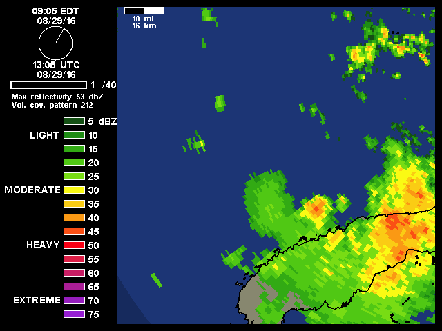
Looks like rain may be setting into the Glades for this afternoon.
That will help put moisture in the mid-levels.
That will help put moisture in the mid-levels.
1 likes
-
drewschmaltz
- S2K Supporter

- Posts: 351
- Joined: Thu Aug 27, 2015 8:19 pm
Re: ATL: NINE - Tropical Depression - Discussion
NDG wrote:In the low levels TD9 is sure is pulling a lot low level moisture from the deep tropics, the caribbean has moisten up nicely.
[i mg]http://tropic.ssec.wisc.edu/real-time/mimic-tpw/natl/anim/latest72hrs.gif[/img]
Are #8 and Gaston blocking off the dry air and even feeding this a little?
0 likes
I HAVE ABSOLUTELY NO IDEA WHAT I'M TALKING ABOUT. PLEASE CONSULT SOMEONE WHO DOES. START WITH THE NHC. ALL POSTS ARE FOR ENTERTAINMENT PURPOSES ONLY.
-
OuterBanker
- S2K Supporter
- Posts: 1761
- Joined: Wed Feb 26, 2003 10:53 am
- Location: Nags Head, NC
- Contact:
Re: ATL: NINE - Tropical Depression - Discussion
Alright, I'm over it!
This looks a lot better than td8, it was first.
217 pages of discussion and still no name.
We all thought this was going to be Hermine to begin with.
Just call it Hermine OK?
Hermine just sounds like bad grammar to begin with.
It should be She's mine not Her mine.
This looks a lot better than td8, it was first.
217 pages of discussion and still no name.
We all thought this was going to be Hermine to begin with.
Just call it Hermine OK?
Hermine just sounds like bad grammar to begin with.
It should be She's mine not Her mine.
5 likes


Re: ATL: NINE - Tropical Depression - Discussion
Can really see the low level vorticity increase on SAT this morning - might be a TS now.
http://www.ssd.noaa.gov/PS/TROP/floaters/09L/flash-vis-long.html
http://www.ssd.noaa.gov/PS/TROP/floaters/09L/flash-vis-long.html
2 likes

Re: ATL: NINE - Tropical Depression - Discussion
is that an ULL near Louisiana? and where is it supposed to go during the trek of TD9?
1 likes
Robbielyn McCrary
I know just about enough to sound like I know what I'm talking about sometimes. But for your safety please follow the nhc for truly professional forecasting.
I know just about enough to sound like I know what I'm talking about sometimes. But for your safety please follow the nhc for truly professional forecasting.
Re: ATL: NINE - Tropical Depression - Discussion
drewschmaltz wrote:NDG wrote:In the low levels TD9 is sure is pulling a lot low level moisture from the deep tropics, the caribbean has moisten up nicely.
[i mg]http://tropic.ssec.wisc.edu/real-time/mimic-tpw/natl/anim/latest72hrs.gif[/img]
Are #8 and Gaston blocking off the dry air and even feeding this a little?
The dry air problem TD9 is having is at the mid levels. Notice how most of the moist environment is to the east of it, any shear could induce dry air from the west and north into the system, this might be why GFS and Euro don't strengthen it much during the next couple of days but we know that can all change.

0 likes
-
wxman57

- Moderator-Pro Met

- Posts: 23175
- Age: 68
- Joined: Sat Jun 21, 2003 8:06 pm
- Location: Houston, TX (southwest)
Re: ATL: NINE - Tropical Depression - Discussion
I was checking out the "depression" on my workstation and what do I see? I see what looks like an eye forming.

17 likes

Re: ATL: NINE - Tropical Depression - Discussion
psyclone wrote:The 5 day HPC rainfall estimate lends credence to the idea of an symmetric, right loaded cyclone with all the heavy rain near and east of the center. the entire west coast gets a hefty dumping from Taylor county all the way to Collier. there is a dramatic cutoff in rain west of Taylor county. It will be worth watching these forecasts evolve for another perspective on thinking. I never discount the possibility of meaningful strengthening, especially in late August but there's another possibility here...which is that the storm remains weak and is ultimately an interesting break from the monotonous heat. that is a distinct possibility. it may not attain great strength and could be accelerating sufficiently to avoid inundating a particular region with excessive rain (I'm referencing florida here not Cuba which is getting bombed with heavy rain). I suspect we get a TS at landfall...but a category 1 seems within the realm of possibility as that's not much higher than the official forecast and the system looks much better (so far) today.
Here's my worry. If one were to back up and look at the broader upper level flow that covers nearly the entire SE Conus (say from Kentucky south) and including the Gulf and well south into the W. Caribbean, it really is largely anticyclonic. I don't know how much the vertical shear will actually let up and frankly I just don't have too much confidence in how the models have handled this system. In the event that T.D. 9 really begin bombing out than it will itself potentially deflect any light shear at that time. Sure, we may see an upgrade to T.S. today but way more important than that would be a nearer term drop in pressure and higher wind speeds than previously forecast (per latest cyclone discussion). The 24hr. forecast calls for 45mph. I'm not suggesting this will occur but if we see this system finally take advantage of temporary upper level conditions along with the very warm SST's already in place, and begin to suddenly witness a quicker level of organization and intensity... than all bets are off AND you might have to "deep six" every bit of model data looked at today. If a 36 hour window exists to an extent where this system can begin to develop deep convection west of center and potentially some semplance of a more symetrical envelope, than I believe that the storm itself could play a greater influence towards the upper level environment than that which has thus far plagued it. Just in respect to the shear itself, its not as if a particularly large influence such as a particularly strong jet dropping out of the westerlies or some split branch of El Nino racing east from the Pacific. Sure, this T.D. might continue to fight unfavorable conditions until landfall and come in as a T.S. but if we start seeing significant development today and tonight, than my worry is not simply a "bump up" of forecast intensity to a min. hurricane. If this were to actually occur than I think it very reasonable that a strong Cat. 2 possibly threaten somewhere from Pensacola to Tampa. Of course, if this were to not play out, than I'd see little reason for it to remain weak but then suddenly intensify just prior to landfall.
3 likes
Andy D
(For official information, please refer to the NHC and NWS products.)
(For official information, please refer to the NHC and NWS products.)
-
PerfectStorm

- Tropical Depression
- Posts: 85
- Joined: Tue Sep 09, 2003 4:39 pm

-
crownweather

- S2K Supporter
- Posts: 602
- Age: 51
- Joined: Sat Aug 12, 2006 9:21 am
- Location: Sturbridge, Massachusetts
- Contact:
Re: ATL: NINE - Tropical Depression - Discussion
That is one of the prettiest eyes I've ever seen. lol.
wxman57 wrote:I was checking out the "depression" on my workstation and what do I see? I see what looks like an eye forming.
http://i65.tinypic.com/23sg478.jpg
3 likes
Rob Lightbown
Crown Weather Services
https://crownweather.com
Crown Weather Services
https://crownweather.com
Re: ATL: NINE - Tropical Depression - Discussion
Good discussion from Dr. Masters this am from his blog:
Intensity forecast for TD 9: more uncertain than usual
Once TD 9 pulls away from Cuba, a round of steady intensification is likely, with the system reaching tropical storm strength by Monday night. Satellite imagery late Monday morning showed that this process was already underway, with a notable increase in the storm’s organization. The SHIPS model on Monday morning predicted moderately favorable conditions for intensification, with wind shear falling to a moderate 10 - 15 knots Monday afternoon through Wednesday. SSTs will be a very warm 30 - 30.5°C (86 - 87°F), and mid-level relative humidity was predicted to be a reasonably moist 65 - 70%. However, there is a significant amount of dry air at middle and upper levels of the atmosphere that may interfere with development, and the usually reliable European and GFS models showed little development of TD 9 in their 12Z Sunday and 0Z Monday (8 pm EDT Sunday) runs because of this dry air, NHC forecaster Stacy Stewart argued in his forecast discussion on Sunday night. Our best dynamical intensity model, the HWRF model, had TD 9 intensifying into a Category 1 hurricane just before landfall, though, and our two best statistical intensity models, the DSHIPS and LGEM models, had TD 9 as a borderline tropical storm/Category 1 hurricane at landfall. NHC is going with a forecast of a 65 mph tropical storm at landfall, noting that increasing wind shear in the final day before landfall may stop the intensification process. TD 9 could be a Category 1 hurricane at landfall, as suggested by our best intensity models, and residents along the Gulf Coast of Florida should anticipate this possibility. This portion of the coast is highly vulnerable to large storm surges, due to the extensive stretch of shallow continental shelf water offshore that extend up to 90 miles from the coast. A worst-case Category 1 hurricane hitting at high tide can cause a storm surge that will inundate the Florida Gulf Coast north of Tampa to a depth to 9 - 10 feet, as seen in SLOSH model imagery available in WU’s storm surge pages.
2 likes
Re: ATL: NINE - Tropical Depression - Discussion
Update from AMSU
Got a nicely defined warm core.
1C centered at 8Km altiitude with no inversion.
Looks primed to ramp up.
Got a nicely defined warm core.
1C centered at 8Km altiitude with no inversion.
Looks primed to ramp up.
1 likes
Re: ATL: NINE - Tropical Depression - Discussion
I am not seeing TD 9 gain any latitude yet, a deep convective on the east quadrant now seems to be very close to the LLC.
MLC still seems to be to the east of the LLC just coming out of Cuba.
MLC still seems to be to the east of the LLC just coming out of Cuba.
2 likes
Who is online
Users browsing this forum: No registered users and 57 guests