ATL: MATTHEW - Post-Tropical - Discussion
Moderator: S2k Moderators
Re: ATL: MATTHEW - Hurricane - Discussion
That buoy just recorded a 74KT gust. 33 foot seas.
0 likes
-
Kingarabian

- S2K Supporter

- Posts: 16361
- Joined: Sat Aug 08, 2009 3:06 am
- Location: Honolulu, Hawaii
Re: ATL: MATTHEW - Hurricane - Discussion
Ptarmigan wrote:SunnyThoughts wrote:[img]http://www.ssd.noaa.gov/PS/TROP/floaters/14L/imagery/jsl_lalo-animated.gif[img] What on earth is that blob doing?
I keep seeing that area of thunderstorm east of Matthew.
I have seen areas of thunderstorms east of hurricanes. I wonder what causes them.
If there was a landfalling hurricane like Matthew, the thunderstorm east of the hurricane would be a second hit.
1900hurricane had a good explanation in Matthew's case:
1900hurricane wrote:Looks like some active convection in a confluent band. We're probably getting some extra convergence on the east side due to the low level trades moving faster than Matthew and running into the system.
0 likes
RIP Kobe Bryant
-
rickybobby
- Tropical Storm

- Posts: 174
- Joined: Fri Sep 18, 2015 11:11 am
- Location: Central Florida
Re: ATL: MATTHEW - Hurricane - Discussion
There's a NASCAR race in North Carolina this Saturday. Looks like it could be a washout.
0 likes
-
AutoPenalti
- Category 5

- Posts: 4091
- Age: 29
- Joined: Mon Aug 17, 2015 4:16 pm
- Location: Ft. Lauderdale, Florida
Re: ATL: MATTHEW - Hurricane - Discussion
Something tells me those west shifts aren't over...
0 likes
The posts in this forum are NOT official forecasts and should not be used as such. They are just the opinion of the poster and may or may not be backed by sound meteorological data. They are NOT endorsed by any professional institution or STORM2K. For official information, please refer to products from the NHC and NWS.
Model Runs Cheat Sheet:
GFS (5:30 AM/PM, 11:30 AM/PM)
HWRF, GFDL, UKMET, NAVGEM (6:30-8:00 AM/PM, 12:30-2:00 AM/PM)
ECMWF (1:45 AM/PM)
TCVN is a weighted averaged
-
txwatcher91
- Category 5
- Posts: 1498
- Joined: Tue Aug 02, 2005 2:29 pm
Re: ATL: MATTHEW - Hurricane - Discussion
It looks like on IR you can finally see the larger eye with an intense band of convection surrounding it and the old one possibly collapsing. If that's the case then EWRC might be finished up by noon tomorrow. Would be a worst case scenario for Haiti, Jamaica and Cuba.
0 likes
-
Bocadude85

- Category 5
- Posts: 2991
- Age: 39
- Joined: Mon Apr 18, 2005 2:20 pm
- Location: Honolulu,Hi
Re: ATL: MATTHEW - Hurricane - Discussion
AutoPenalti wrote:Something tells me those west shifts aren't over...
Maybe a few slight shifts..I don't see this getting any farther west then Grand Bahama Island and even that far west may be stretching it.
Last edited by Bocadude85 on Mon Oct 03, 2016 12:21 am, edited 1 time in total.
0 likes

Re: ATL: MATTHEW - Hurricane - Discussion
clear secondary wind maximum for the first time. EWRC is underway.
Winds may also be down to 100-105 kts. I expect them to increase significantly during the afternoon hours
Winds may also be down to 100-105 kts. I expect them to increase significantly during the afternoon hours
1 likes
-
txwatcher91
- Category 5
- Posts: 1498
- Joined: Tue Aug 02, 2005 2:29 pm
Re: ATL: MATTHEW - Hurricane - Discussion
Latest IR imagery suggest the EWRC is well underway. Also the secondary "blob" of convection is moving off to the NE now which might allow Matthew to grow and strengthen. The bad news is that area is heading right for Haiti and the DR.
0 likes
-
beoumont

- Category 1

- Posts: 473
- Joined: Sun Jul 10, 2011 4:13 pm
- Location: East Central Florida
- Contact:
Re: ATL: MATTHEW - Hurricane - Discussion
rickybobby wrote:There's a NASCAR race in North Carolina this Saturday. Looks like it could be a washout.
One of those cases when a hurricane actually could save lives. I recall in 1960, during the weekend when Hurricane Donna passed over the whole of the Florida Peninsula, 4 people died in auto accidents. During an average weekend, back then, 11 people usually died on Florida highways. The suspension of normal travel patterns was an "unintended consequence"; so Donna actually saved about 7 lives that weekend.

1 likes
List of 79 tropical cyclones intercepted by Richard Horodner:
http://www.canebeard.com/page/page/572246.htm
http://www.canebeard.com/page/page/572246.htm
-
AutoPenalti
- Category 5
- Posts: 4091
- Age: 29
- Joined: Mon Aug 17, 2015 4:16 pm
- Location: Ft. Lauderdale, Florida
Re: ATL: MATTHEW - Hurricane - Discussion
I extracted this from the models thread and chaser made a really interesting point.
Current steering:
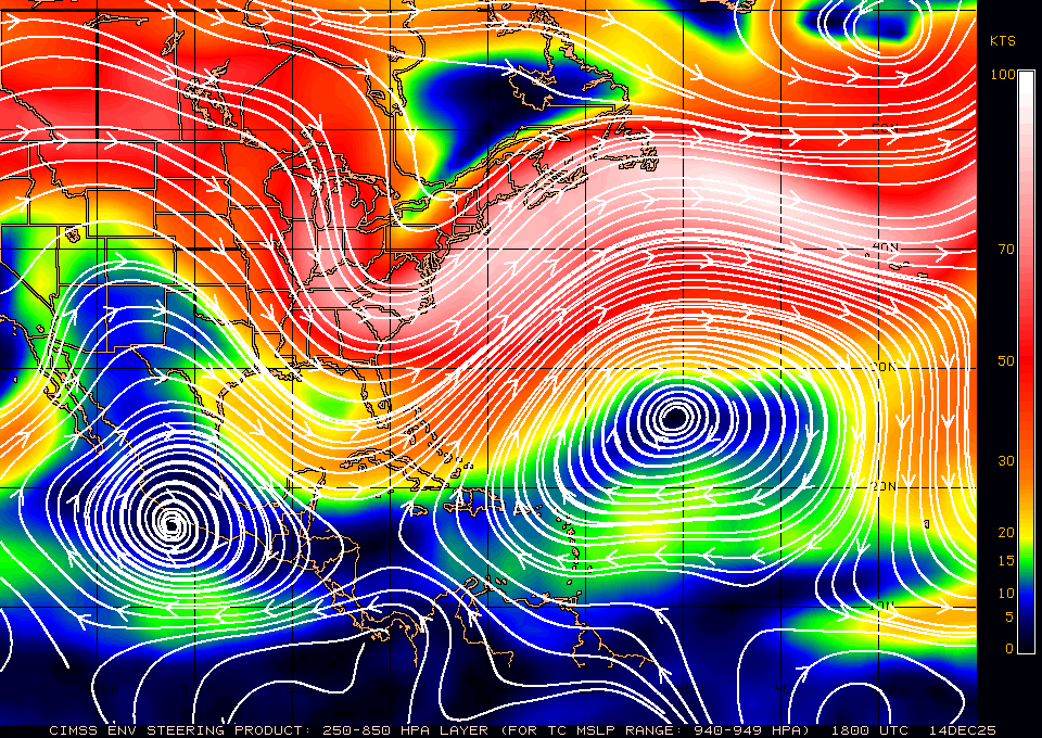
chaser1 wrote:Okay, well this is a bit interesting and something that I think i'll take a look at a bit more closely as compared to tonights GFS 0Z run. As Alonyo mentioned a short while ago regarding the large trough moving eastward from the Pacific Northwest and Upper Plains, here is how the NAM projects this trough at 48 hours (click link: http://www.tropicaltidbits.com/analysis ... ypos=210.4 )
Now, fast forward to 72 hr.'s. What was a negativly tilted trough axis, has very quickly turned into a positive tilted trough axis (link: http://www.tropicaltidbits.com/analysis ... ypos=210.4 )
The mid level low over Montana seems to pull up and slowly NE. Meanwhile, the trough simply becomes broader and covering the western 2/3's of the CONUS, as new energy spills into the trough from the Pacific. Meanwhile it appears to me that increased ridging builds in from the W. Atlantic and also to the north of Matthew at this point. One can see the storm seemingly tracking along the N. Coast of Cuba and seemingly moving NW to a point over W. Andros Island in 84 hours and a much more threatening trajectory for S. Florida than the GFS or UK model. Oh, and before some begin throwing popcorn at their computer monitors, this has less to do with buying into a NAM hurricane forecast, as simply stating the fluid and evolving conditions that might well affect the storms forward motion.
Current steering:
0 likes
The posts in this forum are NOT official forecasts and should not be used as such. They are just the opinion of the poster and may or may not be backed by sound meteorological data. They are NOT endorsed by any professional institution or STORM2K. For official information, please refer to products from the NHC and NWS.
Model Runs Cheat Sheet:
GFS (5:30 AM/PM, 11:30 AM/PM)
HWRF, GFDL, UKMET, NAVGEM (6:30-8:00 AM/PM, 12:30-2:00 AM/PM)
ECMWF (1:45 AM/PM)
TCVN is a weighted averaged
-
stormhunter7

- Category 2

- Posts: 763
- Joined: Mon May 26, 2008 3:13 pm
- Location: Panama City Beach, Florida
- Contact:
Re: ATL: MATTHEW - Hurricane - Discussion

Guess we can say she's in the eyewall now, if not in coc?
Last edited by stormhunter7 on Mon Oct 03, 2016 12:56 am, edited 1 time in total.
0 likes
The following post is NOT an official forecast and should not be used as such. It is just the opinion of the poster and may or may not be backed by sound meteorological data. It is NOT endorsed by any professional institution including storm2k.org For Official Information please refer to the NHC and NWS products. http://www.nhc.noaa.gov
-
SouthFLTropics

- Category 5
- Posts: 4258
- Age: 50
- Joined: Thu Aug 14, 2003 8:04 am
- Location: Port St. Lucie, Florida
Re: ATL: MATTHEW - Hurricane - Discussion
stormhunter7 wrote:
Guess we can she's in the eyewall now, if not in coc?
Very cool observation...looks to be tracking directly over that buoy.
0 likes
Fourth Generation Florida Native
Personal Storm History: David 79, Andrew 92, Erin 95, Floyd 99, Irene 99, Frances 04, Jeanne 04, Wilma 05, Matthew 16, Irma 17, Ian 22, Nicole 22, Milton 24
Personal Storm History: David 79, Andrew 92, Erin 95, Floyd 99, Irene 99, Frances 04, Jeanne 04, Wilma 05, Matthew 16, Irma 17, Ian 22, Nicole 22, Milton 24

Re: ATL: MATTHEW - Hurricane - Discussion
0 likes
Andy D
(For official information, please refer to the NHC and NWS products.)
(For official information, please refer to the NHC and NWS products.)
-
stormhunter7
- Category 2
- Posts: 763
- Joined: Mon May 26, 2008 3:13 pm
- Location: Panama City Beach, Florida
- Contact:
Re: ATL: MATTHEW - Hurricane - Discussion
per new 2am advisory... buoy is about 4-7 miles to east of center.
Last edited by stormhunter7 on Mon Oct 03, 2016 1:05 am, edited 1 time in total.
0 likes
The following post is NOT an official forecast and should not be used as such. It is just the opinion of the poster and may or may not be backed by sound meteorological data. It is NOT endorsed by any professional institution including storm2k.org For Official Information please refer to the NHC and NWS products. http://www.nhc.noaa.gov
-
SouthernBreeze

- Category 1
- Posts: 284
- Age: 69
- Joined: Tue Aug 31, 2004 4:54 pm
- Location: SC/NC line- on the SC Coast
Re: ATL: MATTHEW - Hurricane - Discussion
Well, Matt moved .2 degrees N in the past 3 hrs to 14.9 N. A crawl, but he's moving!
0 likes
My posts are NOT official forecast and should not be used as such. It's just my opinion and not backed by sound meteorological data, and NOT endorsed by any professional institution or storm2k.org. For official information, please refer to the NHC and NWS products.
grazed by many - most wind damage: Hugo (pre-cellphone days!) & most water: Floyd
grazed by many - most wind damage: Hugo (pre-cellphone days!) & most water: Floyd
-
stormhunter7
- Category 2
- Posts: 763
- Joined: Mon May 26, 2008 3:13 pm
- Location: Panama City Beach, Florida
- Contact:
Re: ATL: MATTHEW - Hurricane - Discussion
bouy had a pressure on about 958 over an 2 hour ago... so if data can get out and online soon. we may see 940's, and 100+mph winds? 33ft seas is pretty crazy every 12 seconds
0 likes
The following post is NOT an official forecast and should not be used as such. It is just the opinion of the poster and may or may not be backed by sound meteorological data. It is NOT endorsed by any professional institution including storm2k.org For Official Information please refer to the NHC and NWS products. http://www.nhc.noaa.gov
-
stormhunter7
- Category 2
- Posts: 763
- Joined: Mon May 26, 2008 3:13 pm
- Location: Panama City Beach, Florida
- Contact:
Re: ATL: MATTHEW - Hurricane - Discussion
Can we call that a direct hit?

by the way buoy reported a low pressure of 28.25 (955mb) with a 64 kts ene wind at the same time, hour before last.
by the way buoy reported a low pressure of 28.25 (955mb) with a 64 kts ene wind at the same time, hour before last.
0 likes
The following post is NOT an official forecast and should not be used as such. It is just the opinion of the poster and may or may not be backed by sound meteorological data. It is NOT endorsed by any professional institution including storm2k.org For Official Information please refer to the NHC and NWS products. http://www.nhc.noaa.gov
-
stormhunter7
- Category 2
- Posts: 763
- Joined: Mon May 26, 2008 3:13 pm
- Location: Panama City Beach, Florida
- Contact:
Re: ATL: MATTHEW - Hurricane - Discussion
as i posted new data just went online. wow! direct hit!
wind Direction (WDIR): E ( 80 deg true )
5-day plot - Wind Speed Wind Speed (WSPD): 35.0 kts
5-day plot - Wind Gust Wind Gust (GST): 42.7 kts
5-day plot - Wave Height Wave Height (WVHT): 27.6 ft
5-day plot - Dominant Wave Period Dominant Wave Period (DPD): 9 sec
5-day plot - Average Period Average Period (APD): 8.0 sec
5-day plot - Mean Wave Direction Mean Wave Direction (MWD): ENE ( 75 deg true )
5-day plot - Atmospheric Pressure Atmospheric Pressure (PRES): 27.91 in (945mb!)
5-day plot - Pressure Tendency Pressure Tendency (PTDY): -1.13 in ( Falling Rapidly )
5-day plot - Air Temperature Air Temperature (ATMP): 79.2 °F
5-day plot - Water Temperature Water Temperature (WTMP): 81.1 °F
5-day plot - Dew Point Dew Point (DEWP): 79.2 °F
5-day plot - Heat Index Heat Index (HEAT): 84.4 °F
5-day plot - Wind Speed at 10 Meters Wind Speed at 10 meters (WSPD10M): 38.9 kts
5-day plot - Wind Speed at 10 Meters Wind Speed at 20 meters (WSPD20M): 40.8 kts
http://www.ndbc.noaa.gov/station_page.p ... t=E&tz=CST
Last edited by stormhunter7 on Mon Oct 03, 2016 1:21 am, edited 1 time in total.
0 likes
The following post is NOT an official forecast and should not be used as such. It is just the opinion of the poster and may or may not be backed by sound meteorological data. It is NOT endorsed by any professional institution including storm2k.org For Official Information please refer to the NHC and NWS products. http://www.nhc.noaa.gov
-
1900hurricane

- Category 5
- Posts: 6063
- Age: 34
- Joined: Fri Feb 06, 2015 12:04 pm
- Location: Houston, TX
- Contact:
Re: ATL: MATTHEW - Hurricane - Discussion
Made it all the way down to 944.8 mb.

0 likes
Contract Meteorologist. TAMU & MSST. Fiercely authentic, one of a kind. We are all given free will, so choose a life meant to be lived. We are the Masters of our own Stories.
Opinions expressed are mine alone.
Follow me on Twitter at @1900hurricane : Read blogs at https://1900hurricane.wordpress.com/
Opinions expressed are mine alone.
Follow me on Twitter at @1900hurricane : Read blogs at https://1900hurricane.wordpress.com/
-
stormhunter7
- Category 2
- Posts: 763
- Joined: Mon May 26, 2008 3:13 pm
- Location: Panama City Beach, Florida
- Contact:
Re: ATL: MATTHEW - Hurricane - Discussion
based on 2am pkg. they didnt have the new buoy data in time for pkg. lol
Hurricane-force winds extend outward up to 25 miles (35 km) from
the center and tropical-storm-force winds extend outward up to 195
miles (315 km). NOAA data buoy 42058 reported peak sustained winds
of 78 mph (126 km/h) with a gust to 98 mph (158 km/h) during the
past hour.
The minimum central pressure recently reported by an Air Force
Reserve reconnaissance aircraft was 943 mb (27.85 inches). NOAA
buoy 42058 recently reported a pressure of 957 mb (28.25 inches).
0 likes
The following post is NOT an official forecast and should not be used as such. It is just the opinion of the poster and may or may not be backed by sound meteorological data. It is NOT endorsed by any professional institution including storm2k.org For Official Information please refer to the NHC and NWS products. http://www.nhc.noaa.gov
Who is online
Users browsing this forum: No registered users and 130 guests