ATL: MATTHEW - Post-Tropical - Discussion
Moderator: S2k Moderators
-
HurricaneEric
- Tropical Storm

- Posts: 146
- Age: 31
- Joined: Mon Sep 07, 2015 11:06 am
- Location: Miami, FL
Re: ATL: MATTHEW - Hurricane - Discussion
Local met here in Miami had mentioned that forecast models have a margin of error to right and left of model of about 200 miles. TWC mentioned last couple days that 1/3 of the time, systems fall outside the cone. That being said I'm still gonna put up shutters and pick up today. Better safe than sorry.
1 likes
Irene '99, Katrina '05, Wilma '05, Irma '17 (storms I remember my area getting hurricane force winds/gusts).
The posts in this forum are NOT official forecast and shouldn't be used as such. They are just the opinion of the poster and may or may not be backed by sound meteorological data. For official information, please refer to the experts.
The posts in this forum are NOT official forecast and shouldn't be used as such. They are just the opinion of the poster and may or may not be backed by sound meteorological data. For official information, please refer to the experts.
-
HurricaneFrances04
- Category 2

- Posts: 597
- Joined: Mon Jun 25, 2012 8:09 am
- Location: Fort Lauderdale, Florida
Re: ATL: MATTHEW - Hurricane - Discussion
It's certainly been a while since Florida has seen a hurricane coming from the SE Bahamas, with favorable conditions. Hopefully our new residences take this threat seriously.
1 likes
Re: ATL: MATTHEW - Hurricane - Discussion
The goes left a bit to due north when it hits that tall mountain range.
0 likes
-
tolakram
- Admin

- Posts: 20185
- Age: 62
- Joined: Sun Aug 27, 2006 8:23 pm
- Location: Florence, KY (name is Mark)
Re: ATL: MATTHEW - Hurricane - Discussion
0 likes
M a r k
- - - - -
Join us in chat: Storm2K Chatroom Invite. Android and IOS apps also available.
The posts in this forum are NOT official forecasts and should not be used as such. Posts are NOT endorsed by any professional institution or STORM2K.org. For official information and forecasts, please refer to NHC and NWS products.
-
USTropics
- Professional-Met

- Posts: 2738
- Joined: Sun Aug 12, 2007 3:45 am
- Location: Florida State University
Re: ATL: MATTHEW - Hurricane - Discussion
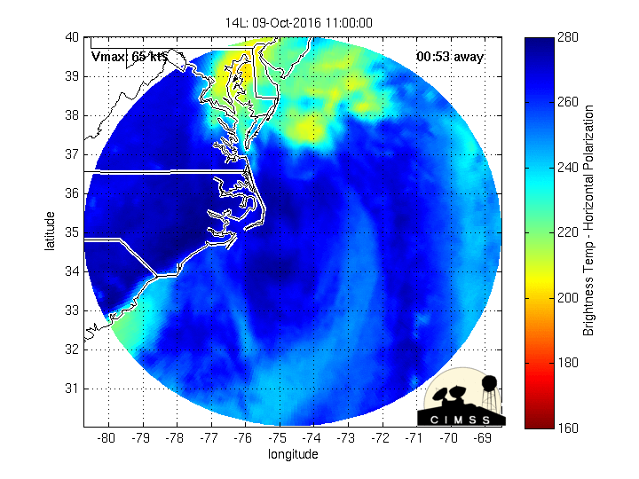
Looks like the eye is starting to emerge off the coast, still fairly strong signature on radar imo:

0 likes
-
MaineWeatherNut
- Tropical Storm
- Posts: 225
- Joined: Sun Sep 01, 2013 5:06 pm
Re: ATL: MATTHEW - Hurricane - Discussion
Looks to be about half way across so maybe another hour or so for it to start making it back out over the water.
0 likes
The content of this post does NOT constitute official forecast and should not be used as such. They are the opinion of the poster and may or may not be backed by sound meteorological data. They are NOT endorsed by any professional institution or Storm2K. For official information, please refer to the local meteorological centers of respective areas.
-
AdamFirst

- S2K Supporter

- Posts: 2490
- Age: 36
- Joined: Thu Aug 14, 2008 10:54 am
- Location: Port Saint Lucie, FL
Re: ATL: MATTHEW - Hurricane - Discussion
xironman wrote:The goes left a bit to due north when it hits that tall mountain range.
Storms tend to wiggle around high peaks if they can. I remember it happened in Hawaii last year when a hurricane was approaching Mauna Kea...the core slid around the southern tip of the island rather than going over it as was projected
0 likes
Dolphins Marlins Canes Golden Panthers HEAT
Andrew 1992 - Irene 1999 - Frances 2004 - Jeanne 2004 - Wilma 2005 - Fay 2008 - Isaac 2012 - Matthew 2016 - Irma 2017 - Dorian 2019 - Ian 2022 - Nicole 2022 - Milton 2024
Andrew 1992 - Irene 1999 - Frances 2004 - Jeanne 2004 - Wilma 2005 - Fay 2008 - Isaac 2012 - Matthew 2016 - Irma 2017 - Dorian 2019 - Ian 2022 - Nicole 2022 - Milton 2024
-
seahawkjd
- S2K Supporter
- Posts: 632
- Joined: Wed Sep 10, 2003 4:12 pm
- Location: Morehead City, NC
- Contact:
Re: ATL: MATTHEW - Hurricane - Discussion
Didn't someone earlier say the heat content of the bay its moving into is extremely warm, like hottest in the area?
1 likes
Gloria, Hugo, Emily, Bertha, Bonnie, Dennis (twice), Fran, Floyd, Isabel, Irene, Arthur, Matthew, Florence, Dorian (and many tropical storms and nor'easters).
-
SouthFLTropics

- Category 5

- Posts: 4258
- Age: 50
- Joined: Thu Aug 14, 2003 8:04 am
- Location: Port St. Lucie, Florida
Re: ATL: MATTHEW - Hurricane - Discussion
Couple of observations and things to note this morning:
1.) First and foremost, thoughts and prayers going out to the people of Haiti. I fear that we are going to see staggering numbers of lives lost on the Tiburon Peninsula.
2.) I would not be surprised if the jog to the NE that was witnessed as Matthew approached Haiti was caused by frictional forces with the terrain on the peninsula. The low level flow hit the mountain tops and spun it off to the NE like a top. It is very possible that we could see this again as it approaches Eastern Cuba, but this time it will probably spin it around the end of the island and off to the NW. This will be important as to where Matthew sets up his approach to Florida.
3.) The GFS in my opinion has put the NHC in a pickle this morning. The NHC definitely doesn't want to understate the seriousness of the situation for Florida but at the same time they don't want to sound a false alarm or trigger evacuations for areas that might not need it. All that does is build complacency for the next time a threat approaches. They will have to pull the trigger on watches at some time but I really think there is some gnashing of teeth going on as to where to draw that line. I don't envy them and I give them all the credit in the world for having to make these tough calls.
Last edited by SouthFLTropics on Tue Oct 04, 2016 7:49 am, edited 1 time in total.
3 likes
Fourth Generation Florida Native
Personal Storm History: David 79, Andrew 92, Erin 95, Floyd 99, Irene 99, Frances 04, Jeanne 04, Wilma 05, Matthew 16, Irma 17, Ian 22, Nicole 22, Milton 24
Personal Storm History: David 79, Andrew 92, Erin 95, Floyd 99, Irene 99, Frances 04, Jeanne 04, Wilma 05, Matthew 16, Irma 17, Ian 22, Nicole 22, Milton 24
-
weathaguyry

- Category 5
- Posts: 1273
- Age: 22
- Joined: Wed Jun 15, 2016 5:16 am
- Location: Long Island, NY
Re: ATL: MATTHEW - Hurricane - Discussion
So, for a few days we have been talking about that if 15L/Nicole forms, she would weaken the ridge, and hurl Matthew right out to sea, now she has an 80% chance of developing, and I haven't heard much about it, will Nicole weaken the ridge, or will she not really have much affect at all?
0 likes
My posts are only my opinions and NOT official forecasts. For official forecasts, consult the National Hurricane Center or the National Weather Service.
Irene 11', Sandy 12', Fay 20’, Isaias 20’, Elsa 21’, Henri 21’, Ida 21’
Irene 11', Sandy 12', Fay 20’, Isaias 20’, Elsa 21’, Henri 21’, Ida 21’
-
AutoPenalti
- Category 5
- Posts: 4091
- Age: 29
- Joined: Mon Aug 17, 2015 4:16 pm
- Location: Ft. Lauderdale, Florida
Re: ATL: MATTHEW - Hurricane - Discussion
weathaguyry wrote:So, for a few days we have been talking about that if 15L/Nicole forms, she would weaken the ridge, and hurl Matthew right out to sea, now she has an 80% chance of developing, and I haven't heard much about it, will Nicole weaken the ridge, or will she not really have much affect at all?
Nicole won't be able to weaken it.
0 likes
The posts in this forum are NOT official forecasts and should not be used as such. They are just the opinion of the poster and may or may not be backed by sound meteorological data. They are NOT endorsed by any professional institution or STORM2K. For official information, please refer to products from the NHC and NWS.
Model Runs Cheat Sheet:
GFS (5:30 AM/PM, 11:30 AM/PM)
HWRF, GFDL, UKMET, NAVGEM (6:30-8:00 AM/PM, 12:30-2:00 AM/PM)
ECMWF (1:45 AM/PM)
TCVN is a weighted averaged
-
AdamFirst
- S2K Supporter
- Posts: 2490
- Age: 36
- Joined: Thu Aug 14, 2008 10:54 am
- Location: Port Saint Lucie, FL
Re: ATL: MATTHEW - Hurricane - Discussion
More strong language from Bryan Norcross - he thinks this threat is very real
https://www.facebook.com/TWCBryanNorcro ... 07138699:0
https://www.facebook.com/TWCBryanNorcro ... 07138699:0
This is the MOST POWERFUL hurricane we’ve seen off or near the east coast of Florida in 37 years, so nobody is used to this situation. That one – Hurricane Floyd in 1999 – ended up missing (it was forecast to just miss), but scared everybody to death and caused an evacuation jam for the ages. You can bet emergency managers are thinking about that.
....
As of this time, the forecast calls for Hurricane Matthew to move over or near the Florida coast bringing hurricane conditions over most of the coastline. The angle of approach brings the strongest winds in north of Palm Beach, but everybody will feel it, even inland in Orlando and south in Miami. The winds will increase in Miami Wednesday with the greatest impact Thursday in South Florida, and Central and North Florida Thursday night and Friday. Winds slowly lessen in north Florida on Saturday as the storm moves farther north.
The bottom line for Florida: It is imperative that everybody think about exactly what you will do if it you live in a threatened area and emergency action is required. Strong wind, coastal flooding, and erosion from monstrous waves are likely for the entire coast. Forecast changes are possible, of course. But there is no way to know which direction they will go – more or less threatening.
THIS IS THE BIGGEST HURRICANE THREAT IN MANY DECADES. Hopefully the worst will stay offshore, but don’t bet your life on it.
4 likes
Dolphins Marlins Canes Golden Panthers HEAT
Andrew 1992 - Irene 1999 - Frances 2004 - Jeanne 2004 - Wilma 2005 - Fay 2008 - Isaac 2012 - Matthew 2016 - Irma 2017 - Dorian 2019 - Ian 2022 - Nicole 2022 - Milton 2024
Andrew 1992 - Irene 1999 - Frances 2004 - Jeanne 2004 - Wilma 2005 - Fay 2008 - Isaac 2012 - Matthew 2016 - Irma 2017 - Dorian 2019 - Ian 2022 - Nicole 2022 - Milton 2024
-
eastcoastFL

- Category 5
- Posts: 3996
- Age: 44
- Joined: Thu Apr 12, 2007 12:29 pm
- Location: Palm City, FL
Re: ATL: MATTHEW - Hurricane - Discussion
weathaguyry wrote:So, for a few days we have been talking about that if 15L/Nicole forms, she would weaken the ridge, and hurl Matthew right out to sea, now she has an 80% chance of developing, and I haven't heard much about it, will Nicole weaken the ridge, or will she not really have much affect at all?
It was mentioned briefly on TWC but they said it wouldn't have any effect. I don't know if thats accurate or not.
1 likes
Personal Forecast Disclaimer:
The posts in this forum are NOT official forecast and should not be used as such. They are just the opinion of the poster and may or may not be backed by sound meteorological data. They are NOT endorsed by any professional institution or storm2k.org. For official information, please refer to the NHC and NWS products.
The posts in this forum are NOT official forecast and should not be used as such. They are just the opinion of the poster and may or may not be backed by sound meteorological data. They are NOT endorsed by any professional institution or storm2k.org. For official information, please refer to the NHC and NWS products.
-
weathaguyry
- Category 5
- Posts: 1273
- Age: 22
- Joined: Wed Jun 15, 2016 5:16 am
- Location: Long Island, NY
Re: ATL: MATTHEW - Hurricane - Discussion
AutoPenalti wrote:weathaguyry wrote:So, for a few days we have been talking about that if 15L/Nicole forms, she would weaken the ridge, and hurl Matthew right out to sea, now she has an 80% chance of developing, and I haven't heard much about it, will Nicole weaken the ridge, or will she not really have much affect at all?
Nicole won't be able to weaken it.
Ok, thanks for the clarification
0 likes
My posts are only my opinions and NOT official forecasts. For official forecasts, consult the National Hurricane Center or the National Weather Service.
Irene 11', Sandy 12', Fay 20’, Isaias 20’, Elsa 21’, Henri 21’, Ida 21’
Irene 11', Sandy 12', Fay 20’, Isaias 20’, Elsa 21’, Henri 21’, Ida 21’
-
HurricaneFrances04
- Category 2
- Posts: 597
- Joined: Mon Jun 25, 2012 8:09 am
- Location: Fort Lauderdale, Florida
Re: ATL: MATTHEW - Hurricane - Discussion
This is my pure uneducated speculation, but I wonder if the west trends aren't done yet. Notice how we've always seen giant shifts to the west, followed by a little east, but then another shift west. I don't think Southeast Florida can breathe easily, just yet.
1 likes
-
AutoPenalti
- Category 5
- Posts: 4091
- Age: 29
- Joined: Mon Aug 17, 2015 4:16 pm
- Location: Ft. Lauderdale, Florida
Re: ATL: MATTHEW - Hurricane - Discussion
Check out Water Vapor loop, ridge looks mighty strong today.
0 likes
The posts in this forum are NOT official forecasts and should not be used as such. They are just the opinion of the poster and may or may not be backed by sound meteorological data. They are NOT endorsed by any professional institution or STORM2K. For official information, please refer to products from the NHC and NWS.
Model Runs Cheat Sheet:
GFS (5:30 AM/PM, 11:30 AM/PM)
HWRF, GFDL, UKMET, NAVGEM (6:30-8:00 AM/PM, 12:30-2:00 AM/PM)
ECMWF (1:45 AM/PM)
TCVN is a weighted averaged
-
SouthFLTropics
- Category 5
- Posts: 4258
- Age: 50
- Joined: Thu Aug 14, 2003 8:04 am
- Location: Port St. Lucie, Florida
Re: ATL: MATTHEW - Hurricane - Discussion
AdamFirst wrote:More strong language from Bryan Norcross - he thinks this threat is very real
https://www.facebook.com/TWCBryanNorcro ... 07138699:0This is the MOST POWERFUL hurricane we’ve seen off or near the east coast of Florida in 37 years, so nobody is used to this situation. That one – Hurricane Floyd in 1999 – ended up missing (it was forecast to just miss), but scared everybody to death and caused an evacuation jam for the ages. You can bet emergency managers are thinking about that.
....
As of this time, the forecast calls for Hurricane Matthew to move over or near the Florida coast bringing hurricane conditions over most of the coastline. The angle of approach brings the strongest winds in north of Palm Beach, but everybody will feel it, even inland in Orlando and south in Miami. The winds will increase in Miami Wednesday with the greatest impact Thursday in South Florida, and Central and North Florida Thursday night and Friday. Winds slowly lessen in north Florida on Saturday as the storm moves farther north.
The bottom line for Florida: It is imperative that everybody think about exactly what you will do if it you live in a threatened area and emergency action is required. Strong wind, coastal flooding, and erosion from monstrous waves are likely for the entire coast. Forecast changes are possible, of course. But there is no way to know which direction they will go – more or less threatening.
THIS IS THE BIGGEST HURRICANE THREAT IN MANY DECADES. Hopefully the worst will stay offshore, but don’t bet your life on it.
With all due respect to Norcross there are a couple of inaccuracies in his statement. First, Floyd was 17 years ago, not 37 years ago. Probably a typo but incorrect nonetheless. Secondly...Biggest threat in many decades??? Define many. Andrew wasn't that long ago. Not to mention Frances was coming through the Bahamas as a Cat 4. I can appreciate what Bryan is trying to do here by alerting the many people in Florida who have never been through one of these, but the post seemed somewhat dramatic.
1 likes
Fourth Generation Florida Native
Personal Storm History: David 79, Andrew 92, Erin 95, Floyd 99, Irene 99, Frances 04, Jeanne 04, Wilma 05, Matthew 16, Irma 17, Ian 22, Nicole 22, Milton 24
Personal Storm History: David 79, Andrew 92, Erin 95, Floyd 99, Irene 99, Frances 04, Jeanne 04, Wilma 05, Matthew 16, Irma 17, Ian 22, Nicole 22, Milton 24
-
cycloneye

- Admin
- Posts: 149456
- Age: 69
- Joined: Thu Oct 10, 2002 10:54 am
- Location: San Juan, Puerto Rico
Re: ATL: MATTHEW - Hurricane - Discussion
1 likes
Visit the Caribbean-Central America Weather Thread where you can find at first post web cams,radars
and observations from Caribbean basin members Click Here
and observations from Caribbean basin members Click Here
Re: ATL: MATTHEW - Hurricane - Discussion
weathaguyry wrote:So, for a few days we have been talking about that if 15L/Nicole forms, she would weaken the ridge, and hurl Matthew right out to sea, now she has an 80% chance of developing, and I haven't heard much about it, will Nicole weaken the ridge, or will she not really have much affect at all?
Why would it hurl it out to sea, seems to me with the counter clockwise motion it would force it further west.
0 likes
-
stormchasr
Re: ATL: MATTHEW - Hurricane - Discussion
eastcoastFL wrote:weathaguyry wrote:So, for a few days we have been talking about that if 15L/Nicole forms, she would weaken the ridge, and hurl Matthew right out to sea, now she has an 80% chance of developing, and I haven't heard much about it, will Nicole weaken the ridge, or will she not really have much affect at all?
It was mentioned briefly on TWC but they said it wouldn't have any effect. I don't know if thats accurate or not.
I don't believe it is accurate. Based on WV satellite you can already see that Matthew will likely recurve and remain east of the forecast. The high pressure does not look to be building so much. My opinion, though pretty obvious.
0 likes
Who is online
Users browsing this forum: No registered users and 12 guests