BULLETIN
TROPICAL STORM NICOLE ADVISORY NUMBER 27
NWS NATIONAL HURRICANE CENTER MIAMI FL AL152016
500 PM AST MON OCT 10 2016
...HURRICANE WATCH ISSUED FOR BERMUDA...
SUMMARY OF 500 PM AST...2100 UTC...INFORMATION
----------------------------------------------
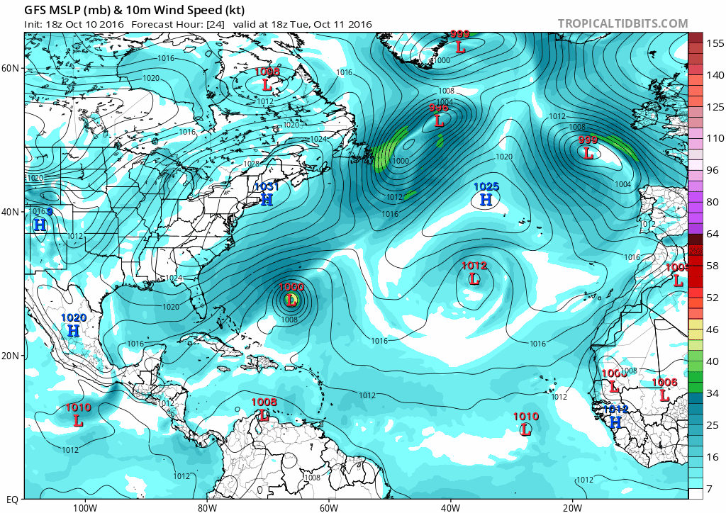
LOCATION...26.3N 65.4W
ABOUT 415 MI...670 KM S OF BERMUDA
MAXIMUM SUSTAINED WINDS...60 MPH...95 KM/H
PRESENT MOVEMENT...N OR 355 DEGREES AT 6 MPH...9 KM/H
MINIMUM CENTRAL PRESSURE...992 MB...29.30 INCHES
WATCHES AND WARNINGS
--------------------
The Bermuda Weather Service has issued a Hurricane Watch for
Bermuda.
SUMMARY OF WATCHES AND WARNINGS IN EFFECT:
A Hurricane Watch is in effect for...
* Bermuda
A Hurricane Watch means that hurricane conditions are possible
within the watch area. A watch is typically issued 48 hours
before the anticipated first occurrence of tropical-storm-force
winds, conditions that make outside preparations difficult or
dangerous.
For storm information specific to your area, please monitor
products issued by your national meteorological service.
DISCUSSION AND 48-HOUR OUTLOOK
------------------------------
At 500 PM AST (2100 UTC), the center of Tropical Storm Nicole was
located near latitude 26.3 North, longitude 65.4 West. Nicole is
moving toward the north near 6 mph (9 km/h). A slow north-
northwestward to northwestward motion is expected through late
Tuesday, followed by a turn toward the north by Wednesday.
Maximum sustained winds remain near 60 mph (95 km/h) with higher
gusts. Slow strengthening is forecast, and Nicole is expected to
reach hurricane strength on Tuesday.
Tropical-storm-force winds extend outward up to 160 miles (260 km)
from the center.
The estimated minimum central pressure is 992 mb (29.30 inches).
HAZARDS AFFECTING LAND
----------------------
SURF: Swells associated with Nicole should increase on Bermuda
during the next couple of days. These swells will create dangerous
surf conditions and rip currents. Please refer to products being
issued by the Bermuda Weather Service for additional information.
WIND: Hurricane conditions are possible on Bermuda by Wednesday
night.
NEXT ADVISORY
-------------
Next intermediate advisory at 800 PM AST.
Next complete advisory at 1100 PM AST.
$$
Forecaster Kimberlain
TROPICAL STORM NICOLE DISCUSSION NUMBER 27
NWS NATIONAL HURRICANE CENTER MIAMI FL AL152016
500 PM AST MON OCT 10 2016
While Nicole's convective organization has not changed much over
the last several hours, satellite data indicate that the cyclone is
maintaining a well-defined inner-core structure. Several bands have
also developed over the eastern half of the circulation. An ASCAT
pass received after the previous advisory's issuance indicated a
couple of reliable 50-kt wind vectors, and the initial intensity
estimate is set to this value in basic agreement with satellite
classifications.
Nicole appears to have turned slightly west of due north, and the
initial motion estimate is 355/05. This general motion is expected
to continue through tonight or early Tuesday while a shortwave
trough treks across Atlantic Canada and bypasses the storm to the
north. In the wake of this weather system, a weak low- to mid-level
ridge is forecast to build north and west of Nicole for a short
time, allowing the track to bend more toward the left. The ECMWF
continues to predict a greater westerly component motion than the
other guidance for the next 3 days, with still about half of the
the 0000 UTC ensemble members left of the current forecast. Before
Nicole reaches 30N, it should encounter a stronger mid-latitude flow
and recurve into the westerlies with increasing forward speed over
the next few days. The new track forecast continues to place greater
weight on the ECMWF guidance suite, which results in the track being
adjusted slightly left of the previous one through the forecast
period. It is in the middle of the 0000 UTC ECMWF ensemble output
and to the left of the latest multi-model consensus.
Nicole is still struggling partially from mid- to upper-level dry
air associated with a lobe of vorticity from a mid-latitude
shortwave trough that has been wrapping around the cyclone's
circulation. In addition, oceanic upwelling beneath the cyclone
has also likely contributed to the cyclone's lack of convective
vigor. Once Nicole starts to move farther west over untapped waters
and its interaction with the above-mentioned feature ends, the
strong northerly shear affecting Nicole for days will have decreased
significantly. With the tropical cyclone moving over near-record
warm SSTs at that time, in a reasonably moist large-scale
environment, and under a diffluent flow at upper levels, a
significant intensification is likely. Global models maintain the
theme of showing substantial deepening over the next few days. By
72 hours, or shortly thereafter, strong southwesterly shear could
bring the predicted intensification to a close unless baroclinic
processes counteract the shear enough to allow for some further
increase in strength. Extratropical transition in shown by day 5.
The new intensity forecast is an update of the previous one and
generally near or just above the model consensus aids.
FORECAST POSITIONS AND MAX WINDS
INIT 10/2100Z 26.3N 65.4W 50 KT 60 MPH
12H 11/0600Z 26.9N 65.7W 55 KT 65 MPH
24H 11/1800Z 27.5N 66.3W 65 KT 75 MPH
36H 12/0600Z 28.2N 66.7W 70 KT 80 MPH
48H 12/1800Z 29.5N 66.7W 80 KT 90 MPH
72H 13/1800Z 33.2N 64.3W 80 KT 90 MPH
96H 14/1800Z 38.1N 58.3W 80 KT 90 MPH
120H 15/1800Z 42.0N 54.2W 70 KT 80 MPH...POST-TROP/EXTRATROP
$$
Forecaster Kimberlain
TROPICAL STORM NICOLE ADVISORY NUMBER 27
NWS NATIONAL HURRICANE CENTER MIAMI FL AL152016
500 PM AST MON OCT 10 2016
...HURRICANE WATCH ISSUED FOR BERMUDA...
SUMMARY OF 500 PM AST...2100 UTC...INFORMATION
----------------------------------------------
LOCATION...26.3N 65.4W
ABOUT 415 MI...670 KM S OF BERMUDA
MAXIMUM SUSTAINED WINDS...60 MPH...95 KM/H
PRESENT MOVEMENT...N OR 355 DEGREES AT 6 MPH...9 KM/H
MINIMUM CENTRAL PRESSURE...992 MB...29.30 INCHES
WATCHES AND WARNINGS
--------------------
The Bermuda Weather Service has issued a Hurricane Watch for
Bermuda.
SUMMARY OF WATCHES AND WARNINGS IN EFFECT:
A Hurricane Watch is in effect for...
* Bermuda
A Hurricane Watch means that hurricane conditions are possible
within the watch area. A watch is typically issued 48 hours
before the anticipated first occurrence of tropical-storm-force
winds, conditions that make outside preparations difficult or
dangerous.
For storm information specific to your area, please monitor
products issued by your national meteorological service.
DISCUSSION AND 48-HOUR OUTLOOK
------------------------------
At 500 PM AST (2100 UTC), the center of Tropical Storm Nicole was
located near latitude 26.3 North, longitude 65.4 West. Nicole is
moving toward the north near 6 mph (9 km/h). A slow north-
northwestward to northwestward motion is expected through late
Tuesday, followed by a turn toward the north by Wednesday.
Maximum sustained winds remain near 60 mph (95 km/h) with higher
gusts. Slow strengthening is forecast, and Nicole is expected to
reach hurricane strength on Tuesday.
Tropical-storm-force winds extend outward up to 160 miles (260 km)
from the center.
The estimated minimum central pressure is 992 mb (29.30 inches).
HAZARDS AFFECTING LAND
----------------------
SURF: Swells associated with Nicole should increase on Bermuda
during the next couple of days. These swells will create dangerous
surf conditions and rip currents. Please refer to products being
issued by the Bermuda Weather Service for additional information.
WIND: Hurricane conditions are possible on Bermuda by Wednesday
night.
NEXT ADVISORY
-------------
Next intermediate advisory at 800 PM AST.
Next complete advisory at 1100 PM AST.
$$
Forecaster Kimberlain
TROPICAL STORM NICOLE DISCUSSION NUMBER 27
NWS NATIONAL HURRICANE CENTER MIAMI FL AL152016
500 PM AST MON OCT 10 2016
While Nicole's convective organization has not changed much over
the last several hours, satellite data indicate that the cyclone is
maintaining a well-defined inner-core structure. Several bands have
also developed over the eastern half of the circulation. An ASCAT
pass received after the previous advisory's issuance indicated a
couple of reliable 50-kt wind vectors, and the initial intensity
estimate is set to this value in basic agreement with satellite
classifications.
Nicole appears to have turned slightly west of due north, and the
initial motion estimate is 355/05. This general motion is expected
to continue through tonight or early Tuesday while a shortwave
trough treks across Atlantic Canada and bypasses the storm to the
north. In the wake of this weather system, a weak low- to mid-level
ridge is forecast to build north and west of Nicole for a short
time, allowing the track to bend more toward the left. The ECMWF
continues to predict a greater westerly component motion than the
other guidance for the next 3 days, with still about half of the
the 0000 UTC ensemble members left of the current forecast. Before
Nicole reaches 30N, it should encounter a stronger mid-latitude flow
and recurve into the westerlies with increasing forward speed over
the next few days. The new track forecast continues to place greater
weight on the ECMWF guidance suite, which results in the track being
adjusted slightly left of the previous one through the forecast
period. It is in the middle of the 0000 UTC ECMWF ensemble output
and to the left of the latest multi-model consensus.
Nicole is still struggling partially from mid- to upper-level dry
air associated with a lobe of vorticity from a mid-latitude
shortwave trough that has been wrapping around the cyclone's
circulation. In addition, oceanic upwelling beneath the cyclone
has also likely contributed to the cyclone's lack of convective
vigor. Once Nicole starts to move farther west over untapped waters
and its interaction with the above-mentioned feature ends, the
strong northerly shear affecting Nicole for days will have decreased
significantly. With the tropical cyclone moving over near-record
warm SSTs at that time, in a reasonably moist large-scale
environment, and under a diffluent flow at upper levels, a
significant intensification is likely. Global models maintain the
theme of showing substantial deepening over the next few days. By
72 hours, or shortly thereafter, strong southwesterly shear could
bring the predicted intensification to a close unless baroclinic
processes counteract the shear enough to allow for some further
increase in strength. Extratropical transition in shown by day 5.
The new intensity forecast is an update of the previous one and
generally near or just above the model consensus aids.
FORECAST POSITIONS AND MAX WINDS
INIT 10/2100Z 26.3N 65.4W 50 KT 60 MPH
12H 11/0600Z 26.9N 65.7W 55 KT 65 MPH
24H 11/1800Z 27.5N 66.3W 65 KT 75 MPH
36H 12/0600Z 28.2N 66.7W 70 KT 80 MPH
48H 12/1800Z 29.5N 66.7W 80 KT 90 MPH
72H 13/1800Z 33.2N 64.3W 80 KT 90 MPH
96H 14/1800Z 38.1N 58.3W 80 KT 90 MPH
120H 15/1800Z 42.0N 54.2W 70 KT 80 MPH...POST-TROP/EXTRATROP
$$
Forecaster Kimberlain